Some of the wildest sights in Oregon hide at the end of a dusty road or behind a quiet coastal pullout. You show up expecting a quick stretch break, and suddenly you are staring at something that looks straight out of a sci-fi movie.
Striped hills, glowing blue pools, and holes that swallow the ocean are all waiting right here in our home state. Grab your camera, because your friends are going to ask if you edited every single shot.
1. Thor’s Well
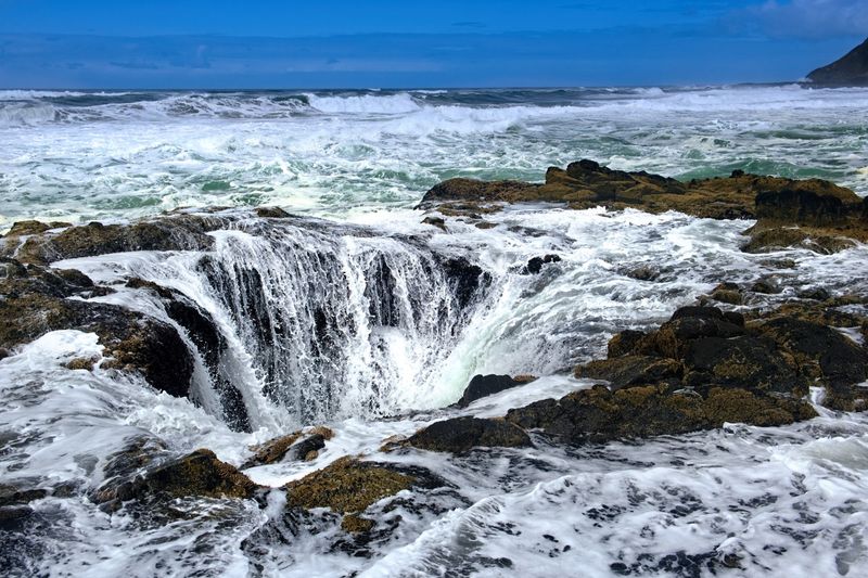
Picture the Pacific pouring into a hole in the rocks like someone pulled a giant bathtub plug. That is the daily show at Thor’s Well, a circular opening in the coastal basalt near Yachats that drains and then spouts seawater in a rhythm you can almost set a clock to.
Timing is everything here. High tide around sunset brings the most drama, when spray catches the light and turns into shimmering beads above the rocks.
The deep blue-green color of the water swirling around the well is honestly hard to believe, even when you are standing right there.
Quiet day at the well? No problem.
The nearby Spouting Horn and a loop trail offer plenty more to watch along this rugged stretch of shoreline. Winter storm season cranks the power up even higher, so bundle up and keep a respectful distance from the edge.
Waves here deserve serious caution.
2. Painted Hills
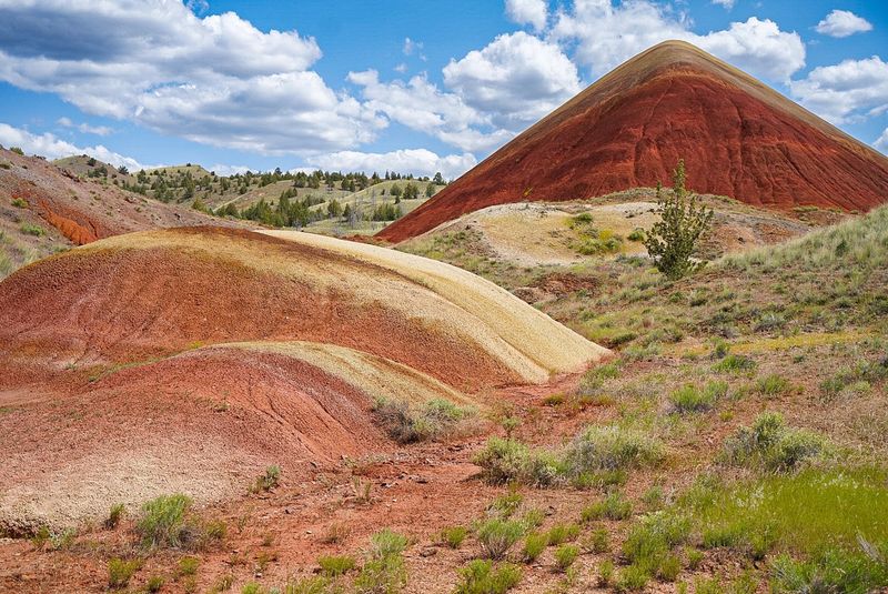
Nobody took a paintbrush to these hills, though you will swear somebody did. Out in Wheeler County, the Painted Hills unit of the John Day Fossil Beds shows off rounded slopes striped in red, tan, orange, yellow, and black, formed as ancient volcanic material weathered over time.
Here is the fun twist. The colors shift with the hour, the season, and even the weather, so a cloudy morning looks totally different from a glowing sunset.
After a light rain, the hues can pop even brighter.
Two easy walks give you very different views:
The Painted Hills Overlook Trail, about half a mile, shows off the sweeping scale of the landscape. Painted Cove Trail brings you close enough to spot the bumpy, popcorn-like texture of the clay mounds.
Stay on the paths, since those delicate surfaces hold footprints for years. Spring and fall bring gentler temperatures and fewer visitors.
3. Crater Lake National Park
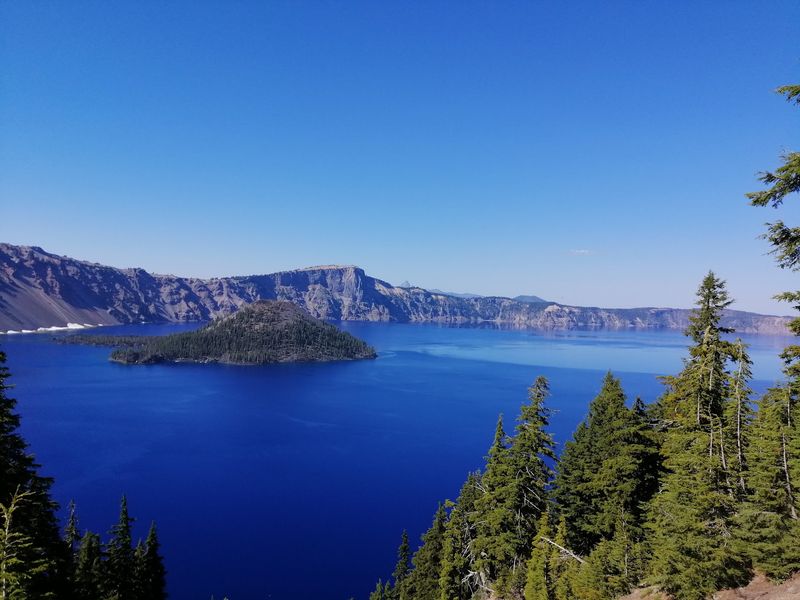
Blue. Then bluer.
Then a shade of blue you did not know existed. Crater Lake, the deepest lake in the United States, fills a caldera left behind when a volcano collapsed more than 7,000 years ago in southern Oregon.
Photos of that water get accused of heavy filters all the time, yet the color comes from pure depth and remarkable clarity. Rim viewpoints give you sweeping looks across the lake, and the Pinnacles Trail adds a side trip to strange rock spires tucked into the park’s forests.
Practical perks make planning simple. The park stays open around the clock, with picnic tables, public restrooms, kid-friendly hikes, and dogs allowed in designated areas.
The historic Crater Lake Lodge offers rooms with lake views if you want to catch sunrise without rushing.
Weekend afternoons draw the biggest crowds, so a weekday visit or early start pays off nicely.
4. Tamolitch Falls (Blue Pool), McKenzie Bridge, OR
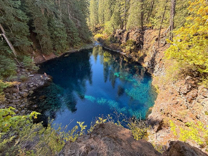
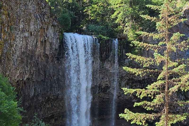
Ever seen water so clear it looks like a hole in the earth filled with liquid topaz? Welcome to Tamolitch Blue Pool, hidden in the forest along the McKenzie River near McKenzie Bridge.
Getting there is half the charm. The well-groomed trail runs about five miles round trip, following the river past wooden bridges, mossy trees, and old lava rock.
Plan on roughly two hours, including photo stops, because you will be stopping a lot.
At the end, the pool glows an unreal turquoise. A seasonal waterfall sometimes spills in, but most of the year the water rises quietly from underground.
Swimming sounds tempting until you remember those frigid temperatures, and reaching the water means scrambling over rocks, so most folks simply sit and soak in the view.
Dogs are welcome outdoors. Weekend afternoons get busy, so an early weekday hike keeps it peaceful.
5. Devils Punchbowl State Natural Area, Otter Rock, OR
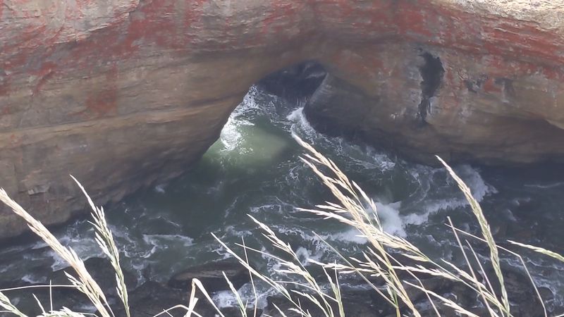
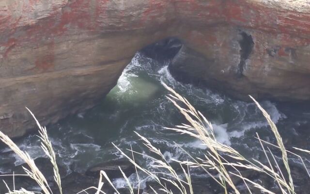
Long ago, a sea cave here lost its roof. What remains is a giant stone bowl in Otter Rock where the ocean crashes in, swirls around, and foams like a witch’s cauldron.
Stand at the viewpoint during high tide and the churning surf feels almost alive. Sunset adds bold colors to the cliffs, making this one of the most photographed stops on the central coast.
Low tide flips the experience completely. Tide pools near the rocks reveal small sea creatures, and trails lead around the area for more exploring.
Nearby waters also draw surfers, which adds some action to your photos.
Logistics are refreshingly easy. A small parking lot and restroom sit right by the entrance sign, with a larger RV lot just past the building.
Picnic tables, kid-friendly paths, and dog access round things out. Visit on a weekday for a calmer scene than Saturday afternoons.
6. Crack in the Ground
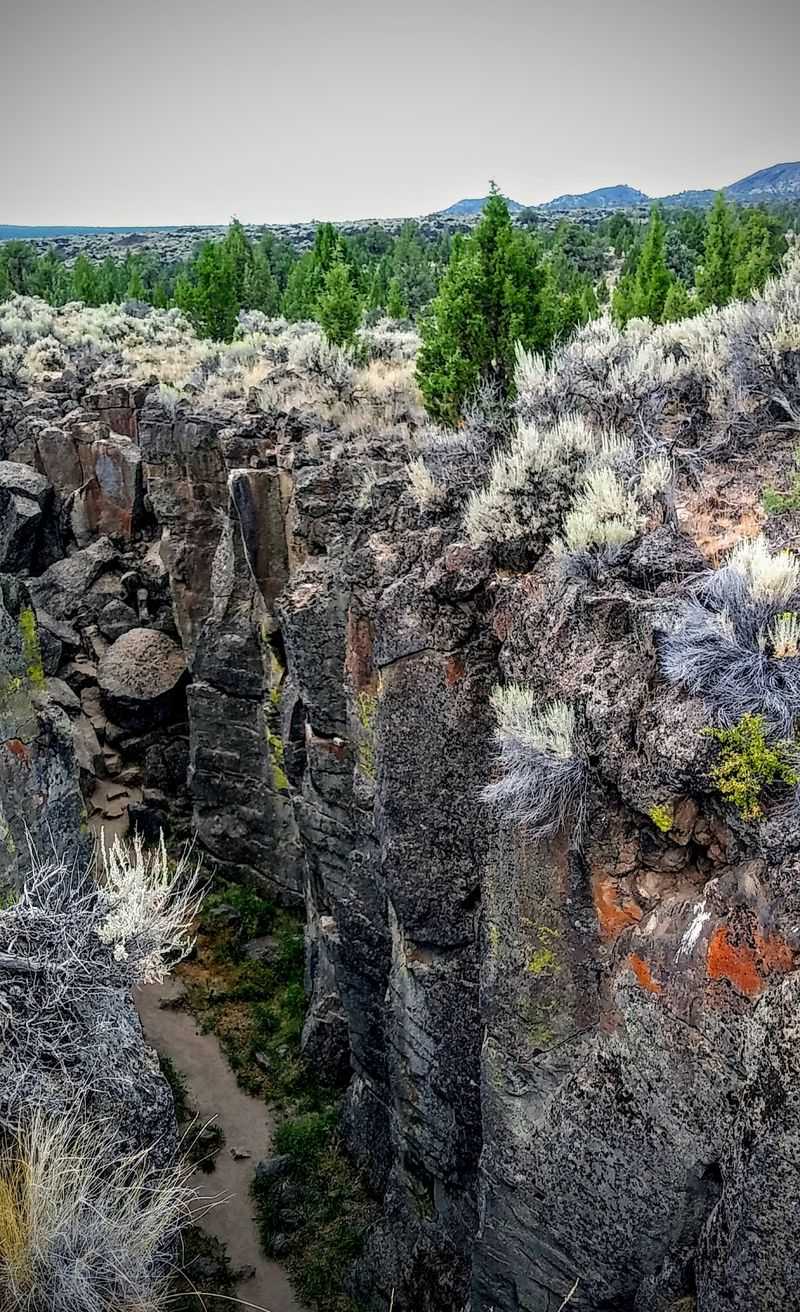
Out in the high desert of Lake County, the ground literally splits open. Crack in the Ground is a narrow volcanic fissure that looks like the set of a sci-fi movie, with rock walls rising high on both sides as you walk through.
Reaching it takes some patience. Expect around seven miles of bumpy, washboard dirt road, though most vehicles handle it fine with a slow pace.
From the parking lot, a short, easy hike brings you to the crack. Then comes the best surprise: step down inside and the air can feel up to 30 degrees cooler than the scorching surface on a summer day.
That natural air conditioning makes exploring the passage a real treat.
Pack plenty of water, sturdy shoes, and a sense of adventure. Few travelers make it out this way, so you may have the whole place to yourself.
7. Fort Rock State Natural Area, Fort Rock, OR
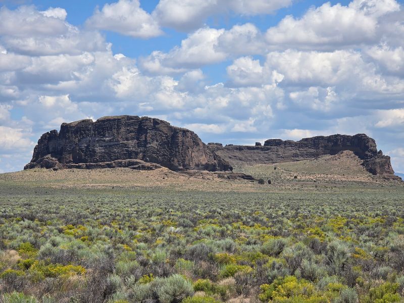
From a distance, it looks like a massive castle wall dropped into the middle of the desert. Fort Rock is an ancient volcanic tuff ring rising sharply above the flat sagebrush basin near the tiny town of Fort Rock.
Shaped like a giant horseshoe, the formation was carved by waves from a lake that once filled this valley. Today, short and easy trails wind all over the rocks, and you can climb up the back side for a look over the natural wall.
History buffs will love this one. Caves in the region have revealed ancient artifacts, adding a deep human story to an already remarkable landscape.
The state park at the base keeps things comfortable with picnic tables, clean public restrooms, family-friendly trails, and room for dogs. Quiet Tuesday afternoons and Thursday mornings are prime times to enjoy the silence of the high desert.
8. Alvord Desert

Silence has a sound out here, and it is mostly coyotes calling in the distance. The Alvord Desert in Harney County is a vast dry lake playa sitting in the rain shadow of Steens Mountain, which rises behind it like an enormous wall.
On a still morning, the flat, pale surface stretches so far it feels like another planet. Cracked earth, endless horizon, and zero crowds make every photo look almost fake.
Night is when the Alvord truly shines. Dark skies here rank among the best in the state, with the Milky Way spilling across the sky above your campsite.
Camping on or near the playa is a big draw for stargazers and photographers.
Hot springs in the area add a soothing soak after a long day. Come prepared with supplies, since services are few, and embrace the rare chance to unplug completely.
9. Oregon Caves National Monument & Preserve, Cave Junction, OR
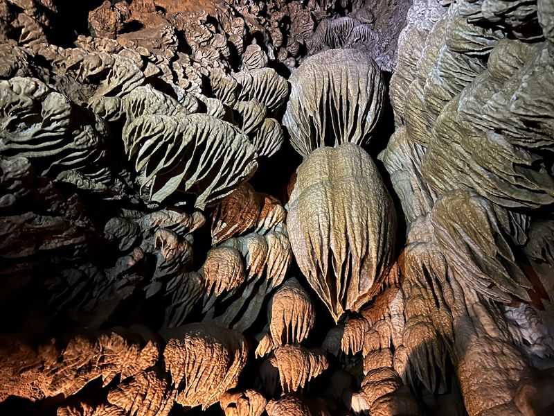
Bring a jacket, even in July. Inside the Oregon Caves near Cave Junction, the temperature holds around 44 degrees, making this a perfect escape on a hot summer day.
Unlike many caves, these were formed in marble, which creates unusually complex passages. Ranger-led tours guide you along roughly a mile of winding paths past stalactites, stalagmites, and columns that look carved by an artist.
The guides share plenty about how the caves formed and their history in the area.
Tours last about an hour and a half, with some stairs and narrow squeezes along the way. Kids tend to love the adventure, and the monument offers kid-friendly activities and hikes above ground too.
Open daily, mostly 9:30 AM to 5 PM, with a 9 AM start on Tuesdays and Wednesdays. Free parking, picnic tables, and restrooms await.
It sits along the scenic route between Grants Pass and Crescent City.
10. Lava Cast Forest
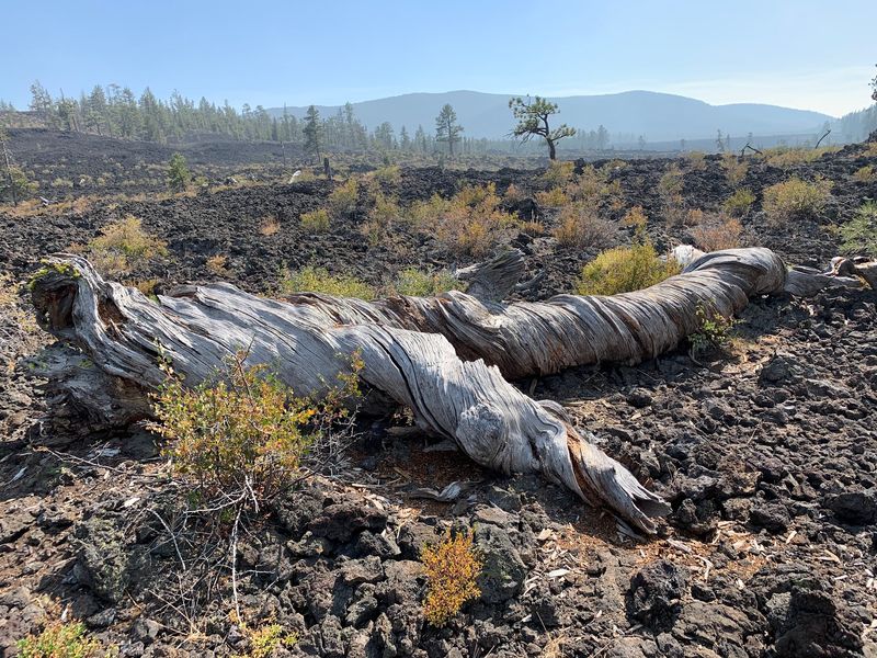
Thousands of years ago, molten lava flowed through a pine forest south of Bend and wrapped around the trees. The wood eventually burned away, leaving hollow molds in the rock.
Those strange tree-shaped holes are what give Lava Cast Forest its name.
Walking the path feels like touring a natural sculpture garden. Casts come in all shapes and sizes, some standing upright and others lying sideways where trunks toppled into the flow.
Most visitors are surprised by just how many there are.
Between the casts, twisted trees and hardy plants push up through the dark lava, adding a haunting beauty to the scene. The trail is very easy, making it a great stop for families.
Quick tip for your GPS: search for the Lava Cast Forest Trail rather than the general name. Spring and fall bring cool, comfortable walking weather in Deschutes County.
11. Leslie Gulch, Jordan Valley, OR
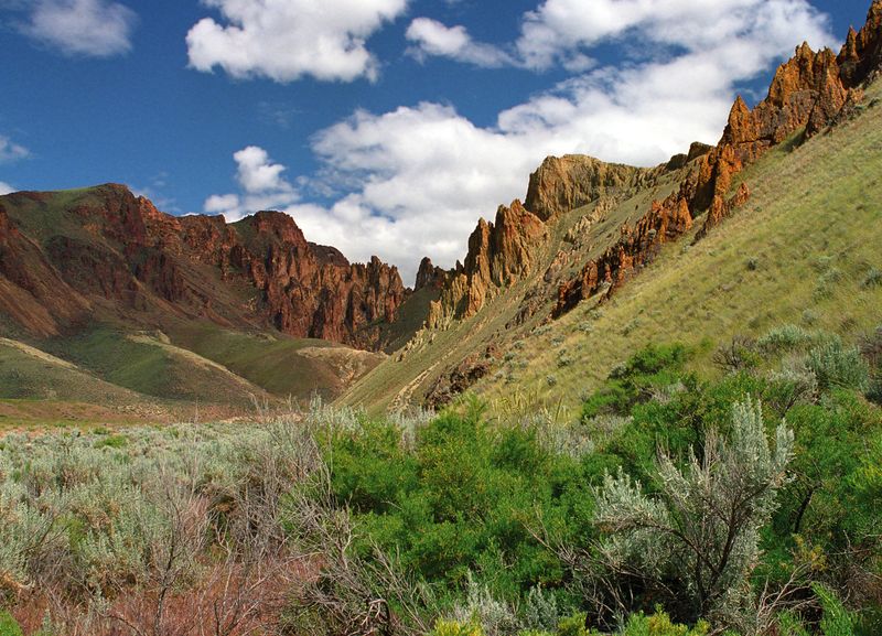
Tucked into the far corner of Malheur County, Leslie Gulch feels like a secret city built entirely of rock. Towering spires of volcanic ash rise on every side, weathered into honeycomb patterns and glowing red and orange in the sun.
Be honest with yourself about the drive. Reaching the canyon means more than 20 miles of dusty, rocky, washboard road with a shallow stream crossing, so a sturdy vehicle helps a lot.
Your car will come out wearing a coat of dust.
The reward? Easy trails wind between the formations, and bighorn sheep sometimes appear on the cliffs.
At the end, the road reaches a lake, adding a surprising splash of blue.
A primitive campground with a single pit toilet lets you stay the night. Pack everything you need, including picnic supplies.
Few people make this trek, which keeps the canyon wonderfully peaceful.
12. Hole-in-the-Ground
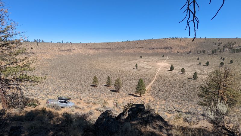
Yes, the name is exactly what you get. Hole-in-the-Ground in Lake County is a nearly mile-wide crater sitting in the pine forest, so round and tidy it looks like a giant scooped it out with an ice cream spoon.
Fun science moment: this is a maar crater. It formed when rising magma hit groundwater, flashing it into superheated steam and triggering a massive explosion.
Standing at the rim, you can almost imagine the blast.
Reaching it means traveling forest service roads, and driving down to the bottom is bumpy enough that high clearance is a must. Many visitors simply park on the rim and hike down instead.
Pair this stop with Crack in the Ground on the same high desert road trip for a double dose of volcanic weirdness. Fall brings crisp air and golden light that makes the crater photos look even more unbelievable.
Share this story