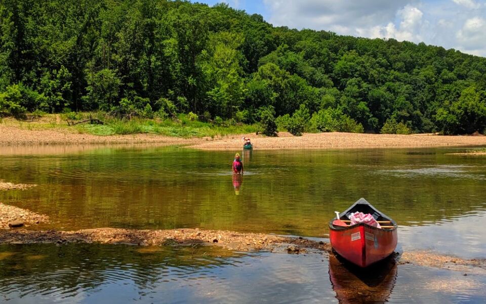
America’s first national river runs free for more than 135 miles through the Ozark Mountains of Arkansas, and no dam has ever slowed it down. Along the way it cuts past limestone bluffs, drops over waterfalls, and winds through valleys where wild elk graze at sunrise.
More than a million people visit each year, and the trip list is long enough to make choosing tricky. This guide narrows it down to ten adventures that show off every side of the park.
You will find float trips for paddlers, trails for hikers, and campsites for anyone who wants to stay past dark. The night sky here even earned an International Dark Sky Park title, so bedtime comes with a free star show.
Expect practical tips on timing, reservations, and trail difficulty, plus a few surprises about history and geology. Some routes are easy strolls and others will make your legs file a complaint.
Pack a water bottle, bring a sense of humor, and let the river set the pace. The first stop sits beneath a giant bluff that photographers love.
Steel Creek Campground, Jasper, Arkansas
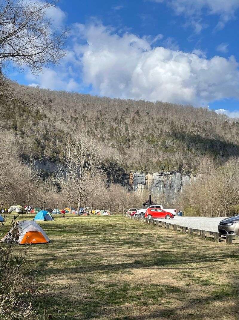
Coffee tastes better when Roark Bluff is your view. This wall of streaked sandstone stretches about three-quarters of a mile and rises over 200 feet above the water.
Steel Creek is the starting point for the famous eight-mile float to Kyles Landing. The trip passes through the Ponca Wilderness, with side canyons, clear pools, and a rapid section nicknamed Hell’s Half Acre.
Weekends from March through June get busy, so plan ahead.
The campground has 26 tent-only sites and 13 equestrian sites. None of them have electric or water hookups, but flush restrooms and drinking water spigots run from mid-March through mid-November.
All sites need reservations for the 2026 season, and popular dates can book up months early. Try recreation.gov well ahead of your trip.
Winter camping is free, though the water is turned off. Large RVs should skip this one, since the access road is steep and winding.
Fall brings colorful leaves to the bluff, which makes for great photos.
Lost Valley Trailhead, Kingston, Arkansas
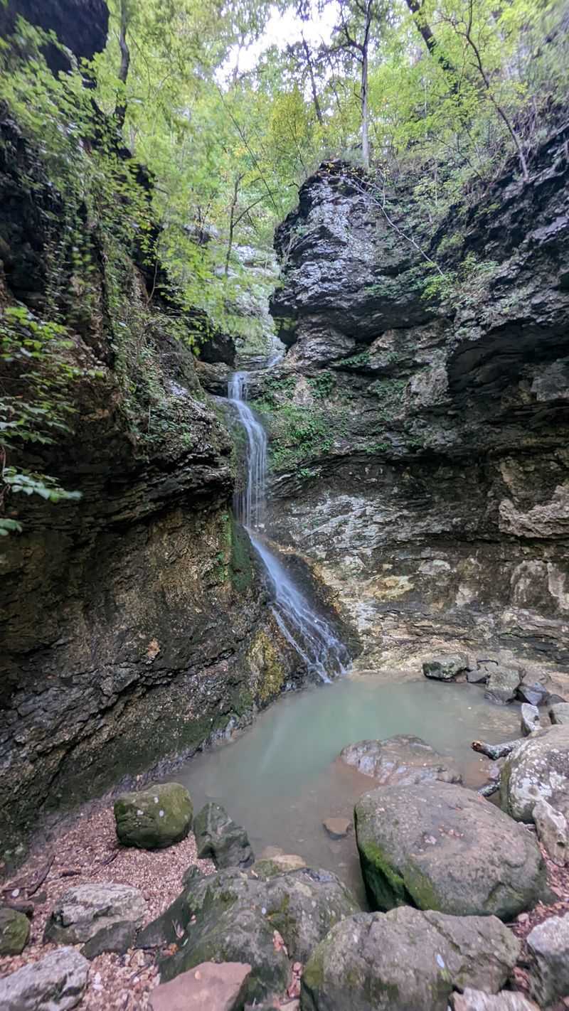
Here is a hike with a built-in scavenger hunt. Lost Valley Trail follows Clark Creek into a narrow box canyon, and the sights come one after another.
About half a mile in, a natural bridge appears, a 50-foot limestone tunnel carved by the creek. An eight-foot waterfall drops beneath it into a bright green pool.
The first stretch of trail is friendly enough for strollers and wheelchairs.
Farther up, the path gets rougher and passes Cob Cave, a 200-foot bluff shelter. Corn cobs found there during excavations show that people used the space long ago.
The big finish is Eden Falls, a 53-foot waterfall. A spur trail leads into a cave with a hidden waterfall inside, but you will need a flashlight and a willingness to get muddy.
Visit after recent rain, especially in spring, when the falls flow best. Pets are generally not allowed on this trail.
Lost Valley pairs well with a trip to nearby Ponca and Steel Creek.
Boxley Valley Historic District, Ponca, Arkansas
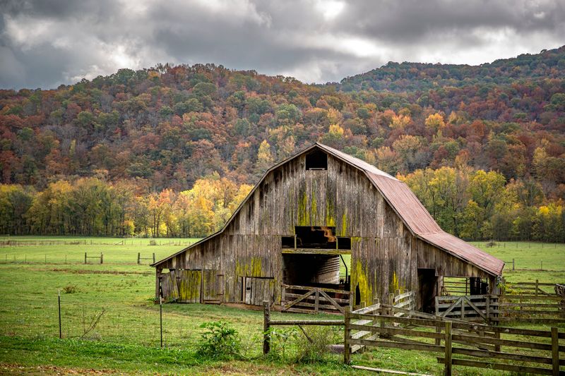
Arkansas has one elk herd, and Boxley Valley is where most people meet it. Pastures spread below wooded ridges, and the animals often wander out to graze near dawn and dusk.
Fall is the busiest time for elk watching. October and November mark the rut, when bull elk compete for mates and call out across the fields.
The herd is the result of a reintroduction program that began in the 1980s.
Use the marked pull-offs along Highways 43 and 21 and keep at least 150 feet between you and the animals. A zoom lens beats a close encounter every time.
The valley is also a living history lesson. It joined the National Register of Historic Places in 1987 and holds more than 200 historic structures, including houses, barns, and a grist mill dating to 1870.
The Osage hunted here before settlers arrived in the 1840s. Today, descendants of those early families still care for many of the farms.
Big Bluff/Goat Trail, Compton, Arkansas
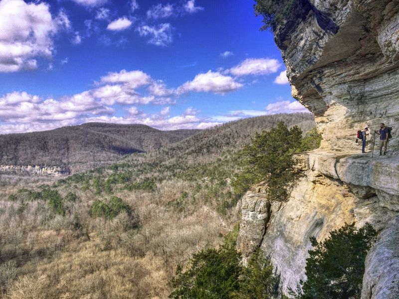
Big Bluff stands 550 feet tall, and it is the tallest sheer bluff between the Rocky and Appalachian Mountains. The view over a horseshoe bend in the Buffalo River is worth the sweat.
The hike starts at Centerpoint Trailhead on an old wagon road. It slopes gently downhill, but you lose more than 1,000 feet of elevation, and every foot has to be climbed back on the return.
Plan on roughly five to six miles round trip and four to six hours.
The Goat Trail branches off and crosses the bluff face about 300 to 350 feet above the river. In places it is only about a meter wide.
The National Park Service calls it narrow and dangerous, and it is a frequent rescue location. Skip it if heights bother you, and leave young children at home.
Bring at least two liters of water, salty snacks, sturdy boots, and a map. Pets are not allowed.
Afternoon light is best for photos.
Hemmed-In Hollow Falls, Compton, Arkansas
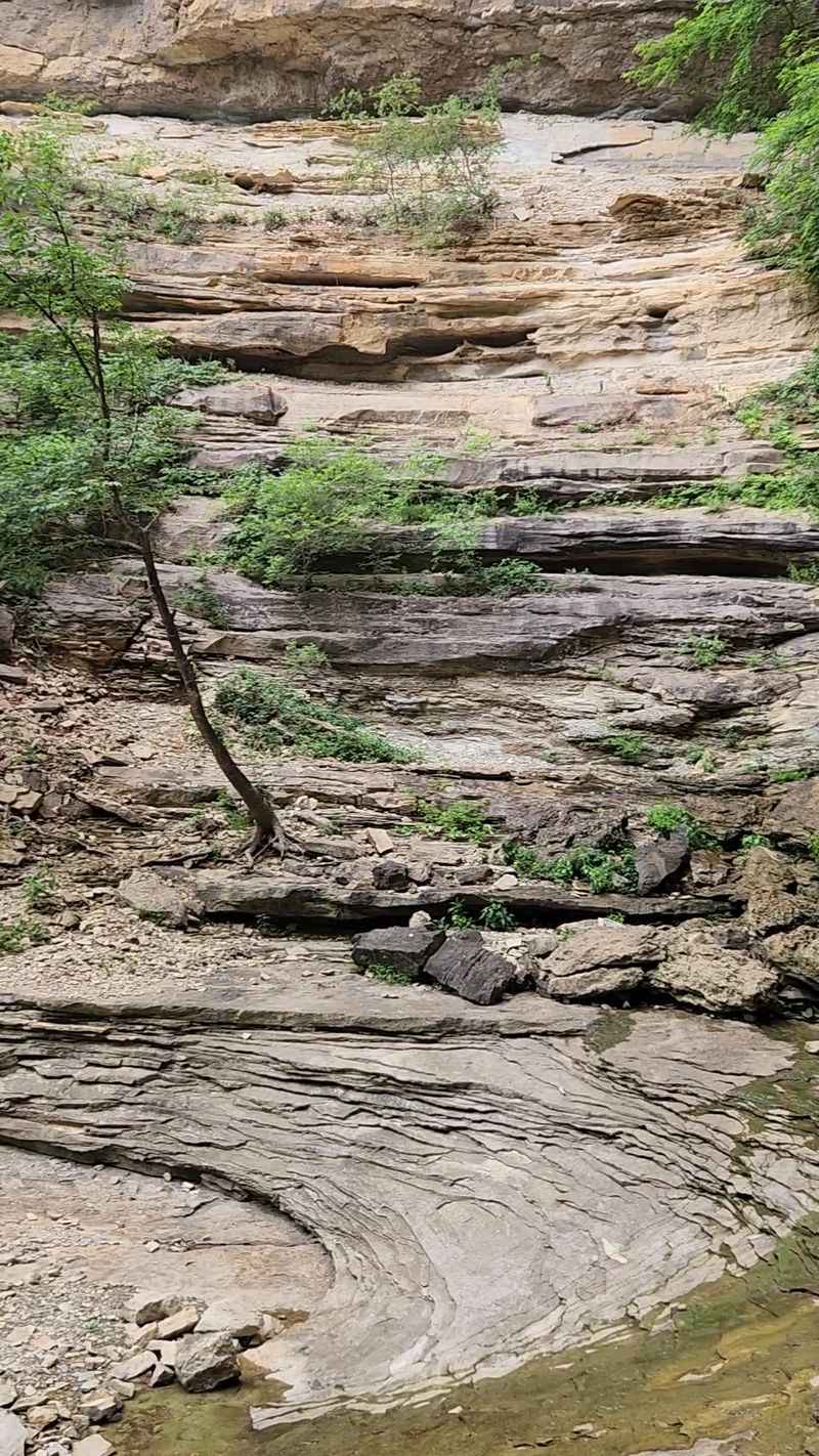
At nearly 210 feet, this is the tallest waterfall between the Rocky and Appalachian Mountains. It sits deep in the Ponca Wilderness, tucked into a sandstone amphitheater.
Rain controls the show. After a dry stretch the falls thin to a light trickle, but after a wet spell they pour heavily over the edge.
Spring is usually the best season.
The hike from Compton Trailhead runs about five to six miles round trip. Going down is the easy part.
The return climb gains over 1,000 feet, so save some energy.
The National Park Service rates the route as extremely strenuous. Wet rock can be slick, and the trail is a frequent site for rescues.
It is not recommended for young children, and pets are not allowed.
Bring two liters of water per person, salty snacks, and sturdy shoes. Paddlers floating the upper Buffalo in canoe season can reach the falls on a shorter, moderately difficult half-mile hike from the river.
Pruitt Landing South, Harrison, Arkansas
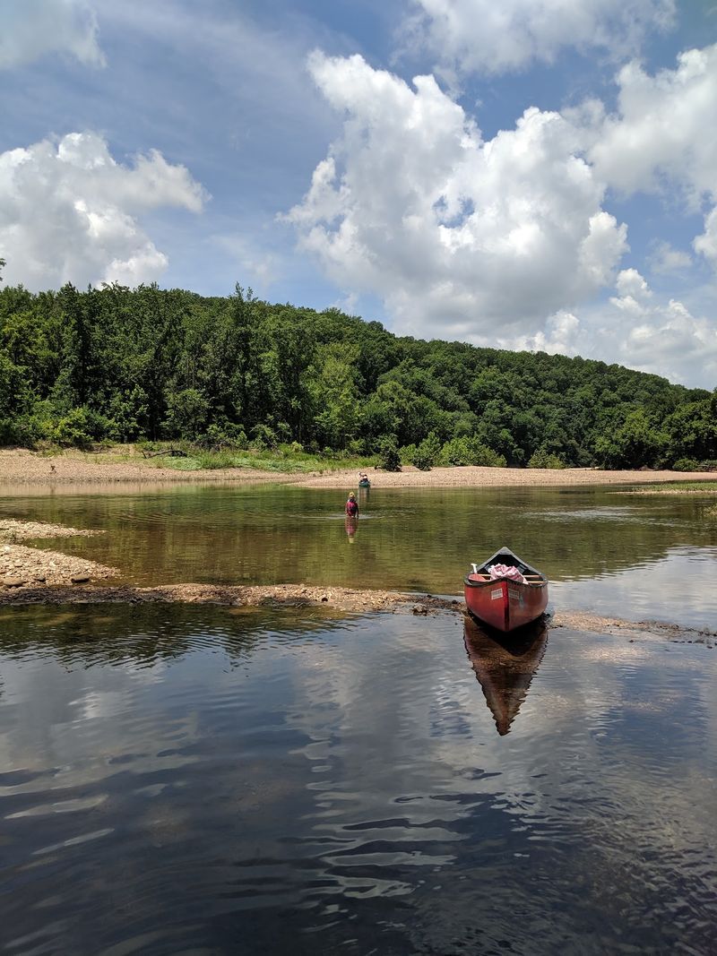
When the upper river runs too low, paddlers head here. Pruitt Landing South is the starting point for a seven-mile float to Hasty that takes about four to five hours.
Some people rank it as the second prettiest stretch of the whole river. The water moves at a steady pace, with deep pools and easy Class I to II rapids when levels are good.
It is generally not recommended for beginners.
About a mile downstream, Welch Bluff shows a real geologic fault. Rock layers have shifted roughly 100 feet, and the tilt can make the river look like it flows uphill.
Crow Hole, a shaded swimming spot, sits at the base.
The landing has picnic tables, restrooms, and a Buffalo River Trail trailhead. Overnight camping is not allowed.
The parking area fills quickly in spring and summer, so arrive early. Anglers can try for smallmouth bass along the way.
Tyler Bend Campground, St. Joe, Arkansas
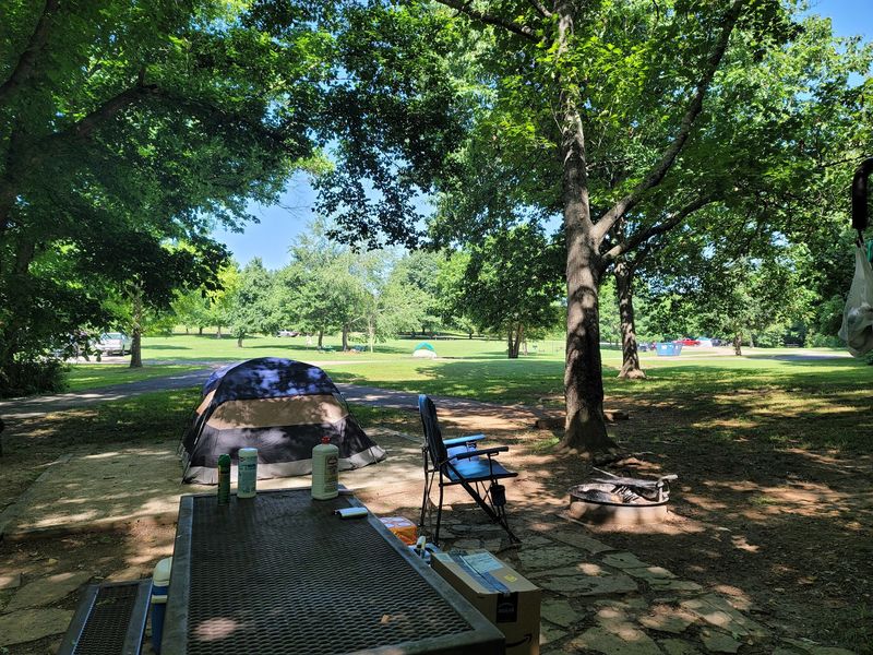
Base camps do not get much more convenient than this. Tyler Bend sits in the Middle District, with river access for picnics, swimming, and fishing.
Choose from drive-in sites, walk-in tent sites, and group sites. Individual sites have no electric or water hookups, but flush restrooms with hot showers and drinking water are available from mid-March through mid-November.
Reservations are required for the 2026 season. You can book up to six months ahead on recreation.gov, and same-day booking is possible when space remains.
Off-season camping is free, with drive-in sites and restrooms still open.
The Riverview Trail is easy to moderate and leads to overlooks above the Buffalo. It suits many hikers.
Nearby, the Collier Homestead is a preserved 1930s Ozark farm. Solomon Collier claimed the land under the 1862 Homestead Act.
The visitor center adds exhibits and programs, so this stop covers history, hiking, and river time in one place.
Indian Rockhouse Trail, Yellville, Arkansas
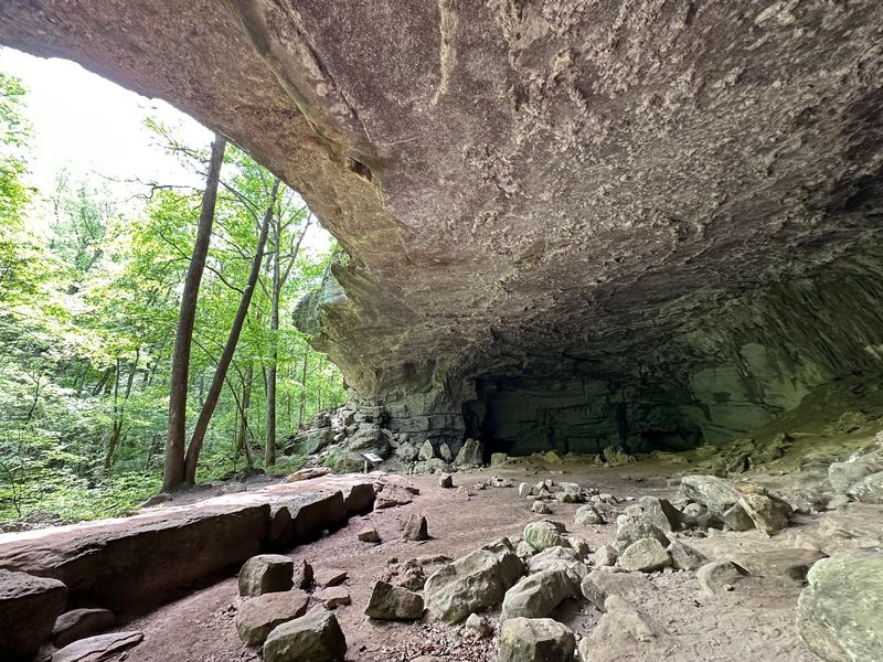
A 3.5-mile loop packs in a sinkhole, a waterfall, a quarry, and a very old shelter. The trail near Buffalo Point is rated moderate to strenuous, with steep rocky sections and about 400 feet of elevation change.
The karst landscape is the theme. Water disappears into the sinkhole during heavy rain, and a spring-fed waterfall spills over sculpted rock that includes a natural bathtub.
Look for drill marks in the old quarry, left by the Civilian Conservation Corps in the 1930s. An abandoned zinc mine adds more industrial history.
The star is the Indian Rockhouse, a huge bluff shelter with a natural skylight and a spring that appears and vanishes. Native Americans used it for as long as 9,000 years.
Excavations in the 1930s turned up tools, basketry, and food remains.
The site is considered sacred because a child’s burial was found there. Bring water, since none is available on the trail, and wear sturdy shoes.
Pets are not allowed.
Buffalo Point River Access, Yellville, Arkansas
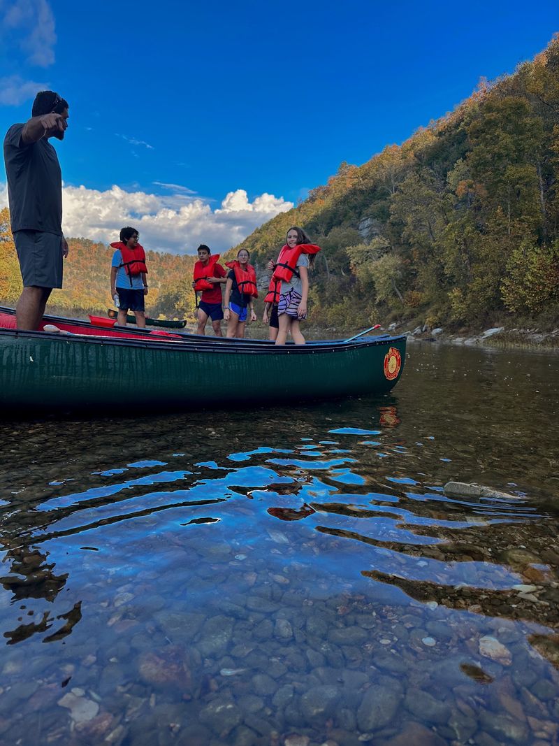
Hot afternoon? Painted Bluff has the answer.
The swimming area sits below one of the most recognizable bluff lines on the Buffalo, with a deep pool and a wide gravel bar.
The bluff gets its name from St. Peter Sandstone, which darkens in streaks as water seeps over it. Paved roads lead right to the river, so families reach the water without a long walk.
Swimming, sunbathing, and fishing all work here. Anglers can chase smallmouth bass, catfish, and sunfish, but an Arkansas fishing license is required.
A small picnic area overlooks the river, and restrooms and changing facilities are nearby. Paddlers can launch canoes and kayaks for floats toward Rush Landing.
Birdwatchers may spot a kingfisher or a heron along the bank. Currents can be strong after heavy rain, so check conditions first.
Younger swimmers should wear life jackets. A morning hike followed by an afternoon dip makes a fine day.
Buffalo Point Campground, Yellville, Arkansas
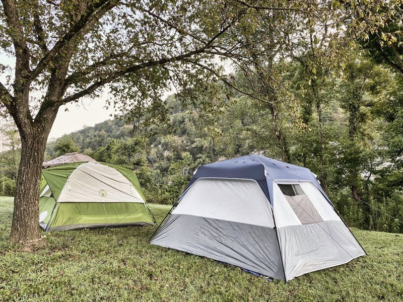
Sunset does not have to end the fun here. Buffalo Point is the largest and most developed campground in the park, with over 100 sites across five loops.
The Civilian Conservation Corps built it in the 1930s as Buffalo River State Park. It is the only spot in the park with water and electric hookups at many drive-in sites.
Walk-in tent sites and group sites are also available.
Reservations are required from mid-March to mid-November. Individual sites can be booked up to six months out, and group sites up to a year.
Flush restrooms, hot showers, and a dump station operate in peak season.
Loop B stays open for free primitive camping in the off-season, with vault toilets only. The park’s only restaurant is here, serving meals and coffee during peak and shoulder seasons.
Trails include Indian Rockhouse and an easy campground trail system where leashed dogs are welcome. Swimming, fishing, and wildlife watching fill out the days.
Share this story