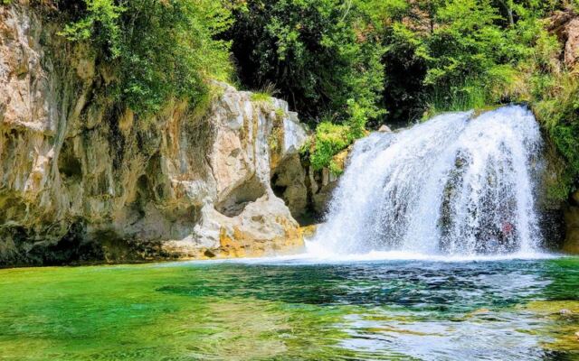
Arizona is famous for red rock, cactus, and long stretches of dry desert. Yet tucked deep in the mountains near Camp Verde, a creek runs so clear and blue that people often say it looks like a movie set.
At the end of a short trail, that water spills over a ledge into a swimming hole you can actually paddle around in. Getting there takes planning, a permit, and a bumpy ride, so here is everything worth knowing before you go.
A Blue Secret Near Camp Verde
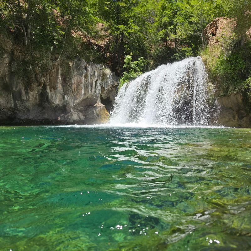
Few people expect a tropical-looking waterfall in the middle of Arizona. Fossil Creek Waterfall sits in the Coconino National Forest, with an address of Camp Verde, AZ 86322.
It is listed as a scenic spot, and it has earned a glowing 4.8-star average from more than 260 people who made the trip.
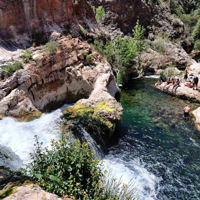
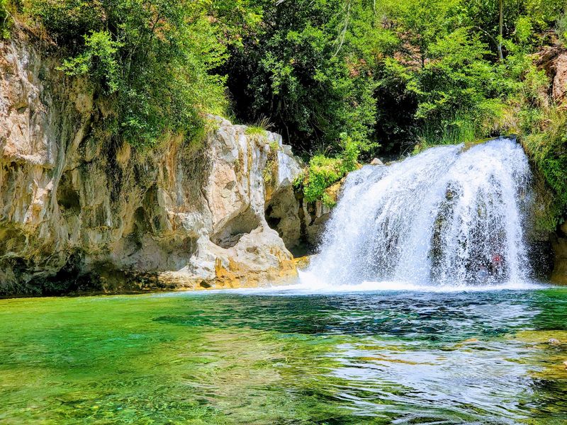
The falls drop into a wide, turquoise pool at the end of a creekside trail. Swimmers can float right below the cascade and look up at the top of the waterfall from the water.
The area around the falls is large, with plenty of room to spread out on rocks or wade in the shallows. Many first-timers describe it as one of the most beautiful places they have ever seen, and some even rank it among their favorite spots in the whole country.
That is a big claim for a creek most travelers have never heard of, so keep reading to see why it holds up.
Why the Water Turns So Blue
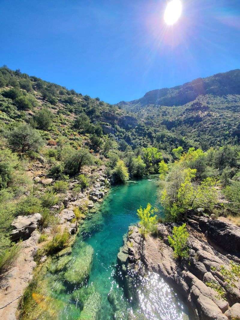
Color is the first thing everyone talks about here. The creek carries a unique mix of minerals, and that composition gives the water its famous turquoise shade.
Clarity plays a role too. The riverbed is made of sandrock rather than loose sand, so the water stays clear instead of cloudy.
Distance helps as well. Fossil Creek sits far from towns and busy roads, which keeps the setting wild and the water remarkably clean.
Schools of fish are easy to spot swimming below the surface. In some pools, the fish are bold enough to nibble at the toes of anyone standing still.
Photos rarely seem to do it justice, though plenty of people try. The blue shows up best on sunny days when light hits the pools directly.
Science explains the shade, but most people simply stand at the edge for a while before they even think about getting in.
Permits Before Paddling
Here is the catch that surprises many first-time planners. From April 1 through early October, a permit is required to enter the Fossil Creek area.
Permits are tied to specific parking lots and are sold on Recreation.gov. They are released the month before your visit.
Demand is high. Permits often sell out within minutes after 8 AM Arizona time, so setting an alarm is a smart move.
Rangers check permits before cars reach the parking areas. Arriving without one in peak season means turning around after a long drive.
Outside that window, from roughly October through March, no permit is needed. The falls stay open daily from 8 AM to 8 PM all week.
Canceled reservations do pop up now and then, so checking back can pay off. Think of the permit as your golden ticket, minus the chocolate factory.
The Road That Earns the Reward
Nobody reaches this waterfall by accident. The entrance sits about 15 minutes from the highway, and then the pavement ends.
A long, winding dirt road leads to the parking lots, and the drive can take around an hour to reach Lot 1. Expect constant bumps, dust, and loose gravel.
A truck or a vehicle with AWD or 4WD is strongly recommended. Sedans have made it on dry days, but the ride is rough on the car.
Rain changes everything. Wet weather can make the road slippery or even impassable for smaller vehicles.
Storms have also damaged the route in the past, closing it to cars for a time. Checking conditions with the Forest Service before leaving is a wise step.
Driving slowly is the name of the game. The shaky ride is part of the story, and almost everyone agrees the destination makes up for it.
Choosing the Right Parking Lot
Lot numbers matter more than most people realize. The permit you book decides how far you will walk to reach the falls.
Lots 1, 2, and 3 sit closest to the creek and the waterfall trail. Lot 1, near the Dixon Lewis area, is the top pick for the shortest hike.
From Lot 3, the round trip to the waterfall runs roughly four miles. That is still very doable for most people.
Lots farther out, such as Lot 5 at Homestead or Lot 6, can add many miles. Some hikers starting there never made it to the falls at all.
Good news, though. Every parking lot has its own access point to the creek.
Those who land a distant lot can still splash around in clear water close by. A far permit is not a failed trip, just a different adventure.
A Mile of Creekside Trail
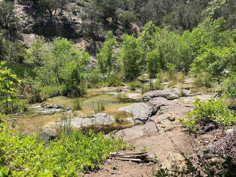
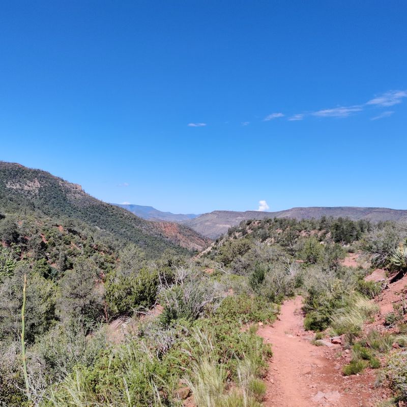
Short and sweet describes the main route. From the closest lot, the trail to the waterfall is about one mile each way.
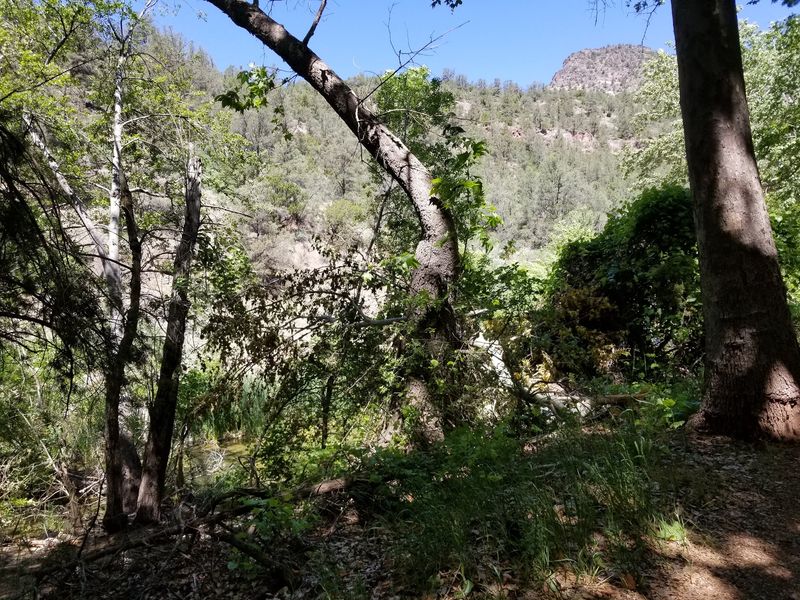
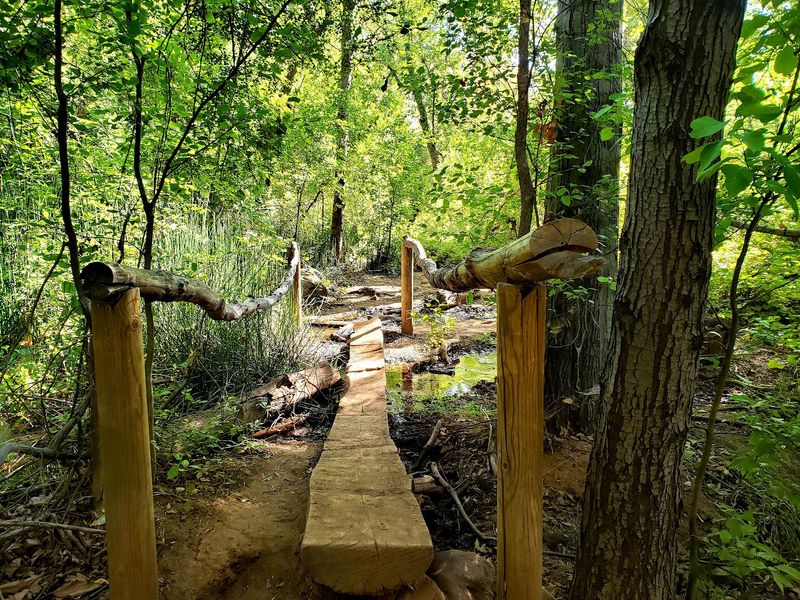
Hikers duck under a gate near the start and then follow the path until it dead ends at the falls. The trail stays close to the creek most of the way.
Elevation gain is minimal, and most people call it manageable for any level of hiker. Families with kids and even dogs have done it comfortably.
There are a few large rocks to scramble across at one point. Sturdy shoes help, since the ground is mostly dust and gravel.
Longer routes can feel tougher on the return, especially with a slight incline and little shade. Some groups spend about two hours each direction on the longer trail.
The walk goes by quickly because the scenery keeps interrupting. Many hikers stop so often that the mile feels like a parade of photo breaks.
Mini Falls Along the Way
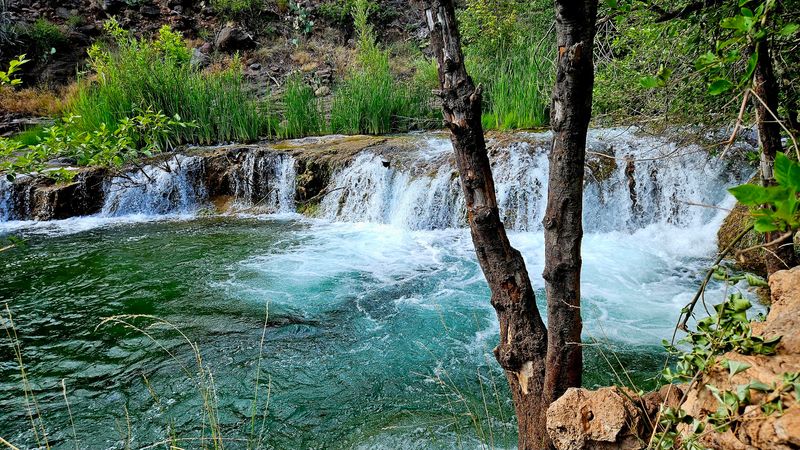
Plenty of people wish someone had warned them about the bonus waterfalls. The trail passes several smaller cascades and swimming holes before reaching the main event.
Right before the large falls, a smaller waterfall feeds a lovely swimming hole. Fish swim here too, and they may nibble a toe or two.
Some regulars actually stop at these mini falls on purpose. The main waterfall can get busy, while the smaller pools often feel more private.
Wandering slightly off the main path also reveals stretches of river just as pretty as the falls. The whole creek seems to be competing for attention.
Shortly after the trail begins, a rope swing hangs near the water. Another spot under a bridge, near restrooms, offers rapids and small falls.
Treat the hike as a series of chapters rather than a race to the finish. The main waterfall will still be there.
Swimming Below the Big Falls
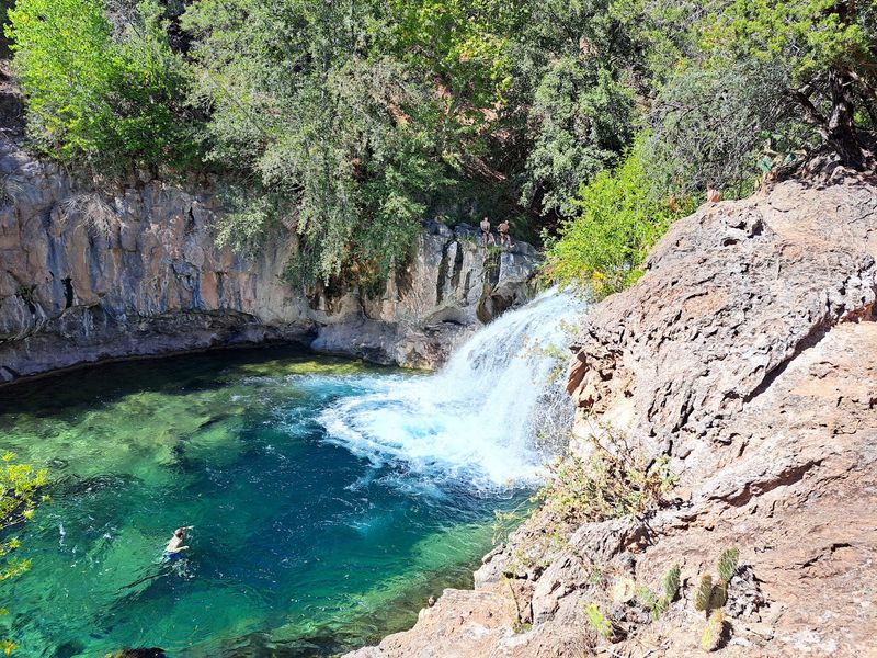
At last, the payoff. The main pool opens wide beneath the waterfall, and swimming right up near the cascade is the highlight for most.
Water temperature varies by season. One summer measurement came in around 74 degrees, while early mornings in June and late May feel chilly.
Visits in October can mean truly cold water. Brave swimmers still take a dip anyway.
A ledge near the falls is popular for jumping. Some cliff jumping is available, and there are trees nearby for stringing up a hammock.
Changing spots are scarce, so wearing swimwear under hiking clothes saves hassle. A small cave sits close to the falls, but it is not much of a changing room.
Packing a picnic makes the stay even better. Once people settle in at the pool, few seem eager to leave.
Respecting the Current
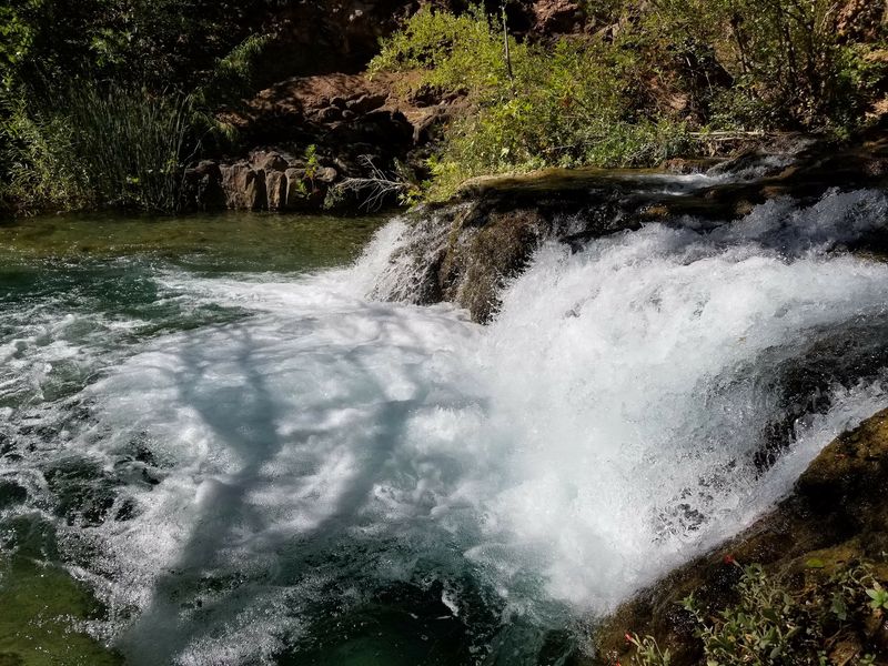
Beauty and caution go hand in hand at this spot. Hazard signs are posted around the falls, and they are there for good reason.
Underwater currents can be strong beneath the waterfall. Jumping from the falls carries real risk, and serious accidents have happened here.
Anyone thinking about leaping should check the water first and follow posted guidance. Diving is fun only when done carefully.
Snakes also live in the area. Watching where you step on the trail is a habit worth keeping.
Ant hills appear along dirt sections between lots. Mosquitoes and bugs are common, so repellent belongs in the bag.
There is no phone service in the area. That means no quick call for help or directions, so travel with a plan and a friend.
Nature runs the show here. Giving it respect keeps the day memorable for all the right reasons.
Wildlife, Fishing, and an Old Power Plant
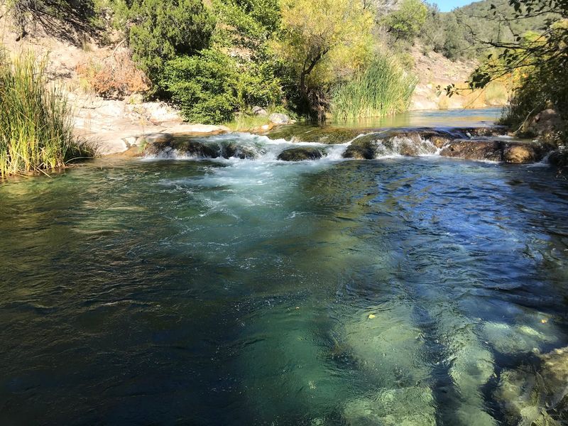
Fish are not the only locals. Lizards sunbathe on rocks, butterflies drift along the trail, and hummingbirds make appearances.
Lucky hikers have spotted a mountain goat and even a black bear in the distance. Keeping a respectful gap is always best.
Fishing is popular too. The creek holds plenty of chub, and one tip suggests raisins as bait for a quick catch.
History buffs have something to explore as well. Across the river near one of the parking lots stands an old APS water and power plant.
Side stops like this one reward anyone willing to linger. The creek has more corners than a single visit can cover.
Bring patience and a curious streak. Between watching schools of fish and poking around the old plant, the day fills up fast.
Packing List and Timing Tips
Preparation separates a great day from a frustrating one. There are no nearby stores, so bring everything you need.
Water tops the list, since much of the walking happens in open sun with little shade. Snacks, sunscreen, and bug spray come next.
Hiking shoes work best for the dusty trail. Water shoes are handy once you reach the creek.
Restrooms are available at the lots, but there are no trash cans. Pack out everything you bring and follow leave no trace habits.
Timing makes a difference. The falls can get crowded, especially on weekends.
Arriving before 10 AM gives you calmer pools and better photo chances. Early starts also beat the midday heat on the trail.
Hours run from 8 AM to 8 PM daily. Plan around them, and the rest falls into place.
Worth Every Bump
So, does the payoff match the effort? Almost everyone who makes it says yes, and many call it their favorite place in Arizona.
The permits are tricky, the road is rough, and the parking lottery can be a gamble. Even so, the turquoise water keeps pulling people back.
Families, solo hikers, dog owners, and groups all find something here. Some come for the cliff jump, others for quiet mini falls.
It works in every season too. Warm months bring swimming weather, while cooler months skip the permit and thin the crowds.
The key is keeping it clean. Packing out trash helps protect the creek for the next crowd of swimmers.
Bring patience, sturdy shoes, and a permit if the calendar calls for one. At the end of the trail, a waterfall and a blue pool are waiting.
Share this story