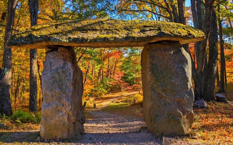
Some of Pennsylvania’s most unusual attractions are miles from the main highways. You can walk onto the remains of a collapsed railroad bridge, tap boulders that ring like bells, or explore the ruins of a dam that failed more than a century ago.
Other detours lead to a massive field of Ice Age rocks, a canyon stretching nearly 50 miles, and a spillway where hundreds of carp gather beneath visiting ducks.
These 15 destinations offer something beyond the usual roadside stop. Some are easy walks from a parking lot, while others require a winding mountain drive or a short hike.
Here is where to find them, what makes each one worth visiting, and what to know before heading out.
1. Kinzua Bridge State Park, Mount Jewett, Pennsylvania
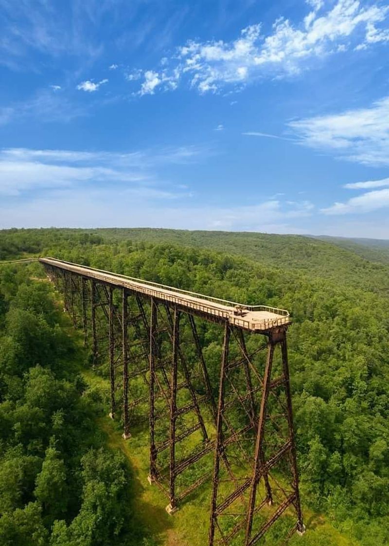
Back in 1882, builders finished a railroad bridge so tall that people called it the Eighth Wonder of the World. It was rebuilt with steel in 1900 and carried trains across the Kinzua Creek Valley for decades.
Then, in 2003, a tornado knocked down 11 of its 20 towers. Instead of clearing the mess away, the state turned the surviving section into the Kinzua Skywalk, which opened in 2011.
Today you can walk about 600 feet out onto the old tracks, roughly 225 feet above the valley. A glass panel at the end lets you look straight down, which is great fun for brave visitors and a quick nope for others.
Below, twisted steel towers still lie where they landed. Stop at the visitor center first to learn the full story before heading out.
2. Bilger’s Rocks, Grampian, Pennsylvania
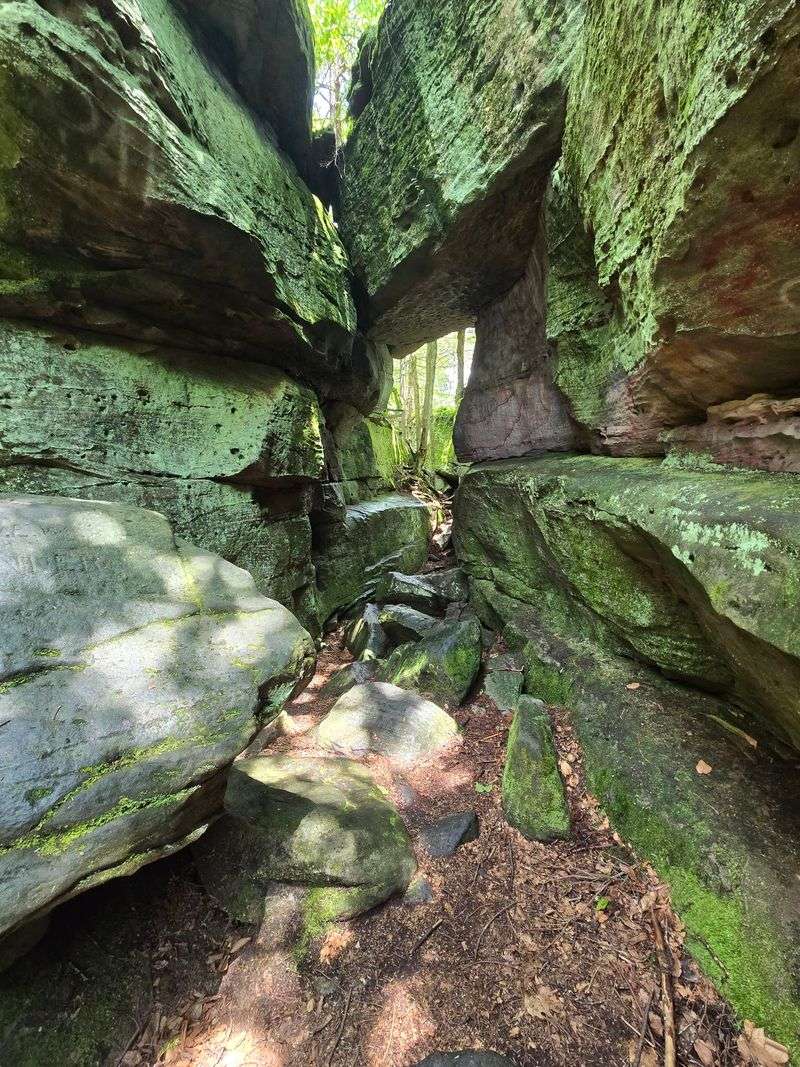
Kids love it, parents chase them through it, and geologists nod at it seriously. Bilger’s Rocks is a maze of huge sandstone blocks spread across a patch of Clearfield County forest.
The rock comes from the Pottsville Formation, which formed on an ancient seabed about 300 million years ago. Over time, weathering split the stone into tall walls, tight cracks, and hidden corridors.
Some passages are barely wide enough for one person. Others open into small rooms with rock ceilings overhead.
Many formations have nicknames, so grab a trail map at the entrance and try to spot them. It turns a hike into a scavenger hunt.
The site is run by a nonprofit and is open year round. Sturdy shoes are a must, since the ground is uneven.
Leave the flip-flops in the car, unless you enjoy limping back to it.
3. Hyner View State Park, Hyner, Pennsylvania
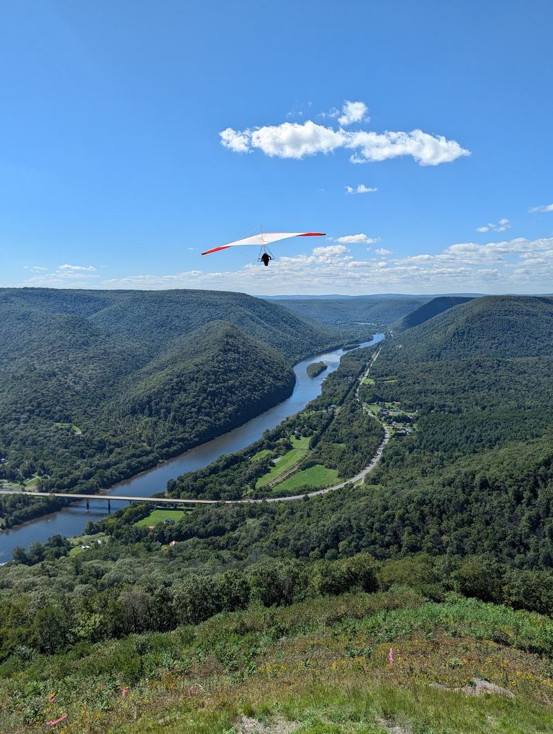
Hang gliders treat this overlook as a launch pad, which tells you just how high it sits. Hyner View State Park perches about 1,300 feet above the West Branch Susquehanna River in Clinton County.
The drive up Hyner View Road is steep and twisty. Take it slow, especially on the switchbacks.
At the top, a stone wall marks the edge of the overlook. From there, the river curves through miles of forested mountains in both directions.
On good weather days, pilots unfold their colorful gliders and run right off the launch ramp. Watching them is free entertainment, and nobody expects you to join.
The park has picnic tables and restrooms, so packing lunch makes sense. It also sits along the Bucktail Path Scenic Byway, Route 120, a great road to keep exploring afterward.
4. Austin Dam Memorial Park, Austin, Pennsylvania
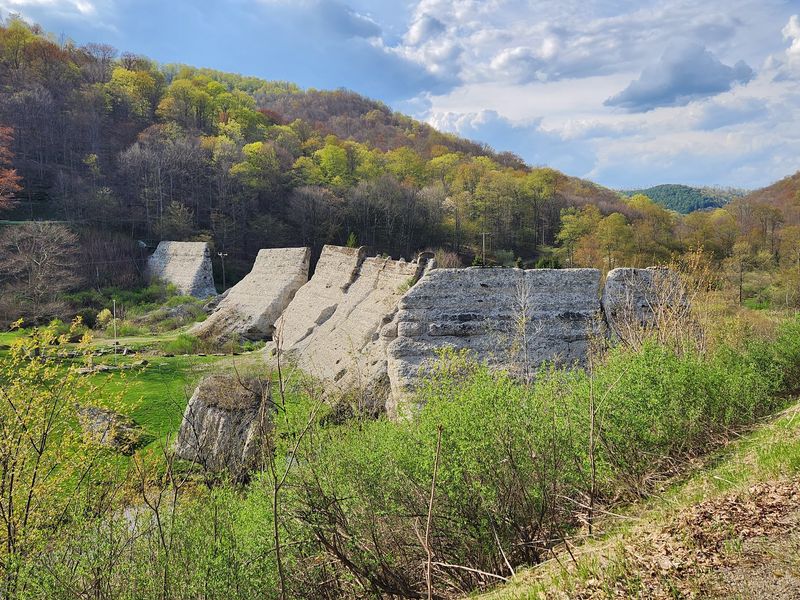
History lessons rarely come in sizes this big. Outside the small town of Austin, giant slabs of broken concrete stand in a quiet valley.
They are what remains of the Bayless Paper Mill Dam, built in 1909. In September 1911, the dam gave way, and a powerful flood swept through the town below.
The disaster changed how engineers and lawmakers thought about dam safety. Pennsylvania soon passed stronger rules for inspecting dams.
Visitors can walk among the remaining sections and read signs that explain what happened. Seeing the concrete pieces up close makes the scale of the event easy to understand.
The park also has a campground and hosts community events through the year. Treat the grounds with respect, since this site honors a hard chapter in local history.
Pair your visit with a stop in Austin to learn more from local displays.
5. Hickory Run Boulder Field, Lake Harmony, Pennsylvania
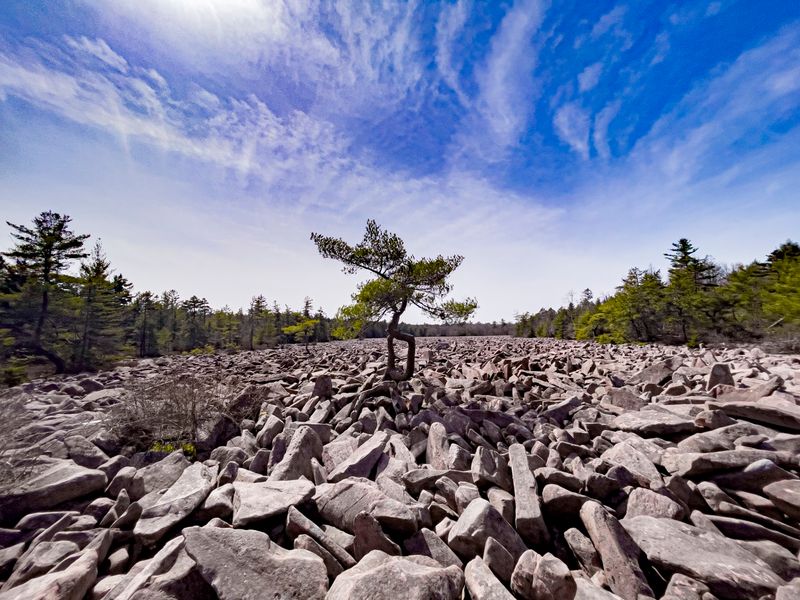
Picture a parking lot, except the cars are boulders and nobody remembers parking them. Hickory Run Boulder Field covers about 16 acres with almost no trees in sight.
The field formed near the end of the last ice age, roughly 20,000 years ago. Repeated freezing and thawing broke rock off nearby ridges, and the pieces slowly crept downhill into this flat spot.
It is a National Natural Landmark, and the rocks reach about 10 feet deep in places. Some boulders are as long as 25 feet.
You are allowed to walk on the field, which is the best part. Hop carefully, because gaps between rocks can catch an ankle.
The road to the field is gravel and bumpy. Painting or moving the boulders is not allowed, so leave everything as you found it for the next visitor.
6. Trough Creek State Park, James Creek, Pennsylvania
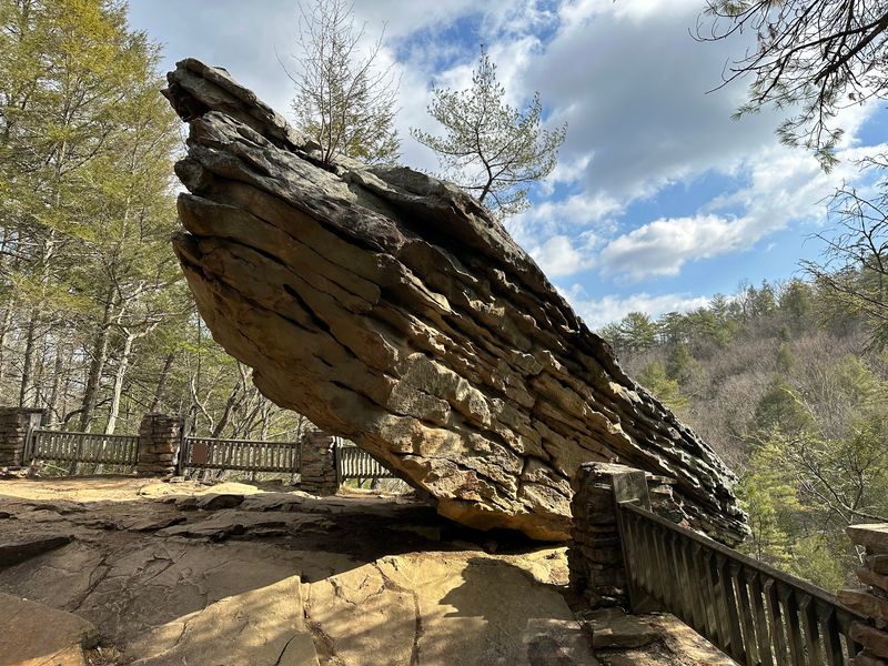
Gravity seems to have taken a vacation at Balanced Rock. A large sandstone boulder sits right at the edge of a cliff, looking like one good shove could send it tumbling.
It has stayed put for a very long time, so relax.
Trough Creek State Park packs plenty into a small gorge near Raystown Lake. A swinging suspension bridge crosses the creek, and short trails lead to Rainbow Falls and Copperas Rock.
Then there is the Ice Mine. Cold air gets trapped underground in winter, so ice can linger at this small opening into early summer.
The mine was dug in the 1900s by people searching for valuable ore. They found cold air instead, which turned out to be more popular.
Trails here are rocky and steep in spots. Bring water and give yourself a few hours.
7. McConnells Mill State Park, Portersville, Pennsylvania
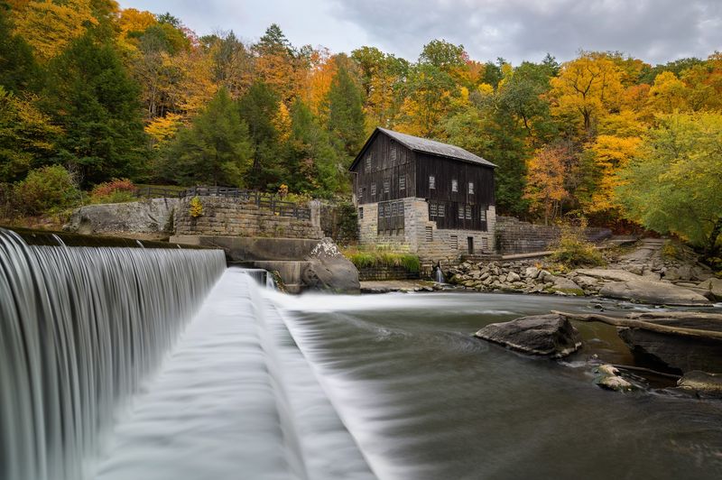
Postcard photographers, this one is for you. A red gristmill and a covered bridge from 1874 sit side by side along Slippery Rock Creek.
The mill was rebuilt in 1868 after a fire, and Thomas McConnell later bought it. It ground grain for local farmers until 1928.
Today, the park offers free tours of the mill during the summer season. You can see the old machinery that turned wheat and corn into flour.
The road down to the mill is narrow and steep, with a one-lane bridge. Patience pays off here.
Beyond the mill, trails follow the gorge past giant boulders and Kildoo Falls. The Kildoo Trail is a popular loop of about two miles.
One warning matters. The creek has strong currents, and swimming is not allowed, so enjoy the water from the shore.
8. Ringing Rocks County Park, Upper Black Eddy, Pennsylvania
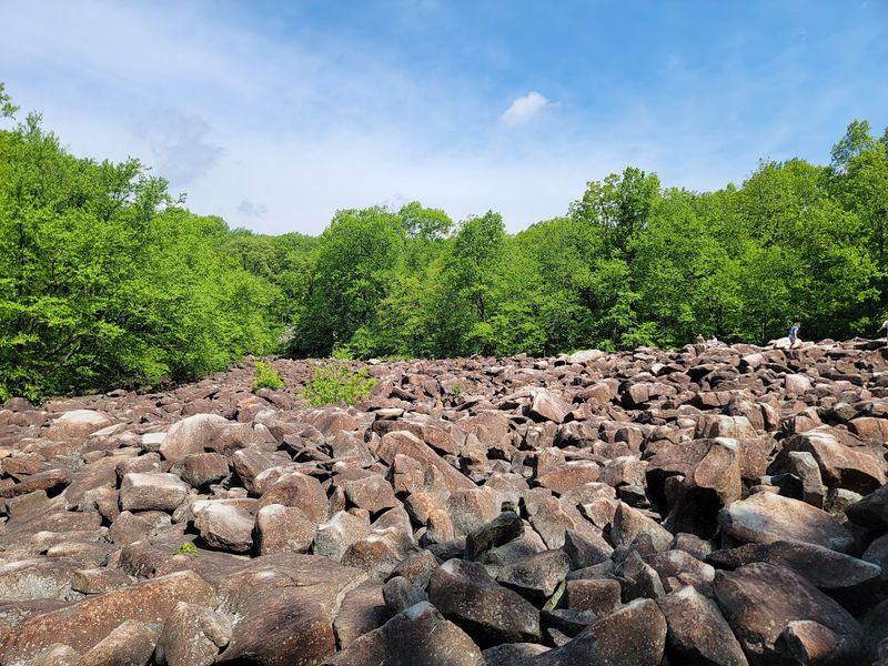
Bring a hammer, and no, this is not a construction project. At Ringing Rocks County Park, many boulders give off clear, bell-like tones when tapped.
The field covers about seven acres in Bucks County. Scientists still debate exactly why some rocks ring and others stay quiet, though the type of rock and stress inside it seem to play a role.
In 1890, a local doctor reportedly played a concert here using the rocks with a band. That is one way to skip buying instruments.
Visitors usually spend time tapping different boulders to find the best notes. Kids often turn it into a contest.
A short trail leads to a waterfall, the largest in Bucks County, which flows best after rain. Wear shoes with good grip, since the rocks are uneven.
Also, keep your fingers clear of your own hammer.
9. Columcille Megalith Park, Bangor, Pennsylvania
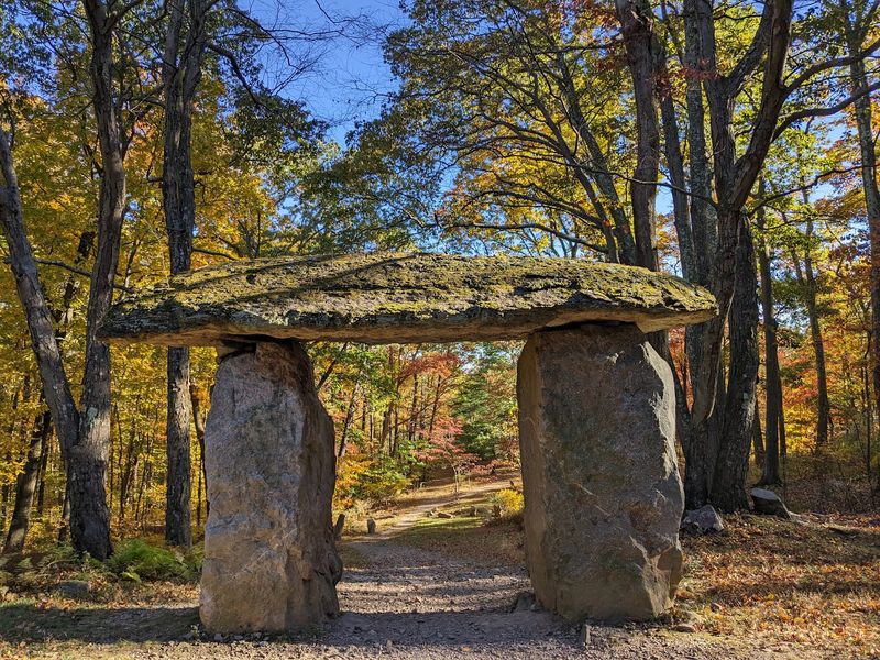
Scotland never sent a moving truck to the Poconos, yet Fox Gap Road somehow ended up with its own standing stones. Columcille Megalith Park was founded in 1978 by William Cohea Jr., who was inspired by the Scottish island of Iona.
Some of the stones stand over 20 feet tall. They are arranged in circles, gateways, and lines across a wooded mountainside.
Here is the twist. None of these stones are ancient, since they were placed in modern times, but they still look like they have been waiting for druids since forever.
Walking paths connect the formations, and a small stone chapel sits on the grounds for quiet visits. Admission is free, though donations help keep the park going.
Wear good shoes, move slowly, and keep your voice low. Visitors treat this spot as a peaceful retreat, not a playground.
10. Worlds End State Park, Forksville, Pennsylvania
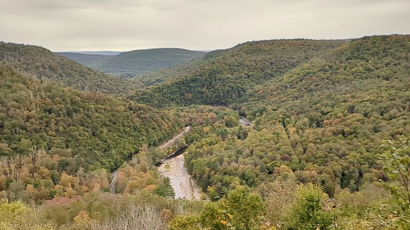
Few parks have a name that doubles as a dare. Worlds End State Park sits in a deep bend of Loyalsock Creek in Sullivan County.
Nobody knows the exact origin of the name. One story says early travelers felt like they had reached the edge of the world on the steep, narrow roads.
Route 154 runs right through the park. Along the way, you can stop at the creek, which has a swimming area in summer.
For the best view, drive the forest roads to Loyalsock Canyon Vista. It looks down over the gorge and the winding creek.
Hikers can tackle part of the Loyalsock Trail, which is rugged and rocky. The park also rents cabins and offers camping.
Cell service is weak here, so download maps before you arrive and tell someone your plans.
11. Leonard Harrison State Park, Wellsboro, Pennsylvania
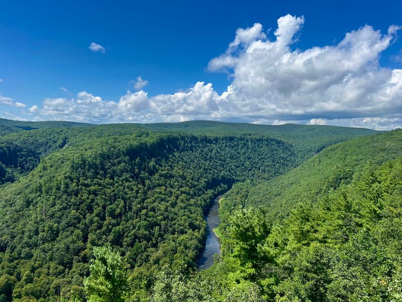
Arizona can keep its famous canyon, because Pennsylvania has a backup. Pine Creek Gorge, nicknamed the Pennsylvania Grand Canyon, stretches about 47 miles and reaches around 1,450 feet deep.
Leonard Harrison State Park sits on the east rim, about 10 miles from Wellsboro. Its main overlook is just steps from the parking area.
For a workout, try the Turkey Path. It drops about 800 feet to the canyon floor, passing small waterfalls along the way.
Going down is easy. Coming back up is when your legs start asking questions.
Fall is peak season, especially in early October, so expect crowds on weekends. Weekday mornings are calmer.
The visitor center explains how the gorge formed. Across the canyon, Colton Point State Park offers a different angle if you want a second look.
12. Bowman’s Hill Tower, New Hope, Pennsylvania
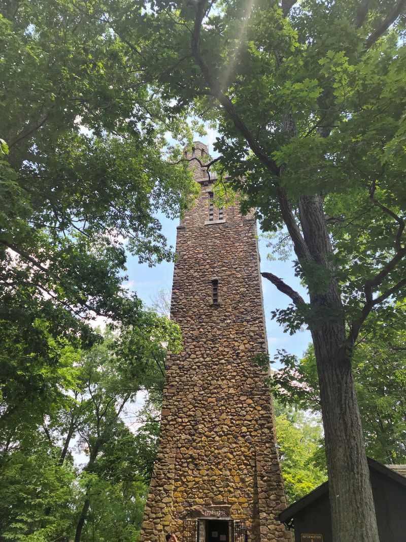
Plenty of people guess this stone tower dates to the Revolutionary War. It does not.
Bowman’s Hill Tower was finished in 1931 and stands 125 feet tall. It was built to honor the area connected to George Washington’s famous crossing of the Delaware River in 1776.
A local story claims lookouts used this hill during the war. Historians are not sure that is true, but it makes for a fun debate on the drive.
An elevator carries visitors most of the way up. The last 23 steps are a narrow spiral staircase to the top.
From the observation deck, you can see the Delaware River Valley and parts of New Jersey. It is a short detour from River Road.
The tower is open seasonally, so check hours before going. Nearby Washington Crossing Historic Park makes a great second stop.
13. Cook Forest State Park, Cooksburg, Pennsylvania
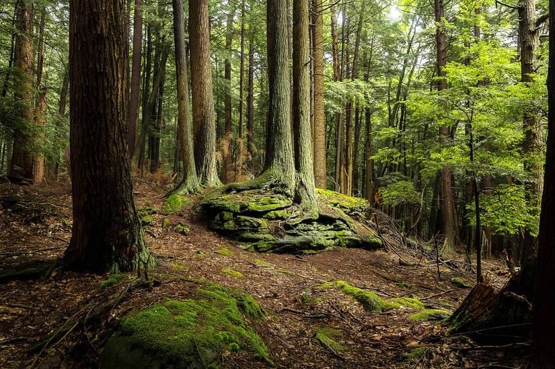
Some of these trees were already old when Pennsylvania became a state. Cook Forest State Park protects the Forest Cathedral, one of the best old-growth woods in the eastern United States.
Many white pines and hemlocks here are over 300 years old. Some reach more than 170 feet tall.
The area is a National Natural Landmark. The Longfellow Trail is the easiest way to walk among the giants, and it starts near the Log Cabin Inn Visitor Center.
Neck strain is the only real danger. You will spend a lot of time looking straight up.
After the forest, drive to Seneca Point Overlook for a view of the Clarion River. The fire tower nearby offers an even higher look.
Canoe and tube rentals operate along the river in summer. The town of Cooksburg also has small shops and ice cream stands for a sweet finish.
14. Pymatuning Spillway, Linesville, Pennsylvania
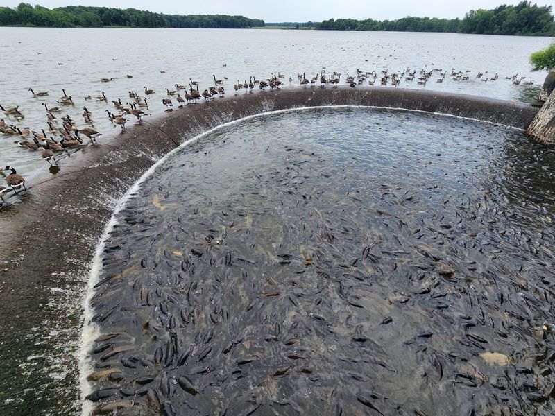
The local slogan says it best: where the ducks walk on the fish. At the Pymatuning Spillway, carp gather so tightly that ducks sometimes stroll right across their backs.
The spillway sits on Pymatuning Reservoir, a huge lake that crosses the Pennsylvania and Ohio border. The reservoir was finished in the 1930s.
Visitors line the railing to feed the fish. For years people brought bread, but the state now asks guests to use fish food pellets sold nearby, since bread is not healthy for the carp.
The crowd of mouths opening at once is either hilarious or a little alarming. Most visitors land on hilarious.
Nearby, the Pymatuning Wildlife Learning Center shows local animals and birds. Bald eagles nest around the lake too, so bring binoculars and keep an eye on the treetops.
Share this story