One bridge on this road runs nearly seven miles over open water. You drive it with turquoise sea on both sides and almost nothing else in view.
The whole route stretches 113 miles and crosses 42 bridges. Much of it rides on the bones of an old railroad that once seemed impossible to build.
I like how a simple highway in Florida can feel more like a boat ride than a commute.
No ticket is needed. No reservation either.
You just point the car south and let the islands show up one by one.
I can’t imagine a cheaper way to feel this far from home without leaving the state. So what exactly makes this drive so hard to forget?
The Road That Floats Across the Florida Keys
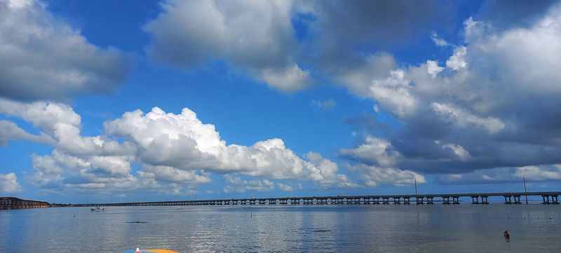
Few roads in America spend this much time over water. The Overseas Highway is the southern tail of U.S.
Route 1, linking mainland Florida to Key West.
Its official length runs about 113 miles through the Florida Keys. Along the way, drivers cross 42 bridges strung between a chain of coral islands.
Islands like Key Largo, Islamorada, Marathon, and Big Pine Key line up like stepping stones. Each one gives you a quick taste of land before the next bridge lifts you back over the sea.
The road itself is mostly two lanes, with occasional passing zones. That keeps the pace relaxed, which honestly suits the scenery better anyway.
Mile markers count down as you head south, ending near zero in Key West. Locals use them like street addresses, so you’ll hear places described by their mile marker number.
For a road that costs nothing to drive, it delivers a lot. Shallow flats glow green and blue beside you for long stretches.
It’s one of those trips where the getting there truly is the main event, and the map barely does it justice.
A Railroad Dream Built on Open Water
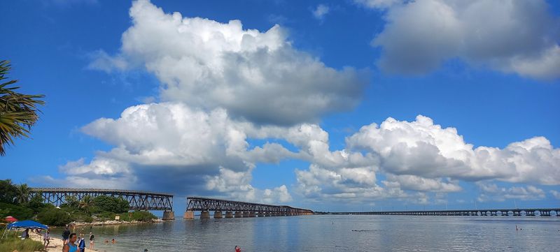
Long before cars cruised here, trains did. Henry Flagler pushed his Florida East Coast Railway across the Keys in the early 1900s.
People called it the Overseas Railroad, and plenty doubted it could be done. Workers built bridges and viaducts across miles of open water with early twentieth-century tools.
The line reached Key West in 1912. For a while, it was celebrated as an engineering marvel, linking the far island city to the rest of the country by rail.
Then came the Labor Day hurricane of 1935. The storm badly damaged the railroad, and the company chose not to rebuild it.
The state stepped in and bought the right-of-way. Engineers adapted the old rail bridges for automobiles, and the Overseas Highway opened in 1938.
That’s why the description says the road rides on an old railroad structure. Many original bridges were later replaced with wider modern spans in the 1980s.
Still, the route follows Flagler’s path, so every drive is a little history lesson on wheels.
Seven Miles of Nothing but Blue
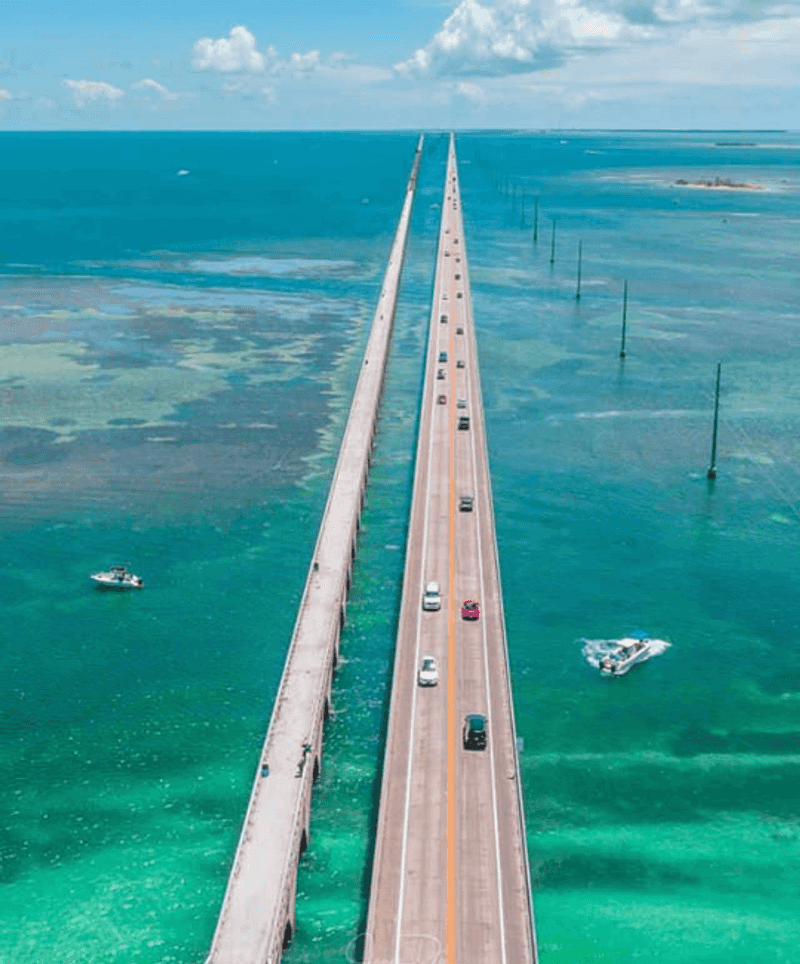
Here’s the bridge everyone talks about. The Seven Mile Bridge connects the Marathon area to the Lower Keys, and it lives up to its name.
Technically it’s a little shy of seven miles. Nobody seems to mind, because the view does all the talking.
Out in the middle, land shrinks to a thin line behind you. The Gulf of Mexico sits on one side, and the Atlantic spreads out on the other.
The current bridge opened in 1982. It rises in a gentle hump near the center so boats can pass underneath.
Right beside it runs the original Flagler-era span. You’ll notice gaps where sections were removed, which gives the old structure a weathered, end-of-the-line look.
Movie fans may recognize the area from big-screen car scenes filmed here over the years. Even without that trivia, it’s a jaw-drop moment.
Keep your eyes on the road, though. Passengers get the best deal here, free to stare at the water while the driver handles all that blue.
Old Bridges Reborn as Walking Paths
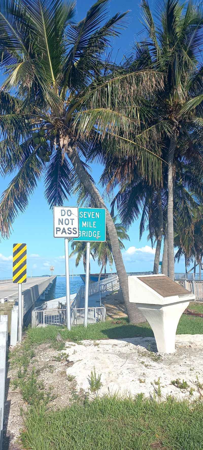
Retired bridges don’t always disappear in the Keys. Many of the old spans now serve walkers, cyclists, and folks who fish from the rails.
The Old Seven Mile Bridge is the star example. A restored section leads out toward Pigeon Key, a tiny island that once housed railroad workers.
Walking it feels very different from driving. You hear the wind, notice the water color shift, and spot fish moving in the shallows.
These old bridges are part of the Florida Keys Overseas Heritage Trail. The trail is a long-running state project aimed at connecting a path for biking and walking along the corridor.
Pieces of it already exist on many islands. You can hop out of the car, stretch your legs, and see the old railroad engineering up close.
That’s a nice bonus on a long drive. A short stroll breaks up the miles and turns a scenic road trip into a hands-on look at Florida history, all without spending a dime.
Water Colors That Look Edited
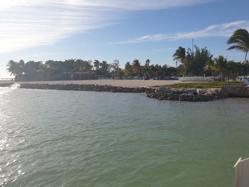
Some shades of blue don’t seem real until you see them. The shallow water around the Keys shifts from pale mint to deep teal within a few car lengths.
Sandy bottoms and seagrass beds create that patchwork look. When the sun is high, the colors pop the brightest.
Mangrove islands dot the flats like little green tufts. They give the open views some texture and make the bridges feel even more exposed.
Along much of the route, the Gulf side and Atlantic side look slightly different. One may be calmer while the other has more chop, depending on the wind.
The Keys are surrounded by protected waters, including the Florida Keys National Marine Sanctuary. That protection covers coral reef, seagrass, and mangrove habitat around the island chain.
So yes, the scenery is gorgeous. It’s also part of a fragile system worth respecting.
Stick to designated pull-offs, keep trash in the car, and let the colors stay as dazzling for the next traveler.
Mile Markers as a Built-In Countdown
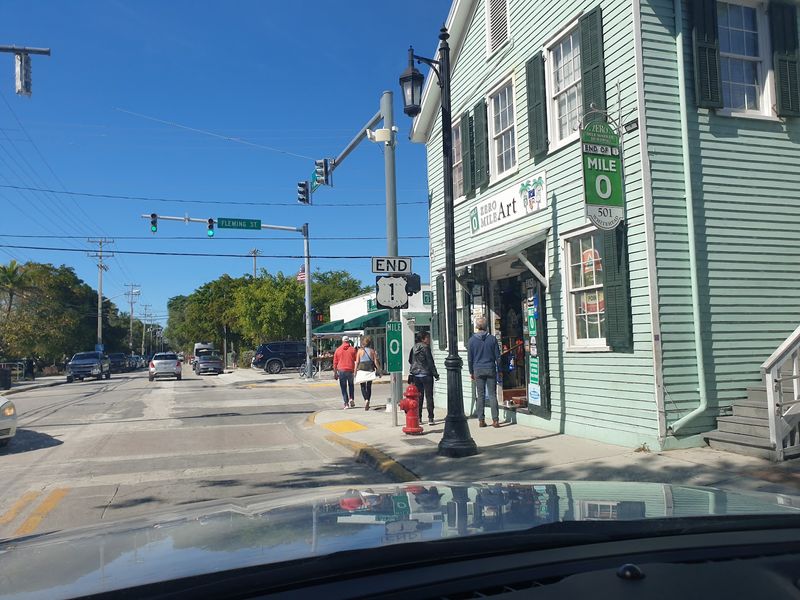
Forget street numbers for a while. In the Keys, small green mile marker signs tell you exactly where you are.
They start in the high double digits near Key Largo and drop toward zero as you head south. Mile Marker 0 sits in Key West.
Businesses, parks, and beaches often list their location this way. You might see something like MM 50 instead of a full address.
Many listings also add bayside or oceanside. Bayside means the Gulf or Florida Bay side, while oceanside faces the Atlantic.
That little system makes trip planning surprisingly easy. Want to stop for lunch around the middle?
Just watch for the right number and look left or right.
It also adds a fun countdown feeling for kids. Watching the numbers shrink beats asking how much longer every ten minutes.
The famous Mile Marker 0 sign in Key West is a popular photo stop. Snapping a picture there makes a fitting finish line after more than a hundred miles of island hopping across Florida.
Bahia Honda and Its Broken Bridge
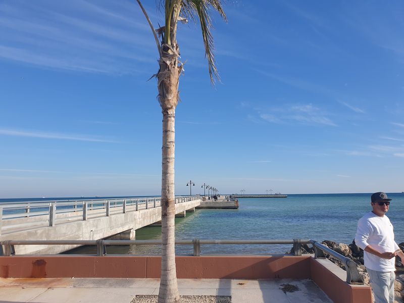
Ask road trippers about memorable views, and Bahia Honda often comes up. The state park sits right off the highway in the Lower Keys.
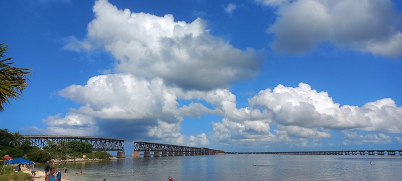
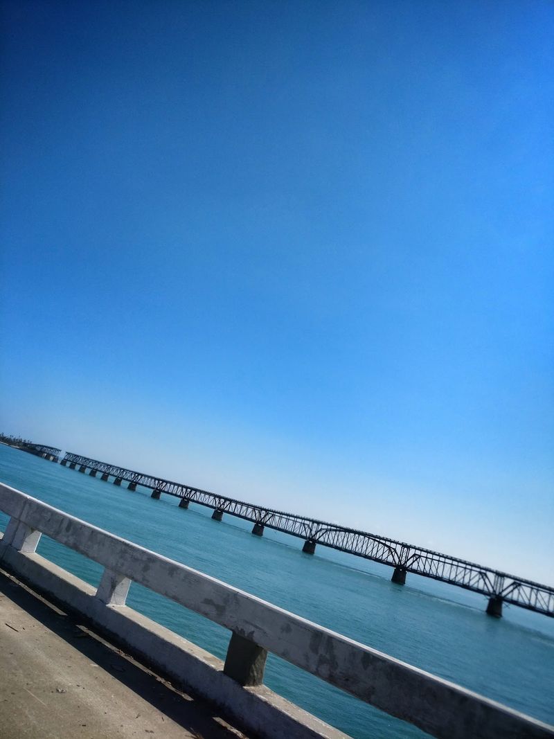
Its old railroad bridge is a showstopper. The steel truss span has a section removed, leaving a gap high above deep water.
That structure once carried trains, and later cars rode on top of the trusses. Today, a remaining piece offers an elevated look across the channel.
Bahia Honda State Park also has sandy beaches, which are not as common in the Keys as many expect. Much of the coastline here is rocky or lined with mangroves.
The park charges an entry fee, so it isn’t free like the highway. Still, it’s a popular stop for swimming, snorkeling, and simply enjoying the water.
The old bridge doubles as a perfect history lesson. You can see how the railroad engineers handled deep channels, and why the highway needed newer spans later.
It’s a scenic pause and a reminder of how this route came together.
Key Deer Country on Big Pine Key
Slow down when you reach Big Pine Key. Tiny deer live here, and they really are tiny.
Key deer are the smallest subspecies of white-tailed deer in North America. They’re protected and found in the National Key Deer Refuge area.
Speed limits drop through parts of the island to protect them. Signs remind drivers that these animals cross roads, especially around dawn and dusk.
Fencing and wildlife underpasses help guide the deer away from traffic. Still, sharp eyes behind the wheel matter most.
Feeding the deer is against the rules. It can harm their health and encourage them to wander toward cars, so admire them from a respectful distance.
Spotting one feels like a small win on the drive. They look almost like a cartoon version of a regular deer, with a calm, unbothered attitude.
Big Pine Key also has a quieter, more natural feel than busier islands. Pine rocklands and freshwater ponds make it a refreshing change of scenery on the way south.
Sunsets Worth Pulling Over For
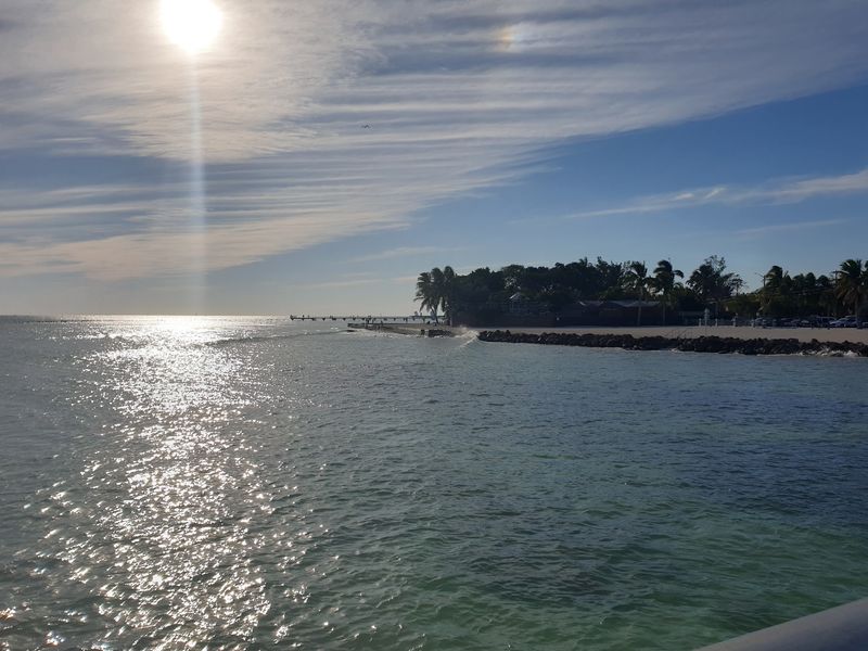
Timing changes everything on this road. A late-afternoon drive can end with the sky turning orange, pink, and gold over the water.
Since much of the route runs east to west in the Lower Keys, the sunset often lands right in your path. That’s beautiful, but it can also be bright.
Sunglasses and a clean windshield help a lot. So does pulling over at a safe spot instead of squinting through it.
Many waterfront parks and public areas along the Keys face west. They make easy places to stop, stretch, and watch the light fade.
Key West famously celebrates the sunset at Mallory Square. Street performers and crowds gather there in the evening, turning the moment into a small festival.
Of course, you don’t need a party to enjoy it. A quiet roadside view works just fine.
The water reflects the sky, and the whole scene feels peaceful in a way that’s hard to describe. Bring a camera, then put it down for a minute.
Who Will Love This Drive Most
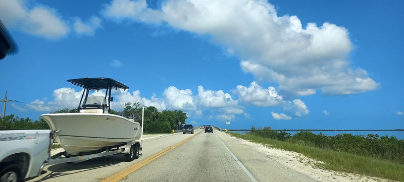
Road trip fans, this one’s basically your dream. It’s long enough to feel like an adventure but short enough for a single day.
Families tend to do well here. Frequent islands mean plenty of chances to stop for snacks, beaches, or a quick stretch.
Photographers will stay busy too. Bridges, water, mangroves, and sunsets offer fresh shots around nearly every curve.
Budget travelers get a sweet deal. The highway itself costs nothing to drive, and the views are free for everyone.
History buffs can trace the old railroad route mile by mile. Nature lovers can look for birds, fish, and those little Key deer.
Retirees and snowbirds already in Florida may find it an easy getaway. There’s no need for a flight, just a full tank and an open schedule.
Folks who dislike heights or long stretches over water might feel a bit nervous on the biggest bridges. Most find the open views more thrilling than scary, though, and the guardrails keep things steady.
Getting There From Mainland Florida
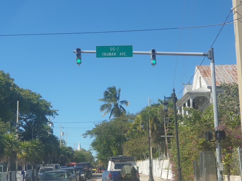
Most trips begin near Florida City at the southern edge of Miami-Dade County. From there, U.S. 1 heads south toward Key Largo.
That first stretch is called the 18-mile stretch. It crosses wetlands and leads to the Jewfish Creek Bridge, one of the gateways into the Keys.
Another option is Card Sound Road. It’s an alternate route to North Key Largo that has a small toll.
Once you’re on the Overseas Highway, navigation is simple. There’s basically one main road, so getting lost takes real effort.
Driving straight through to Key West takes several hours without stops. Traffic can slow things down, especially on weekends and holidays.
Gas stations, restrooms, and food stops appear regularly on the larger islands. On long bridges, though, there’s nowhere to pull off.
A full tank before crossing big spans is smart planning. So is downloading maps ahead of time, in case signal dips.
The road is open around the clock, so you pick the hours that suit you.
Smart Timing and Practical Tips
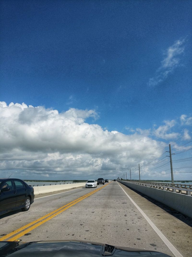
Early mornings are your friend. Roads tend to be calmer, and the light makes the water look extra bright.
Winter and spring bring busy tourist season to the Keys. Expect more cars and a slower pace during those months.
Summer brings heat and afternoon storms. Hurricane season runs June through November, so watch the forecast before you go.
Patience matters on two-lane sections. Passing zones are limited, and rushing rarely saves much time.
Pack water, sunscreen, and snacks. Even with frequent stops, long bridges leave no options for a while.
Plan for a few planned pauses rather than one marathon drive. Parks, beaches, and old bridges make great breaks.
Parking can be limited at popular spots. Arriving earlier usually makes life easier.
And remember that speed limits drop on some islands for safety and wildlife. Following them keeps things relaxed for everyone.
It’s a drive built for slowing down, so give yourself the gift of extra time and let the islands set the rhythm.
Why This Highway Stays With You
Plenty of roads are pretty. Very few make you feel like you’re gliding across the sea for mile after mile.
The Overseas Highway blends history, nature, and pure fun into one easy trip. It’s free to drive, open all day, and loaded with places worth a stop.
You get railroad stories, tiny deer, bright water, and sunsets that make you forget the clock. Not bad for a stretch of U.S. 1.
For Florida residents, it’s a reminder that some of the best adventures sit right in the home state. No passport needed, just a sense of curiosity.
Visitors from farther away get something special too. Few places offer such a sweeping ocean view straight from the driver’s seat.
Sure, traffic happens, and the sun can be fierce. Those small hassles fade fast once the next bridge lifts you over the water.
So top off the tank and pick a sunny day. The Keys are waiting, and those 42 bridges won’t cross themselves.
Share this story