Namibia is a country in southwestern Africa where the land can look like it belongs on another world. Red dunes, white salt pans, jagged peaks, and empty coasts fill its wide open spaces.
Many of these places are protected, and each one tells a story about wind, water, and time. Here are twelve landscapes that show why Namibia stands out for travelers and photographers alike.
1. Deadvlei
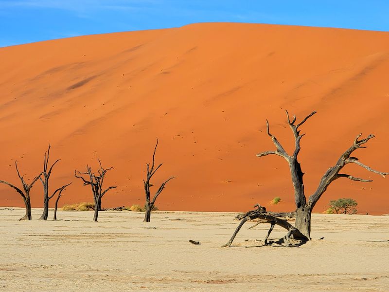
Picture a floor of cracked white clay, black skeleton trees, and a wall of orange dunes behind them. That is Deadvlei, and it looks more like a painting than a real place.
The trees are camel thorn, and they died roughly 600 to 700 years ago. A river once fed the pan, but shifting dunes cut off the water.
The dry air kept the wood from rotting, so the trunks still stand today.
Visitors usually reach Deadvlei by walking about one kilometer across soft sand from a parking area. Start early in the morning, when the air is cooler and the light makes the dunes glow.
Bring plenty of water, a hat, and sunscreen, since there is almost no shade. Photographers love the strong contrast of colors, so a wide lens and a little patience go a long way here.
2. Sossusvlei
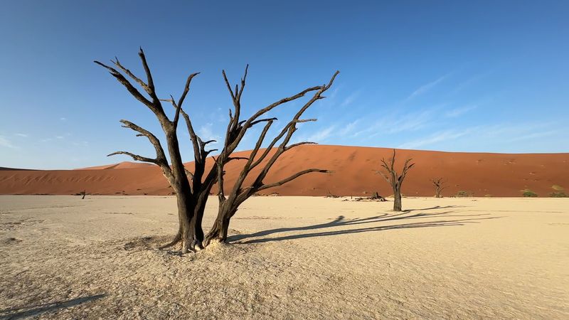
Few places make you feel as small as the base of a giant dune. Sossusvlei sits in the heart of the Namib Desert, where sand ridges climb hundreds of meters into the sky.
The name roughly means a dead-end marsh. When rare rains fill the Tsauchab River, water can reach the pan and turn it into a shallow lake, though this happens only in some years.
Most of the time the pan stays dry and pale.
Some of the dunes here, such as Big Daddy, rise more than 300 meters. Climbing one takes strong legs and lots of breaks, but the view from the top is worth it.
Gates to the park open around sunrise, and arriving early helps you beat both the crowds and the midday heat. Wear closed shoes, because the sand gets hot quickly.
3. Sandwich Harbour
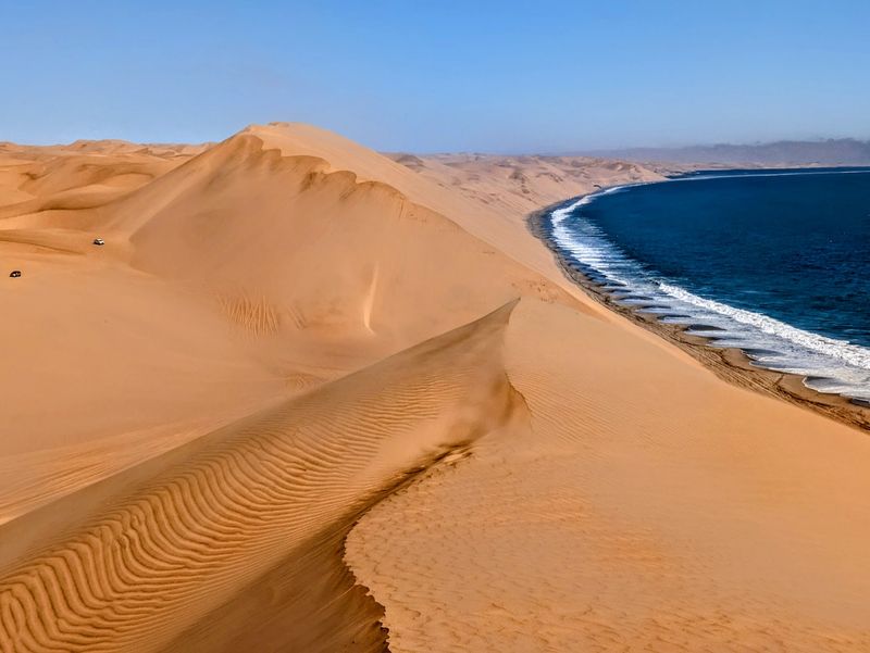
Where else can you watch a desert tumble straight into the sea? At Sandwich Harbour, tall dunes drop into the cold Atlantic, creating a scene that seems almost impossible.
The area lies south of Walvis Bay inside the Namib-Naukluft Park and is recognized as an important wetland. A lagoon here attracts thousands of birds, including flamingos and pelicans.
Seals and jackals also roam the shore.
Getting there takes a four-wheel-drive vehicle and a good driver, since tides and soft sand can trap careless visitors. Most people join a guided tour from Walvis Bay, which is the safest choice.
Tours often include a drive along the beach, a stop on top of the dunes, and a picnic with a sea view. Pack a windbreaker, because the coastal breeze can be chilly even on sunny days.
4. Spitzkoppe
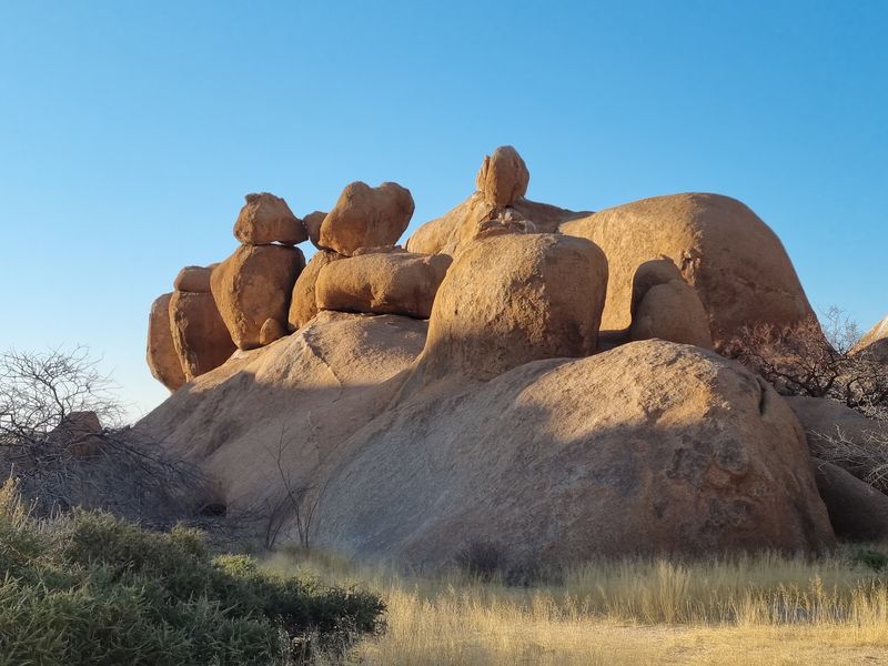
Rising out of a flat plain, Spitzkoppe looks like a cluster of stone fingers pointing at the sky. Locals often call it the Matterhorn of Namibia, thanks to its sharp shape.
The granite is about 120 million years old, and wind and weather have shaped it into smooth domes, huge boulders, and a famous rock arch. Some shelters hold ancient paintings made by the San people, so visitors should look but never touch.
The area is managed by the local community, and you can camp right among the rocks. Sunset is the best time to visit, because the stone turns deep red and orange.
Nights are just as good, since the sky is dark enough to show thousands of stars. Bring a flashlight, sturdy shoes for scrambling, and more water than you think you will need.
5. Fish River Canyon
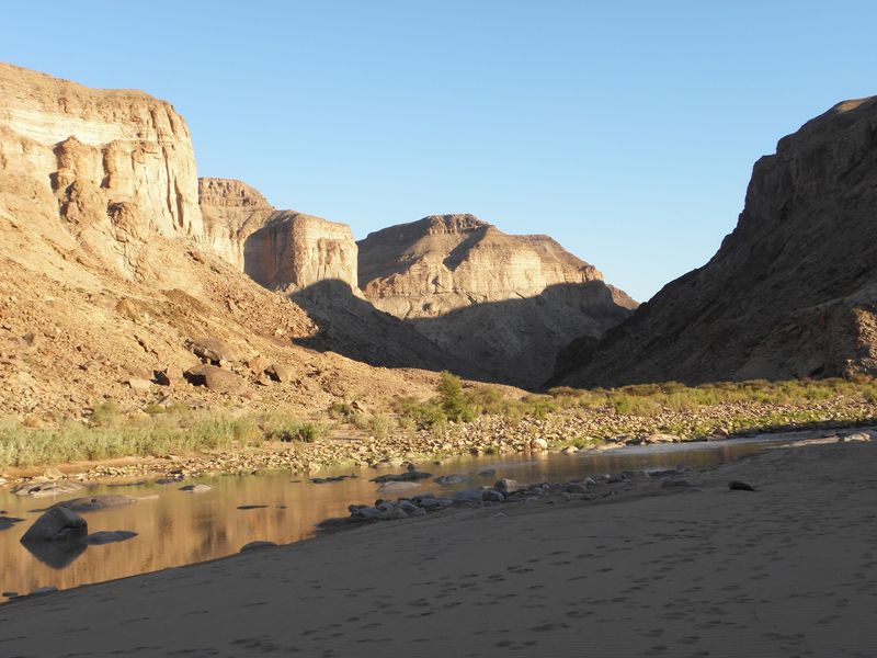
Stand at the edge of Fish River Canyon and the ground simply disappears. The gorge runs about 160 kilometers long, up to 27 kilometers wide, and roughly 550 meters deep in places, making it one of the largest canyons in the world.
It formed over hundreds of millions of years through cracking of the earth and the slow work of water. Today the river winds along the bottom in big, lazy bends, though it often shrinks to a string of pools in the dry season.
Hikers can take on a famous five-day trail through the canyon, but it is open only during the cooler months, roughly May to September, and a permit is required. If you only have a short time, viewpoints near Hobas offer wide views with little effort.
Late afternoon light brings out the deepest colors in the rock.
6. Skeleton Coast
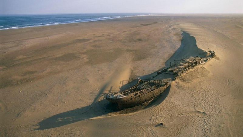
Sailors once feared this shore, and it is easy to see why. Thick fog, strong currents, and hidden sandbanks wrecked many ships along Namibia’s northern coast.
Some old hulls still rest on the sand, slowly turning to rust. Whale bones were once common here too, which may have helped inspire the name.
Behind the beach lies a huge stretch of gravel plains and dunes with almost no people.
The Skeleton Coast National Park is protected, and entry needs a permit. Many travelers join a fly-in safari to see it from the air, which shows the sharp line between desert and sea.
On the ground, you might spot Cape fur seals, desert-adapted wildlife, and the occasional hyena track. Dress in layers, since the fog brings cool, damp air even when the inland desert is hot.
7. Moon Landscape
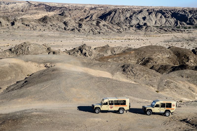
Some places are named after faraway worlds, and this one earns it. The Moon Landscape lies inland from Swakopmund, where the Khan River has carved a maze of ridges and gullies into ancient rock.
The stone here is around 500 million years old. Wind and rare floods have slowly worn it down, leaving bare hills in shades of gray, tan, and brown.
There is almost no plant life, which adds to the lunar feeling.
The best way to see it is from a lookout point, where the whole valley spreads out below. Many people visit on a half-day tour from Swakopmund that also stops at nearby sights.
Go in the late afternoon, when long shadows show off every fold in the land. Keep to marked paths, since the dry ground is fragile and easy to damage.
8. Etosha Pan
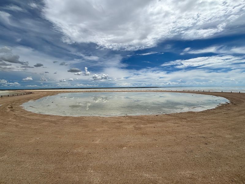
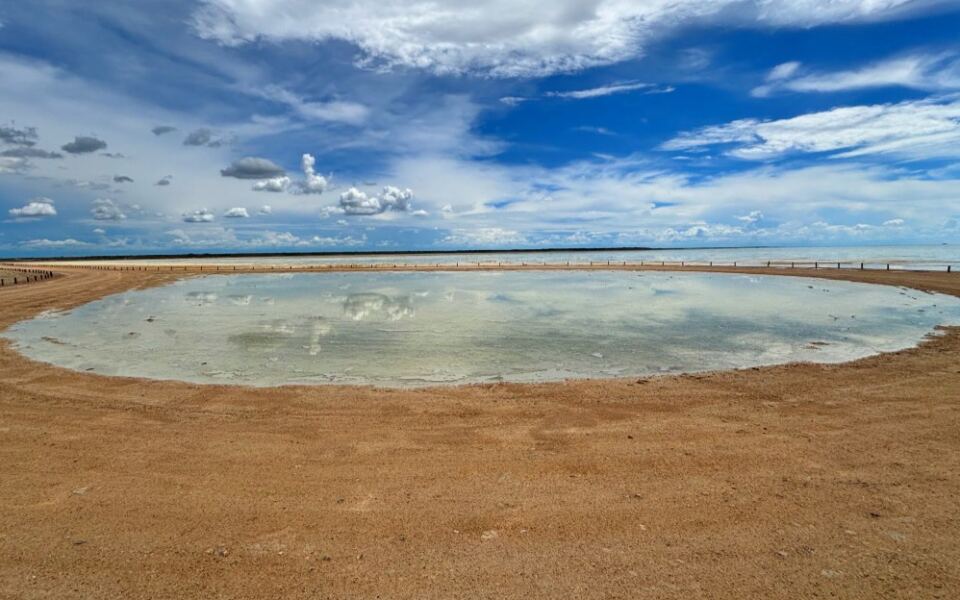
From space, Etosha Pan shows up as a pale patch on the African map. It covers about 4,800 square kilometers, and standing on its edge feels like looking at an endless white sheet.
The pan is a dry lake bed. Long ago, a river fed a large lake here, but the water changed course and left behind salty clay.
In rare wet years, shallow water briefly returns and can draw flocks of flamingos.
Etosha National Park surrounds the pan and is among the best places in Africa to see wildlife. Elephants, lions, giraffes, and rhinos gather at waterholes near its edge.
Self-drive trips are popular, and roads are mostly easy to follow. Visit in the dry season, roughly May to October, when animals are easier to spot.
Keep a respectful distance and stay inside your vehicle.
9. Burnt Mountain
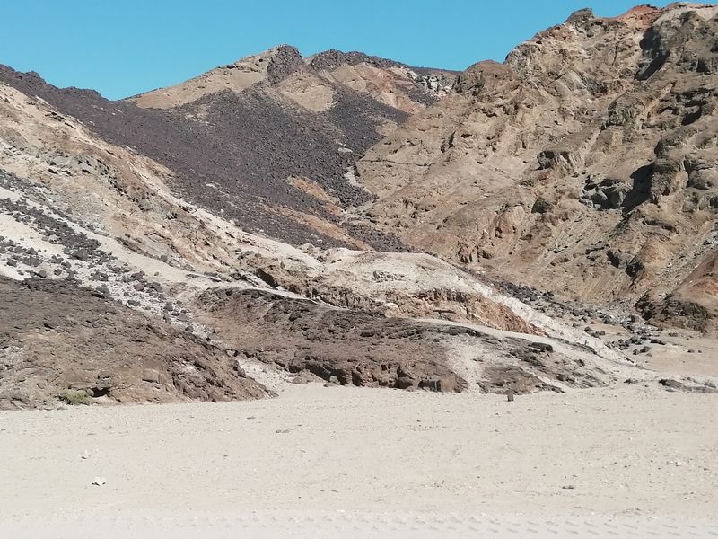
Timing is everything at Burnt Mountain. In flat midday light it looks like a plain, dark hill, but as the sun sinks, the slopes can glow in red, purple, and black.
The mountain sits in Damaraland, not far from Twyfelfontein. Its colors come from layers of different rock and minerals, which reflect the low sun in changing ways.
The name comes from the way the hill looks as if it has been scorched by fire.
You can see it from a short walk or just from the roadside, so it fits easily into a day of sightseeing. Combine it with nearby stops such as the Organ Pipes and the rock engravings at Twyfelfontein, which are a UNESCO site.
Arrive about an hour before sunset and bring a camera. A guide can help you pick the best viewing spot.
10. Organ Pipes
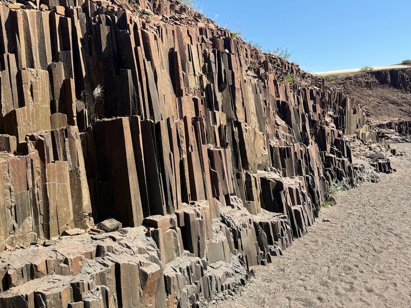
Nature rarely draws straight lines, yet the Organ Pipes seem to have been stacked by a careful builder. Tall, narrow columns of dark rock stand side by side in a small gorge.
They formed about 150 million years ago, when molten rock pushed into cracks in the ground and cooled. As it cooled, it split into regular vertical pieces, and later erosion exposed them.
The rock is dolerite, and the columns reach about five meters high.
A short walk from the parking area leads to the formation, so it works well for families and casual travelers. Morning visits are best, since the gorge stays cooler and shaded.
The site sits close to Twyfelfontein, making it easy to pair with other stops. Take a moment to look closely at the sharp edges and the lines running along each column.
11. Messum Crater
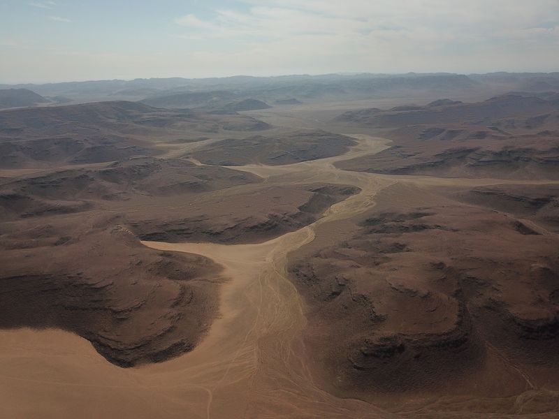
Few visitors ever see it, and that is part of the appeal. Messum Crater lies deep in the Namib Desert and measures about 20 kilometers across, which makes it hard to recognize from the ground.
It is the remains of an ancient volcano formed around 130 million years ago, when Africa and South America were splitting apart. Time has worn it down into a wide bowl of hills, plains, and dry riverbeds.
The crater lies within the Tsiseb Conservancy area, and reaching it requires a four-wheel-drive vehicle and often a local guide. The rough tracks are not suited to beginners.
Those who make the trip often camp under a huge night sky, far from any town. Bring extra fuel, spare tires, and a good offline map, because there is no phone signal for long stretches.
12. Welwitschia Plains
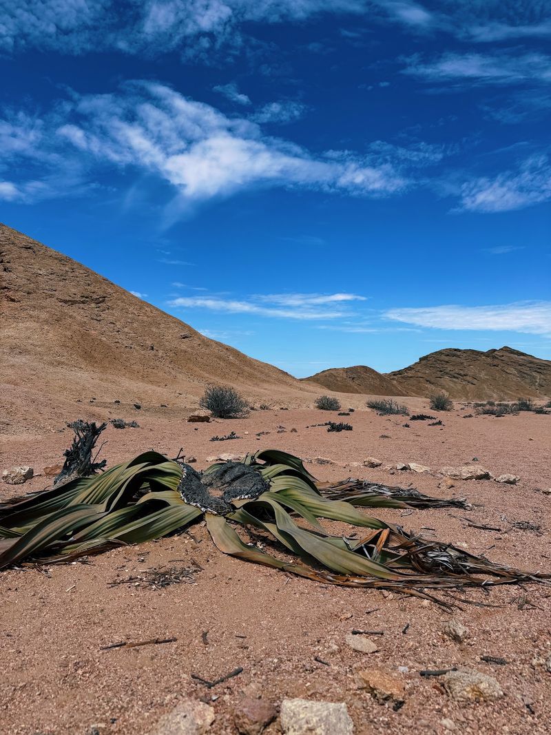
Some plants look like they were designed by a cartoonist. The welwitschia has just two leaves, yet they grow long, split, and curl into a messy pile across the gravel.
Found naturally only in the Namib Desert of Namibia and southern Angola, it survives on morning fog and very little rain. Some plants are thought to be over 1,000 years old, and a few may be even older.
The leaves never fall off, they simply keep growing from the base.
The Welwitschia Plains lie east of Swakopmund, and a marked route leads to several famous specimens. Stay on the paths, since the surrounding crust of lichens and gravel is easily harmed by footsteps.
Visit in the cooler part of the day and bring water. A short guided stop adds helpful details about how this strange plant manages to survive.
Share this story