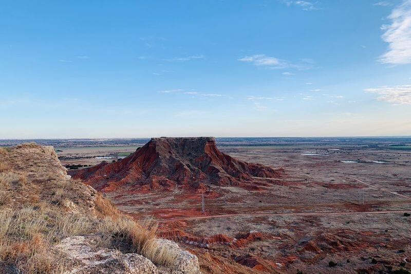
Drive west on a map of Oklahoma and you hit a strange rectangle sticking out like a handle on a skillet. It looks like a drafting mistake, but it is really the leftover piece of some very old boundary decisions.
For about 40 years, this slice of the plains had no state or territorial government, and it picked up a famous nickname along the way. The real story is more interesting than the legend, and it starts with two lines drawn on paper.
Two boundary lines left a strip between Texas and Kansas
Picture two surveyors working from opposite directions and never meeting in the middle. That is close to what happened on the southern plains.
The gap came from two separate laws, passed four years apart.
First came 1850. Under the Compromise of 1850, Texas accepted a northern boundary along 36°30′ north between the 100th and 103rd meridians.
Texas also gave up its claims beyond its agreed boundaries, and the package included a $10 million federal payment. The Compromise covered many issues, so no single motive, slavery-related or otherwise, explains the strip by itself.
Then came 1854. The Kansas-Nebraska Act set the southern edge of Kansas Territory at 37° north.
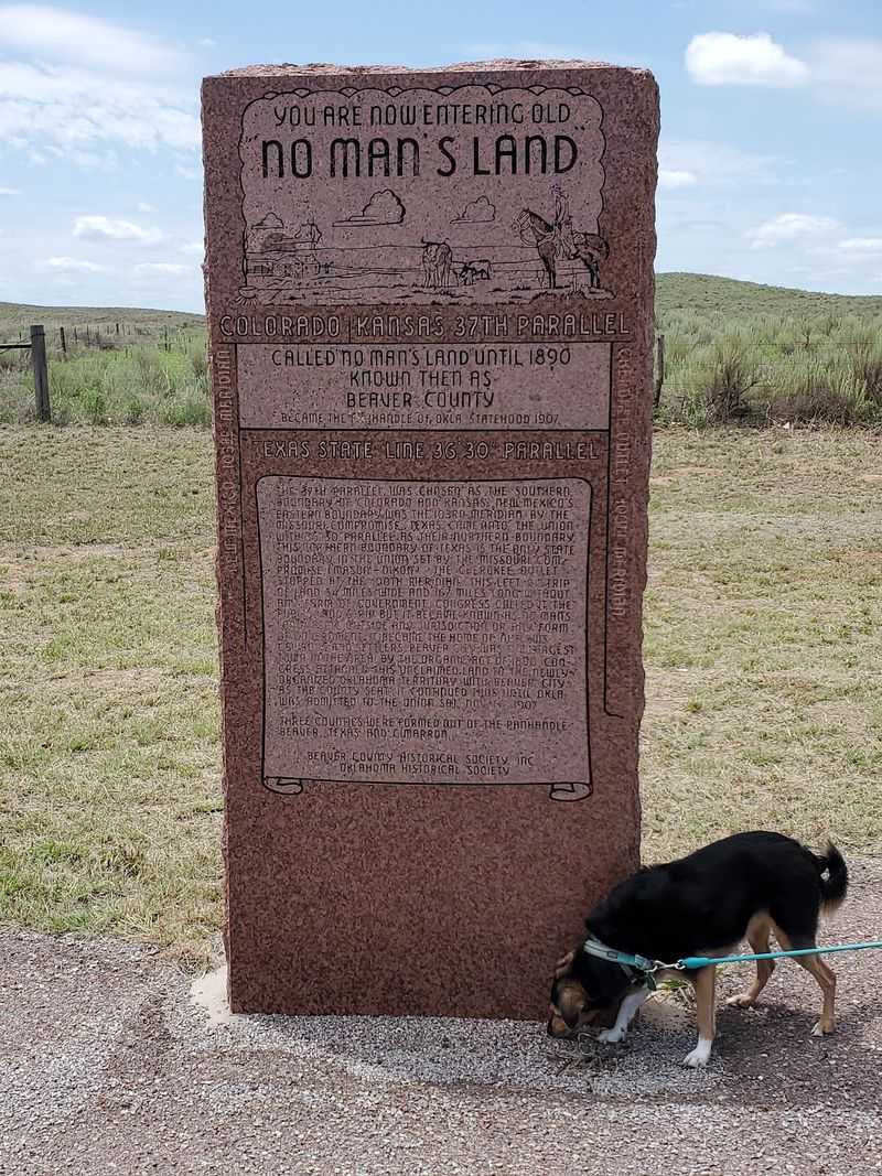
Texas stopped at 36°30′, and Kansas began at 37°, so a band of land about 34.5 miles wide and 167 miles long fell between them.
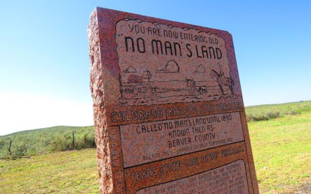
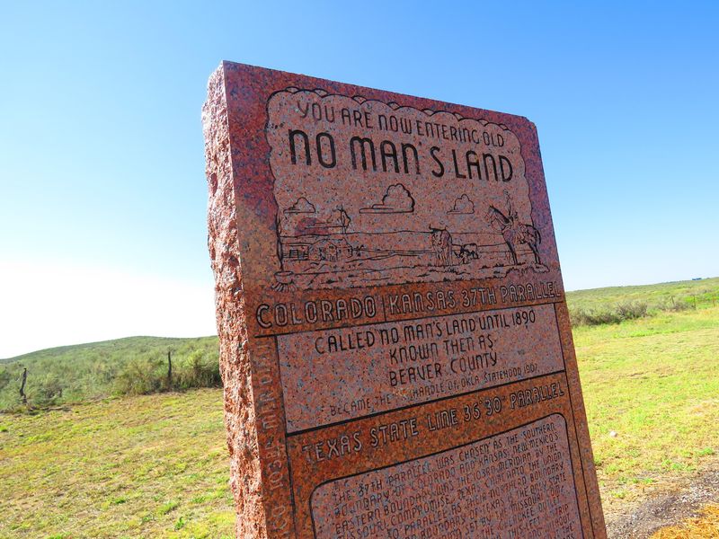
That leftover band became federal public land. As the Oklahoma Historical Society explains, it was known as the Public Land Strip and later, popularly, as No Man’s Land.
The shape of today’s Panhandle is simply that legal gap, preserved on the map.
Federal public land with a history before settlement
Here is a detail that trips people up: having no state government did not mean having no government at all. The strip was federal public land, and it stayed under U.S. jurisdiction the whole time.
It did not belong to no country, and it had no gap in legal status. In 1885, according to the Oklahoma Historical Society, the U.S.
Land Office affirmed that the strip was federal public land rather than part of Indian Territory.
Legal labels also say little about who used the land. The Oklahoma Historical Society describes seasonal Indigenous communities in the region and Comanche control before the last free-roaming Southern Plains groups were forced onto reservations.
A state archeology study adds more. The Oklahoma Department of Transportation report describes the area as Native American hunting territory under the 1867 Medicine Lodge Treaty.
So two separate stories sit on the same ground. One is the federal public-land designation that came from the boundary lines.
The other is a much older record of people living, traveling, and hunting here. Settlers arrived on land that already had a deep past.
“No Man’s Land” described ownership, not lawlessness
The nickname sounds like a warning sign, yet its original meaning was far more ordinary. Around 1885 or 1886, the name No Man’s Land came into wide use.
The Oklahoma Historical Society explains it as a reference to the fact that no individual could legally own land there at the time.
In other words, it was a paperwork problem. Settlers could live and farm there, but they could not get clear legal title to a claim.
The name did not originally mean lawless, and it does not prove this region was uniquely wild.
Stories of outlaws and disorder did grow up around the strip. A Chronicles of Oklahoma article says tales of outlaw activity in the early settlement years were exaggerated.
It reports fewer than 20 homicides from 1885 to 1890, about a third of them vigilante executions. That number comes from one historical study, so treat it as that author’s account rather than a final, independently verified count.
The fair reading is that local order was informal and uneven. That is different from a place where nobody kept any rules.
The catchy nickname simply outlived its original meaning, as the state’s historical society notes.
Settlers built local institutions and sought a territorial government
When no outside government showed up, residents built their own. They organized claims boards to record who had settled where, which helped settle land disputes among neighbors.
They set up courts and schools, and some communities hired town sheriffs, as the Oklahoma Historical Society records.
None of these bodies had official federal backing. They were self-organized, which made them useful but limited.
A claims board could keep the peace between neighbors, yet it could not hand out a legal land title.
Residents wanted more than local fixes. They organized a provisional government and petitioned Congress to create a federally authorized Cimarron Territory.
The Oklahoma Historical Society’s Cimarron Territory entry describes it as a settlers’ movement, and its officials and institutions were provisional rather than part of an established territory.
Congress never approved the request. Cimarron Territory therefore never became a U.S. territory, no matter how much its supporters hoped.
Still, the effort shows a community working hard to build order and win recognition, which fits poorly with the idea of a place left to chaos.
The 1890 Organic Act brought the strip into Oklahoma Territory
Change arrived in 1890 with a federal law. The Oklahoma Organic Act created Oklahoma Territory and folded the Public Land Strip into it.
The strip’s separate status, after about 40 years without state or territorial government, was over.
The act also established the strip as Beaver County. For settlers, the key practical change was a route to homestead claims, which gave them a way to secure the legal land title they had lacked, as the Oklahoma Historical Society’s Organic Act entry summarizes.
Beaver County stayed whole for a while. Then, in 1907, Oklahoma became a state, and the county was divided into three: Beaver, Texas, and Cimarron counties, according to the same historical society account of No Man’s Land.
Those three counties still make up the Panhandle. If you drive through Beaver, Guymon, or Boise City today, you are crossing the old strip, now carved into the counties that took over from that single territorial county.
The Panhandle’s outline preserves a layered history
Look at that rectangle again and you can read several chapters in it. A boundary gap, federal public land, Indigenous presence, settlers’ homemade institutions, and an 1890 act all left their mark.
The nickname No Man’s Land is memorable, but it only captures the ownership question.
The Panhandle is not a mistake on the map. It is a record of how people, laws, and lines met on the plains.
Share this story