Hidden deep in North Carolina’s Nantahala National Forest lies a secret gem that most hikers overlook. Pickens Nose offers incredible mountain views without the crowds you’ll find at popular spots like Grandfather Mountain or Mount Mitchell. This short but rewarding trail packs multiple cliff-edge overlooks into just over a mile of hiking. Get ready to discover your new favorite hidden adventure in the Tar Heel State.
1. Meet Pickens Nose
Tucked away in Nantahala National Forest near Franklin and Highlands, this ridge-top adventure leads to dramatic rock outcrops that few people know about. The official U.S. Forest Service trail measures just 0.7 miles one way, making it perfect for families or anyone wanting big rewards without a huge time commitment.
What makes this trail special is how quickly you reach stunning viewpoints. Most hikers complete the 1.4-mile round trip in under two hours, leaving plenty of time to explore nearby attractions or simply soak in the mountain atmosphere from multiple cliff-edge perches.
2. Why it wows
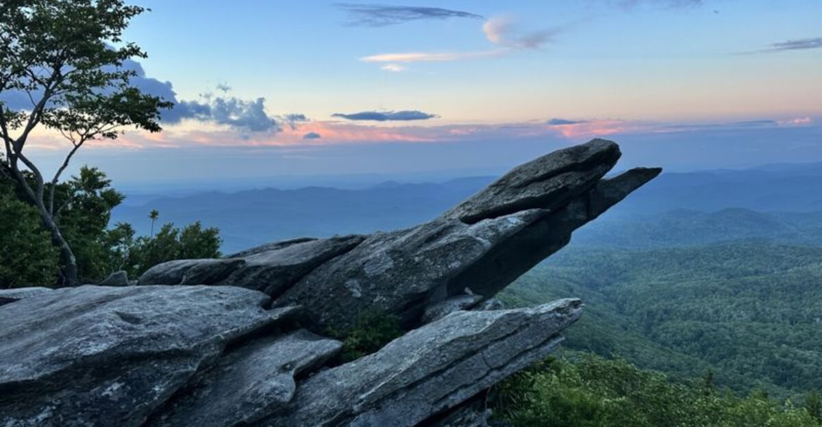
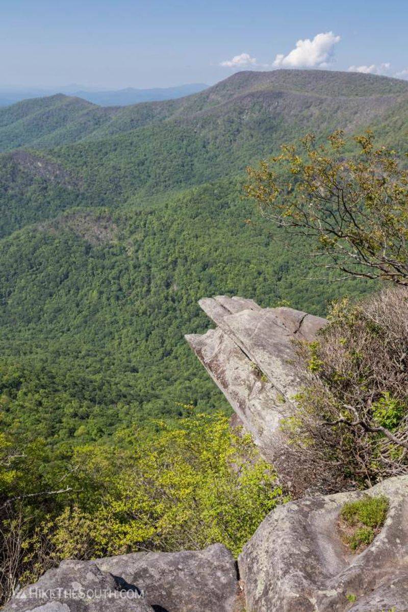
Four major viewing ledges spread along the short ridge, each offering a different perspective of the surrounding wilderness. You won’t need to hike for miles to reach breathtaking vistas – they start appearing early and keep coming as you follow the rocky path.
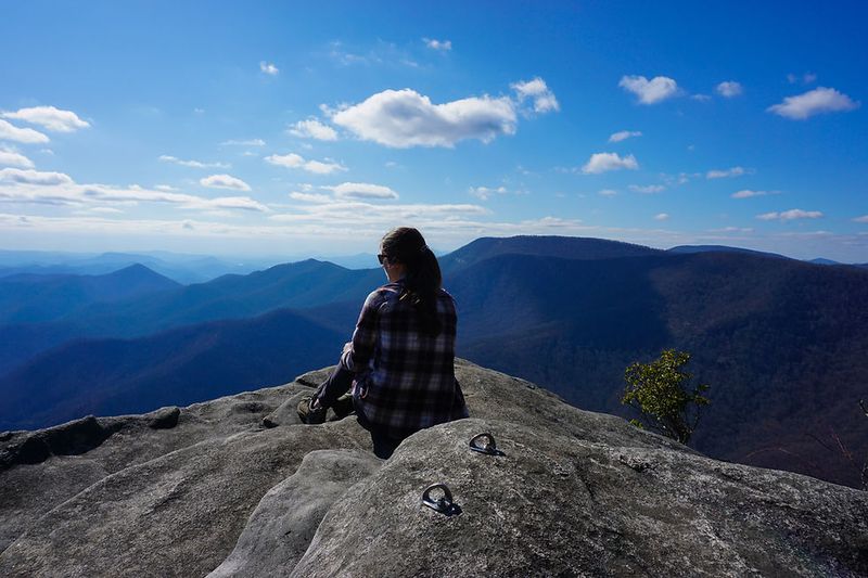
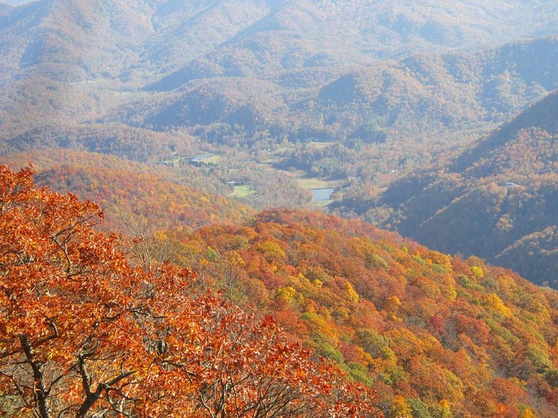
Each overlook presents sweeping views across untouched forest valleys and distant mountain peaks. The variety of viewpoints means every photo opportunity feels fresh and unique. Weather permitting, you can see for miles across the Southern Appalachian landscape, making this short hike feel like a much bigger adventure than the distance suggests.
3. Quick stats
Plan for approximately 1.4 to 1.6 miles round trip with 200 to 300 feet of elevation gain, depending on your parking spot along the forest road. The trail features rocky terrain and begins with a brief but noticeable climb before leveling out along the ridge.
Most hikers complete this adventure in 1.5 to 2 hours, including time for photos and enjoying the views. The moderate difficulty rating makes it accessible for most fitness levels. Sturdy hiking shoes are recommended due to the rocky surface, especially near the overlook areas where footing becomes more challenging.
4. Getting there (read this)
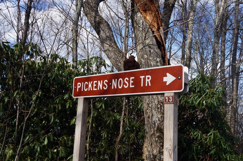
From Forest Service Road 67, drive 9 miles past the Backcountry Information Board, then turn right onto FS 83 (Ball Creek). Look for the Pickens Nose TR13 sign on your right side – it’s easy to miss if you’re not watching carefully.
Both roads are gravel and can develop ruts, especially after heavy rain. Low-clearance vehicles should proceed slowly and consider alternative destinations during wet conditions. The drive takes patience, but the remote location is part of what keeps crowds away and preserves the trail’s peaceful character.
5. When to go
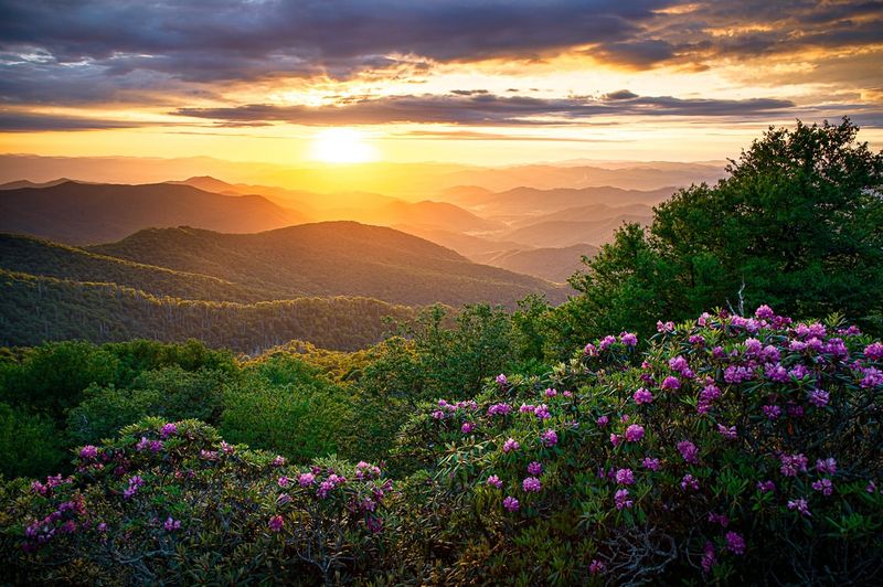
Sunrise and late-day lighting create magical conditions year-round, painting the mountain views in golden hues. Clear skies offer the best visibility, so check weather forecasts before making the drive to this remote location.
June brings a special bonus when native rhododendron blooms throughout the high country, with rosebay varieties extending the show into July. Spring and fall offer comfortable temperatures and excellent visibility. Winter hiking is possible but requires extra preparation for potentially icy conditions on the rocky surfaces and forest roads leading to the trailhead.
6. Falcon season note

Rock climbing routes on the East Face close from January 15 through August 15 to protect nesting peregrine falcons. However, hiking the trail and enjoying all overlooks remains completely open during this period – just avoid climbing the closed cliff faces.
Drone use is prohibited in closure zones during falcon nesting season. This restriction helps protect these magnificent birds while they raise their young. The hiking experience isn’t affected by these closures, so you can still enjoy all the scenic viewpoints. Spotting a peregrine falcon during nesting season adds an extra thrill to your adventure.
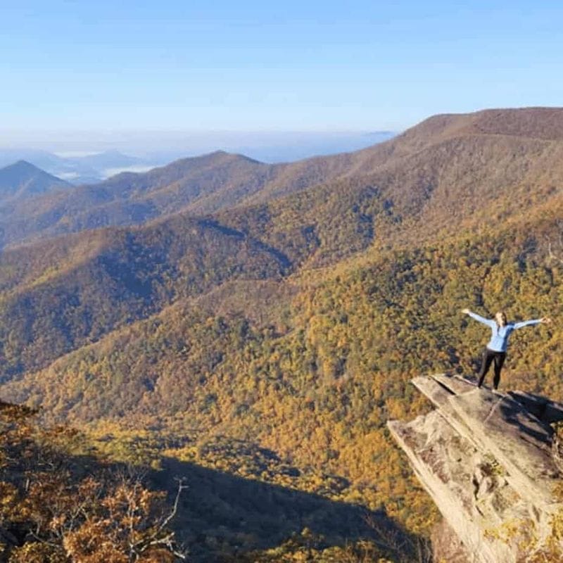
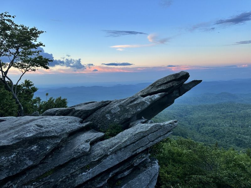
7. Safety on the ledges
Sheer drop-offs await at every overlook with no guardrails or safety barriers. Keep children and dogs close at all times, staying behind natural boundaries formed by roots and rock formations.
Avoid cliff edges during windy or wet conditions when footing becomes treacherous. Standard Leave No Trace principles apply – pack out all trash and stay on designated paths. The views are spectacular, but respect for the environment and personal safety should always come first. Take photos from safe distances and resist the urge to get too close to dramatic edges.
8. What you’ll see

Clear days reveal waves of Blue Ridge peaks stretching across the Southern Nantahala Wilderness – impressive scenery that rivals much longer hikes. The ridge tops out around 4,800 feet elevation, so pack an extra layer even during summer months.
Mountain temperatures can change quickly at this elevation, and afternoon thunderstorms develop rapidly during warmer months. The panoramic views encompass endless forested ridges and valleys with minimal signs of human development. This unspoiled wilderness perspective makes the short hike feel like you’ve traveled deep into backcountry territory without the typical time and effort investment required.
9. Pair it with a “wow” tower or bald
Fire towers and mountain balds create the perfect finishing touch to any hidden trail adventure. Many secret paths connect directly to these stunning viewpoints, doubling your hiking reward.
Old fire towers offer 360-degree views that stretch for miles across the Blue Ridge Mountains. Climbing these metal structures feels like reaching the top of the world. Mountain balds provide wide-open spaces where wildflowers bloom and wildlife roam freely.
Planning your hike to include both the trail and a tower or bald makes the journey twice as memorable and Instagram-worthy.
10. Essentials before you go
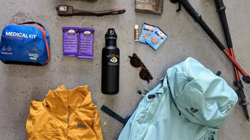
Smart preparation turns a good hike into an amazing adventure without any scary surprises. Check weather conditions the night before since mountain weather changes quickly and can catch hikers off guard.
Pack extra water, snacks, and a first-aid kit even for short hikes. Your phone might not work on remote trails, so download offline maps ahead of time. Tell someone your hiking plans and expected return time for safety.
Wear sturdy hiking boots and bring layers since temperatures drop as you climb higher into the mountains.


