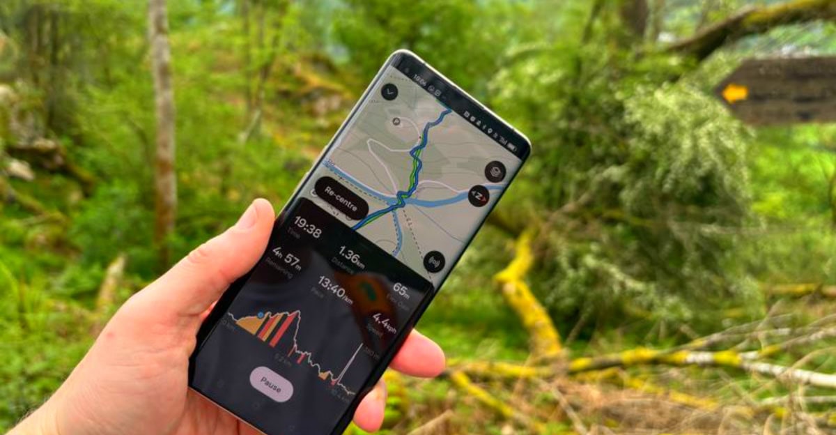
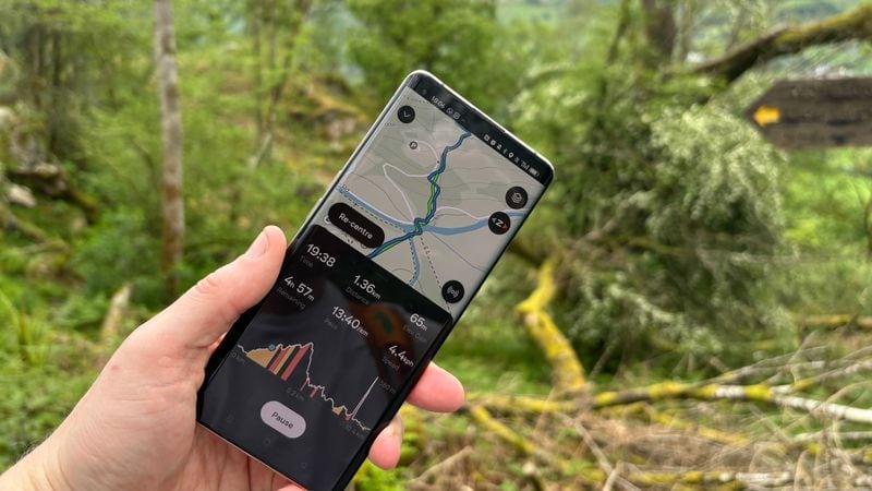
Getting lost on a mountain trail isn’t anyone’s idea of fun, especially when your phone shows no signal bars. Modern hiking apps have solved this problem by offering offline maps that work without internet connection, plus amazing 3D features that let you preview terrain before you step foot on the trail. These digital tools transform how we plan and navigate outdoor adventures, making hiking safer and more enjoyable for everyone from weekend warriors to serious backpackers.
1. Gaia GPS
Serious adventurers swear by Gaia GPS because it offers professional-grade mapping tools that rival expensive GPS devices. The app’s strength lies in its incredible variety of map layers – topographic, satellite, weather overlays, and specialized outdoor maps.
Built specifically for offline use, you can download entire regions and switch to airplane mode without losing functionality. The 3D terrain visualization works on both phone and computer, making route planning feel like flying over mountains from your couch.
Search and rescue teams actually use this app, which speaks volumes about its reliability and accuracy in challenging conditions.
2. komoot
European hikers discovered komoot first, but now adventurers worldwide appreciate its smart routing system that adapts to different outdoor activities. The app excels at suggesting routes based on your fitness level and preferred terrain type.
Free users can save regions for offline navigation, while Premium subscribers unlock stunning 3D terrain maps with one simple click. These three-dimensional views reveal hidden valleys, steep ridges, and gentle slopes that flat maps simply can’t show.
What sets komoot apart is its sport-specific recommendations – the app knows that mountain bikers and hikers prefer different types of trails and surfaces.
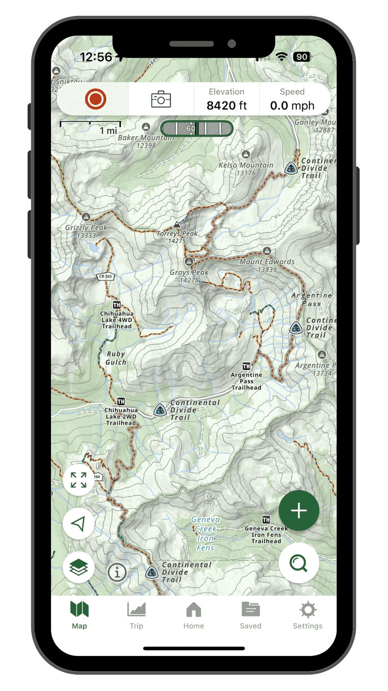
3. CalTopo
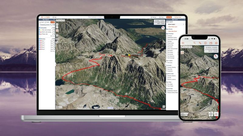
When professional wilderness guides and search-and-rescue teams need mapping software, they often choose CalTopo. This isn’t your average hiking app – it’s a powerful planning tool with specialized layers for avalanche zones, fire danger, and slope analysis.
The offline mode works flawlessly once you’ve downloaded your chosen map layers, and the dedicated 3D view lets you tilt and rotate terrain like a video game. Both mobile and web versions offer identical functionality, so you can plan detailed routes on your computer then access them on your phone.
Beginners might find the interface overwhelming, but experienced outdoors enthusiasts love the professional-grade features.
4. onX Backcountry
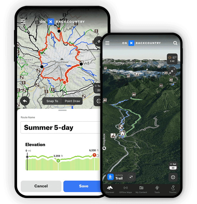
Speed matters when you’re trying to navigate tricky terrain, and onX Backcountry delivers lightning-fast performance with crystal-clear map displays. The app specializes in detailed land ownership data, showing you exactly which areas are public versus private property.
Downloading topographic maps, satellite imagery, and trail data for offline use takes just minutes, and the system rarely glitches even in extreme conditions. The 3D mapping tools work seamlessly across phone and desktop platforms, letting you inspect terrain from every angle before committing to a route.
Recent updates have significantly improved the 3D features, making terrain visualization more realistic and helpful for route planning decisions.
5. AllTrails
This app dominates the hiking world with its massive database of user-generated content and professional trail information.
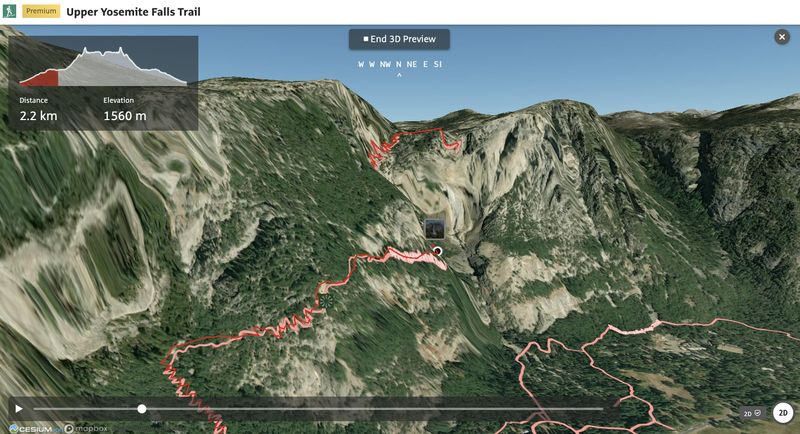
The offline maps feature requires a subscription, but downloading trails before your hike means you’ll never lose your way even in dead zones. Premium members get the coolest feature: 3D trail previews that play like mini-movies, showing you exactly what elevation changes and terrain challenges await.
Families especially love reading recent trail conditions and difficulty ratings from other hikers who’ve walked the same path.
6. Outdooractive
Born in the heart of Europe’s hiking culture, Outdooractive brings official topographic data from European mapping agencies right to your fingertips. The app shines brightest in Alpine regions where it offers incredibly detailed and accurate trail information.
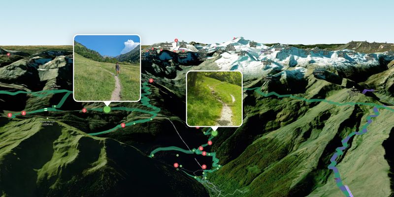
Saving routes and map sections for offline adventures works smoothly, ensuring you stay connected to navigation even in remote valleys. The automated flyover feature creates breathtaking 3D animations of your planned route, almost like having a personal helicopter tour before you hike.
European hikers particularly appreciate the app’s integration with local tourism boards and official trail maintenance organizations for the most up-to-date conditions.
7. PeakVisor

Ever stood on a mountaintop wondering which peaks you’re looking at? PeakVisor solves this age-old hiking mystery with its incredible peak identification technology that uses your phone’s camera to label surrounding summits in real-time.
The offline 3D satellite maps download in compact regional packages, making efficient use of your phone’s storage space. Beyond peak identification, the app offers surprisingly robust route planning with detailed elevation profiles and time estimates for hiking trails.
Mountain photographers and peak baggers consider this app essential because it helps them identify and plan approaches to specific summits with unprecedented accuracy and visual detail.
8. Topo Maps+
Designed from the ground up for backcountry adventures, Topo Maps+ focuses entirely on offline functionality without sacrificing advanced planning features. The developers understand that wilderness areas often lack cell coverage, so every feature works perfectly in airplane mode.
The specialized 3D “look-around” map lets you virtually scout terrain before hiking, revealing potential obstacles or scenic viewpoints you might miss on traditional flat maps. Trail flyover animations help you understand what elevation changes and terrain challenges lie ahead on your chosen route.
Backcountry enthusiasts appreciate the app’s no-nonsense approach – it prioritizes essential navigation tools over social features that require internet connectivity to function properly.
9. Maps 3D PRO (iOS)
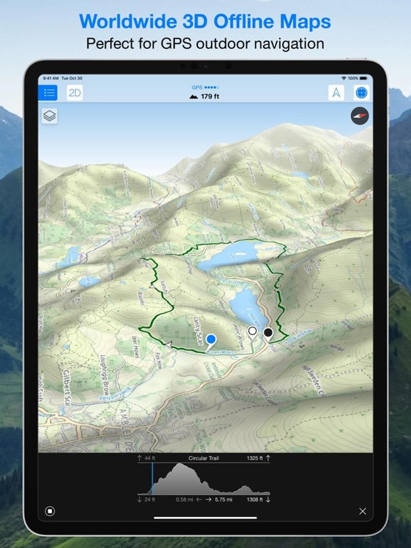
Apple users have enjoyed this longtime favorite for years, and it continues improving with regular updates that enhance the true 3D terrain rendering. Unlike apps that show pseudo-3D views, this one creates genuinely three-dimensional landscapes you can rotate and examine from any angle.
Preloading map data before your hike ensures complete independence from cellular networks, and the app’s stability in offline mode has earned trust from serious hikers. The ability to plan routes directly within the 3D environment makes it feel natural and intuitive.
iPhone and iPad users particularly love how the app takes advantage of iOS features and integrates smoothly with other Apple apps and services.
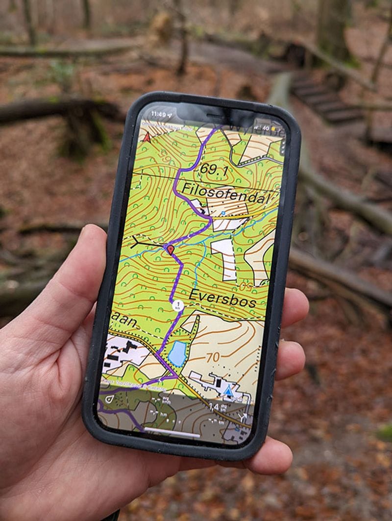
10. Relief Maps (Android & iOS)
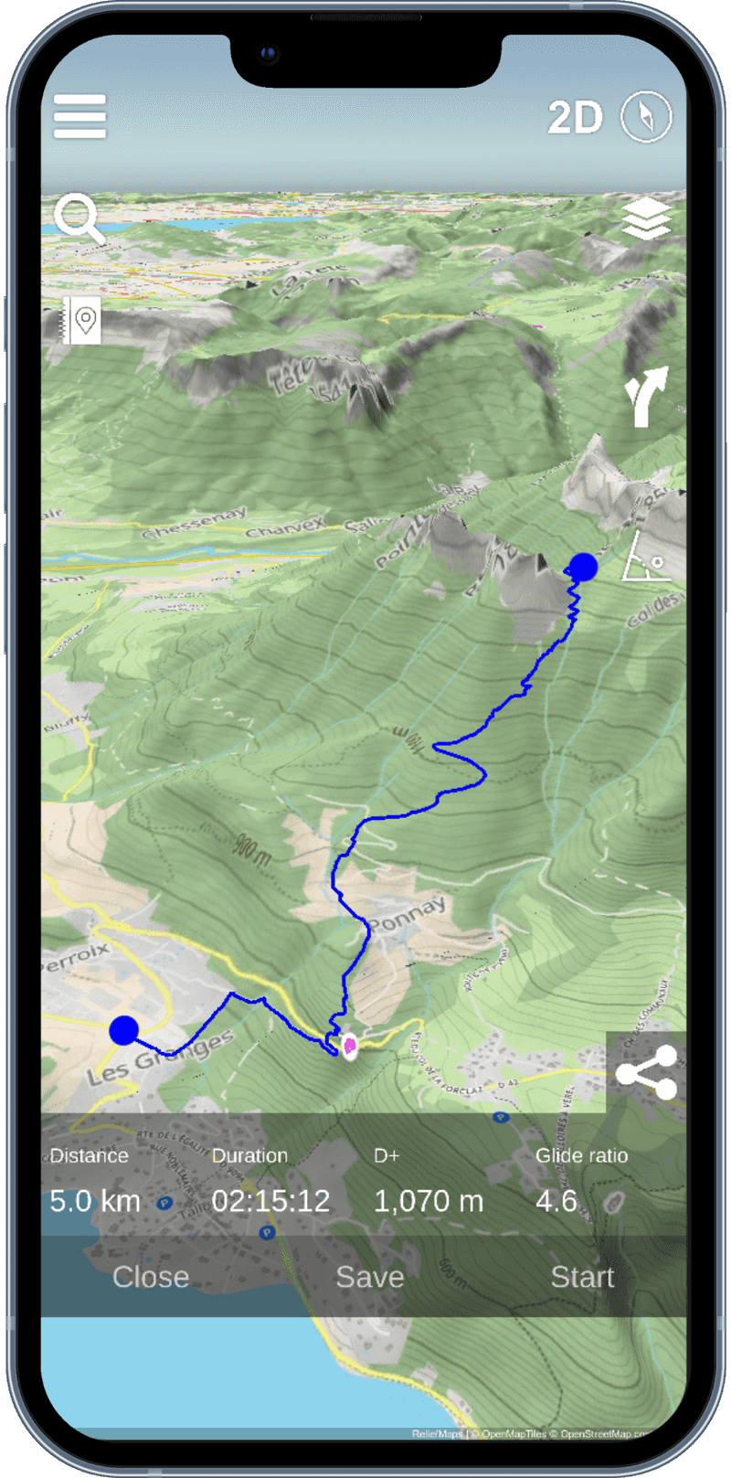
Built around an interactive 3D terrain model, Relief Maps transforms hiking planning into an engaging visual experience that feels more like exploring than studying maps. The app’s clean interface makes complex topographic information accessible to hikers of all skill levels.
USGS map layers provide official government accuracy, while the extensive catalog of user-contributed routes offers real-world hiking experiences from fellow adventurers. Downloading maps for offline use ensures your position displays accurately even in areas with zero cellular coverage.
The entire app revolves around three-dimensional terrain visualization, making it perfect for hikers who learn better through visual exploration rather than traditional flat map reading.


