Far beneath the frozen surface of Greenland, something extraordinary is happening. The world’s largest island is quietly drifting northwest while its bedrock rises and stretches in ways scientists are only beginning to understand. These movements, driven by melting ice and ancient geological forces, are reshaping how we view our planet’s response to climate change and revealing secrets hidden for thousands of years.
Melting Ice, Rising Land
Imagine pressing down on a thick sponge and then releasing it—that’s essentially what’s happening beneath Greenland. For thousands of years, massive ice sheets pressed downward on the bedrock below. Now, as ice melts away, that compressed rock springs back upward.
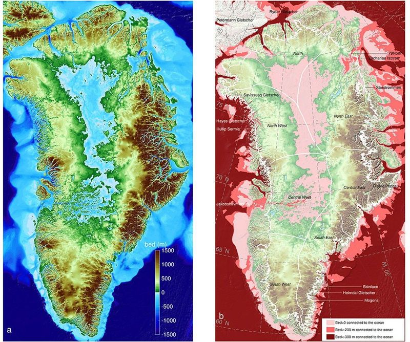
Southeast Greenland experiences the most dramatic uplift, with some areas rising more than 10 millimetres annually. The rebound speed varies depending on rock composition, underground heat sources like hidden mantle plumes, and historical ice coverage patterns.
This upward bounce affects everything from glacier behavior to sea-level predictions. Understanding how quickly land rebounds helps scientists create better models for future climate scenarios and ecosystem changes across the Arctic.
Why Surveyors and Navigation Experts Care
Here’s something most people never consider: the fixed points surveyors use for maps and navigation systems aren’t actually fixed in Greenland. Those reference markers slowly creep northwest along with the island itself, creating challenges for anyone relying on precise positioning.
Aviation controllers, ship captains, and satellite operators all depend on centimetre-level accuracy. When the ground itself shifts, those tiny changes accumulate into significant navigation concerns over time.
Beyond practical applications, these movements provide valuable clues about how rapidly ice loss transforms Earth’s structure. Greenland isn’t just a frozen landmass—it’s dynamic machinery revealing how our planet responds to environmental change in real-time.
Greenland Is on the Move—Literally
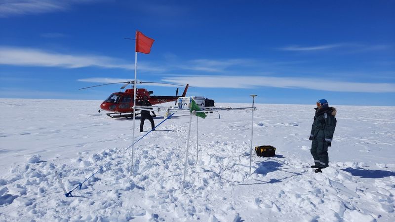
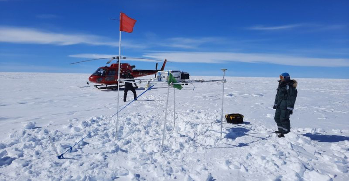
Scientists using advanced GPS technology have discovered something remarkable: Greenland shifts northwest by roughly two centimetres each year. A network of 58 tracking stations scattered across the island monitors this slow-motion journey, capturing data that reveals both ice loss and lingering effects from the last Ice Age.
What makes this movement even more fascinating is how different parts of Greenland behave. Some regions stretch outward while others compress inward, causing the island’s overall shape to morph subtly over time.
Two centimetres might not sound impressive, but in geological terms, it’s dramatic proof that Earth constantly evolves. Greenland’s drift demonstrates how powerful forces continue shaping our planet beneath the ice.
What This Means for the Future
Greenland’s complex movements signal profound climate-driven transformations ahead. Combined ice loss and bedrock changes suggest that current sea-level rise projections might need significant adjustments. Hidden meltwater storage beneath ice sheets and shifting subsidence patterns are forcing scientists to reconsider Greenland’s entire hydrological system.
Regions once considered geologically stable are quietly transforming in both horizontal and vertical directions. This dual movement creates unpredictable scenarios that challenge existing climate models and coastal planning strategies.
Communities, researchers, and government officials must adapt their monitoring and planning efforts to match Greenland’s surprisingly rapid evolution. What seems like slow geological change is actually happening at breakneck speed compared to historical patterns.
The Expanding Dark Zone Mystery
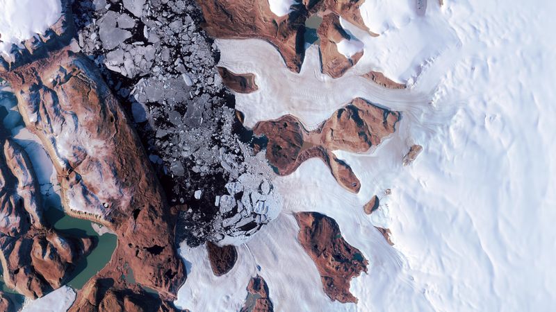
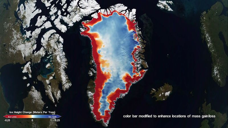
Along Greenland’s western margin, something unusual catches the eye of satellite cameras—a spreading dark zone that looks completely different from surrounding ice. This shadowy area gets its color from accumulated dust, soot, and surprisingly, living algae that thrive on the ice surface.
Why does this matter? Darker surfaces absorb more sunlight instead of reflecting it back into space. This absorption accelerates melting in a dangerous feedback loop—more darkness creates more melting, which exposes more dark material.
Recent observations show this dark zone expanding year after year. Scientists worry that this growing shadow could dramatically increase Greenland’s contribution to rising oceans, making it a critical area for continued climate monitoring and research.
Hidden Lakes Beneath the Ice
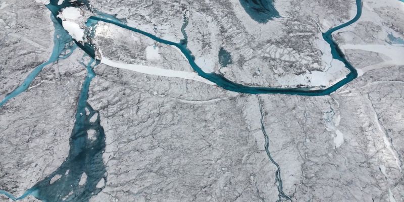
Did you know massive lakes exist beneath Greenland’s ice? In 2014, researchers discovered one such hidden lake that suddenly drained, releasing approximately 90 billion liters of meltwater in just 10 days—enough to fill 36,000 Olympic swimming pools.
This dramatic drainage event carved a deep crater and temporarily slowed nearby glacier movement, surprising scientists who hadn’t anticipated such rapid underground water systems. These subglacial lakes act like hidden plumbing networks beneath the ice.
Understanding these concealed water bodies is crucial for predicting ice sheet behavior and future sea-level contributions. Each discovery reveals how little we truly knew about the complex world existing beneath Greenland’s frozen surface.


