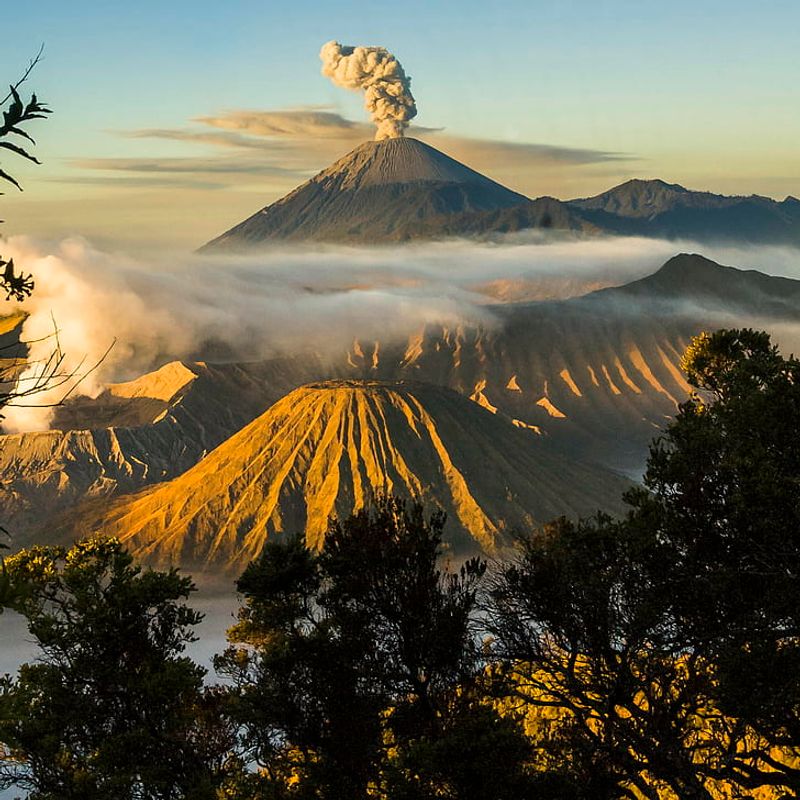
Mount Semeru has roared to life, recording dozens of eruptions in a matter of hours and putting East Java on edge. You can almost feel the ground tense as ash, tremors, and glowing rock remind everyone how powerful this volcano is. Authorities have raised high alerts and tightened exclusion zones to keep people safe. Keep reading to understand what is happening, where you should not go, and how to stay prepared as conditions evolve.
1. Mount Semeru Shows Intense Volcanic Activity
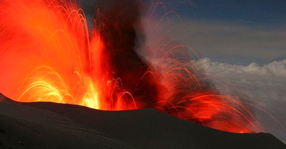
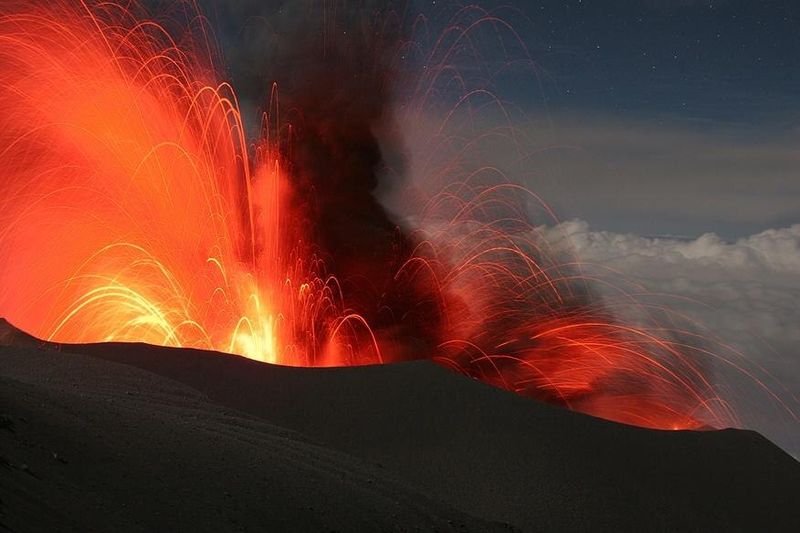
Mount Semeru has surged with activity, clocking more than 30 eruption events within just six hours. You might picture ash bursts pulsing from the summit while instruments tick off tremors like a metronome. This is Indonesia’s highest and most active volcano reminding everyone nearby to respect distance and heed alerts.
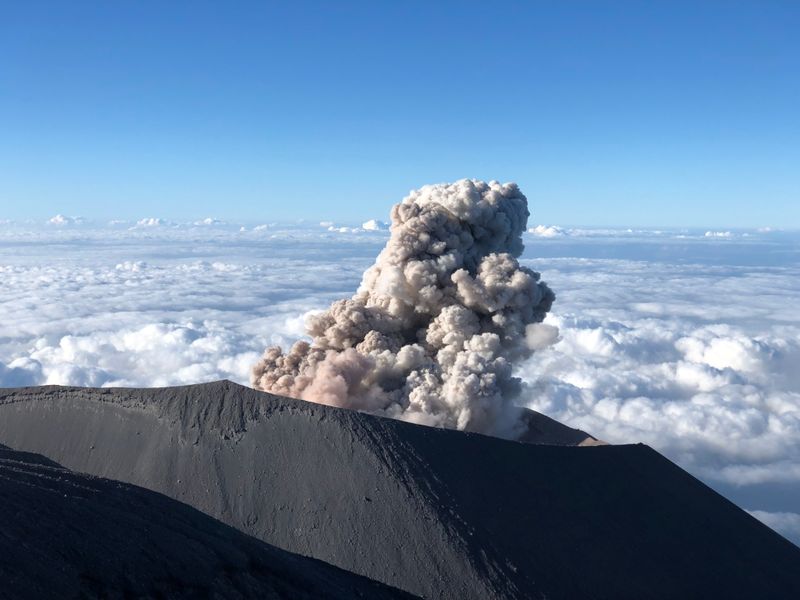
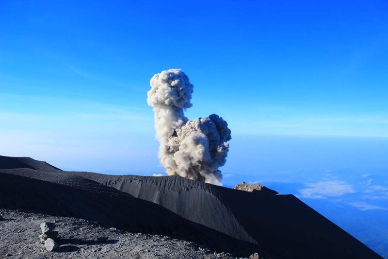
Monitoring teams report frequent seismic signals linked to ash emissions, lava movement, and rock avalanches sliding down flanks. Some ash plumes have risen visibly, but others stay subtle, picked up through ground vibrations and tremor signatures. The combination suggests magma is moving, pressurizing, and venting in bursts.
Officials have maintained Alert Level III and reinforced strict exclusion zones near the summit and southeast drainages. If you live or travel near river valleys, avoid them due to possible pyroclastic flows or lahars. Rainfall could quickly mobilize loose ash and debris, amplifying hazards downstream.
2. Seismic Signals and What They Mean
When you hear that Semeru registered dozens of eruption events, it means instruments captured repeated pulses tied to eruptive behavior. Long period tremors often relate to fluid movement, while volcano tectonic quakes can signal fracturing rock. Continuous tremor might hint at sustained degassing or ash venting.
Seismologists read waveform patterns and frequencies to infer whether lava is moving, pressure is building, or ash is venting. Some events do not produce visible plumes yet still shake sensors. Others send ash above the summit and sprinkle gritty fallout downwind.
For you, the takeaway is practical. Seismic noise climbing usually precedes more surface activity, so warnings may tighten quickly. Even if skies look clear, trust the instruments and follow guidance. Data from the Semeru Volcano Monitoring Station is the frontline early signal for changes.
3. Alert Level III and Exclusion Zones
Authorities have set Alert Level III, which signals heightened activity and a serious need for distance. You should not approach the summit area or enter valleys on the southeast flank where pyroclastic flows and lahars may travel. The safest choice is to stay several kilometers away from the crater.
Exclusion zones aim to prevent injuries from rockfall, ash bursts, or sudden surges that outpace escape. River corridors act like highways for volcanic debris, funneling heat and mud far downstream. Even strong hikers cannot outrun a hot avalanche or lahar.
Think of the boundary lines as flexible buffers that may expand if data changes. Respect closures, obey roadblocks, and check official updates before any trip. If you live nearby, plan alternate routes, prepare go bags, and keep masks ready for ash days. Safety starts with distance.
4. Ash Plumes, Air Quality, and Health Tips
Even small ash plumes can reduce visibility, irritate lungs, and scratch eyes. If you see ashfall in your area, wear a proper mask, use goggles, and limit outdoor activity. Keep windows closed, seal gaps if possible, and protect water sources from contamination.
Ash is abrasive and heavy when wet, so sweep lightly from roofs to avoid overload. Driving can be slippery and risky for engines, so slow down and use headlights. Pets and livestock need sheltered spaces and clean water clear of ash.
For respiratory sensitivity, prepare extra filters and medication refills. Store plastic covers for electronics and rainwater inlets. Listen for advisories that may suspend outdoor work or school. You can reduce exposure by staying informed about wind direction and forecasted ash dispersion around Semeru, especially during periods of frequent eruptive bursts.
5. Rainfall and Lahar Danger
Heavy rain is a force multiplier at Semeru. It sweeps loose ash and fresh pyroclastic deposits into river channels, creating lahars that rush downstream like wet concrete. If you live near a riverbank, the safest move during storms is to get to higher ground early.
Lahars can arrive quietly at first, then roar with boulders and logs. Bridges, fords, and culverts can fail without warning. You should avoid crossing channels during rainfall, even if they seem calm, because upstream surges can arrive suddenly.
Prepare evacuation routes that avoid valleys on the southeast flank and other drainages linked to the volcano. Local agencies may sound sirens or radio alerts when rainfall thresholds are met. Keep vehicles fueled, pack essentials, and rehearse with family. Quick decisions save lives when muddy torrents accelerate.
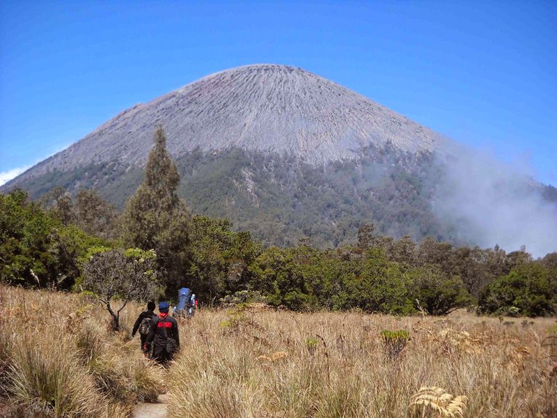
6. Travel and Access Restrictions Near Semeru
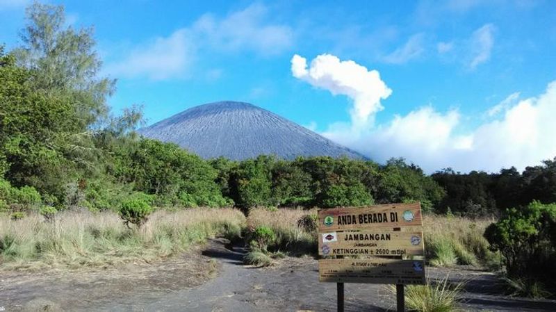
If you are planning a trek, this is the time to pause. With high alerts in place, authorities are restricting access to the summit routes and sensitive valleys. Trail closures protect you from sudden rockfall, ash bursts, and fast moving pyroclastic hazards.
Expect checkpoints, signage, and changing advisories that can update by the hour. Local guides will follow official instructions, and reputable operators will not bypass closures. Your best move is to monitor agency bulletins and postpone summit ambitions until conditions stabilize.
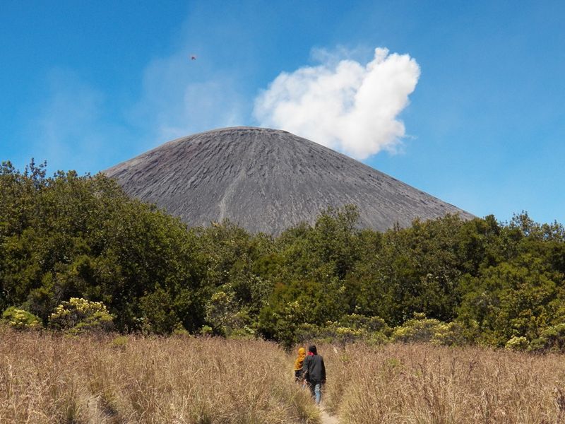
Semeru remains a spectacular landmark, but safety trumps views. Consider distant vantage points recommended by local tourism offices that lie outside exclusion zones. Bring masks, eye protection, and a flexible plan. When alerts step down, verified routes may reopen with new guidance to keep everyone safe on the mountain.
7. Community Preparedness and Communication
Prepared communities near Semeru fare better when activity spikes. Simple steps help a lot: charge phones, keep portable radios, and agree on family meeting points. Go bags with masks, water, medications, and copies of IDs reduce chaos during quick moves.
Local leaders coordinate shelters and share verified updates from monitoring agencies. You can join neighborhood groups that practice evacuation drills and map safe routes away from rivers. Keep a list of vulnerable neighbors who might need help with transport and supplies.
During ashfall or rain, communicate early, not after roads clog. Share official notices instead of rumors. If a message seems alarming, confirm it through multiple trusted channels. Clear, calm communication prevents panic and ensures the right actions happen at the right time when Semeru pulses with energy.
8. Semeru’s History and Ongoing Monitoring
Semeru has a long record of persistent eruptive behavior and sits near populated areas, which is why monitoring never stops. You can think of this volcano as active in cycles, with ash bursts, lava domes, and rock avalanches repeating across years. Scientists track patterns to anticipate changes that might precede stronger activity.
Right now, eruptions appear localized, but instruments watch for escalation signs. Gas output, tremor intensity, and thermal imagery all help refine alerts. Emergency agencies say there is no broader regional threat, yet they urge vigilance.
If you follow updates, focus on official bulletins that synthesize seismic data with field observations. Respect Alert Level III and exclusion boundaries while conditions fluctuate. When alerts relax, it means multiple indicators align, not just a single quiet day. Patience and attention keep you safe while Semeru’s story continues.


