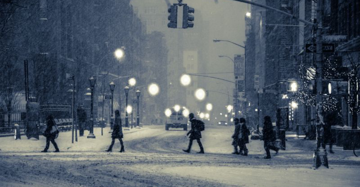
After weeks of teeth-chattering cold and relentless snow across the East, the nation is poised for a major winter flip. Forecast models now point to a jet stream realignment that shifts storm tracks westward while easing the Arctic bite in the East.
If you have been waiting for relief or rooting for fresh mountain snow, this is the pivot. The stakes are high for water supply, travel, and outdoor plans as the atmosphere redraws the map of who gets winter next.
After a ruthless stretch of historic cold and disruptive snow in the East, guidance now signals a sweeping pattern turn. The jet stream is forecast to buckle, allowing storm energy to reload across the West while the East warms relative to recent standards.
You will likely feel the difference first in milder mornings and fewer intrusive wind chills. For the West, this shift invites Pacific systems to return, steering moisture toward the coast and up into the Sierra, Cascades, and Rockies.
That means snow at elevation and beneficial rain for lower valleys that have been parched. Travel impacts will follow, so plan around chain controls, avalanche mitigation, and intermittent pass closures.
In the East, the polar vortex influence looks set to retreat north, loosening its icy grip. Temperatures should moderate, turning some icy commutes into more manageable days.
It is not an all clear, but it is a reset that redistributes winter’s sharpest edges. Timing matters.
Signals point to a mid February ramp for Western storms, with successive waves improving snowpack. Water managers, skiers, and shippers alike will be tracking each system’s trajectory and intensity.
For weeks, a stubborn ridge over the eastern Pacific blocked classic winter storm paths, starving the Sierra and Rockies of snow. Mild air dominated, and snowpack withered to record lows in places that typically bank water for spring and summer.
Resorts felt the pinch, and reservoirs watched the calendar with unease. Now the ridge is relaxing as the jet stream reorients, opening the door for a convoy of systems.
You can picture a moisture conveyor belt pointing at the coast, with cold enough air aloft to wring out snow at higher terrain. Each wave will matter, stacking inches into feet where elevation and aspect cooperate.
This change is tied to larger scale circulation swings across the North Pacific and North America. Subtle shifts in sea surface temperatures and upper level winds nudge storm tracks into new lanes.
The result is renewed precipitation potential across previously bypassed basins. Snow lovers should root for consistent, moderate events rather than one blockbuster.
That pattern builds stable coverage, reduces avalanche volatility, and bolsters spring runoff. Water managers will parse snow water equivalent numbers daily, watching for signs the deficit begins to close.
From the Great Lakes to New England and down into parts of the Mid Atlantic, relentless lake effect bands and frigid highs have defined daily life. With the jet tilting back north, the harshest Arctic intrusions should ease.
You will notice more days edging closer to seasonal norms and fewer nights plunging dangerously low. That does not end winter.
Short waves can still spin through, producing quick hitting snow or mixed precipitation when cold pockets align. Black ice and refreeze remain hazards as temperatures seesaw.
Snow totals in the East are likely to slow, particularly away from favored lake belts and interior high ground. The tone shifts from emergency deep freezes toward manageable, episodic wintry phases.
Commuters, utilities, and schools may finally catch a breather. Use the window to dig out fully, clear roof loads, and widen driveways before the next round.
Travel becomes more predictable, though coastal lows can still surprise. Keep layers handy, but plan some outdoor time as wind chills relent.
The polar vortex is not a storm but a sprawling, cold core circulation high above the surface. When it weakens or shifts, lobes of Arctic air can spill south, amplifying cold across the continent.
Earlier this season, a displaced vortex helped deliver record lows and prolific snow in the East. As the jet stream adjusts, the vortex is forecast to withdraw northward, reducing the East’s exposure to its coldest reservoir.
You should feel fewer piercing wind bursts and see more frequent thaws between fronts. This is a moderation, not a flip to spring.
The interplay between stratosphere and troposphere is subtle but decisive. Wave energy can jostle the vortex, altering downstream storm tracks and temperature gradients.
Those ripples decide who gets buried and who dries out. In the coming weeks, expect a milder East punctuated by standard winter shots and a reinvigorated West with mountain snow.
Forecasters will watch for any renewed disruptions that could re deepen cold. For now, the headline is balance returning to where winter shows up.


