There is a stretch of California coastline so remote that highway engineers gave up trying to build a road through it, and that decision turned out to be one of the best things that ever happened to hikers. The result is a rugged, wind-scoured beach trail where black sand meets crashing Pacific surf, elk wander freely, and cell service is a distant memory.
I packed my boots, grabbed my permits, and drove out to experience it for myself. What I found along the Lost Coast Trail near Petrolia, California, was something that felt less like a hiking route and more like a secret the land had been keeping for decades.
Finding the Trailhead at Mattole Beach
The journey to the northern trailhead sets the tone for everything that follows. The official address is Lighthouse Rd, Petrolia, CA 95558, and getting there requires navigating a long, winding road riddled with potholes and occasional washouts that will test your vehicle’s patience as much as your own.
Mattole Beach sits at the northern end of the Lost Coast Trail in Humboldt County, deep in the King Range National Conservation Area. The drive alone through the tiny community of Petrolia feels like crossing into another era, where cattle graze along the roadside and the nearest traffic light is a very long way away.
A day-use parking fee of around seven dollars applies, and overnight camping at the primitive Mattole Campground runs about eight dollars per night. Permits for the trail itself can be reserved through Recreation.gov for around ten dollars, which is a small price for access to one of the most unspoiled coastal corridors in the entire American West.
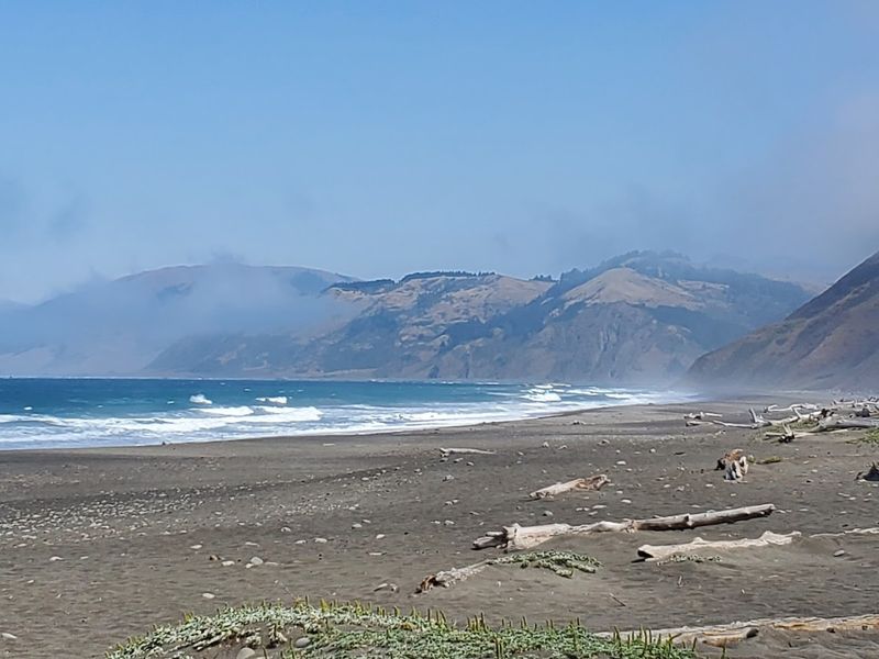
The Black Sand That Stops You in Your Tracks
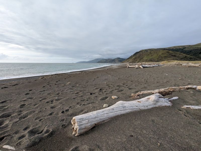
Most beach sand is pale and familiar, but the sand along this stretch of coastline is dramatically dark, almost charcoal-colored, and it makes every wave look like it is crashing against something ancient and otherworldly. The black sand comes from the erosion of the surrounding greywacke and other dark coastal rocks, and it stretches for miles in both directions without a single building or boardwalk in sight.
The contrast between the dark sand and the white foam of the Pacific surf is genuinely striking. I kept stopping to take photos even when I knew the photos would never fully capture what my eyes were seeing in person.
Driftwood logs the size of small cars lie scattered across the beach, deposited by storms and tides over many years. They serve as natural windbreaks, resting spots, and occasional navigation markers.
That combination of raw materials, dark sand, massive logs, and relentless surf, creates a beach atmosphere unlike anything you would find along more developed stretches of the California coast.
The Full Trail Distance and What to Expect
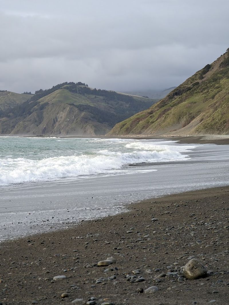
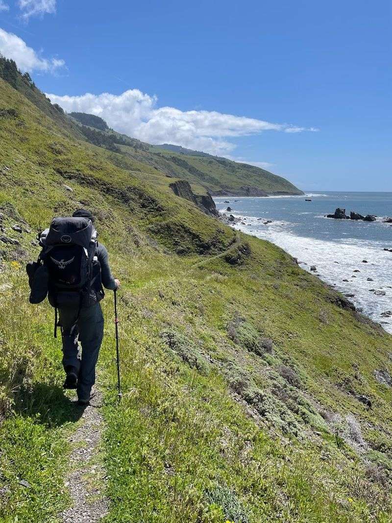
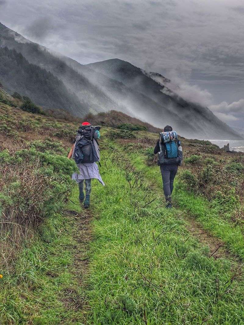
The main north-to-south route of the Lost Coast Trail covers roughly 24 to 25 miles of serious coastal terrain, and calling it a casual stroll would be a generous misrepresentation. The trail runs from Mattole Beach in the north down to Black Sands Beach near Shelter Cove in the south, passing through some of the most rugged and beautiful shoreline in North America.
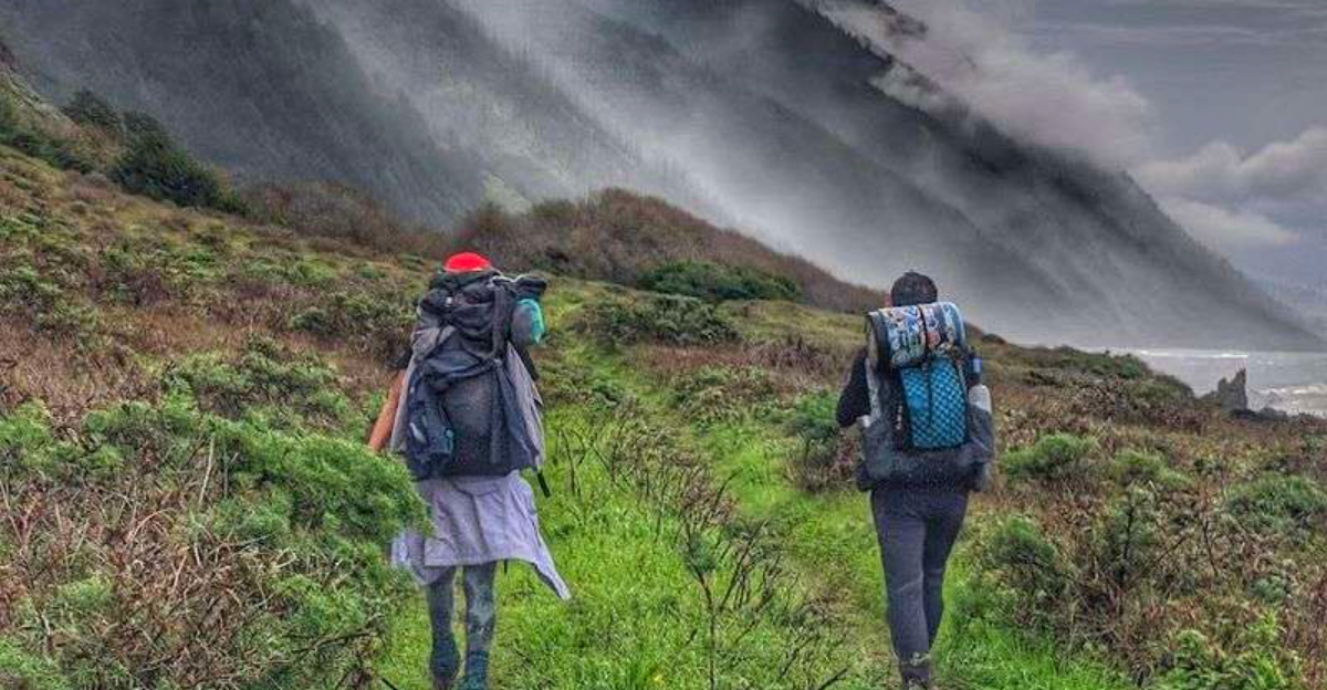
Most hikers complete the route over three to four days, carrying full backpacking gear and timing their passage through tide-dependent sections with careful attention to the tide charts. Several portions of the trail become impassable at high tide, so checking conditions before you set out is not optional, it is essential for a safe trip.
The terrain alternates between stretches of soft sand that drain your energy with every step, rocky cobblestone beaches that demand sure footing, and short inland detours over grassy bluffs. Visitors who trained beforehand consistently found the experience far more enjoyable, while those who underestimated the physical demands tended to have a harder time.
Either way, the views made every difficult step feel worth the effort.
Wildlife Encounters Along the Shore
One of the most memorable parts of hiking the Lost Coast Trail is the wildlife that shares the beach with you, completely unbothered by your presence. Roosevelt elk are a common sight, often grazing on the grassy bluffs above the beach or crossing the sand in small herds.
Seeing an elk the size of a small horse trot across black sand with the Pacific Ocean behind it is the kind of moment that stays with you for years.
Sea lions haul out on rocks along the coast and bark loudly enough to wake campers at Sea Lion Gulch, which is worth knowing before you pitch your tent there. Bear tracks in the sand are a regular reminder that you are the visitor here, not the local.
One hiker on the road to the trailhead spotted a bobcat with two kittens, which sounds like something from a nature documentary but is entirely normal in this ecosystem. The King Range supports a remarkable range of species precisely because so few people have disrupted the habitat over the decades.
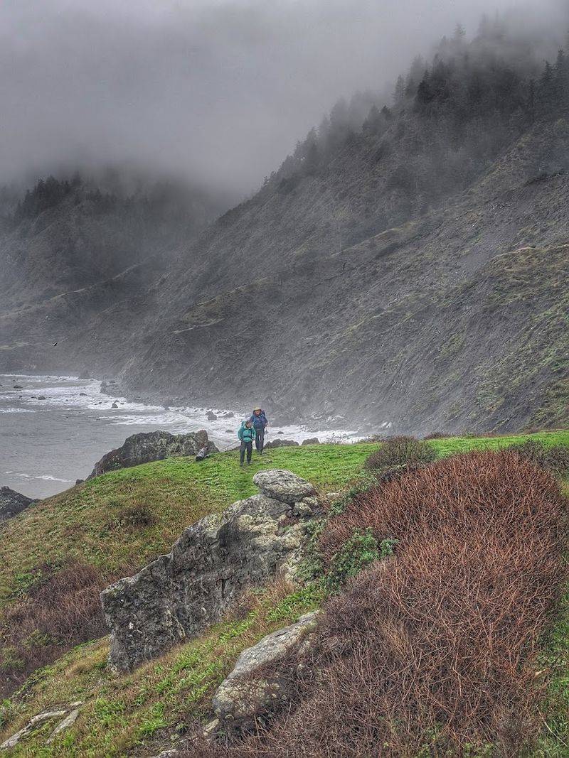
Navigating the Tides Safely
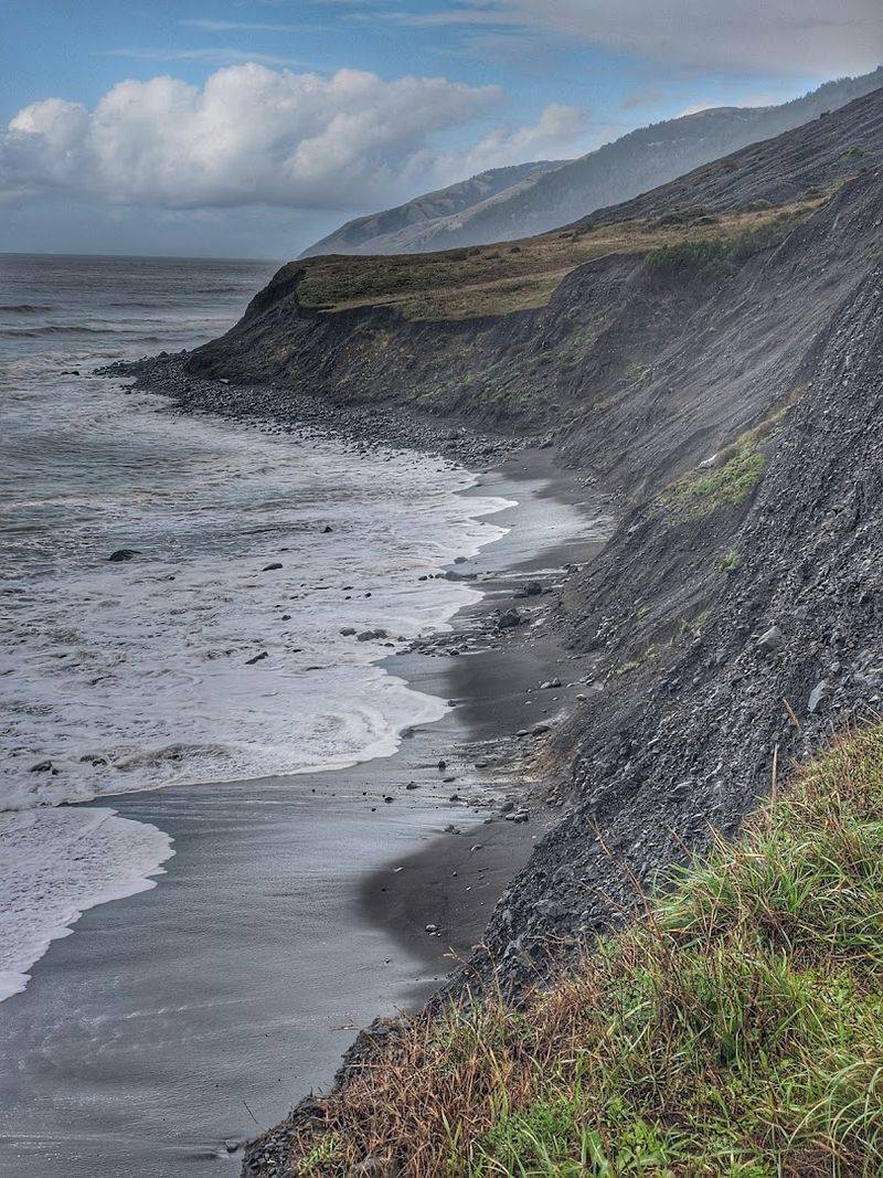
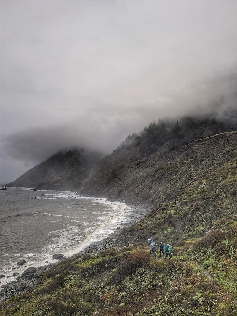
Tide management is the skill that separates a smooth Lost Coast Trail experience from a stressful one. Several sections of the trail, particularly around Punta Gorda and the area near Sea Lion Gulch, are only passable during low tide.
At high tide, the ocean pushes all the way to the base of the cliffs, leaving no room to pass safely.
Before starting the hike, every experienced visitor downloads a tide chart for the specific dates of their trip and plans each day’s mileage around the tidal windows. The King Range National Conservation Area website and Recreation.gov both provide guidance on which sections require tidal awareness and when the windows typically open.
Getting caught at a tide-restricted section with the water rising is not a situation anyone wants to be in, and it is entirely avoidable with a bit of planning. The general advice is to pass through the most sensitive sections during the two hours before and after low tide.
A waterproof watch and a printed tide table tucked into your pack are two of the most practical items you can bring.
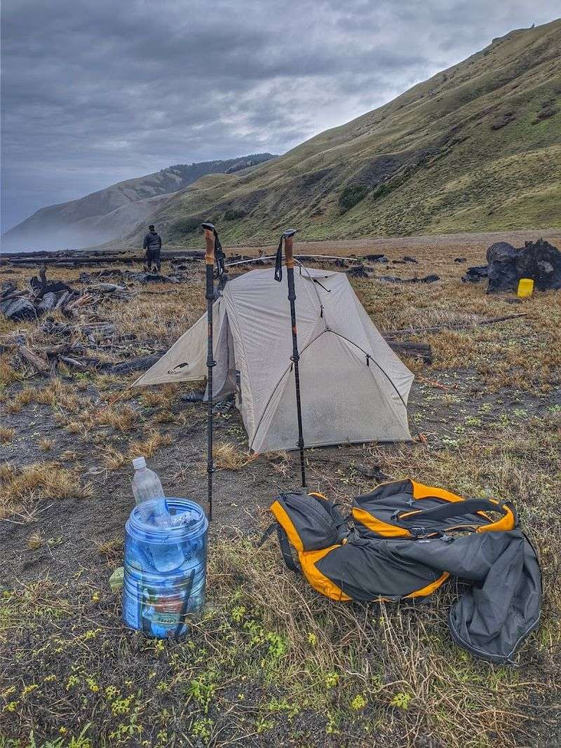
Camping Under a Sky Full of Stars
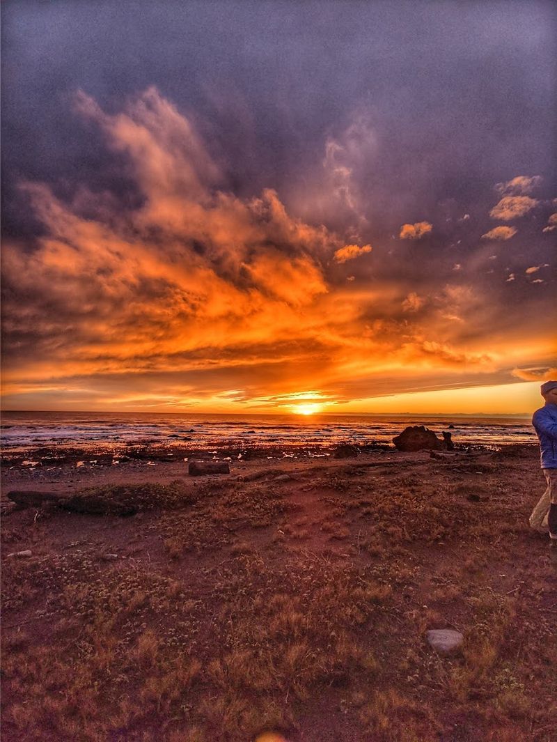
Zero cell service means zero light pollution from nearby towns scrolling through their feeds, and the night sky along the Lost Coast Trail is one of the most stunning natural rewards the hike offers. On a clear night, the stars do not just appear, they crowd the sky from horizon to horizon in a way that feels almost too good to be real for anyone used to urban skies.
Camping is permitted along the beach corridor with a free permit, and the experience of falling asleep to the sound of waves while surrounded by that kind of darkness is deeply restorative. The Mattole Campground at the northern trailhead offers a more structured option with basic facilities, though the restrooms are rustic and showers are not available.
Wind is a constant companion along the coast, so a four-season tent with solid stakes is worth the extra weight in your pack. Campers who set up on the north side of natural barriers reported more manageable conditions.
The combination of salt air, wave sounds, and an unfiltered view of the Milky Way makes every chilly night feel like a fair trade.
The Punta Gorda Lighthouse
About three miles south of the Mattole trailhead, the ruins of the Punta Gorda Lighthouse stand quietly on a rocky point as one of the most atmospheric historical landmarks on the entire trail. Built in 1912 and decommissioned in 1951, the lighthouse was constructed to warn ships away from this notoriously dangerous stretch of coastline, which had claimed numerous vessels over the years.
The structure itself is no longer intact, but the remaining concrete buildings and the setting are compelling enough to make the short detour worthwhile. The point juts out into the ocean in a way that gives you a panoramic view of the coastline in both directions, and on a clear day, the visibility stretches for miles.
Many hikers use the Punta Gorda Lighthouse as a day hike destination on its own, starting from the Mattole trailhead and turning around after visiting the ruins. It is a satisfying out-and-back option for those who want a taste of the Lost Coast experience without committing to the full multi-day route.
The wind at the point tends to be stronger than almost anywhere else along the coast.
Gear Up Right: What to Bring
The Lost Coast Trail has a reputation for chewing up underprepared hikers, and the right gear makes an enormous difference in how the experience feels from start to finish. Gaiters are one of the most frequently recommended items, since the soft black sand has a talent for working its way into boots and causing blisters within the first few miles.
Trekking poles help enormously on the cobblestone and rocky sections where ankle stability is constantly being tested. A dry bag or waterproof pack liner is essential because the coastal weather can shift from sunny to foggy and damp within a single afternoon, and wet sleeping gear on a cold night is a serious problem.
Navigation tools matter more here than on most California trails because the route does not always follow a clear path. A downloaded offline map, a compass, and a physical tide chart give you reliable information when your phone has no signal.
Layers are non-negotiable since morning temperatures near the ocean can feel genuinely cold even in summer, and the wind along the beach amplifies that chill considerably.
Pack smart and the trail rewards you generously.
Getting There: The Long Drive In
The drive to the Mattole trailhead is a journey in itself, and treating it as part of the adventure rather than an inconvenience makes it much more enjoyable. From the town of Ferndale, the road winds through the Mattole Valley for roughly an hour, passing through Petrolia before continuing down Lighthouse Road to the beach.
The scenery along the way is pastoral and genuinely beautiful, with green hills, grazing cattle, and very little traffic.
Lighthouse Road from Mattole Road has a well-earned reputation for potholes and rough patches, and some sections can be partially washed out after heavy rain. A high-clearance vehicle is helpful, though standard cars have made the trip successfully when drivers take it slowly and watch for the worst spots.
Local drivers know the road well and tend to move at a confident pace, so pulling over to let them pass on the narrow sections is both courteous and practical. The drive from Eureka takes approximately two hours, and from Oklahoma-style flatlands or any distant inland point, the shift to this wild coastal terrain feels dramatic and immediate.
Plan to arrive with daylight to spare.
Why This Trail Stands Apart from the Rest
Most popular California hiking trails come with paved parking lots, trail apps, and a steady stream of other hikers. The Lost Coast Trail operates on a completely different set of terms.
The King Range is one of the steepest coastal mountain ranges in the contiguous United States, which is exactly why no highway was ever built through it, and why the landscape remains so extraordinarily intact.
The trail draws visitors from across the country and beyond, including people from far-inland states like Oklahoma who are seeing the wild Pacific coast for the first time. For someone from Oklahoma or any landlocked region, the sheer scale of the ocean meeting untouched cliffs is a genuine revelation.
What makes this trail feel like a hidden world is not just the scenery, though that is exceptional. It is the combination of physical challenge, genuine solitude, raw natural beauty, and the quiet knowledge that you are in a place that has resisted the pressure to become convenient.
Not every trail earns the word unforgettable, but the Lost Coast Trail does so without trying very hard at all.


