A sprawling winter storm is gearing up to test nerves and travel plans across the East. Forecasts hint at snow, ice, and quick shifts that could change your day with little warning. If you live from the Midwest through the Northeast, this is the kind of setup where small temperature tweaks matter a lot.
Stay flexible, because the path and timing could evolve even as flakes begin to fly.
Complex Winter Storm Threatens Snow Across the Eastern U.S.
Meteorologists are tracking a layered storm pulling Gulf moisture into cold Canadian air, and that tug of war could shape your week. You might see steady snow in one neighborhood and a slick glaze just a few miles away. That is the tricky part of complex systems, where timing and subtle shifts decide whether commutes are slushy or dangerous.
Expect the storm to evolve over several days, pulsing in waves. This means impacts could migrate from the Tennessee Valley to the Mid Atlantic and into New England, with bursts of snow or pockets of freezing rain. Crews may struggle to keep up as surfaces refreeze overnight, turning damp roads into black ice.
Your best move is to watch updates closely and build buffer time into plans. Have ice melt, warm layers, and a charged phone ready before the first flakes fly. Even if heavy snow misses your town, a thin icy crust can make steps and driveways treacherous, so walk and drive slowly.
Snow and Ice Possible From the Midwest to the Northeast
From the upper Midwest through the Ohio Valley and into the Northeast, colder air will lock in snow on the storm’s north side. Higher elevations should stack up accumulations faster, while valleys flirt with the freezing line. You could leave home in flurries and drive into sleet within minutes.
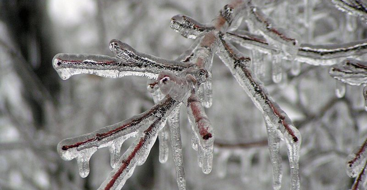
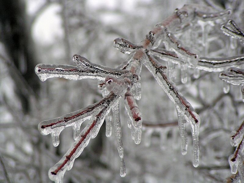
Freezing rain is the wildcard that turns a routine trip into a slide. A light glaze can coat bridges, ramps, and sidewalks, making traction vanish and stopping distances explode. Trees and power lines do not handle that weight well, so scattered outages may pop up as ice thickens.
Plan routes with fewer hills and give yourself more time than usual. Keep your tank half full, stash an emergency kit, and clean off lights and mirrors before moving. If the forecast mentions a warm nose aloft, expect precipitation to flip types quickly, and treat every shiny surface like it is icy.
Travel and Infrastructure Impacts a Growing Concern
This storm is lining up with major travel corridors, and delays will stack fast if snow bands or ice arrive during peak hours. Airports from Chicago to Boston could trigger deicing queues and ground stops. Trains may slow through icy stretches, while buses fight traction at intersections and hills.
Road crews will pretreat, but timing matters. If freezing rain beats the salt trucks, surfaces glaze before chemicals can bite. That is when bridges, overpasses, and shaded roads become traps, and a minor spinout turns into a backup that lasts for hours.
Prepare like power could blink. Charge devices, secure loose outdoor items, and keep flashlights handy. If you rely on medical equipment, confirm backup plans and notify your provider.
Stagger departures at work or school if possible, and watch live traffic maps for closures before committing to a long drive.
Forecast Uncertainty Highlights Need for Preparedness
Confidence is high that winter hazards are coming, but the exact mix near your street remains sensitive to track and temperature. A one or two degree swing can flip snow to sleet or drizzle to a dangerous glaze. Instead of obsessing over totals, zero in on timing, wind, and surface temperatures.
Prep now so last minute changes do not rattle your day. Restock ice melt, check wiper blades, and test your flashlight. Move vehicles off the street if plows need room, and charge power banks so you are set if lines snap under ice.
Follow trusted alerts and keep notifications on. If conditions worsen, shift plans rather than racing the first band. Be patient after the storm too, because refreezing often sneaks in at dawn and after sunset, turning yesterday’s slush into today’s hidden ice.


