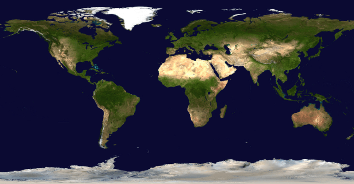
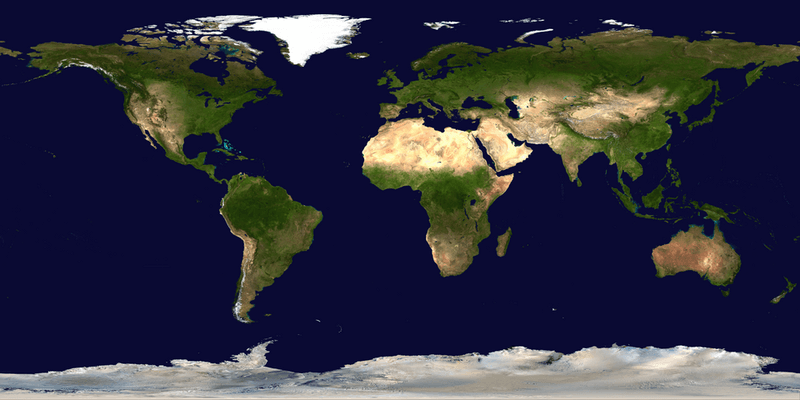
Scientists have made a fascinating discovery that challenges what we thought we knew about Earth’s continents. A new study suggests that our planet might be missing a continent, or at least part of one, hidden beneath the waters of the North Atlantic Ocean.
This finding could rewrite geology textbooks and change how we understand the very ground beneath our feet.
1. The Seven-Continent Model May Be Oversimplified
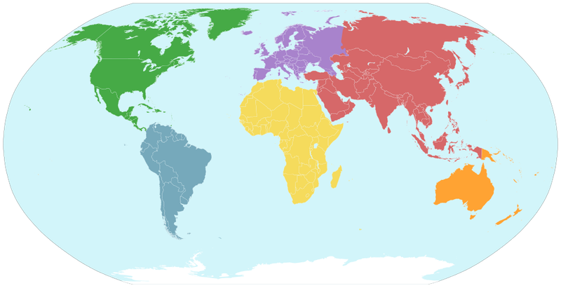
Geography lessons have taught generations about seven continents neatly divided across the globe. But fresh geological evidence paints a messier picture than what appears on classroom maps.
Scientists now recognize that the boundaries between continents blur and overlap in ways we never fully appreciated.
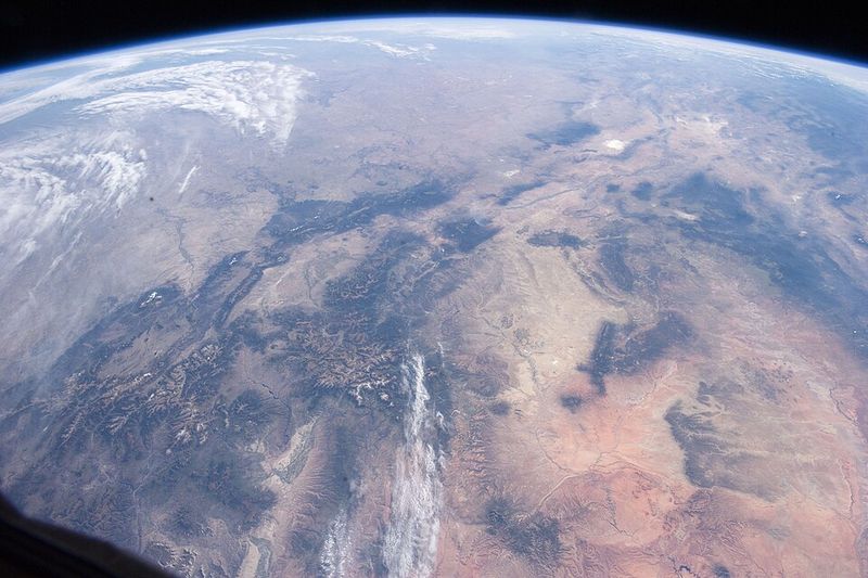
Traditional maps show clean lines separating land masses, yet tectonic reality tells a different story. Continental edges extend far beyond visible coastlines, sometimes stretching hundreds of miles underwater.
These submerged zones complicate our understanding of where one continent ends and another begins.
Researchers studying the ocean floor have uncovered surprising connections between supposedly separate land masses. Their findings suggest that our seven-continent model oversimplifies an incredibly complex geological puzzle.
The boundaries we memorized in school may need serious revision as new data emerges from beneath the waves.
2. Europe and North America Might Still Be Partly Connected
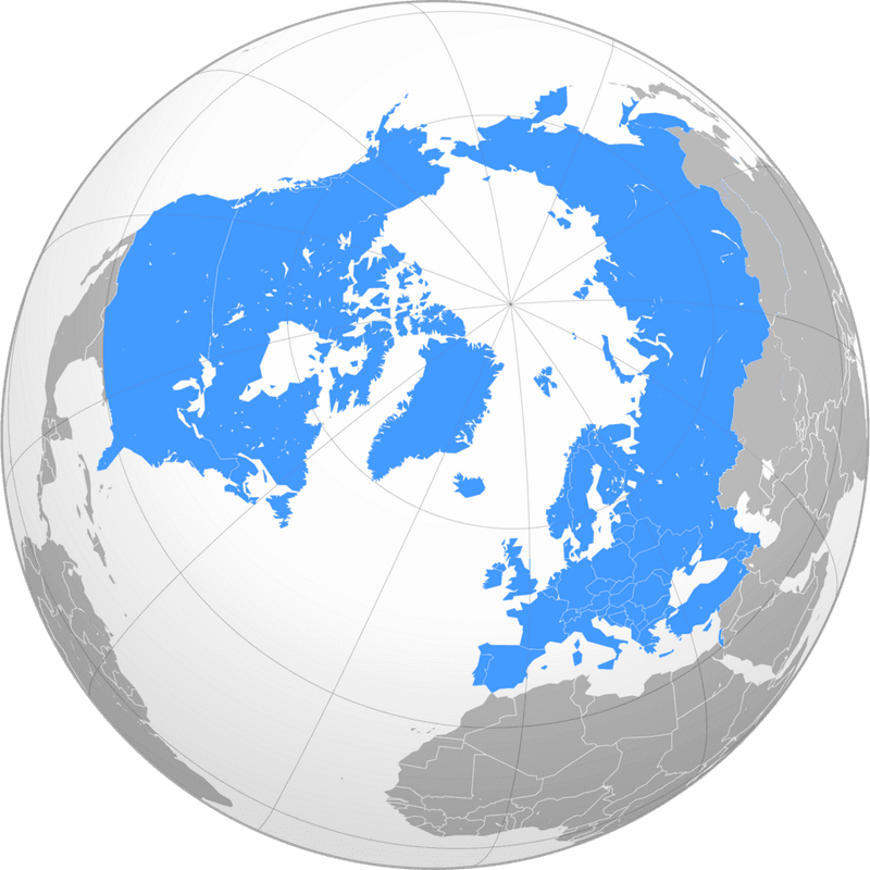
Most people assume Europe and North America separated completely millions of years ago. Recent research challenges this assumption with startling implications.
Scientists examining tectonic plates beneath the North Atlantic have found evidence that these two continents may still share underground connections.
The seafloor between these land masses tells a complicated story. Rather than a clean break, the continental crust appears to stretch and thin without fully severing.
This means that deep below the ocean waves, fragments of continental material might still link the two continents together.
Think of it like pulling apart a piece of taffy that never quite breaks. The Atlantic Ocean opened up between Europe and North America, but the separation may not be as complete as we imagined.
This partial connection could explain unusual geological features found on both sides of the ocean.
3. The Mid-Atlantic Ridge Isn’t Just an Ancient Scar
Running down the center of the Atlantic Ocean lies a massive underwater mountain range called the Mid-Atlantic Ridge. For decades, textbooks described it as the boundary where two continents finished separating long ago.
New scientific perspectives are changing that interpretation dramatically.
Scientists now view this ridge as evidence of an ongoing process rather than a completed event. The breakup between continents may still be happening in slow motion.
Instead of representing a healed wound from ancient times, the ridge marks an active zone where separation continues today.
This shift in understanding matters because it affects how we model Earth’s past and future. If the continental split remains incomplete, then the Atlantic Ocean is still widening.
The Mid-Atlantic Ridge becomes a living laboratory for studying how continents drift apart, offering insights into processes that shape our planet over millions of years.
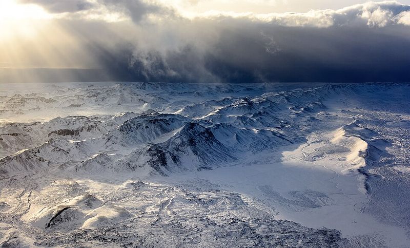
4. Iceland Is Not Just a Volcanic Island
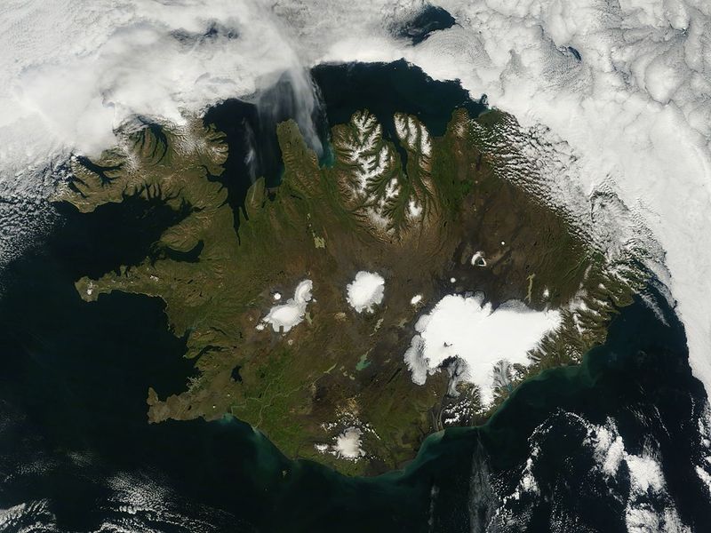
Visitors to Iceland marvel at its volcanoes, geysers, and dramatic landscapes formed by fire and ice. But beneath this volcanic wonderland lies something unexpected that challenges its classification as a simple island.
Scientists have discovered that Iceland might actually sit atop pieces of ancient continental crust.
Rather than being purely volcanic rock pushed up from Earth’s mantle, Iceland appears to contain continental fragments. These pieces may belong to both Europe and North America, making Iceland a geological crossroads.
The island essentially straddles the boundary between two continents that never fully separated.
This revelation transforms how geologists understand Iceland’s formation and significance. The country becomes more than just a volcanic hot spot; it represents a unique hybrid of continental and oceanic geology.
Tourists walking across Icelandic landscapes might actually be stepping on fragments of two different continents at once, making every hike a journey between worlds.
5. A Lost Continent May Be Hidden Under the Atlantic

Atlantis may be pure legend, but a real lost continent might actually exist beneath Atlantic waters. Researchers have identified submerged continental fragments buried under layers of volcanic rock and seawater.
These hidden pieces of crust represent a missing chapter in Earth’s geological history.
Unlike the mythical Atlantis that supposedly sank dramatically, this continental material never rose above sea level in recent times. Instead, it represents crust that got trapped in the middle of a continental breakup.
As Europe and North America pulled apart, some sections stretched thin and sank, becoming covered by younger volcanic material.
Detecting these hidden fragments requires sophisticated technology that can peer through ocean water and rock layers. Gravity measurements and seismic surveys reveal density differences that expose the buried continental crust.
What scientists are uncovering suggests that substantial amounts of continental material lie hidden where we least expected it, rewriting our understanding of Atlantic geology.
6. A New Geological Term Has Been Introduced

When scientists discover something that doesn’t fit existing categories, they need to invent new terminology. The study of the North Atlantic’s hidden continental fragments has produced exactly such a situation.
Researchers have proposed calling this unusual geological feature a Rifted Oceanic Magmatic Plateau, or ROMP for short.
This term describes a hybrid region that combines characteristics of both continents and ocean basins. The word rifted refers to the splitting process that tried to separate the continents.
Oceanic magmatic plateau acknowledges the volcanic material that covered the stretched continental crust, creating a thick layer of igneous rock.
Creating new geological terms matters because it shapes how scientists communicate and think about Earth’s features. ROMP gives researchers a precise way to discuss these in-between zones that are neither purely continental nor typically oceanic.
As more examples get identified worldwide, this term will help geologists recognize similar features and understand the incomplete breakup processes that created them.
7. Continental Breakups Don’t Always Finish
Imagine starting to tear a piece of paper but stopping halfway through. Something similar can happen with continents, according to new geological understanding.
Not every rift that begins actually completes the separation process, leaving continents partially connected in unexpected ways.
Several factors can cause a continental breakup to stall midway through the process. Changes in tectonic stress, shifts in plate movement direction, or variations in crustal strength might halt the rifting.
When this happens, the partially separated regions remain connected by stretched and thinned continental crust rather than breaking cleanly apart.
These incomplete rifts challenge the simple model of continental drift taught in many schools. Earth’s surface doesn’t always follow neat patterns or complete the processes it starts.
The North Atlantic may represent one of the best examples of a stalled breakup, where Europe and North America began drifting apart but never achieved full separation in certain areas.
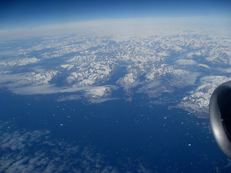
8. The Davis Strait Holds a Geological Surprise
Between Canada and Greenland lies a body of water called the Davis Strait that most people have never heard of. This remote waterway connects Baffin Bay to the Labrador Sea in the far north.
Beneath its cold waters, scientists have discovered something that shouldn’t exist according to standard geological models.
The seafloor crust under the Davis Strait measures much thicker than typical oceanic crust found elsewhere. Normal ocean floor runs about 4 to 7 miles thick, but the Davis Strait crust reaches unusual depths.
This excessive thickness caught researchers’ attention and prompted closer investigation using advanced surveying techniques.
What makes this discovery particularly intriguing is its location in what should be a straightforward oceanic basin. The Davis Strait lies between clearly separated land masses, so finding thick crust there defies expectations.
This geological surprise has become a key piece of evidence supporting the idea that continental material persists in unexpected places throughout the Atlantic region.
9. That Crust Looks Continental, Not Oceanic
Not all crust is created equal, and geologists can tell the difference by measuring thickness and density. The unusual crust beneath the Davis Strait displays characteristics that match continental rather than oceanic material.
This distinction carries huge implications for understanding the region’s geological history.
Continental crust typically measures 20 to 40 miles thick and consists of lighter, less dense rocks like granite. Oceanic crust, by contrast, runs much thinner at 4 to 7 miles and contains denser volcanic rocks like basalt.
The Davis Strait crust falls into the continental thickness range, strongly suggesting it originated as land rather than seafloor.
Scientists interpret this thick crust as stretched continental material rather than a volcanic buildup. When continents begin to separate, the crust thins and stretches like pulled dough.
The Davis Strait appears to preserve this stretched continental crust, offering a window into the incomplete breakup between North America and Greenland that occurred millions of years ago.
10. Scientists Identified a Proto-Microcontinent
Geology textbooks describe continents as massive land masses and islands as small volcanic outcrops. But a newly identified category called a proto-microcontinent fits neither definition neatly.
This term describes a continental fragment that started breaking away from a larger land mass but never completed the journey to independence.
The prefix proto means early or beginning, indicating something that didn’t fully develop. A proto-microcontinent represents an arrested stage of continental separation.
It began rifting away millions of years ago but stopped midway through the process, remaining partially attached to its parent continent by stretched crustal connections.
Finding a proto-microcontinent in the North Atlantic helps explain the region’s puzzling geology. Rather than a clean break between Europe and North America, the separation process stalled, leaving behind this transitional feature.
Proto-microcontinents may be more common than previously thought, hiding beneath oceans worldwide and waiting for modern technology to reveal their presence to curious scientists.
11. The Atlantic Opened in Multiple Stages
Continental breakups don’t happen overnight or even in a single smooth process. The Atlantic Ocean’s formation spanned an incredible timeline stretching back over 220 million years.
This separation occurred in fits and starts, with periods of active rifting interrupted by long pauses and changes in direction.
Early rifting began during the age of dinosaurs as the supercontinent Pangaea started breaking apart. The process didn’t proceed uniformly along the entire boundary between continents.
Some sections separated quickly while others lagged behind, creating a complex pattern of rifts at different stages of development.
Understanding this multi-stage opening helps explain why the Atlantic contains such varied geological features today. Areas that separated early show typical oceanic crust, while regions where rifting stalled preserve continental characteristics.
The North Atlantic’s unusual features make sense when viewed as products of incomplete separation during one of these paused stages, frozen in time by changing tectonic forces.
12. Gravity Data Revealed Hidden Structures
Gravity seems constant, but it actually varies slightly from place to place depending on what lies beneath the surface. Scientists have learned to use these tiny variations as a tool for mapping hidden geological structures.
Satellites measuring Earth’s gravitational field have uncovered the North Atlantic’s buried continental fragments that would otherwise remain invisible.
Dense rocks create stronger gravitational pull than lighter materials. Continental crust, being less dense than oceanic crust, produces distinctive gravity signatures.
By carefully measuring these variations across the Atlantic, researchers can essentially see through the ocean water and seafloor to detect buried continental material.
This gravity mapping technology has revolutionized geology by revealing features that traditional methods miss. The technique works like an X-ray for the planet, exposing structures hidden kilometers below the surface.
Without these gravity measurements, scientists might never have discovered the proto-microcontinent and other continental fragments lurking beneath Atlantic waters, fundamentally changing our understanding of the ocean’s formation.
13. Transform Faults Played a Key Role
Most people learn about faults as cracks where earthquakes happen, but transform faults have a special role in shaping continents. These sideways-sliding boundaries can dramatically affect how continental breakups proceed.
In the North Atlantic, shifting transform fault zones helped prevent a clean split between land masses.
Transform faults cut perpendicular to the main rifting direction, creating a zigzag pattern along continental boundaries. As these faults shift position over millions of years, they can redirect tectonic stresses in ways that complicate the separation process.
Some sections may pull apart while adjacent areas remain stuck together due to fault geometry.
The complex arrangement of transform faults in the North Atlantic created conditions that stalled the continental breakup in certain regions. Rather than a straight tear, the continents experienced uneven separation with some zones successfully rifting while others remained partially connected.
Understanding these fault systems helps geologists explain why the Atlantic contains such varied features along its length and why some continental fragments never fully broke away.
14. This Changes How We Model Earth’s Past
Reconstructing where continents sat millions of years ago requires careful attention to geological details. Scientists use plate reconstructions to create maps of ancient Earth, showing how land masses fit together before drifting apart.
The discovery of hidden continental fragments in the Atlantic forces researchers to revise these reconstructions significantly.
Accurate plate reconstructions matter for more than just satisfying curiosity about the past. These models affect our understanding of ancient climate patterns, ocean circulation systems, and even evolutionary history.
If continents were positioned differently than we thought, then weather patterns, sea currents, and habitat connections all need reconsideration.
The proto-microcontinent finding suggests that Europe and North America remained more closely connected for longer than previous models assumed. This changes calculations about when the Atlantic Ocean reached certain widths and how that affected global climate.
Even small adjustments to plate positions can cascade into major revisions of Earth’s environmental history, affecting theories about everything from ice ages to species migration patterns.
15. It Could Shape the Future of Resource Exploration
Mineral and energy companies pay close attention to geological discoveries because different rock types host different valuable resources. Continental crust and oceanic crust contain distinct mineral deposits, making the identification of hidden continental fragments economically significant.
The North Atlantic findings could guide future exploration efforts in unexpected directions.
Continental rocks often contain deposits of metals like copper, gold, and rare earth elements that formed through different processes than oceanic minerals. If substantial continental crust lies hidden beneath Atlantic waters, it might host undiscovered resource deposits.
Companies exploring for minerals and hydrocarbons need accurate geological maps to focus their expensive search efforts.
Beyond immediate economic implications, understanding the true extent of continental versus oceanic crust helps predict where various resources might accumulate. This knowledge becomes increasingly valuable as land-based deposits deplete and exploration moves offshore.
The proto-microcontinent discovery demonstrates that our geological maps still contain major blind spots that could conceal significant mineral wealth beneath the waves, waiting for technology and understanding to catch up.


