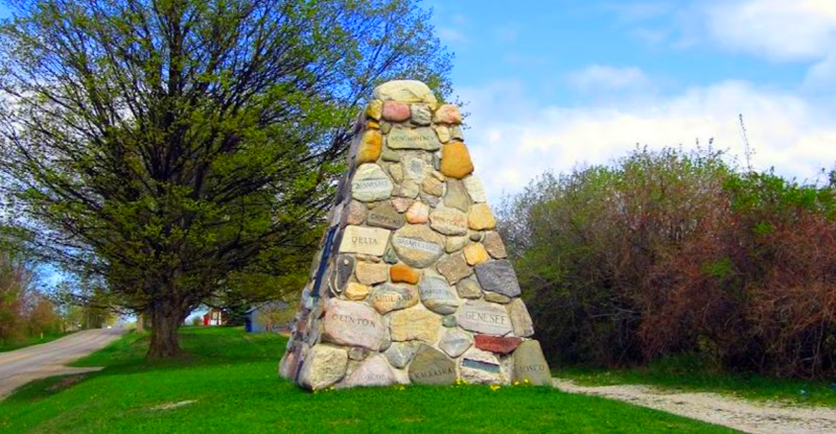
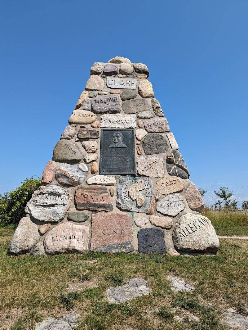
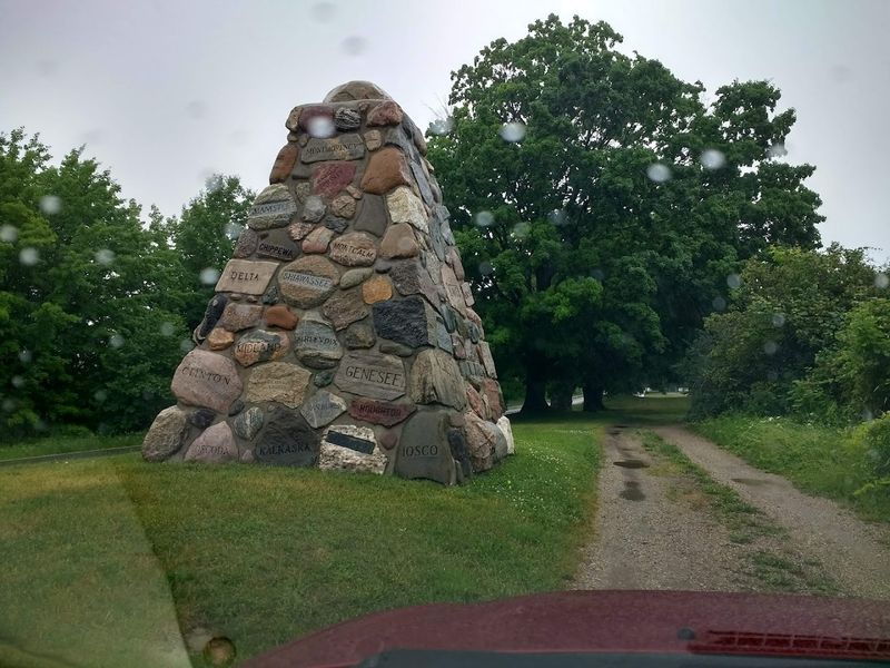
A roadside stone cairn in Northern Michigan holds pieces of all 83 counties, yet most drivers pass it without realizing what it represents. Built in 1938, it was designed as a statewide tribute, with each county contributing a marked stone.
Hidden inside is a sealed crypt filled with period items like resort brochures and newspapers, capturing a snapshot of Michigan at the time. One county even submitted a piece of rubber instead of stone, a detail that still stands out today.
It’s easy to overlook, but once you know the story, it becomes one of the more unusual historical markers in the state.
Where Exactly This Cairn Stands
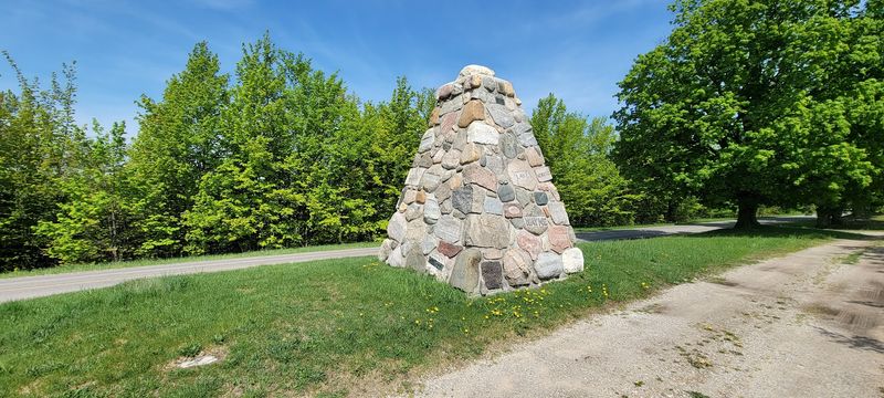
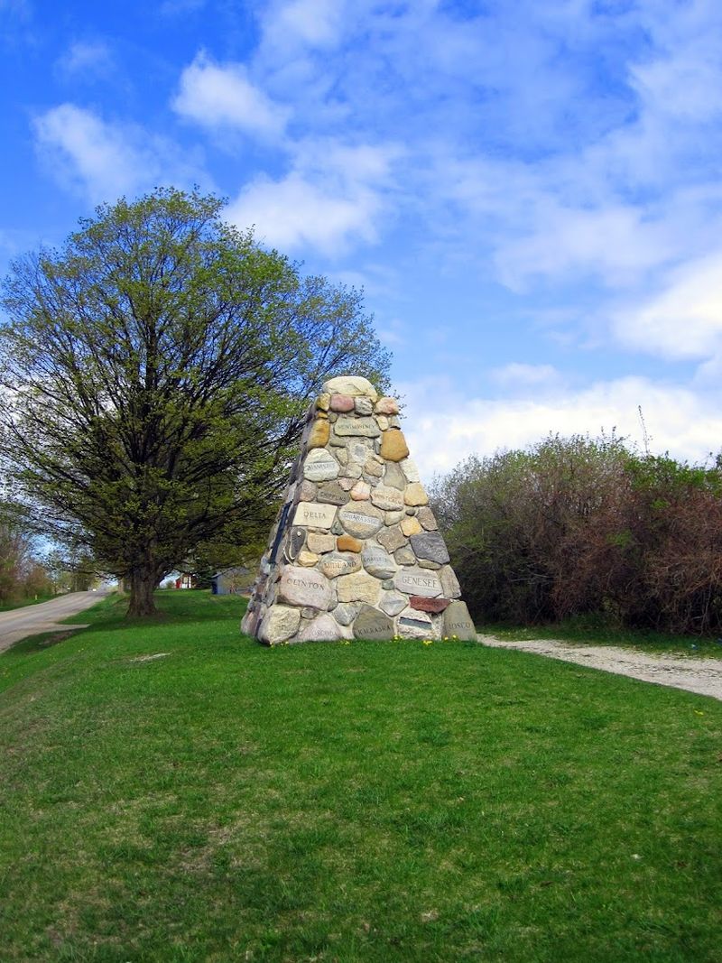
The Michigan Rock Cairn sits at 5899 Cairn Highway in Kewadin, Michigan 49648, right along the old US-31 corridor in the northwestern Lower Peninsula. Kewadin is a small community in Antrim County, tucked between Elk Lake and the shores of Grand Traverse Bay.
The road it stands on is literally named after it, which is a small but satisfying detail. Cairn Highway used to be the main north-south route through this part of Michigan before US-31 was rerouted in 1955, pulling most of the traffic away from this stretch.
The cairn is open 24 hours a day, every day of the week, with no admission fee. You simply pull off the road, walk up to it, and take your time.
The surrounding landscape is classic Northern Michigan, with tall trees and a sense of calm that makes the stop feel genuinely refreshing rather than just a quick checkbox on a road trip itinerary.
The Man Behind the Monument
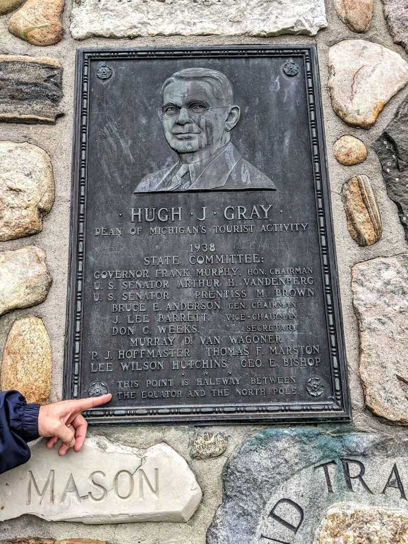
Hugh J. Gray was not a politician or a military figure, which makes him an unusual candidate for a monument.
He was a tireless promoter of Michigan tourism during the early twentieth century, a man who genuinely believed that the state’s lakes, forests, and small towns deserved a national audience.
Gray worked hard to put Northern Michigan on the map for travelers at a time when road trips were still a relatively new concept. His efforts helped shape how people thought about Michigan as a destination rather than just a place to pass through.
The cairn features a bronze plaque with his likeness, mounted on the stone structure as a permanent tribute. Inside the monument, a sealed crypt holds resort booklets, brochures, and newspapers from across Michigan, preserving a snapshot of the tourism world Gray helped build.
It is a fitting tribute for someone who spent his career convincing people that Michigan was worth the trip.
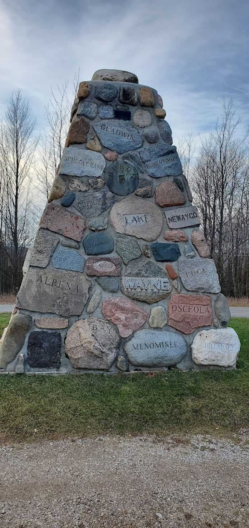
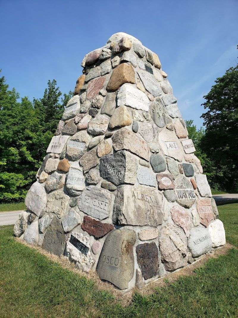
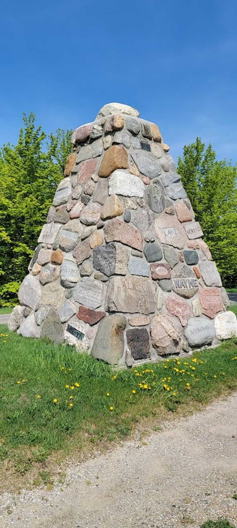
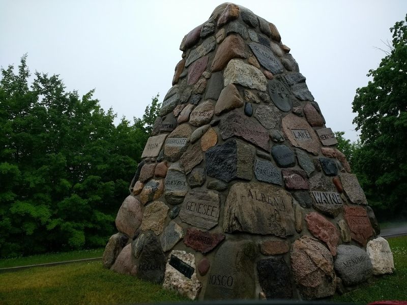
83 Stones, One for Every County
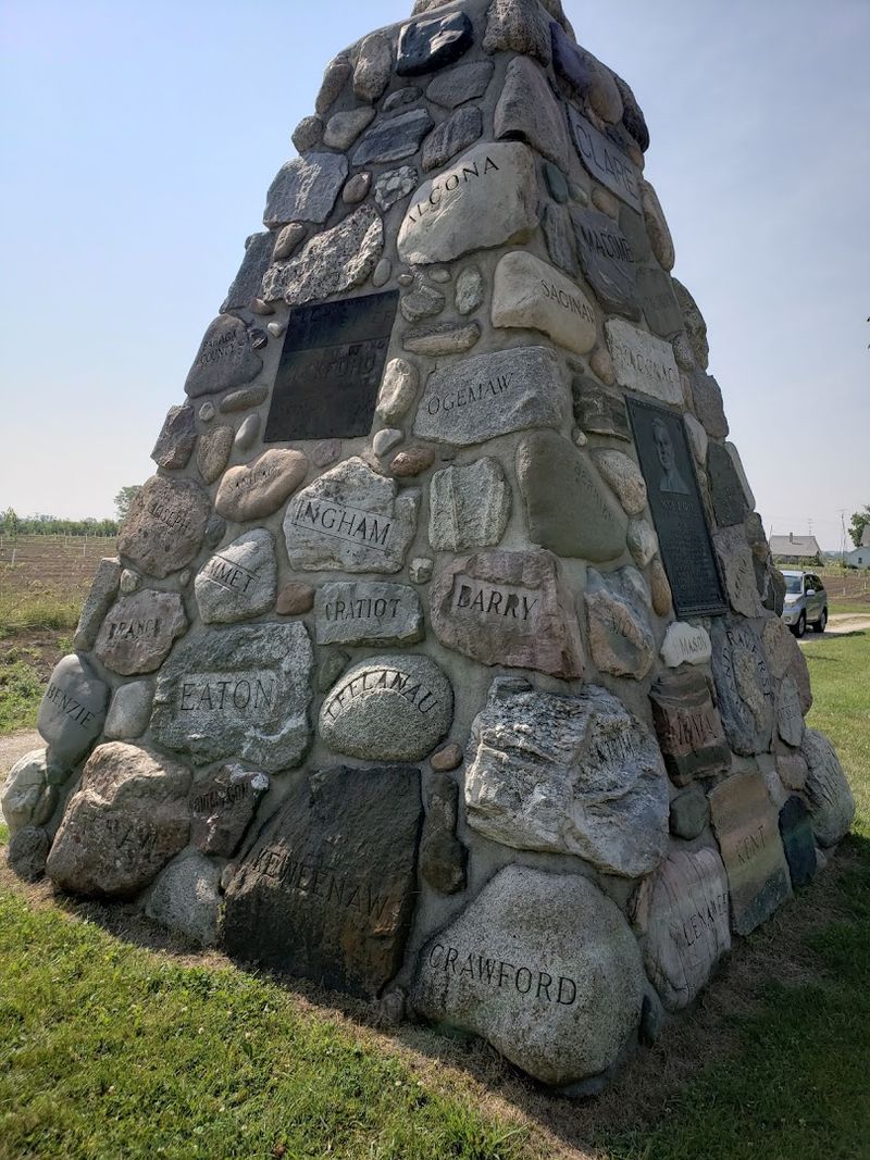
The concept behind this cairn is straightforward but genuinely clever. Each of Michigan’s 83 counties contributed one stone to the structure, and every stone is engraved with the name of the county it came from.
That means you can actually walk around the cairn and read Michigan geography right off the rocks. Some stones hint at their origins through their texture, color, or composition, giving the whole structure a kind of geological variety that a geology enthusiast would find hard to walk away from quickly.
The idea was to create something that represented the entire state, not just the region where the cairn stands. In that sense, it functions almost like a physical map of Michigan, compressed into a single 16-foot structure.
Each county had a say in what stone to send, which is why the collection feels so personal and specific rather than generic. More on one very surprising county contribution coming up next.
The County That Sent Rubber Instead of Rock
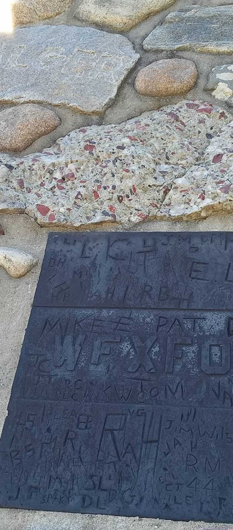
Wexford County made a choice that nobody else made. Instead of submitting a traditional stone, the county contributed a two-foot-square piece of rubber, a nod to the rubber industry that was significant in that area at the time the cairn was built in 1938.
It is one of those details that makes you stop and look twice. Among all the granite and limestone and sandstone, there sits a slab of rubber, completely unapologetic about not fitting in.
It is oddly charming.
This kind of quirky authenticity is exactly what makes the cairn worth seeking out. It is not a polished museum exhibit with explanatory signage on every surface.
It is a real artifact of a specific moment in Michigan’s history, where each county made its own call about what best represented its identity. Wexford County apparently decided that rubber said more about who they were than any rock could, and honestly, that confidence is admirable.
What the Sealed Crypt Actually Contains
Somewhere inside the stone walls of this cairn, sealed away from the outside world, is a collection of resort booklets, brochures, and newspapers from Michigan circa 1938. Nobody has opened it since the cairn was completed, and that is part of what makes it interesting.
Think about what those documents represent. Michigan tourism in the late 1930s was a world of lakeside resorts, fishing cabins, and promotional pamphlets printed on paper that has now been sitting in the dark for decades.
The language in those brochures, the photographs, the prices, all of it frozen in time inside a stone monument on a quiet country road.
It functions as an accidental time capsule, one that was intentional in its creation but is now far more historically valuable than anyone probably anticipated. The sealed crypt is a big part of why this cairn feels like more than just a pile of rocks, and it adds a layer of mystery that is hard to shake once you know about it.
Standing at the Halfway Point Between Equator and Pole
The cairn sits close to the 45th parallel, which is the geographic line marking the halfway point between the equator and the North Pole. That is not just a fun fact to tuck away for trivia night.
It gives the location a sense of scale that feels almost cosmic when you are standing there.
You are, in a very literal sense, equidistant from two of Earth’s most defining geographic points. Northern Michigan does not often get described in those terms, but this spot earns it.
The 45th parallel runs through several U.S. states and a number of countries, but there are not many places where you can stand next to a handmade stone monument that was specifically placed to honor that position. The combination of geographic significance and human craftsmanship gives the cairn a weight that goes beyond its physical size.
And the fact that most people have never heard of it makes finding it feel like a genuine discovery.
The Size and Structure of the Cairn Itself
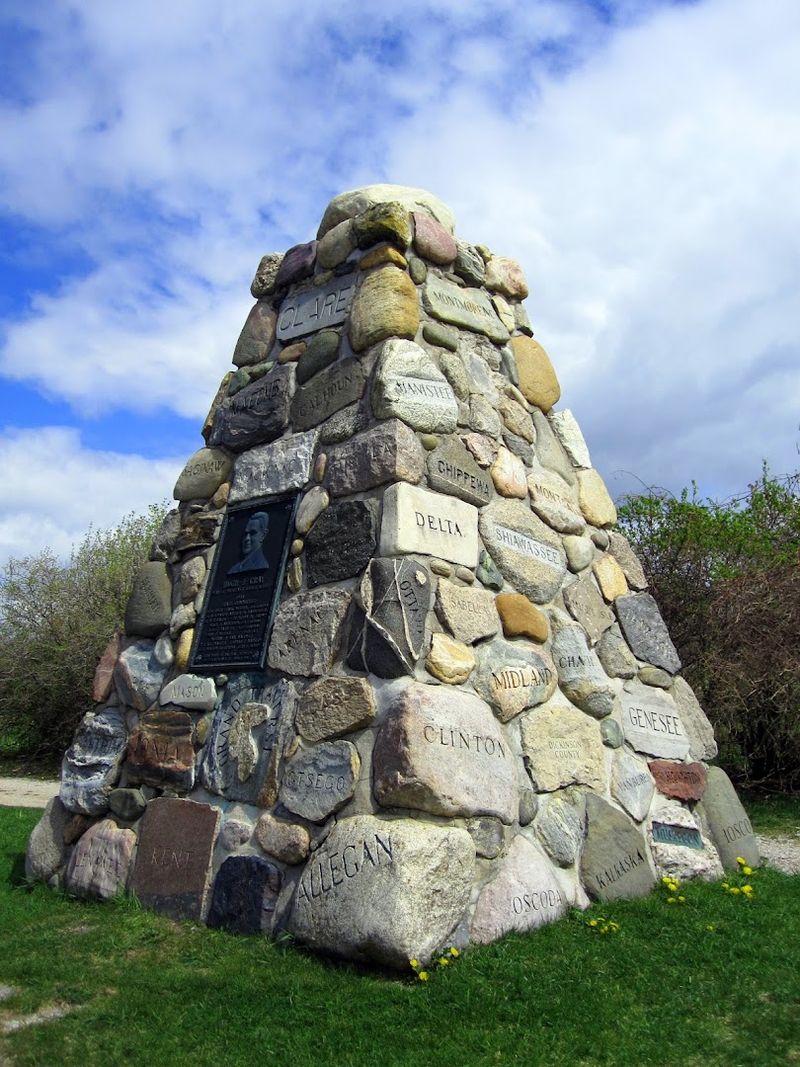
At 12 feet square at its base and rising 16 feet into the air, the Michigan Rock Cairn is not a subtle structure. It has real presence, and when you stand next to it, the scale is more impressive than photos suggest.
The construction required careful planning to ensure that stones from 83 different counties, each with different shapes, sizes, and compositions, could be stacked into a coherent and stable monument. The result is a patchwork of Michigan geology that somehow holds together with quiet authority.
The bronze plaque of Hugh J. Gray adds a formal element to what might otherwise feel purely rustic.
It anchors the structure as an intentional memorial rather than just a decorative pile of stones. The cairn was built in 1938, which means it has weathered more than eight decades of Northern Michigan winters, spring thaws, and summer heat.
The fact that it still stands as solidly as it does is a testament to the craftsmanship of the people who built it.
How the Highway Rerouting Changed Everything
Before 1955, the cairn sat right on US-31, which was the main artery for north-south travel through this part of Michigan. Travelers heading up to Petoskey, Traverse City, or beyond would pass it regularly.
It was a roadside attraction in the truest sense of the phrase.
Then the highway was rerouted to the west, and the traffic simply stopped coming. The cairn did not move, but the audience did.
What had once been a well-traveled stop became a quiet detour that most people never thought to take.
In some ways, the rerouting did the cairn a favor. It removed the noise and the rush, leaving behind a slower, more contemplative experience.
The road it sits on was renamed Cairn Highway, which at least ensures that the landmark gets credit for defining the street. But the reduced visibility also means that many Michigan residents have never heard of it, which feels like a genuine missed opportunity for the state’s tourism story.
The Atmosphere When You Actually Visit
The quiet at this spot is the first thing you notice. There is no parking lot attendant, no gift shop, no audio tour.
Just a pull-off area, a path to the cairn, and the sound of whatever the Northern Michigan wind is doing that day.
The trees around the cairn give it a sheltered feeling, as if the landscape is in on the secret. Summer visits bring birdsong and warm light filtering through the leaves.
Fall visits turn the whole scene into something that looks almost staged, with the stone cairn framed by orange and red foliage.
There is something genuinely calming about a place that asks nothing of you except your attention. No ticket, no time limit, no crowd jostling for the best angle.
Just you, a remarkable stack of rocks, and the knowledge that every stone around you came from a specific place in a state that clearly cared enough to build this. That combination is harder to find than it sounds.
What Makes It Worth the Detour
The cairn holds a 4.8-star rating from the people who have visited it, which is a strong score for a free roadside landmark with no amenities. That rating reflects something real: the experience consistently delivers more than people expect from a roadside stone structure.
Part of what makes it work is the interactivity. You can walk the perimeter and try to find your home county’s stone.
You can read the names engraved on each rock and think about the geography of a state that is larger and more varied than many people realize. You can look for Wexford County’s rubber contribution and feel the small, satisfying jolt of finding something genuinely odd.
It is not a destination that requires hours of your day. A 20-to-30-minute stop covers it comfortably.
But the details you take away, the 83 counties, the sealed crypt, the rerouted highway, the 45th parallel, tend to stay with you longer than a more elaborate attraction might. That kind of lasting impression is rare and worth chasing.
Best Times to Visit and What to Bring
The cairn is accessible year-round and open around the clock, which gives you a lot of flexibility. Summer is the most popular time, and for good reason.
The weather cooperates, the surrounding greenery frames the monument beautifully, and the light in Northern Michigan during July and August is genuinely excellent for photography.
Fall is arguably even better visually. The foliage in Antrim County turns vivid in late September and October, and the stone cairn set against autumn colors is a strong photograph by almost any standard.
A few practical notes: the road is paved and easy to navigate, but the pull-off area is small, so larger vehicles should plan accordingly. Bring a camera or make sure your phone is charged.
Comfortable walking shoes are enough since the terrain is flat and manageable. There are no restroom facilities on-site, so plan your visit with that in mind.
The experience is simple, but a little preparation makes it smoother.
A Quiet Corner of Michigan History Worth Knowing
Most Michigan residents have never visited this cairn, and many have never heard of it. That is a curious fact about a monument that was built specifically to celebrate the entire state.
History has a way of letting its quieter chapters fade, especially when a highway rerouting removes the foot traffic that kept a story alive.
But the cairn is still there, still holding its 83 stones, still sealed around that crypt full of 1938 Michigan tourism materials. It has not moved, has not changed much, and has not asked for attention it stopped receiving decades ago.
Finding it feels a little like discovering a chapter of a book that most people skipped. The story it tells about Michigan’s counties, its tourism history, and one man’s belief that the state was worth celebrating is genuine and specific in a way that polished attractions rarely are.
Roads like Cairn Highway exist because someone built something worth naming a road after, and that is a legacy worth a 20-minute detour.


