Just north of Dillon, a small limestone bluff overlooks the Beaverhead Valley from a place that played a remarkable role in the Lewis and Clark Expedition. Visitors come for sweeping mountain views, a short scenic trail, and a granite compass monument marking William Clark’s historic observations, but many leave most moved by the story of Sacagawea recognizing the homeland she had not seen since childhood. Despite covering only a few acres, this quiet park preserves one of the most meaningful landscapes in the story of the American West.
The experience goes far beyond the overlook itself. Interpretive exhibits, panoramic views that have changed little since 1805, abundant birdlife, and nearby Lewis and Clark landmarks transform a brief stop into a memorable journey through history. Whether you’re following the Lewis and Clark Trail or exploring southwestern Montana, it’s a destination that rewards anyone willing to slow down and take it in.
Here’s why Clark’s Lookout State Park has become one of Montana’s most meaningful historic destinations and a stop that’s well worth adding to your itinerary.
Where History Perches Above the Beaverhead Valley
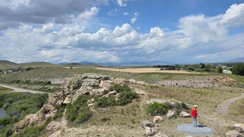
My first glimpse of Clark’s Lookout State Park came from the road, where a modest brown sign off old Highway 91 pointed toward something far bigger than its acreage suggested. The park sits at 25 Clarks Lookout Rd, Dillon, MT 59725, roughly one mile north of town, and the approach is refreshingly simple: a gravel lot, a vault toilet, and a short path leading upward.
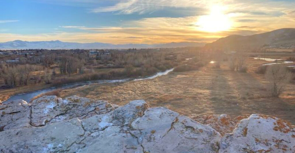
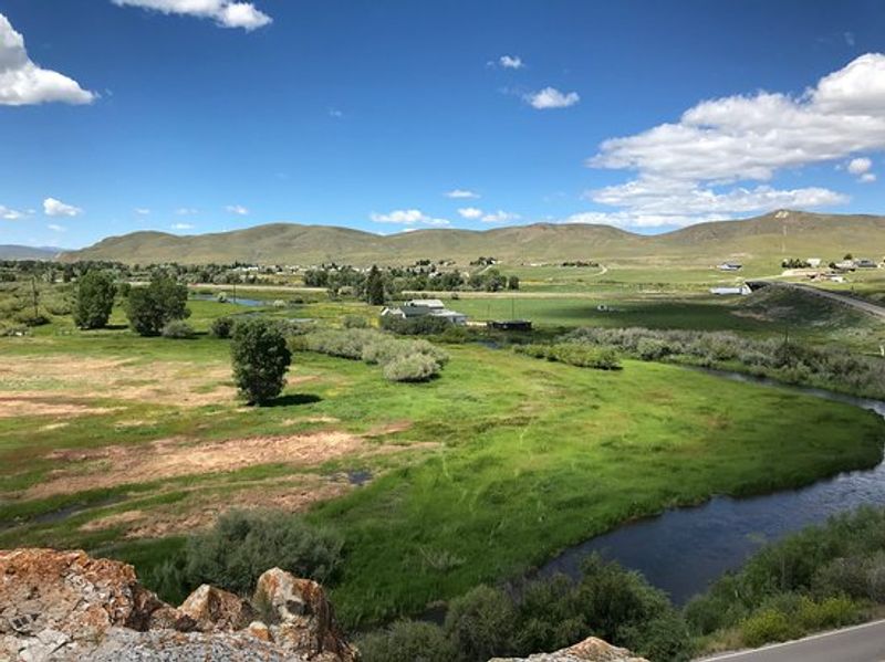
At just over eight acres, this Montana Fish, Wildlife and Parks site might sound modest, but the elevation of 5,118 feet grants a panoramic view that immediately justifies the detour. The Beaverhead River winds below like a careful brushstroke across the valley floor, and the surrounding mountains form a natural amphitheater around the scene.
What surprised me most was how little has changed since 1805. The agricultural patchwork in the valley is newer, of course, but the ridgelines and river bends that Clark surveyed remain essentially intact, making this one of the most authentically preserved Lewis and Clark sites anywhere along the historic trail.
Captain Clark’s August 13th Mission on the Limestone Bluff
On August 13, 1805, Captain William Clark did not climb this bluff for the view. He climbed it because the Corps of Discovery was running out of options, pushing their dugout canoes up a river that was getting shallower and colder by the mile, and he desperately needed to understand what lay ahead.
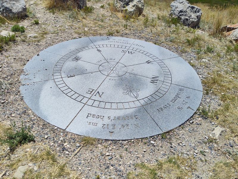
From the summit, Clark took precise compass bearings on three landmarks: Beaverhead Rock, the mouth of the Wisdom River (today’s Big Hole River), and a mountain gap where the river passed through a ridge. Those readings, faithfully copied into his journal, became foundational data for the maps that would guide the expedition forward.
Today, a granite monument shaped like a compass rose stands at the exact summit, reproducing those three historic bearings so visitors can align their own gaze with Clark’s. Standing there and following each bearing with your eyes across the valley is a quietly thrilling exercise, a direct line of sight stretching more than two centuries into the past.
Sacagawea’s Emotional Recognition of Her Homeland
A few days before Clark climbed this bluff, something remarkable happened downstream. Sacagawea, the young Shoshone woman traveling with the Corps, spotted Beaverhead Rock and recognized it immediately as a landmark near her people’s summer camps. She had been kidnapped from this very valley around age twelve, and now, years later, the landscape was telling her she was almost home.
That recognition changed everything for the expedition. It confirmed they were on the correct route to find the Shoshone, whose horses and mountain knowledge were absolutely essential for crossing the Continental Divide. Without Sacagawea’s familiarity with this terrain, the Corps might have wandered for weeks.
Clark’s Lookout sits within that same stretch of valley, making the entire area a landscape of personal and historical significance that goes far beyond cartography. Knowing this backstory while standing on the bluff transforms the visit from a scenic stop into something genuinely moving, a place where geography and human experience intersect in ways that are hard to articulate but easy to feel.
The Granite Compass Monument: A Stone Record of Exploration
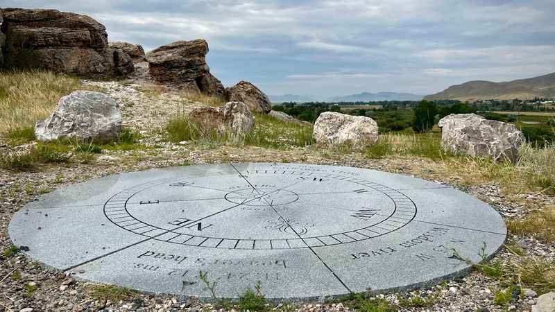
Most historical markers are plaques bolted to boulders, easy to glance at and walk past. The monument at the summit of Clark’s Lookout is different in a way that genuinely stops you in your tracks. It is a large granite compass rose, carved with the three specific bearings Clark recorded in his journal on August 13, 1805, and oriented so that each bearing actually points toward its real-world target in the surrounding landscape.
Follow the bearing marked for Beaverhead Rock and your eyes land on the distinctive formation miles down the valley. Follow the one for the Wisdom River mouth and you are looking at the precise confluence Clark identified. This is not decorative history; it is interactive geography, and it works beautifully.
Photographers tend to linger here longer than they planned, experimenting with angles that frame the compass against the valley below. The monument manages to be both a functional educational tool and a genuinely photogenic landmark, which is a rarer combination than you might expect at a small state park.
The Short Trail That Delivers Big Rewards
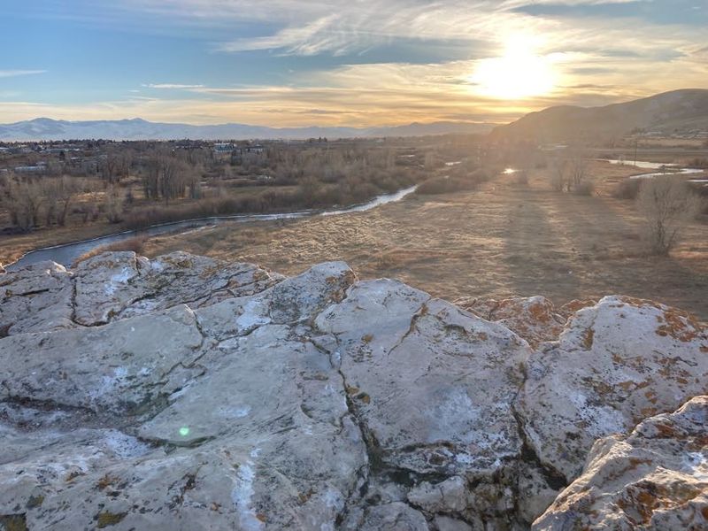
The trail to the summit of Clark’s Lookout is approximately a quarter mile, and calling it a hike feels slightly generous. It is more of a purposeful stroll with a modest incline, the kind of walk that most people, regardless of fitness level, can complete comfortably in under fifteen minutes. That said, the path does get noticeably steeper near the top, so wearing actual shoes rather than flip-flops is a reasonable idea.
What the trail lacks in length it compensates for in pacing. Interpretive signs appear at natural intervals along the route, each one offering a new piece of the expedition’s story before the next stretch of path reveals another slice of the valley below. By the time you reach the summit, you have been gradually briefed and gradually rewarded, which is smart trail design.
One practical note: there is essentially no shade on this trail. A late morning visit in July means the limestone reflects heat generously, so bringing water is less a suggestion and more a firm recommendation. The views are worth every step regardless of the season.
Panoramic Views That Have Barely Changed in 220 Years
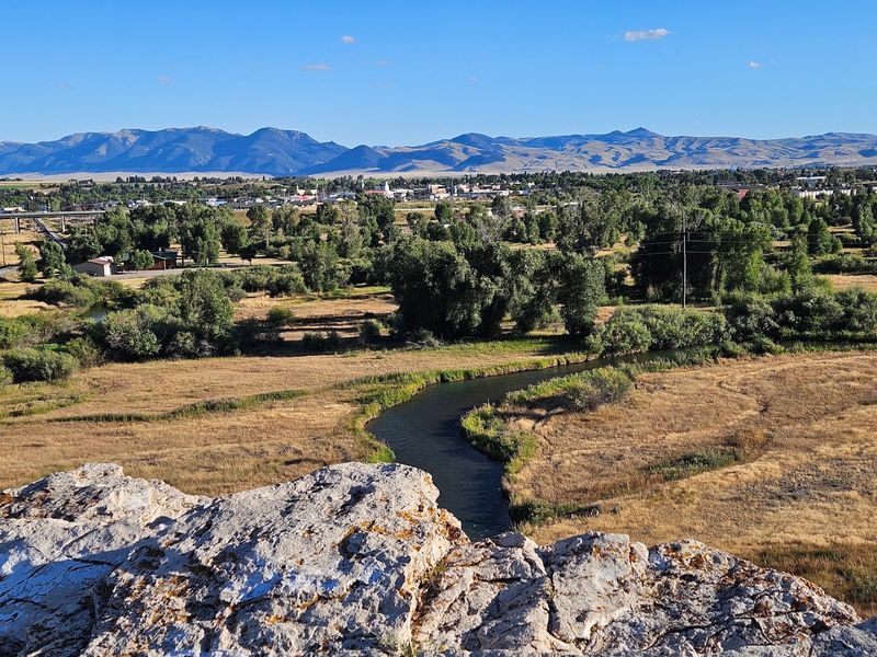
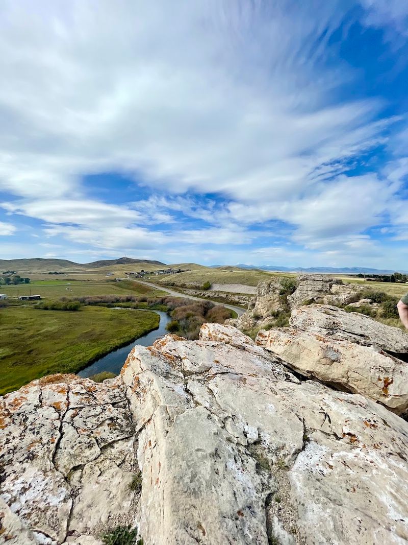
The view from the top is the kind that makes you stop talking mid-sentence. The Beaverhead River traces a lazy, looping path through the valley below, its banks lined with cottonwoods that flash silver in the wind. Beyond the river, the valley floor opens into a wide patchwork of ranch land before rising toward mountain ridges that still carry snow well into late spring.
What makes this panorama historically significant, beyond its obvious beauty, is how little the essential geography has changed. The river bends Clark sketched in 1805 are still recognizable. The mountain gaps he used as landmarks are still there, still framing the same horizon. Modern agriculture has added fences and irrigation pivots, but the bones of the landscape are unchanged.
Early morning visits reward photographers with soft, directional light that emphasizes the valley’s topography, while late afternoon turns the whole scene amber and gold. Either way, the view earns its reputation as one of the more quietly spectacular overlooks in southwestern Montana, and it costs almost nothing to experience.
Interpretive Signs That Actually Teach You Something
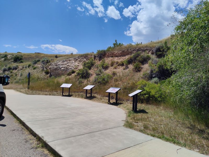
State park interpretive signage has a reputation for being dry, text-heavy, and easy to skip. The panels at Clark’s Lookout break that pattern in a satisfying way. They are well-designed, clearly written, and placed at moments along the trail where the surrounding landscape directly illustrates what the sign is describing. Reading about Clark’s compass bearings while looking at the exact terrain he was measuring creates an immediacy that a museum exhibit rarely achieves.
The signs cover a range of topics: the navigational methods used by the Corps of Discovery, the role of the Beaverhead River as a travel corridor, the broader context of the expedition’s mission, and the significance of Sacagawea’s geographical knowledge. Each panel is concise enough to read without losing the thread of the story.
For families with school-age children, these signs function as a ready-made outdoor classroom. The content is accessible without being dumbed down, and the fact that you are standing in the actual location being described gives the information a weight that textbooks simply cannot replicate. History taught on-site hits differently.
Wildlife and Wildflowers: Nature’s Supporting Cast
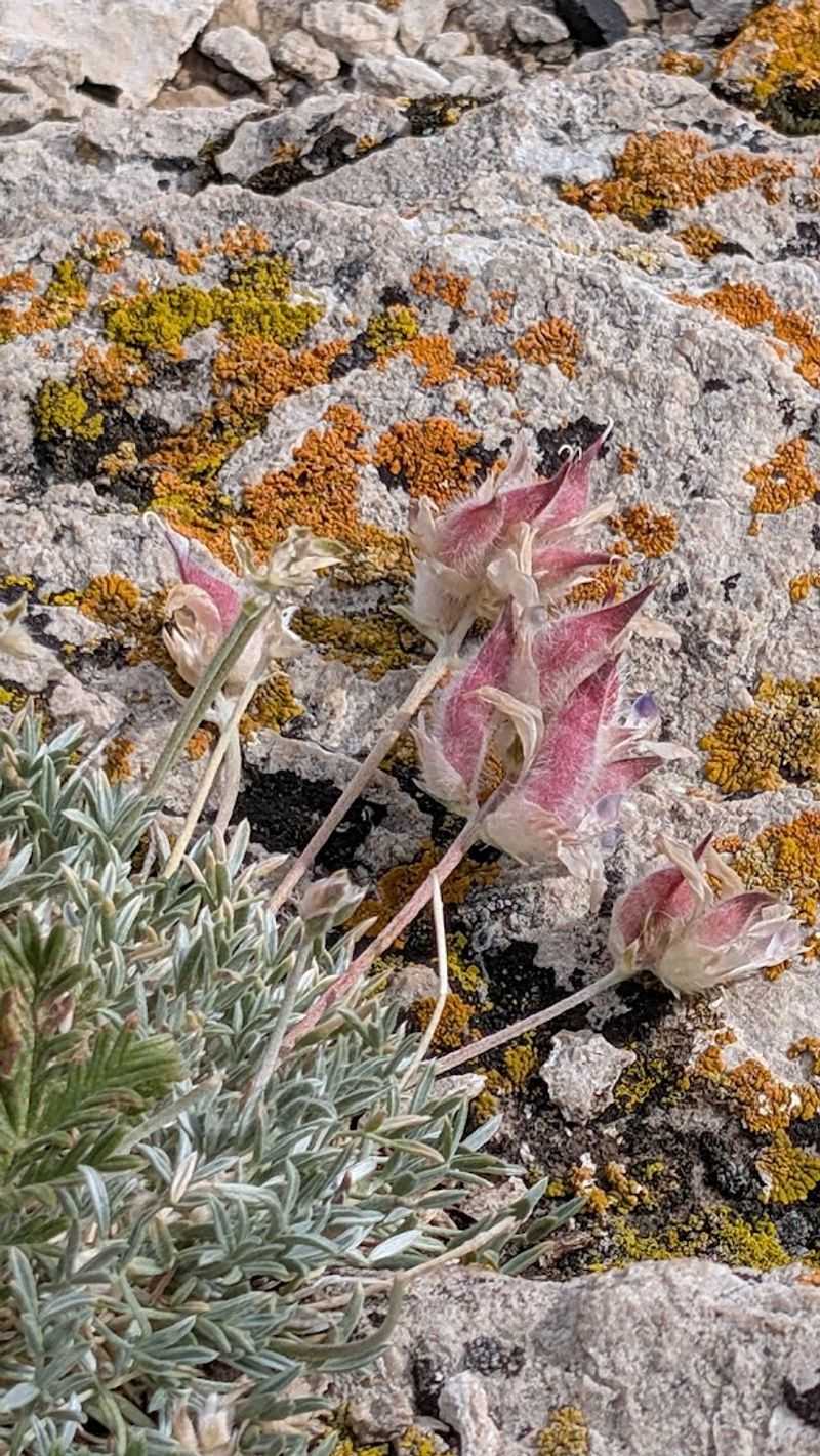
History is the main draw here, but the natural environment quietly competes for attention. The limestone bluff and surrounding scrubby terrain support a surprising variety of plant life, including native grasses and seasonal wildflowers that add unexpected color to the rocky hillside. Spring visits, particularly in May and June, reveal small blooms tucked into crevices that would be easy to miss if you were walking too fast.
Birdwatchers will find the site rewarding with minimal effort. The river corridor below attracts waterfowl, and the open skies above the bluff are prime territory for raptors. Red-tailed hawks are a frequent sight, riding thermals above the valley with the kind of effortless authority that makes you briefly jealous of their commute.
Larger wildlife is less predictable but not unheard of in the broader area. White-tailed deer occasionally browse the valley floor visible from the summit, and the cottonwood corridors along the river harbor a lively songbird population throughout summer. Bringing binoculars turns a historical visit into a naturalist outing as well, doubling the return on a single stop.
Planning Your Visit: Hours, Fees, and Getting There
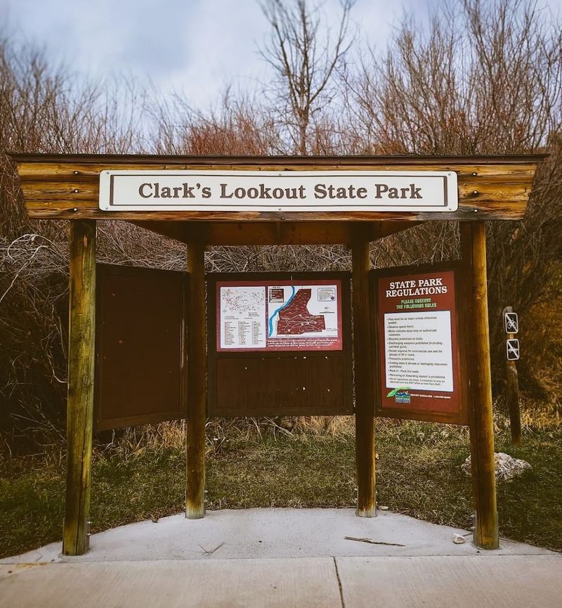
A few practical details can make the difference between a smooth visit and a frustrating one. Clark’s Lookout State Park is open daily from 8 AM to 9 PM between April 1 and November 30, and the park closes for winter, so a December detour will leave you looking at a locked gate. The operating hours are consistent across all seven days, which simplifies planning considerably.
Entrance fees are modest: Montana residents who paid the $9 annual state parks fee with their vehicle registration enter free. Non-residents pay $8 per vehicle or $4 for walk-ins and cyclists. The phone number for the park is +1 406-834-3413, and more information is available at fwp.mt.gov/stateparks/clarks-lookout.
One navigation note worth heeding: GPS apps have a documented habit of sending drivers to the wrong location. The reliable approach is to find old Highway 91 north of Dillon and watch for the brown state park signs. Once you spot them, the gravel parking area appears quickly and the bluff is immediately visible from the lot, making the final approach reassuringly straightforward.
Nearby Sites That Complete the Lewis and Clark Story
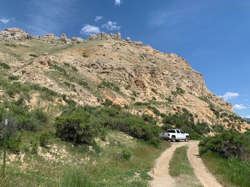
Clark’s Lookout works beautifully as a standalone stop, but it becomes even more meaningful when paired with other Lewis and Clark sites in the region. Beaverhead Rock State Park, the very formation Sacagawea recognized on August 8, 1805, is located a short drive from Dillon and makes for a natural companion visit. Seeing both sites in sequence creates a genuine sense of the expedition’s progress through this valley.
Camp Fortunate, the location where the Corps of Discovery met Chief Cameahwait and acquired the horses needed to cross the Continental Divide, is another significant nearby landmark, though it now lies beneath Clark Canyon Reservoir. The reservoir itself is a popular destination for fishing and boating, offering a pleasant recreational contrast to the historical focus of the lookout.
Back in Dillon, the Beaverhead County Museum provides indoor exhibits on regional history, ranching heritage, and the broader settlement story of southwestern Montana. Combining the museum with the outdoor sites creates a well-rounded day that moves fluidly between landscape and artifact, outdoor experience and indoor context, making the whole region feel like an open-air history book.
The Atmosphere of Quiet Solitude That Sets This Park Apart
Crowds are not a problem here. On the afternoon I visited, I shared the summit with exactly two other people, both of whom were absorbed in their own quiet contemplation of the valley below. That kind of solitude is increasingly rare at historically significant sites, and it is one of Clark’s Lookout’s most underappreciated assets.
The absence of a gift shop, a visitor center, or any commercial element keeps the experience remarkably pure. There is a vault toilet in the parking area and a picnic table near the trailhead, and beyond that, the park simply offers the trail, the signs, the monument, and the view. Nothing competes with the history and the landscape for your attention.
That simplicity is either the park’s greatest strength or its only limitation, depending entirely on what you are looking for. Visitors seeking a reflective, unhurried connection to American history will find it here without distraction. Those expecting amenities beyond the basics should adjust expectations accordingly. The park is honest about what it is, and what it is turns out to be genuinely special.
Share this story