Hurricane Melissa has left an unmistakable scar across the Caribbean, and you can feel the urgency in every update. The storm’s raw power and human toll are still unfolding, even as forecasts hint at a shift away from the U.S. mainland. If you are along the East Coast, you are not in the clear, with dangerous surf and coastal flooding still possible. Here is what matters now, what comes next, and how communities are fighting to recover.
Melissa began as a modest tropical wave in the central Atlantic, then quickly tapped into abnormally warm sea surface temperatures and low wind shear. You could see it on satellite as the core tightened, the outflow blossomed, and the eye warmed rapidly. Within days, the system underwent explosive intensification and surged toward the Caribbean with a well-defined, nearly symmetric eyewall.
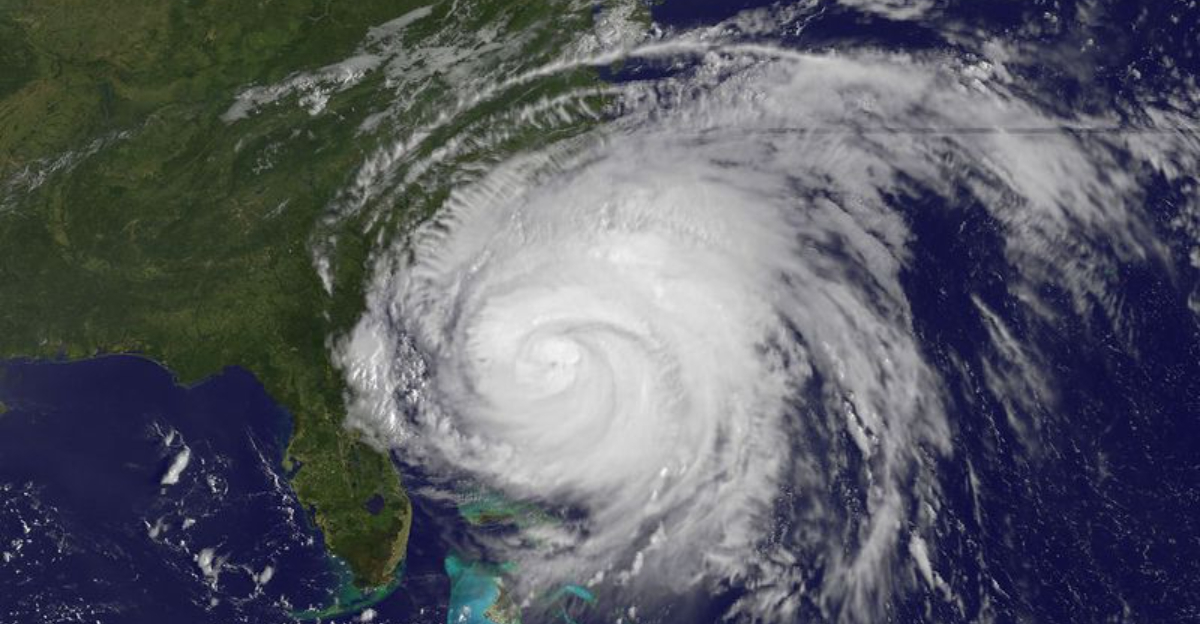
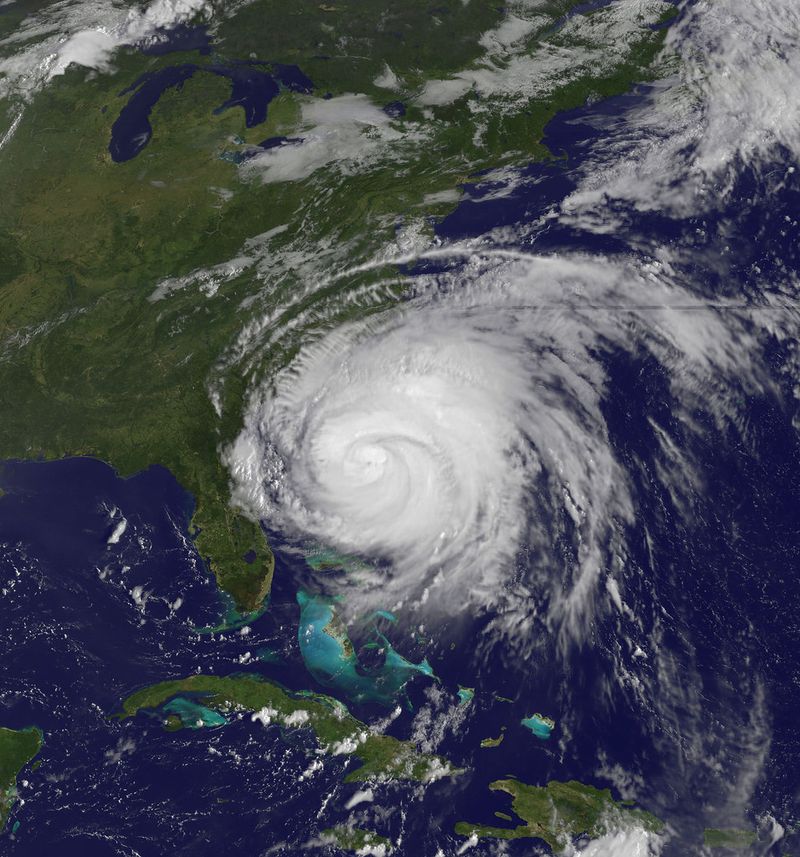
By late October, Melissa achieved Category 5 strength, with sustained winds near 160 mph and exceptionally low central pressure. Landfall in Jamaica on October 28, 2025, set a grim record as the strongest hurricane to strike the island. The pressure fell so quickly that reconnaissance crews noted extreme turbulence, while Doppler radar showed hot towers firing around the eye.
As intensity peaked, the storm’s inner core dynamics produced violent eyewall replacement cycles, creating brief lulls followed by renewed ferocity. You might think that meant relief, but each replacement reloaded the wind field and broadened damaging gusts. Even before crossing Jamaica, outer bands swept Haiti and eastern Cuba with torrential rain, priming rivers and hillsides for disaster.
After landfall, Melissa began to interact with land terrain and a slightly drier mid-level environment, nudging gradual weakening. Still, the wind field expanded, prolonging dangerous gusts and surge. The storm then curved northward over cooler waters and increasing shear, but its legacy of damage was already sealed.
The human toll across the Caribbean is staggering, and you feel it in every story from the ground. In Jamaica, neighborhoods lost roofs, schools and clinics flooded, and grid failure left entire parishes in the dark. Authorities reported significant loss of life and property, with economic damages ballooning into the tens of millions.
Haiti endured catastrophic flooding and crop destruction, pushing millions closer to food insecurity. You can trace hunger to flattened fields, ruined storage, and cut-off roads that delay aid. Weeks later, families remain displaced, living under tarps or in crowded shelters as relief convoys navigate landslides and washed-out bridges.
Cuba saw tens of thousands unable to return home as swollen rivers and saturated soil kept communities unsafe. Coastal towns wrestled with saltwater intrusion, while interior provinces struggled with landslide risks. Health workers fought waterborne illness, and power restoration crept along amid snapped poles and debris-choked corridors.
Across the region, the storm’s reach outlasted the headlines, lingering in empty cupboards and shattered routines. You can sense resilience in volunteer brigades, church kitchens, and youth teams patching roofs with salvaged tin. But long-term recovery hinges on sustained funding, transparent logistics, and rebuilding smarter to withstand the next blow.
Current guidance points to Melissa weakening as it moves north over cooler waters and higher wind shear. Model consensus keeps the core offshore, so a direct U.S. landfall appears unlikely for now. Still, do not ignore indirect threats like dangerous surf, long-period swells, rip currents, and spotty coastal flooding at high tide.
Forecast busts can happen, especially when a hurricane interacts with mid-latitude troughs and frontal boundaries. You might see small wobbles that shift wind and swell impacts hundreds of miles. If you live along the Southeast or mid-Atlantic coasts, check the NHC and local NWS updates at least twice daily until the storm exits.
Mariners and beach communities should secure loose gear, review evacuation routes, and respect red flag warnings. Coastal roads that flood during king tides could close earlier than usual, so plan detours now. Even without landfall, ports may enforce restrictions, and ferry schedules can change with short notice.
Think of readiness as layers: trusted forecasts, local alerts, and your own commonsense checks at home. You can reduce risk by timing errands around peak tide cycles and avoiding jetties and inlets when surf is high. Stay flexible, because timing and intensity of marine hazards will hinge on exactly how Melissa passes offshore.
Melissa is part of an active 2025 Atlantic hurricane season shaped by unusually warm sea surface temperatures and supportive atmospheric patterns. You can see the signal in the high accumulated cyclone energy and repeated rapid intensification events. For coastal communities, that pattern turns preparedness from a task into a habit.
Recovery in the Caribbean will take months to years, and the timeline depends on funding, supply chains, and governance. International agencies are prioritizing food security, shelter materials, and restoring clinics and schools. Long-term success will require resilient housing, elevated infrastructure, and nature-based defenses that blunt surge.
For you, this season is a reminder to update insurance, document valuables, and understand flood maps even outside designated zones. Early warning systems help only if alerts prompt action, so practice family plans and verify backup power. Local leaders can strengthen building codes and invest in microgrids and hardened communications.
Research continues into how ocean heat content and background climate influence storm structure and rainfall extremes. You will hear more about coupling models, improved radar assimilation, and ensemble forecasts that better capture uncertainty. Between now and the next storm, the smartest move is steady preparation, not panic.


