Bitter Arctic air is surging into Illinois, and the timing could not be worse. Meteorologists say the polar vortex is distorted, sending repeated waves of cold straight down the Midwest pipeline. You will feel it in your bones as temperatures plunge, winds howl, and travel plans get messy. Stay ready, because the next two weeks look brutally cold with only short breaks in between.
Polar vortex distortion explained
The polar vortex usually circles the Arctic, but this month it is stretched and lopsided. That distortion opens a pathway for deeply cold air to slide south into the Midwest. You will notice the difference as the jet stream bends and funnels frigid air toward Illinois.
Meteorologists highlight a southern extension near Hudson Bay as the driver. Early season strength makes December feel like mid January. Expect repeated drops as lobes of cold rotate through.
This setup is already pulling sub freezing air across the state. Prepare for multiple shots through mid December. The pattern hints at a colder winter overall.
Back to back Arctic surges
Do not expect just one cold snap. The first surge dropped temperatures and triggered freeze alerts, and another is lining up midweek. A third wave closer to December 15 may lock Illinois into a prolonged cold spell.
Brisk winds will slice through layers, pushing wind chills far below air temperatures. That means little time to rebound between fronts. Your routines might need winter pacing.
Plan errands around lulls and watch evening peaks for energy demand. Keep fuel tanks half full. The pattern favors frequent advisories and fast changing conditions statewide.
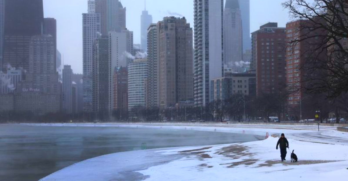
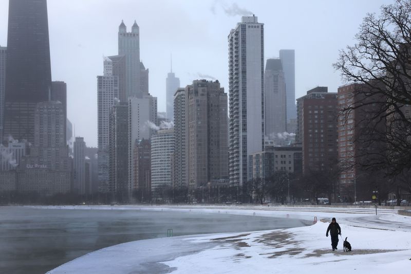
Chicago temperatures and wind chills
Chicago area highs may cling to the 20s and 30s, with lows sliding into the teens. Outlying suburbs could flirt with single digits on the coldest mornings. Add wind and it may feel like minus five to minus ten at times.
That is well below the usual December average. Frostbite risk climbs when wind chills dive. Set a personal time limit outdoors and layer smart.
Check pipes, drafty windows, and furnace filters. Downtown may be slightly warmer, but not by much. Even short trips require gloves, hats, and face protection.
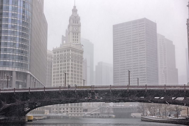
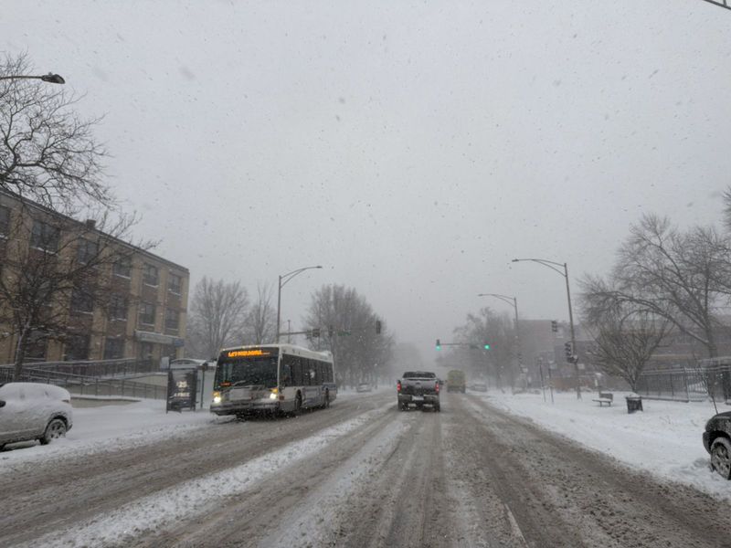
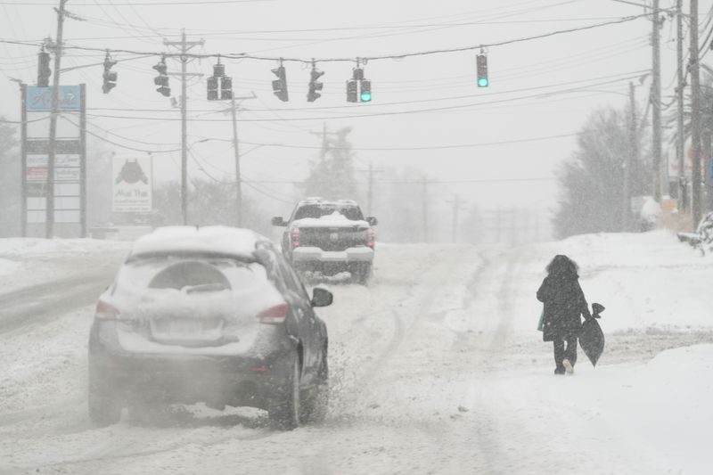
Snow, squalls, and ice hazards
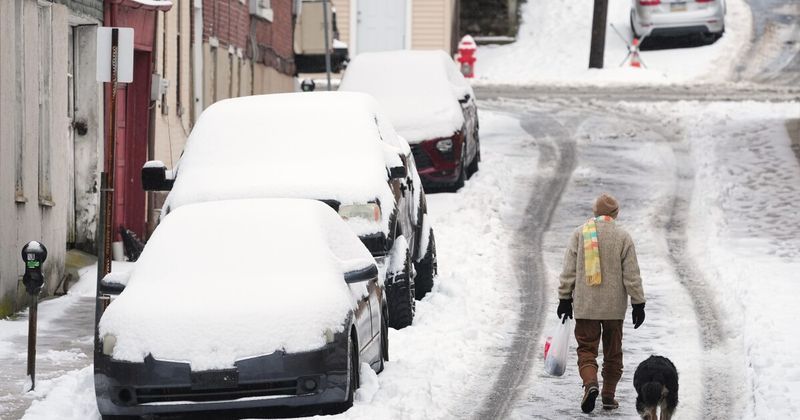
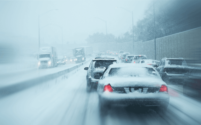
Cold air alone is harsh, but added moisture makes it treacherous. Light to moderate snow may develop as surges collide with passing disturbances. Quick hitting snow squalls can drop visibility to near zero.
Bridges and overpasses freeze first. Brief glazing from freezing rain is possible around transition zones. Downstate tracks could favor higher totals depending on storm paths.
Time matters more than totals. A one inch burst at rush hour multiplies crash risk. Check pavement temperatures and watch for black ice where sun never touches.
Power grid and energy strain
When the mercury sinks, furnaces run nearly nonstop. That spikes electricity and natural gas demand, stressing parts of the grid. Utilities are preparing for peak evenings as wind chills intensify.
Past Arctic blasts pushed prices higher and tested capacity. Illinois infrastructure is robust, but prolonged cold narrows margins. Simple conservation helps smooth the curve.
Lower thermostats a notch, seal drafts, and stagger heavy appliance use. Space heaters demand clearance and working detectors. Charge devices early in the day in case outages occur during the busiest hours.
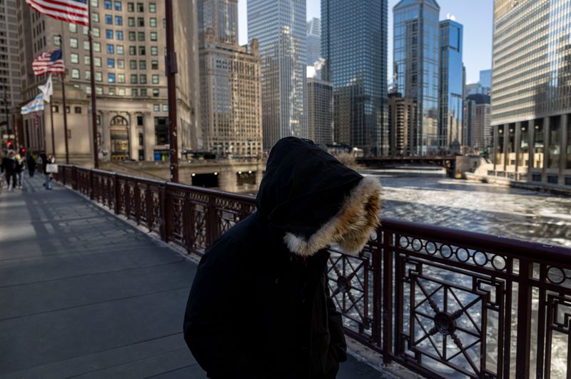
Health and safety for vulnerable groups
Extreme cold is more than uncomfortable. With wind chills below zero, frostbite can strike in under thirty minutes. Hypothermia risks rise for older adults, those with chronic illness, and anyone without reliable shelter.
Cities are opening warming centers and outreach teams are canvassing. Check on neighbors and relatives who might hesitate to ask for help. Pets should come indoors, too.
Dress in layers that trap heat and cover exposed skin. Avoid excess alcohol, which speeds heat loss. Keep a go bag with hand warmers, socks, and a charged phone in case plans shift suddenly.
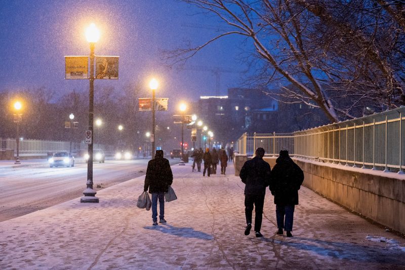
Schools and transit disruptions
Schools may announce late starts or switch to remote learning when wind chills and snow collide at commute time. That is frustrating, but safety comes first. Expect rolling adjustments as each surge arrives.
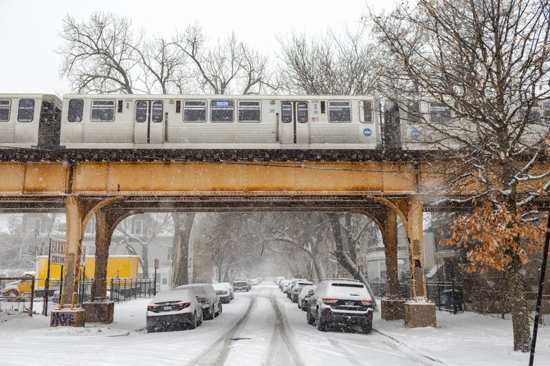
CTA rails and switches struggle in deep cold. Trains and buses can slow for maintenance checks. Rural routes may see longer service gaps while plows catch up.
Build buffer time into morning travel. Refresh transit apps and district alerts before bed. Pack extra layers and a small emergency kit for any unexpected wait outdoors.
Signals of a harsher winter
Early season cold often foreshadows a tougher winter. Meteorologists point to a distorted vortex, stratospheric shifts, and a modest La Nina tilt. Together, those ingredients favor more frequent cold waves.
Confidence is never absolute, but probabilities lean colder than normal. That may mean periodic snow bursts and fast freeze thaw cycles. Planning now reduces stress later.
Stock winter gear you will actually wear. Service heating systems and chimney flues early. If the pattern persists, January and February could amplify what December has started.
Holiday travel complications
The back to back surges are landing right as holiday plans firm up. Cold, ice, and lake effect snow can ripple through flight schedules. De icing delays at O’Hare and Midway are likely during peak windows.
Road travel is vulnerable to squalls that cut visibility in seconds. Interstates like I 55, I 57, and I 80 can slick over quickly. Keep flexible itineraries and backup routes.
Build an emergency kit with blankets, snacks, water, and chargers. Top off wiper fluid and check tire tread. Watch advisories closely the week of the third surge.
How to stay safe and prepared
Preparation turns a deep freeze from crisis into inconvenience. Insulate windows, bleed radiators, and replace furnace filters. Set indoor faucets to drip on the coldest nights to protect pipes.
Build a home kit with lights, batteries, non perishables, and medications. For the car, pack a shovel, scraper, jumper cables, traction aids, and warm clothing. Keep the fuel tank at least half full.
Check forecasts from NOAA and local outlets twice daily. Share check ins with neighbors who might need help. Stay flexible, stay layered, and you will get through the back to back blasts.


