Most islands are known for their scenery, but a handful stand out for something far more interesting: the rules and traditions that shape everyday life there. Some ban cars entirely, others limit how many visitors can arrive, and a few follow calendars that the rest of the world stopped using centuries ago. These places did not develop their quirks by accident. Each rule or tradition has a history rooted in geography, culture, religion, conservation, or community survival.
Whether you are a traveler, a history fan, or just someone who enjoys learning that the world is stranger and more varied than it appears, these thirteen islands offer a fascinating look at how human communities can organize life in ways that feel genuinely different from the mainstream.
1. Sark, Channel Islands, United Kingdom
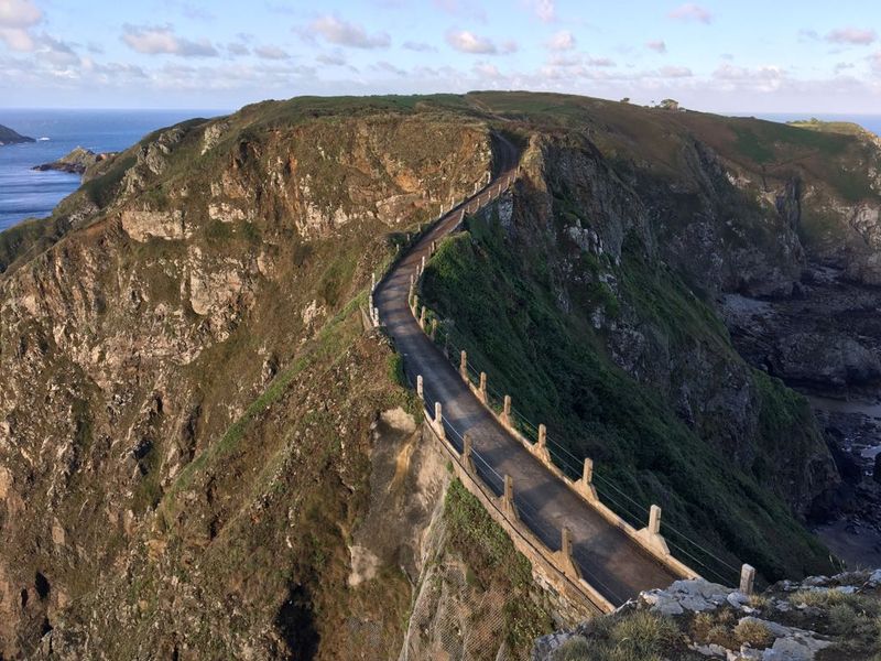
Sark earned the title of Europe’s last feudal state and held it until 2008, when democratic reforms finally arrived after nearly 450 years of governance under a seigneurial system established in 1565.
Cars have never been permitted on its roads, a rule that was not born from nostalgia but from practical geography: the island covers just 5.5 square kilometers, and its narrow lanes were never built with motor traffic in mind.
Residents and visitors travel by bicycle, on foot, or in horse-drawn vehicles, keeping traffic noise completely absent from daily life.
Sark also holds a designation as one of the world’s first International Dark Sky Islands, a status it earned in 2011 after demonstrating exceptionally low light pollution.
That combination of car-free roads and genuine darkness after sunset gives the island two distinct identities: a place shaped by medieval governance and one that happens to offer some of the clearest night skies in Europe.
2. Hydra, Hydra, Greece
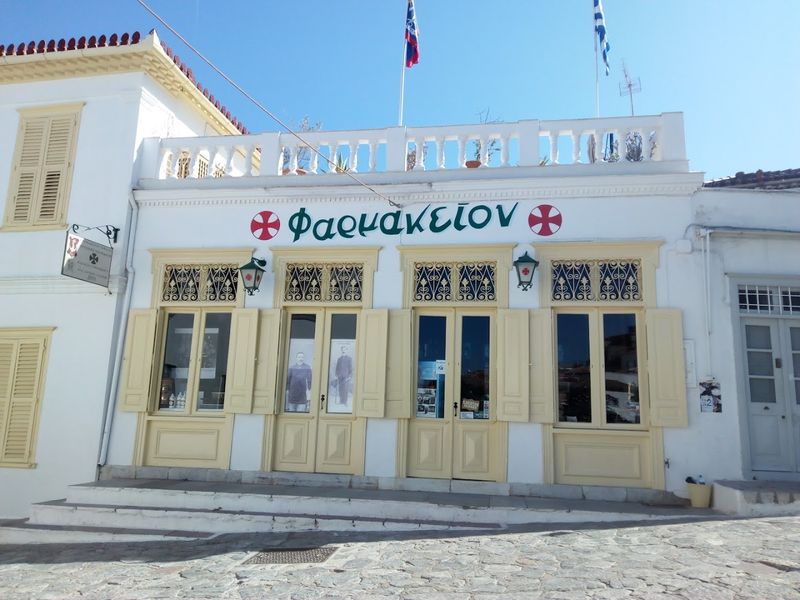
Hydra banned cars and motorbikes in 1963, a decision that turned the island into something of an accidental time capsule for Greek island life before mass tourism reshaped the Aegean.
The ban was not purely about charm. Hydra’s terrain is steep and rocky, its lanes are narrow, and the harbor was simply not designed to accommodate motor vehicles in any practical way.
Donkeys became the primary working animals for transporting goods and luggage from the port to homes higher up the hillside, a role they still perform today alongside water taxis that connect the island to the mainland.
The island attracted a notable international arts community from the 1950s onward, including Leonard Cohen, who lived there for several years in the 1960s and credited the environment with influencing his creative output.
That mix of enforced slowness, working animals, and artistic history gives Hydra a distinct cultural identity that goes well beyond the typical Greek island postcard.
3. Lord Howe Island, New South Wales, Australia
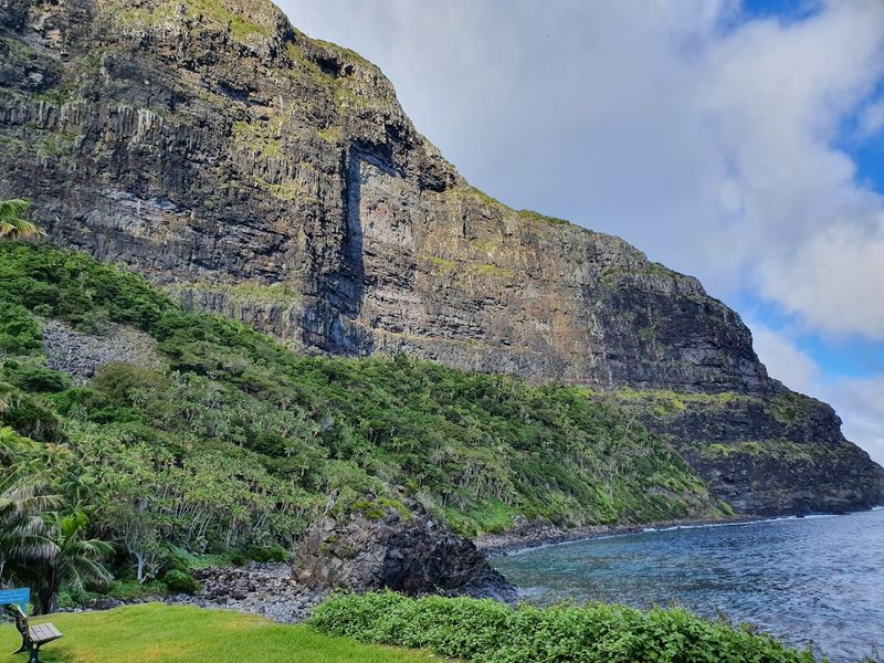
Lord Howe Island enforces a visitor cap of 400 people at any given time, a limit written into New South Wales legislation and strictly maintained as a direct conservation measure.
The island was listed as a UNESCO World Heritage Site in 1982, recognized for its marine ecosystems, endemic bird species, and largely intact natural environment. That listing brought international attention and also reinforced the case for keeping visitor numbers tightly controlled.
At roughly 11 kilometers long and 2.8 kilometers wide, the island simply cannot absorb large tourist volumes without permanent ecological damage to its reefs and walking tracks.
Accommodation providers are limited in number, and bookings are often made months in advance, which means the visitor cap functions as a practical ceiling rather than just a policy statement.
The result is an island where wildlife encounters are genuine rather than staged, walking tracks remain clear, and the coral lagoon retains water quality that most tropical destinations lost decades ago.
4. Christmas Island, Australia
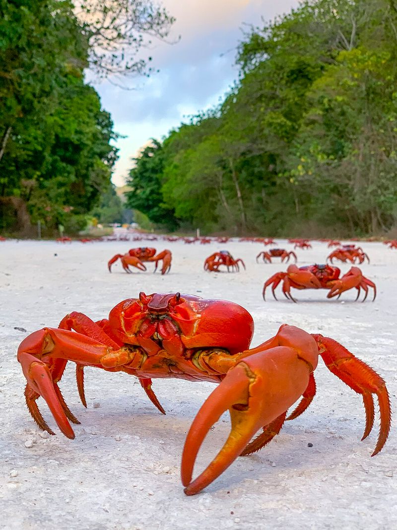
Each year, an estimated 40 to 50 million red crabs begin one of the most dramatic wildlife migrations on the planet, moving from the forest interior of Christmas Island to the coast to breed.
The migration typically begins with the first wet season rains in October or November, and its timing is also tied to lunar cycles, specifically the last quarter moon phase before the crabs release their eggs into the ocean.
Roads across the island are partially or fully closed during peak migration periods, and the Christmas Island National Park Authority installs crab bridges and barriers to reduce road crossings and allow safe passage.
The red crab, known scientifically as Gecarcoidea natalis, is found nowhere else on Earth in such concentrations. Conservation of its migration has become a defining element of the island’s public identity and land management policy.
Residents treat the annual closures not as inconveniences but as a fixed part of the island calendar, making conservation a genuinely embedded community tradition.
5. Mackinac Island, Mackinac Island, Michigan
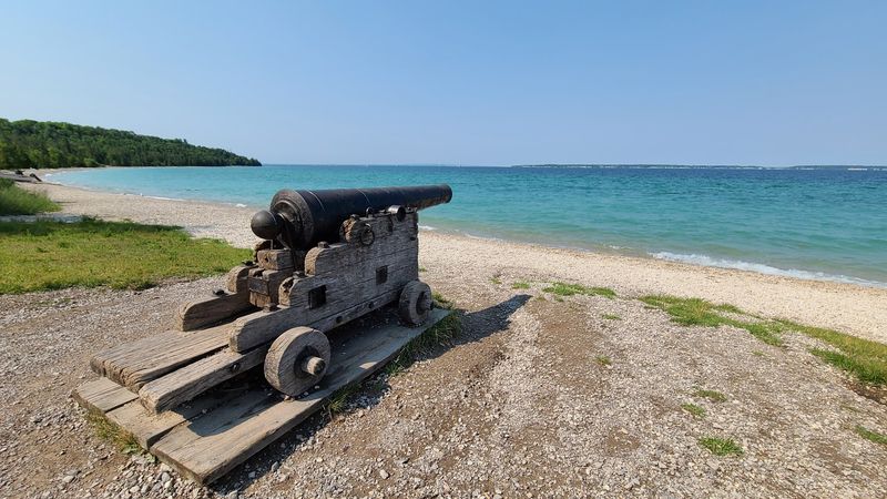
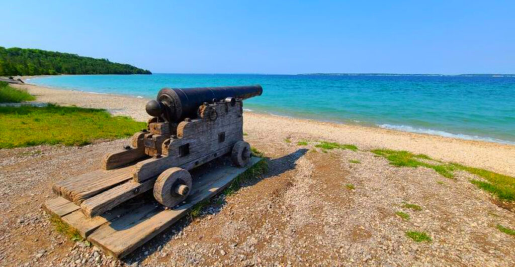
On July 6, 1898, the Mackinac Island Village Council voted to ban motorized vehicles from its streets, making it one of the earliest places in America to take that kind of stand against the automobile age.
The decision came largely from horse-drawn carriage operators and residents who worried that early cars would startle horses and damage the island’s peaceful character. A 1900 incident involving a steam-powered Locomobile that reportedly scared horses and damaged carriages helped seal the deal.
By 1901, the ban extended to the state park, and a 1923 attempt to reverse it failed after strong local pushback.
Today, M-185, the 8.2-mile road looping the island, is the only state highway in the United States where motor vehicles are fully prohibited year-round, except for emergency vehicles and winter snowmobiles.
Bicycles, horse-drawn carriages, and foot travel remain the standard, giving the island a rhythm that has stayed largely unchanged for well over a century.
6. Burano, Venice, Italy
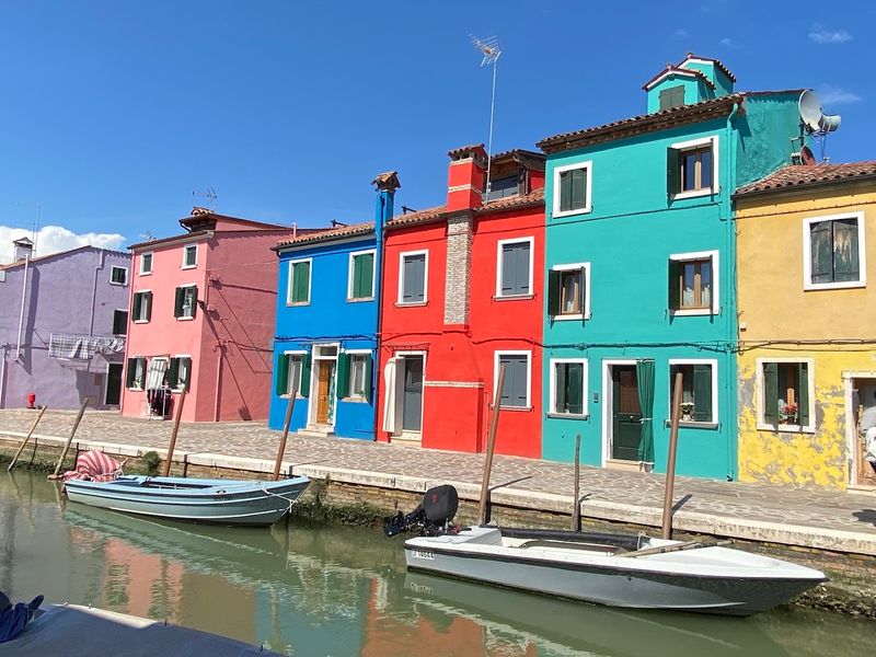
Burano’s famous multicolored houses are not the result of individual residents choosing freely from a paint chart. The island operates under a regulated color-assignment system managed by local authorities.
When a homeowner wants to repaint their house, they must submit a request to the local government. Officials then designate which colors are approved for that specific property, based on the surrounding palette and the street’s established visual pattern.
The tradition of painting houses in bright colors is believed to have practical origins. Fishermen returning through fog reportedly used the bold colors to identify their homes from the water, though the documented history of the regulation itself is more recent than the folk story suggests.
Burano is also historically recognized as a center of Venetian lacemaking, a craft that dates back to the 16th century and earned the island a separate cultural identity distinct from the rest of the Venetian lagoon.
The lace tradition and the color rules together give Burano a dual heritage that is actively maintained rather than simply inherited.
7. Miyajima, Hatsukaichi, Hiroshima, Japan
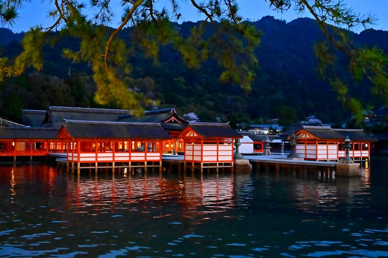
Itsukushima, commonly called Miyajima, has been treated as a sacred site since at least the 6th century, when the first shrine structures were built to honor the three daughters of the Shinto deity Susanoo.
For centuries, the island maintained strict rules of ritual purity: no births and no passing were permitted on the island itself, forcing residents and visitors to travel to the mainland for both events. These restrictions eased over time but were enforced rigorously during the Heian period.
The current main shrine structure dates to the 12th century, rebuilt under the patronage of the powerful military commander Taira no Kiyomori, who transformed it into one of Japan’s most elaborate examples of shinden-zukuri architectural style.
The floating torii gate, which appears to stand in the water at high tide, became a recognized symbol of Japan and was designated a UNESCO World Heritage Site in 1996 along with the broader forest and shrine complex.
Deer roam freely on the island today, considered messengers of the gods in Shinto tradition and protected accordingly.
8. Foula, Shetland, Scotland
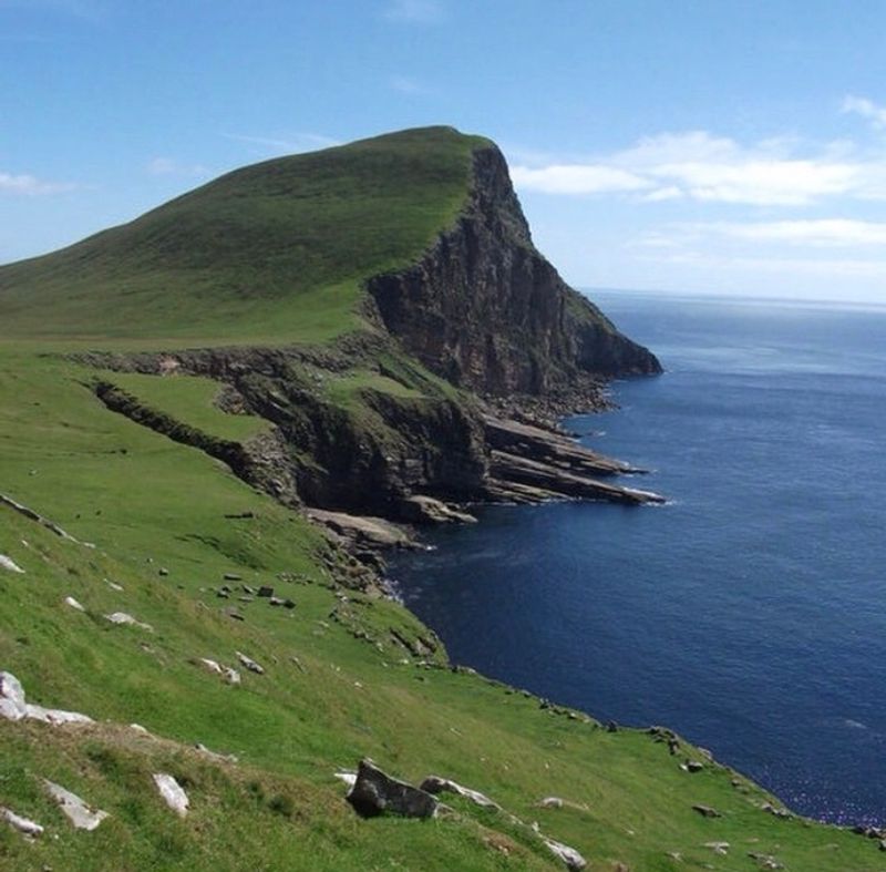
Foula, one of the most remote inhabited islands in Britain, still observes Christmas on January 6 and New Year on January 13, dates that correspond to the Julian calendar rather than the Gregorian calendar adopted by Britain in 1752.
The island’s population, which numbered around 30 people as of recent census counts, never fully transitioned to the new calendar system, and the old dates became embedded in local tradition over generations.
Foula sits about 27 kilometers west of the Shetland mainland, and its isolation has historically meant that outside changes in law, policy, and custom arrived slowly or incompletely.
The island is also notable for its dramatic sea cliffs, including the Kame, which rises to approximately 376 meters and ranks among the highest vertical sea cliffs in Britain.
Its small community maintains a primary school, a post office, and regular air and ferry links to the mainland, but the calendar tradition remains one of the most concrete examples of how geographic isolation can preserve practices that the wider world has long since abandoned.
9. Tristan Da Cunha, Edinburgh Of The Seven Seas, St Helena
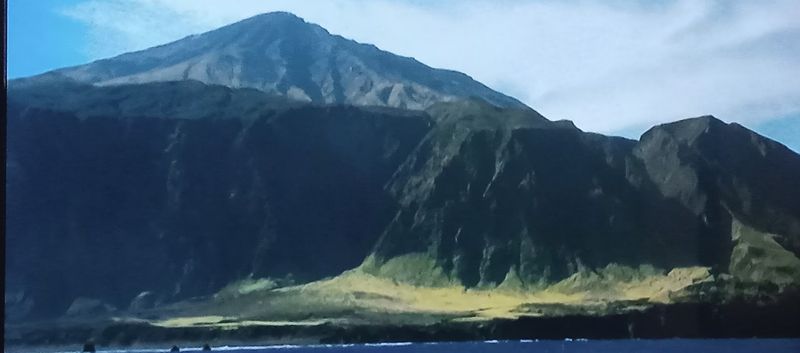
Tristan da Cunha holds the distinction of being the most remote permanently inhabited archipelago on Earth, sitting roughly 2,400 kilometers from the nearest inhabited land, which is the island of Saint Helena.
Its only settlement, Edinburgh of the Seven Seas, was named in honor of Prince Alfred, Duke of Edinburgh, who visited in 1867. The entire island community consists of fewer than 300 residents, most of whom share just eight surnames, a reflection of the small founding population.
Visiting requires significant planning. There are no commercial flights to the island, and the only way to arrive is by ship from Cape Town, a journey of roughly seven days each way.
The island falls under British Overseas Territory governance, and the community manages its own internal affairs through an elected island council. Fishing, farming, and a small craft industry form the economic backbone.
Outsiders wishing to stay must obtain prior permission from the island administration, making it one of the few places on Earth where immigration control is genuinely enforced by a community of under 300 people.
10. Pitcairn Island, Adamstown, Pitcairn Islands
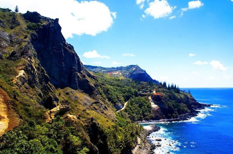
Pitcairn Island owes its entire modern population to one of history’s most famous naval events: the 1789 mutiny aboard HMS Bounty, after which nine mutineers, along with Tahitian men and women, settled the island in 1790 to avoid British authorities.
The island was not officially rediscovered by the outside world until 1808, by which point only one mutineer, John Adams, remained alive. The current population of roughly 40 to 50 people are largely descended from those original settlers.
Pitcairn operates under its own governance structure as a British Overseas Territory, with an elected Island Council and a Mayor. The community uses Pitkern, a creole language blending 18th-century English with Tahitian, as its everyday tongue.
Visitors must apply in advance and arrive by supply ship from New Zealand, a journey of several days. There is no airstrip, no hotel, and no casual drop-in option.
The island’s isolation means that nearly every aspect of daily life, from food supply to medical care, requires careful long-term planning by both residents and anyone hoping to visit.
11. Tangier Island, Tangier, Virginia
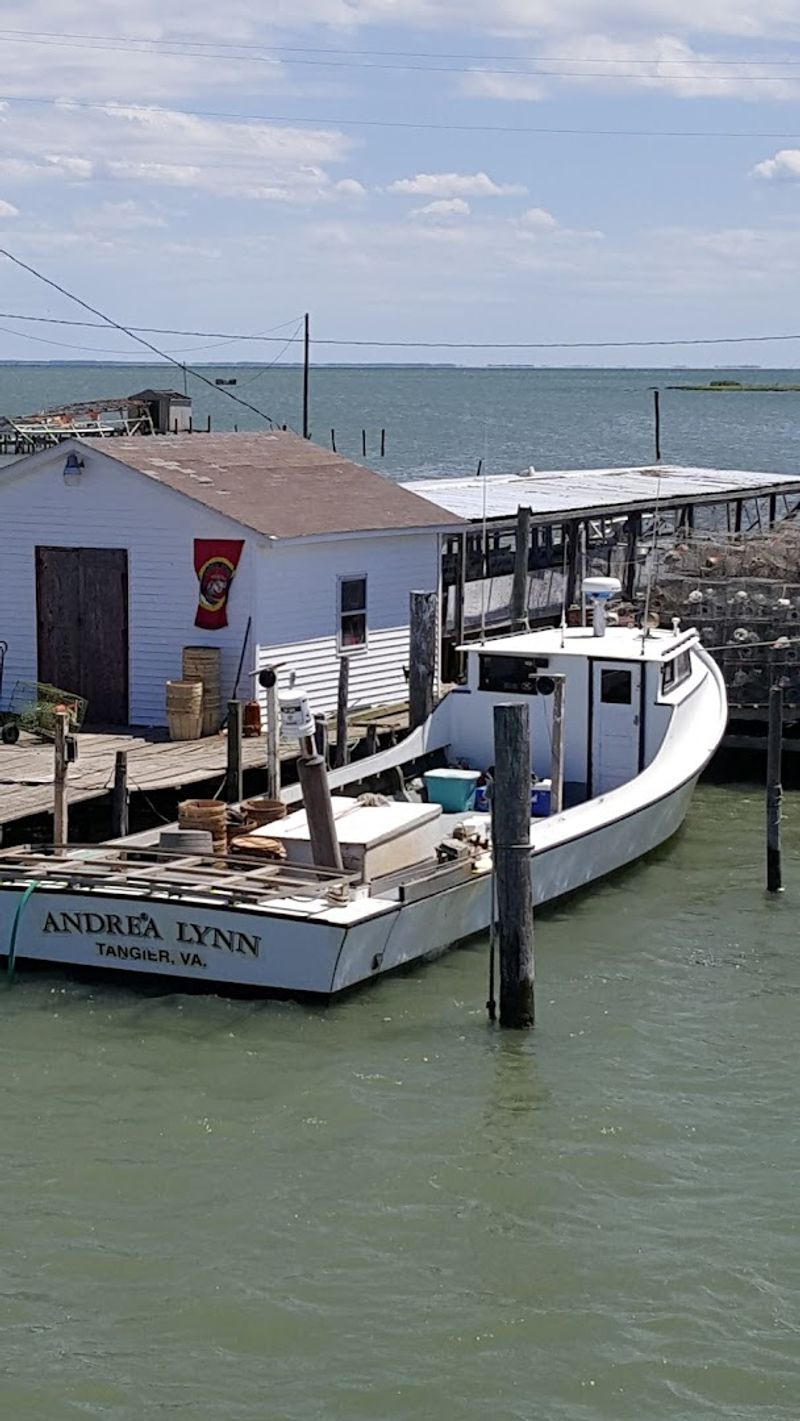
Tangier Island has been a working watermen’s community in the Chesapeake Bay since the late 17th century, and its culture has remained remarkably consistent across those centuries due largely to its geographic isolation.
The island sits about 16 kilometers from the Virginia mainland and is accessible only by ferry or small aircraft. There are no bridges, and the ferry schedule effectively controls the rhythm of daily life for its roughly 450 residents.
Linguists have noted that the local dialect retains features of 17th and 18th century English speech patterns that have largely disappeared elsewhere in the United States, making it a living document of early American language development.
The economy is built almost entirely around blue crab harvesting, a tradition passed down through families over generations. Soft-shell crabs from Tangier are considered a regional specialty across the mid-Atlantic.
The island also faces documented land erosion, with estimates suggesting significant landmass loss over the past century, making its cultural preservation an increasingly urgent conversation alongside its physical one.
12. La Digue, Seychelles
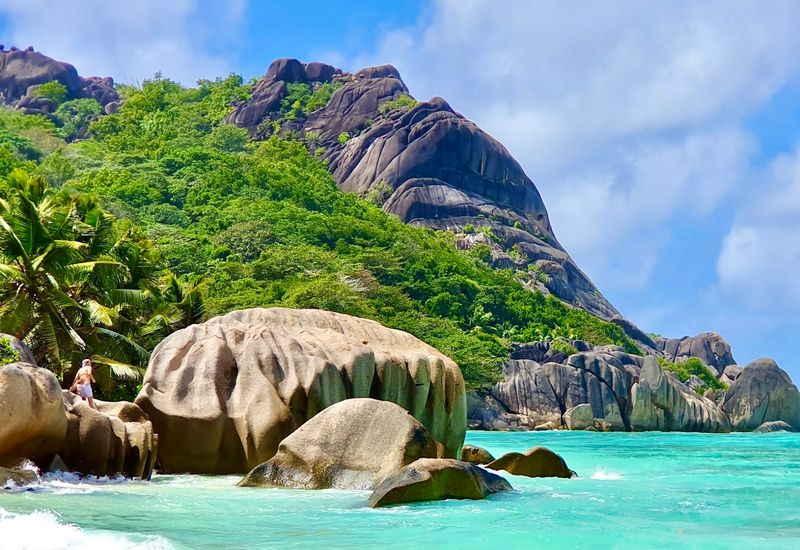
La Digue is the fourth-largest island in the Seychelles and has maintained a near-total restriction on private cars for most of its modern history, making bicycles and ox-carts the default modes of transport for residents and visitors alike.
The ox-cart tradition dates back to the plantation era, when the island’s economy was built around vanilla and coconut production. While ox-carts have become less common in recent decades, bicycles remain the dominant personal transport, and rental shops operate near the ferry dock.
The island covers roughly 10 square kilometers, which makes cycling genuinely practical rather than just picturesque. Most key destinations, including the famous Anse Source d’Argent beach, are reachable within minutes by bike.
La Digue is also home to the Black Paradise Flycatcher, one of the rarest birds in the world, with a reserve established to protect its remaining habitat on the island.
That combination of restricted motor traffic and active wildlife conservation gives La Digue a coherent environmental identity that has shaped its tourism model for decades.
13. Spitsbergen, Longyearbyen, Svalbard, Norway
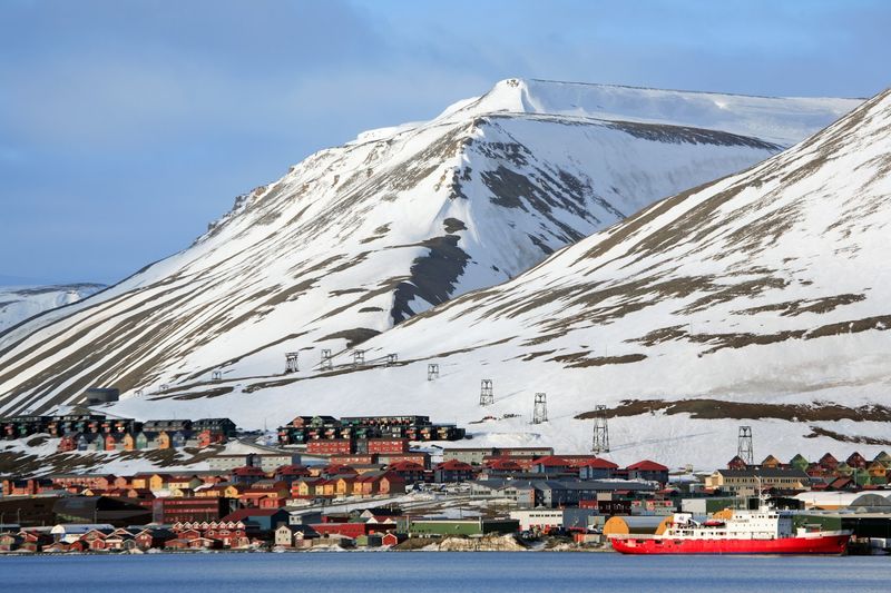
Longyearbyen, the main settlement on Spitsbergen in the Svalbard archipelago, operates under a set of rules shaped directly by Arctic conditions and international treaty obligations rather than conventional national law.
The Svalbard Treaty of 1920 granted Norway sovereignty over the archipelago while giving citizens of signatory nations the right to live and work there, creating a governance structure unlike almost anywhere else in the world.
Domestic cats are heavily restricted in Longyearbyen to protect native bird populations, particularly the Svalbard ptarmigan. The rules around cat ownership are enforced at the municipal level and have been in place for decades.
Burials are not permitted in the permafrost ground of Longyearbyen because frozen soil prevents normal decomposition, meaning that bodies do not break down over time. Residents who pass away must be transported to mainland Norway for burial.
Polar bears outnumber people on Svalbard, and residents are legally required to carry rifles when traveling outside of town boundaries, a practical safety rule rather than a cultural tradition but one that shapes daily life in concrete ways.
Share this story