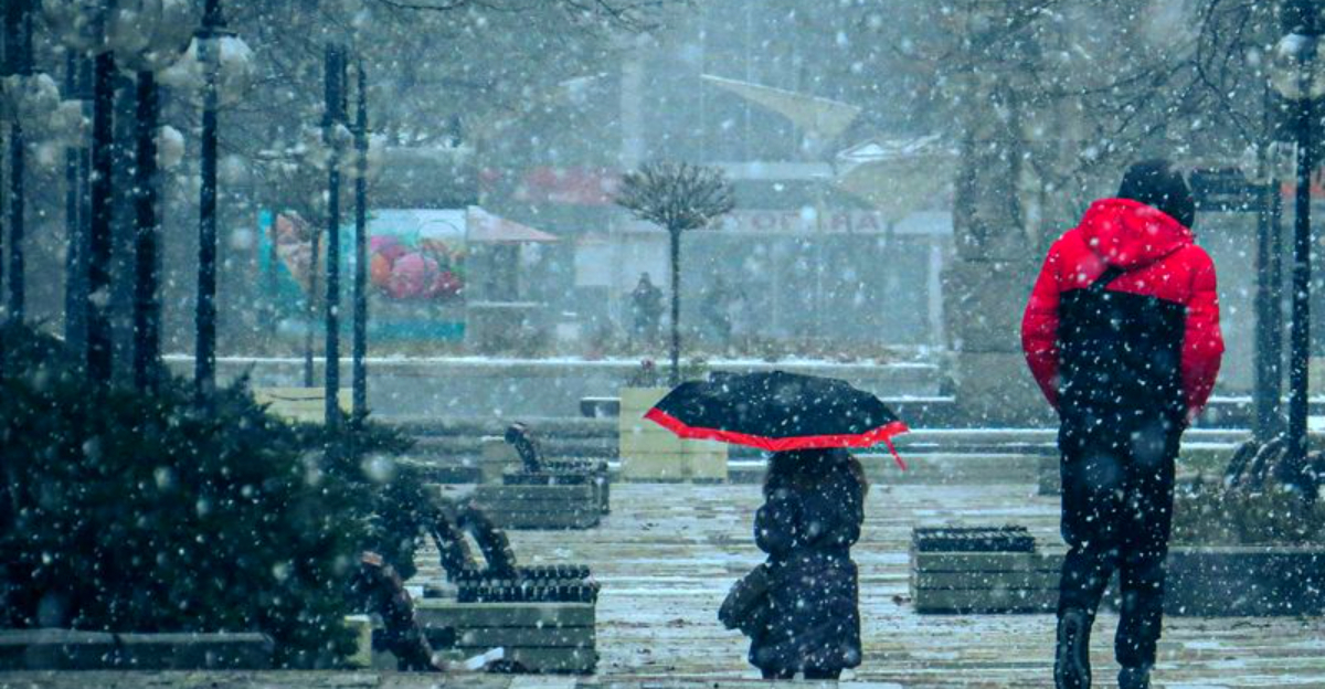
Winter is not done with us yet, and the signs are getting louder. La Niña looks ready to reassert itself by mid to late January, nudging the jet stream and reviving colder patterns across much of the nation.
If recent mild spells had you packing away heavy coats, you might want to keep them within reach. Here is what to watch, where the chill may hit first, and how snow risks could ramp up.
La Niña Conditions Expected to Re-Emerge Later in January
La Niña is poised to strengthen again by mid to late January, and that shift matters for your day-to-day weather. Cooler-than-average sea surface temperatures in the equatorial Pacific tend to tug the jet stream north and south in new ways, steering storms and opening the door for colder intrusions.
After a brief winter lull, signals have flipped back, suggesting a renewed push of Arctic air into the northern and central U.S.
Do not expect a uniform freeze. La Niña stacks the odds for cold shots, especially east of the Rockies, but it also allows for breaks between blasts.
Those swings can be jarring, with sharp temperature drops and wind chills that bite, particularly at night and during frontal passages.
Short-term forecasts will still wobble, so timing and intensity can vary. Even so, the broader pattern says winter is not finished, and late January into February often hosts impactful storms.
If you travel, follow local forecasts closely, and plan flexible itineraries.
Layer up, protect pipes where vulnerable, and check heating systems now. A little prep goes far when the pattern turns.
La Niña may not promise snow everywhere, but it often brings winter back with intent.
Colder Air Could Spread Across Much of the Nation
As La Niña flexes, cold air is likely to pour south in waves, especially across the northern Plains, Midwest, Great Lakes, and Northeast. You may notice quick hits of warmth in between, but once Arctic air settles, overnight temperatures can tumble.
Wind chills become a real concern during stronger outbreaks, making it feel markedly colder than the thermometer shows.
This pattern favors a punchier, more active northern jet stream. That means frequent chances for Canadian air to spill south rather than a single dramatic plunge.
The result can be prolonged stretches of chill, where daily highs underperform and mornings start with frosty breath and slick sidewalks.
Even the South could spend time a few degrees below normal, though enduring cold is less likely there. If you live along the Gulf Coast, expect variability, with quick fronts, gusty north winds, and cooler nights.
Plan ahead by refreshing cold weather gear, checking furnace filters, and keeping your vehicle winter ready. Keep an eye on local forecasts for wind advisories and hard-freeze alerts.
When cold consolidates, small steps like dripping faucets and covering plants can save headaches.
What La Niña’s Return Means for Snow and Winter Storms
Colder air raises the odds that storms flip to snow in key regions, and La Niña often tilts the field that way. If you live in the Upper Midwest, Great Lakes, northern Rockies, or interior Northeast, you could see more frequent snow chances.
Lake-effect bursts may flare when Arctic air races over comparatively warm Great Lakes, stacking inches quickly.
Not every system becomes a blockbuster. La Niña can speed up storm tracks, favoring quick-hitting events instead of long-duration nor’easters.
That still brings impactful commutes, slick roads, and airline delays, especially when snowfall bands set up over busy corridors.
Mixed precipitation is a wildcard during temperature transitions. Freezing rain and sleet can glaze roads, weigh down branches, and cause power disruptions faster than steady snow.
When you see a wintry mix in the forecast, consider alternate travel plans and charge devices.
Stay alert to short-term updates, since small track shifts change rain-snow lines dramatically. Keep an ice scraper, traction mats, and an emergency kit in your car.
With La Niña returning, the snow window broadens, and preparedness helps you adapt to sudden winter swings.
Why Late January and February Are Key Winter Months
The heart of winter often arrives after mid January, and La Niña years can amplify that rhythm. By late January and February, Canada’s cold pools reach peak intensity, primed to surge south when the pattern aligns.
That pairing with active storm tracks can produce significant snow, ice, and high-impact travel disruptions.
Do not let early season warmth lull you into complacency. Now is the time to winterize homes, test generators, and review travel contingencies.
Simple steps like sealing drafts, insulating pipes, and topping off windshield fluid pay off when temperatures dive unexpectedly.
Energy demand typically rises during prolonged cold spells. Utilities prepare for strain, and you can help by monitoring usage and having backup heat plans if needed.
Check on neighbors, especially older adults, when cold snaps persist.
Meteorologists will keep watching ocean temperatures and jet stream signals to gauge La Niña’s staying power. Expect forecast refinements as new data arrives, and stay flexible with plans.
The clear takeaway is straightforward: winter’s coldest chapter may still sit ahead, and being ready gives you an edge.


