
A powerful winter storm is hammering the Northeast right as post-Christmas travelers try to head home. Heavy snow, freezing rain, and glaze ice are turning roads and runways into slick hazards from Philadelphia to New York City and north toward Albany. If you have travel plans, this is the moment to rethink timing and double check every update. Staying flexible and safety minded could make all the difference over the next 24 hours.
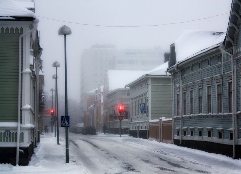
A fast strengthening winter storm is turning post-Christmas travel into a risky gamble across the Northeast. Heavy snow bands, bursts of freezing rain, and rapidly forming ice are sweeping through New Jersey, eastern Pennsylvania, and the New York City metro. You can feel conditions changing block by block, with visibility falling fast and traction disappearing beneath a thin glaze.
Officials moved quickly, declaring states of emergency to free up resources and keep nonessential traffic off the roads. New York Governor Kathy Hochul urged everyone to delay trips and use extreme caution if travel cannot wait. Plows and salt spreaders are out, but ice can win the race when precipitation flips between snow and freezing rain.
The corridor from Philadelphia through New York toward Albany drew the heaviest bands, and those hours after dark are the most treacherous. If you must drive, slow way down, leave extra space, and pack warm layers, water, and a phone charger. This storm keeps evolving overnight, and that snow plus ice combo overwhelms road treatments faster than you expect.
Expect lingering slick spots into Saturday morning, especially on bridges, ramps, and untreated side streets. A cautious plan now could prevent a spinout later.
Totals are a patchwork this time, and the ice is the wildcard that makes modest snow feel much worse. Interior New England, Long Island, and parts of upstate New York could rack up 6 to 10 inches. Farther south, lighter snow mixes with freezing rain that turns roads and sidewalks into glass.
In New York City, a northeast shift trimmed earlier snowfall projections to roughly 2 to 5 inches, with some northern neighborhoods flirting with 6. That would be manageable if not for the glaze from freezing rain riding in behind. It only takes a whisper of ice to send tires spinning and people sliding.
Philadelphia is on track for 1 to 3 inches with icing that peaks after dark, a tough window for commuters and anyone returning from holiday visits. Western Pennsylvania already saw roads shellacked by freezing rain, triggering an ice storm warning and raising the specter of outages and downed limbs. Remember, overnight temperatures lock in the slickness.
Even small totals become dangerous when a thin crust forms on top. Step carefully on untreated steps and crosswalks, and assume black ice on shaded stretches. A mile can change everything, so check hyperlocal forecasts.
The storm is hitting air travel exactly when terminals are packed with post-Christmas crowds. More than 1,500 flights were canceled on Friday, with JFK, LaGuardia, Newark, and Philadelphia bearing the brunt. By Saturday, another 500 cancellations piled on as snow and ice kept slowing everything down.
De-icing is essential but time consuming, and each round stacks delays as crews battle freezing rain and gusty snow. Runway friction checks take longer, ramp operations crawl, and aircraft and staff wind up out of position. If you are flying, keep your airline app open and do not head to the airport without a fresh confirmation.
Even when the flakes quit, icy stands and taxiways can ripple disruptions for hours or longer. Rebooking windows may be tight, so look for waived change fees and consider nearby airports if that fits. Pack patience, a charger, and snacks because gate holds and rolling delays are likely.
The timing makes this sting, but safety checks come first. You will get moving sooner by staying flexible and reacting to updates. A small schedule tweak can save a long night on a terminal floor.
From city grids to rural byways, emergency crews are fanning out as conditions deteriorate. New York City Mayor Eric Adams called it a significant snow event and sent plows out Friday night to get ahead of the worst. In suburbs and countryside, the bigger fear is ice stacking on branches and lines.
Utility teams are staging for possible outages, and road departments are salting, brining, and circling problem spots. The truth is that ice can outpace treatment when precipitation toggles quickly. If you can stay home, give crews the space they need to work.
For anyone who must drive, slow down, lengthen following distance, and keep an emergency kit with blankets, water, snacks, and a scraper. Watch bridges, overpasses, and ramps that freeze first, and do not swerve around plows. If power flickers, charge devices and report outages promptly.
Refreezing is a real threat as temperatures dip after snowfall tapers. Expect slick patches to reappear at dawn and linger in shaded corners. Patience will help everyone tonight and into Saturday, and a cautious plan keeps you and responders safer.


