There is a trail in Michigan that was once a busy railroad corridor, carrying freight and passengers through the heart of the state. Today, that same route has been transformed into one of the most beautiful and accessible recreational paths in the entire Midwest.
The White Pine Trail stretches nearly 92 miles through western Michigan, connecting communities, forests, rivers, and farmland in a way that feels almost cinematic when you are out there pedaling through it. I first heard about this trail from a friend who had ridden it end to end over two days, and the way she described the scenery made me want to drop everything and go immediately.
What really caught my attention was the history behind it. The old Grand Rapids and Indiana Railroad, later absorbed by the Pennsylvania Railroad, once ran through this exact corridor, and now cyclists, runners, and walkers get to enjoy what the trains left behind.
This article covers everything you need to know before you go.
The Trail’s Location and Railroad Roots
The White Pine Trail runs through western Michigan, stretching from Comstock Park in Kent County all the way north to Cadillac in Wexford County. The trail follows the former Grand Rapids and Indiana Railroad corridor, which later became part of the Pennsylvania Railroad network before eventually being abandoned.
The trailhead in Comstock Park sits just north of Grand Rapids, making it easy to access from one of Michigan’s largest cities. The full paved section runs approximately 92 miles, passing through towns like Rockford, Cedar Springs, Howard City, Big Rapids, and Reed City before reaching Cadillac.
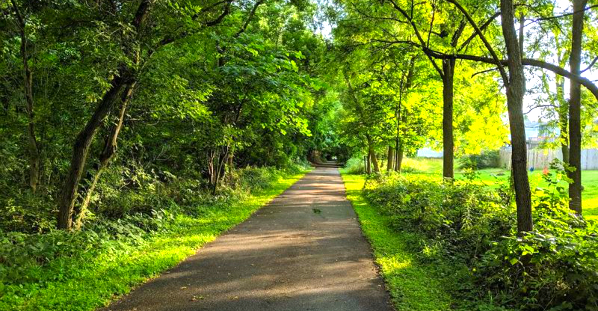
What makes this trail special is how seamlessly it blends history with recreation. The railroad ties and steel rails are long gone, but the flat, straight corridor they left behind is practically perfect for cyclists and runners who want a smooth, low-effort ride through genuinely beautiful Michigan scenery.
The trail is managed by the Michigan Department of Natural Resources.
How an Old Railroad Became a Beloved Trail
The story of how this trail came to be is a classic rails-to-trails success story. The Grand Rapids and Indiana Railroad was chartered in 1854 and eventually connected Grand Rapids to Petoskey, serving as a major artery for moving timber, agricultural goods, and passengers through western Michigan during the late 1800s and early 1900s.
As rail travel declined through the mid-20th century, the corridor was absorbed by the Pennsylvania Railroad and later Norfolk and Western, before freight service finally ceased. The state of Michigan acquired the right-of-way and began developing it into a recreational trail in the 1990s.
The Rails-to-Trails Conservancy has recognized the White Pine Trail as part of the broader effort to convert unused rail lines into public green spaces across America. Michigan has been a leader in this movement, and the White Pine Trail stands as one of the finest examples of what thoughtful trail development can accomplish when a community decides to invest in outdoor recreation infrastructure.
The Scenery Along the Route
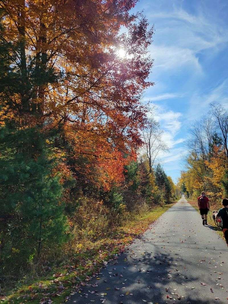
Riding the White Pine Trail feels like flipping through a photo album of Michigan’s most underrated landscapes. South of Big Rapids, the trail rolls past open farmland and small wetlands where red-winged blackbirds perch on cattails and occasionally defend their nesting territory with surprising boldness during early summer months.
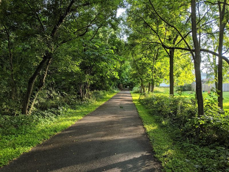
North of Big Rapids, the scenery shifts noticeably. Mature pine and hardwood forests close in on either side of the trail, creating a canopy of shade that makes warm summer rides genuinely comfortable.
The flat terrain means you can actually look around and enjoy the view instead of grinding up a hill.
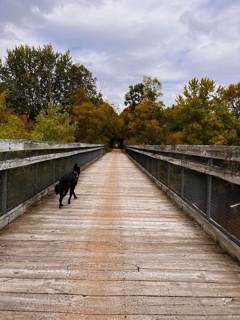
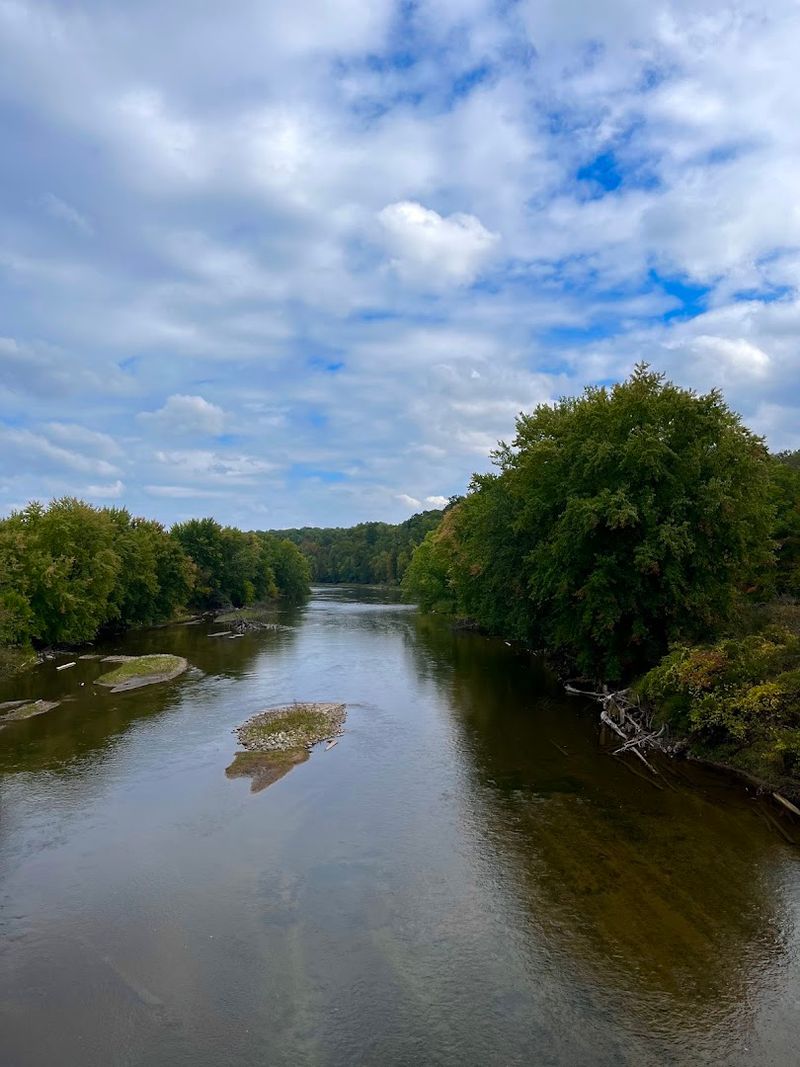
Several river crossings along the route offer some of the most picturesque moments on the trail. The Muskegon River, which the trail crosses near Hersey, is particularly striking, with its wide, clear water reflecting the sky on calm mornings.
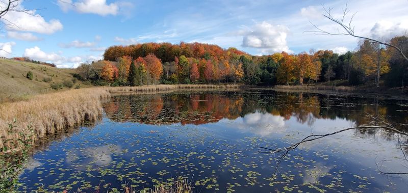
Autumn brings a completely different palette of colors that transforms the entire corridor into something worth planning a trip around specifically.
Trail Surface and Conditions
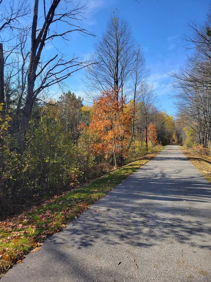
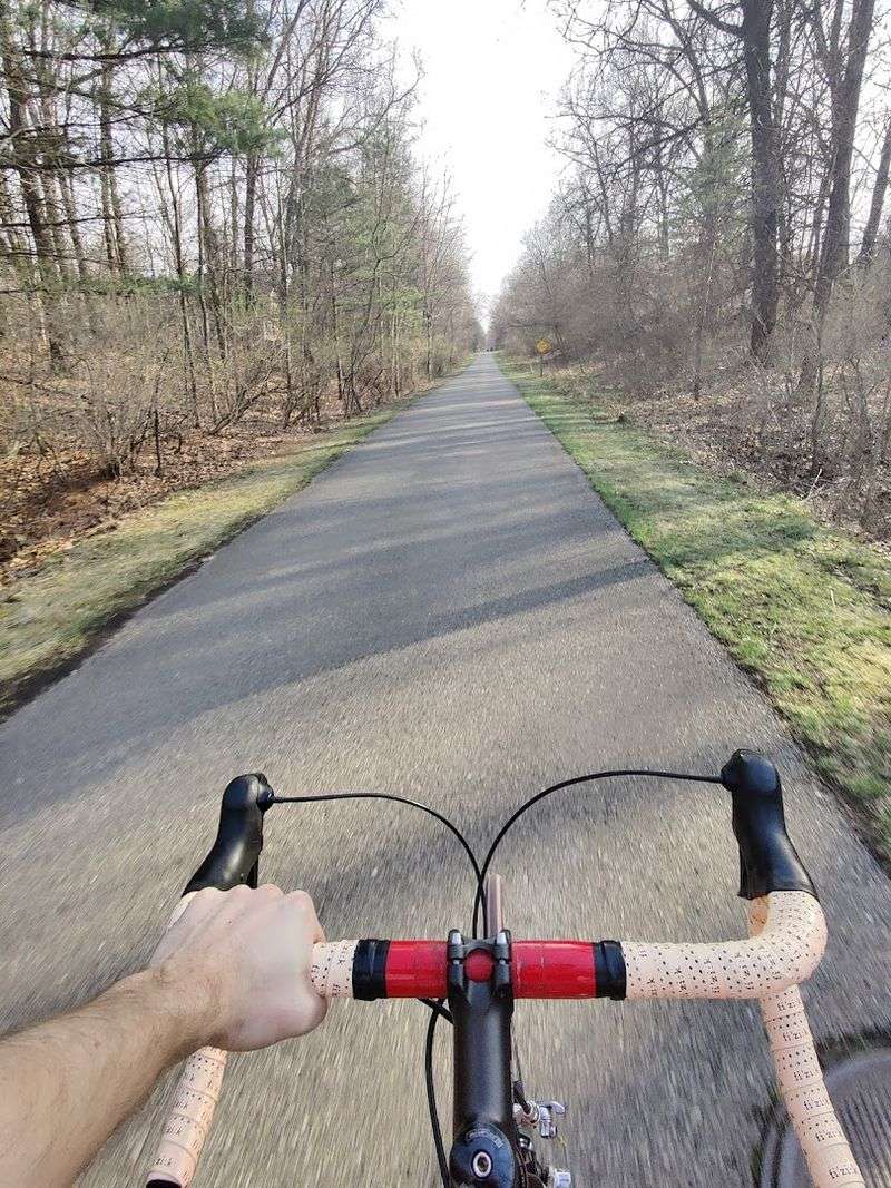
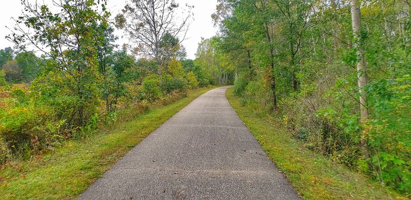
As of 2025, the White Pine Trail is fully paved from Comstock Park all the way to Cadillac, which is a significant upgrade that has made the trail far more accessible to casual cyclists and those riding road bikes or hybrid bikes. This was not always the case, as sections north of Big Rapids were once unpaved gravel.
The pavement quality is generally very good, and the flat grade inherited from the old railroad makes the trail one of the most beginner-friendly long-distance routes in Michigan. You do not need to be an experienced cyclist to enjoy a meaningful stretch of this trail.
Maintenance crews keep the trail in solid shape throughout the riding season, and impressively, portions of the trail are plowed during winter months, making it usable for runners and walkers even when snow is on the ground. The trail surface is wide enough to comfortably accommodate cyclists going in both directions without any awkward maneuvering, which matters more than you might expect on a busy weekend afternoon.
Starting Your Ride at Cadillac Commons
Cadillac Commons is one of the most popular starting points for White Pine Trail rides, particularly for cyclists who want to tackle a significant out-and-back trip. The park sits right in Cadillac, Michigan, near the northern terminus of the paved trail section, and it offers a generous amount of free parking that makes logistics simple.
One thing worth knowing before you arrive: the signage at Cadillac Commons pointing toward the trail start can be a little tricky to follow. A few riders have found themselves asking locals for directions before locating the exact point where the trail begins, so it helps to look up the trailhead location on a map app before you park the car.
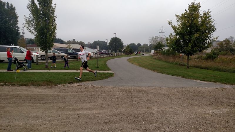
Once you find the trail, the ride south toward Reed City covers roughly 30 miles one way, making a 60-mile round trip that is very achievable for fit recreational cyclists in a single day. The flat terrain helps considerably, and the shade cover along much of the northern section keeps the effort level manageable even on warm summer days.
Best Access Points Along the Trail
One of the practical strengths of the White Pine Trail is the number of access points spread along its length. You are not forced to start at either end.
Towns like Rockford, Cedar Springs, Howard City, Big Rapids, Reed City, and Cadillac all offer parking areas and trail access, which means you can design your ride based on the distance you want to cover.
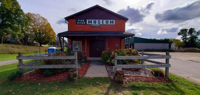
Rockford is a particularly charming starting point for riders coming from the Grand Rapids area. The town has a small-town character with local shops and food options nearby, making it a good spot to begin or end a ride with a meal.
Big Rapids, roughly at the midpoint of the trail, serves as a natural halfway marker for those attempting longer rides. The city of Big Rapids is home to Ferris State University and has solid amenities including restaurants, convenience stores, and restrooms near the trail.
Planning your stops around these towns turns a long bike ride into a genuinely pleasant day trip through the Michigan countryside rather than just a workout.
Wildlife You Might Encounter
The trail passes through enough varied habitat that wildlife sightings are a regular part of the experience rather than a lucky bonus. Wetland sections attract herons, egrets, and ducks, and early morning riders are the most likely to catch these birds wading in the shallows alongside the path.
Red-winged blackbirds are practically a trail mascot during early summer. The males are territorial during nesting season, typically June and July, and they have been known to swoop at passing runners and cyclists near certain access points, particularly around the North Park area near Grand Rapids.
Wearing a hat during that window is genuinely useful advice, not just a quirky trail legend.
Deer are frequently spotted in the wooded sections, especially during the early morning and late afternoon hours. Wild turkeys occasionally wander across the path in agricultural areas, and various species of songbirds fill the tree canopy with sound throughout the spring and summer months.
The trail essentially doubles as a moving nature observation platform if you keep your eyes open.
Winter Use and Year-Round Appeal
Most people think of bike trails as warm-weather destinations, but the White Pine Trail breaks that assumption in a satisfying way. Portions of the trail are actively plowed during the winter months, which is a meaningful commitment from trail management that keeps the path usable for runners, walkers, and even sled enthusiasts when conditions allow.
The winter landscape along the trail is genuinely striking. Snow-covered pine forests and frozen wetlands create a quiet, almost meditative environment that is completely different from the busy summer experience.
Cross-country skiers and snowshoers also use sections of the trail depending on snow depth and local conditions.
The fact that the trail stays usable year-round makes it an asset to local communities rather than a seasonal amenity. Residents who rely on the trail for daily exercise do not have to give it up when the temperature drops, which speaks to how seriously Michigan takes its outdoor recreation infrastructure.
Few bike trails in the Midwest can claim this kind of four-season functionality, and it adds real long-term value to the White Pine Trail experience.
The Towns Along the Way
Passing through a string of small Michigan towns is one of the quiet pleasures of riding the White Pine Trail. These are not tourist towns polished for visitors.
They are working communities with hardware stores, local diners, and residents who are genuinely pleased to see trail users stopping in.
Reed City is a highlight for many riders. The town sits at a natural midpoint between Cadillac and the southern trailhead, and it has the relaxed, unpretentious character of a classic mid-Michigan community.
A rest stop here before heading back makes a long ride feel more like a journey than a workout.
Cedar Springs, known locally as the Red Flannel Town for its annual festival celebrating the garment, adds a bit of local color and quirk to the southern portion of the trail. Howard City and Morley are smaller stops with modest amenities but the kind of unhurried pace that reminds you why people seek out trails like this one in the first place.
Each town adds a different texture to the overall experience.
Practical Tips Before You Go
A few practical details can make the difference between a great day on the trail and a frustrating one. Water is the first priority.
While towns along the route have convenience stores and restaurants, the gaps between services can be long enough that carrying more water than you think you need is always the right call, especially on hot days.
Parking at most trailheads is free, which is a genuine perk. Cadillac Commons, Rockford, and Big Rapids all have reliable parking areas, and none of them charge a fee as of the time of writing.
A Michigan Recreation Passport may be required at certain state-managed access points, so checking current requirements before your visit is worth a few minutes of research.
Flat terrain does not mean effortless riding over long distances. A 60-mile round trip from Cadillac to Reed City and back is still a serious commitment that requires a properly fitted bike, padded shorts, and at least a basic repair kit.
Sun protection matters too, since open farmland sections offer zero shade and Michigan summer sun can be more intense than riders expect.
How the Trail Connects Communities
One of the most underappreciated aspects of the White Pine Trail is how it functions as a connector between communities that might otherwise feel isolated from one another. The trail links Comstock Park to Cadillac through a continuous corridor that passes through or near more than a dozen communities, giving residents a shared green space that crosses county lines.
Local schools in towns along the route have used the trail for physical education programs and field trips. The trail also supports local economies in a quiet but consistent way, as cyclists stopping in Reed City or Big Rapids for lunch or supplies add up to real revenue for small businesses over the course of a busy riding season.
The Michigan Department of Natural Resources has worked with local governments and trail advocacy groups to maintain and expand access over the years. This kind of multi-stakeholder collaboration is what keeps trails like the White Pine in good condition and keeps them relevant to both residents and visitors.
The trail is genuinely woven into the fabric of the communities it passes through, not just a recreational afterthought.


