America offers some of the world’s most breathtaking drives, from coastal highways hugging dramatic cliffs to mountain passes that touch the clouds. Road trips let you explore at your own pace, stopping whenever something catches your eye or when you need to stretch your legs. Planning the perfect scenic drive means knowing which routes offer the best views and understanding any special conditions for 2025. Pack your camera and get ready to discover fifteen incredible journeys that showcase America’s natural beauty from behind the wheel.
1. Pacific Coast Highway (CA State Route 1 – Big Sur)
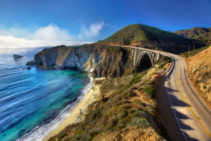
Winding along California’s rugged coastline, this legendary highway delivers heart-stopping views around every curve. Massive waves crash against towering cliffs while fog dances through ancient redwood forests just inland.
The famous Bixby Bridge stands as an engineering marvel, arching gracefully over a deep canyon with the Pacific stretching endlessly beyond. Wildlife spotting opportunities abound, from sea otters playing in kelp beds to condors soaring overhead.
Road repairs continue following recent storms, so check Caltrans updates before departure. Some sections operate with single-lane traffic controls, adding extra travel time to your adventure.
2. Oregon’s Pacific Coast Scenic Byway (US-101)
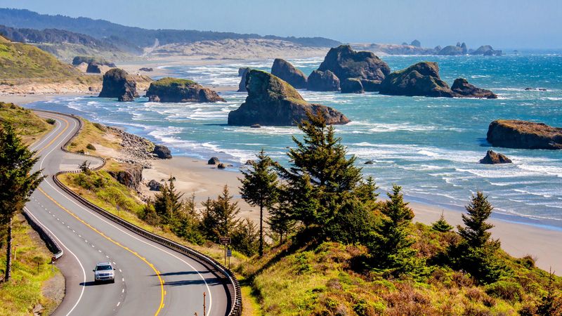
Oregon’s entire coastline unfolds like a nature documentary along this officially designated scenic route. Towering sea stacks rise from churning waters while historic lighthouses stand sentinel against dramatic storms.
Massive sand dunes near Florence create an otherworldly landscape perfect for exploration and photography. Charming coastal towns offer fresh seafood and local art galleries showcasing maritime heritage.
State parks dot the route every few miles, providing beach access and hiking trails. Summer brings heavy traffic near popular destinations, so consider visiting during shoulder seasons for a more peaceful experience with equally stunning weather.
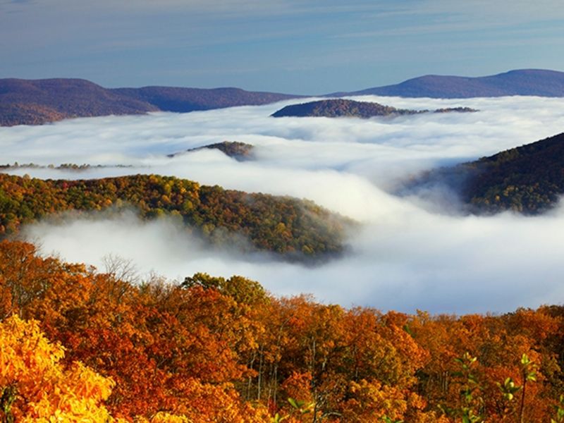
3. Blue Ridge Parkway (VA–NC)
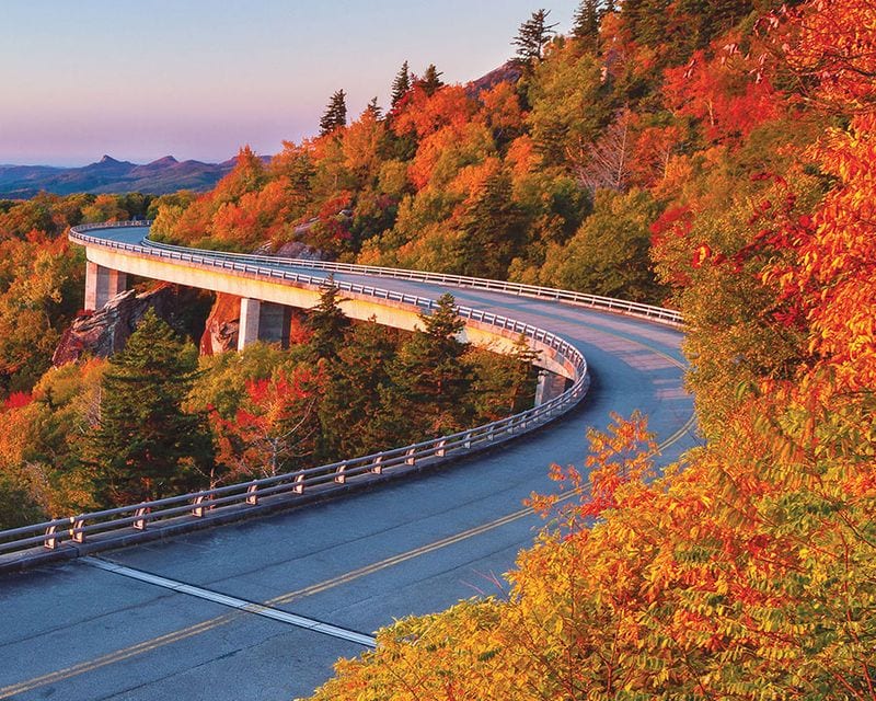
Rolling through the heart of Appalachian country, this 469-mile ribbon connects two beloved national parks with endless mountain vistas. Ancient peaks stretch toward distant horizons while morning mist clings to forested valleys below.
Stone tunnels carved through solid rock add adventure to your journey, while frequent overlooks invite lingering stops for photography. Hiking trails branch off at regular intervals, leading to waterfalls and scenic summits.
Hurricane damage from 2024 caused temporary closures in some areas, though repairs continue steadily. Check National Park Service alerts for current conditions before planning your route through America’s favorite mountain drive.
4. Skyline Drive (Shenandoah National Park, VA)
Following the spine of Virginia’s Blue Ridge Mountains, this 105-mile journey offers over seventy scenic overlooks showcasing the Shenandoah Valley’s timeless beauty. Each viewpoint reveals different perspectives of rolling farmland and distant peaks.
Waterfalls cascade down rocky slopes just short walks from roadside parking areas. The famous Appalachian Trail crosses the drive multiple times, tempting travelers to explore deeper into the wilderness.
Wildlife encounters happen frequently, especially during dawn and dusk hours when deer emerge from forest cover. Weather can change quickly at elevation, so pack layers even during warm seasons for comfortable sightseeing stops.
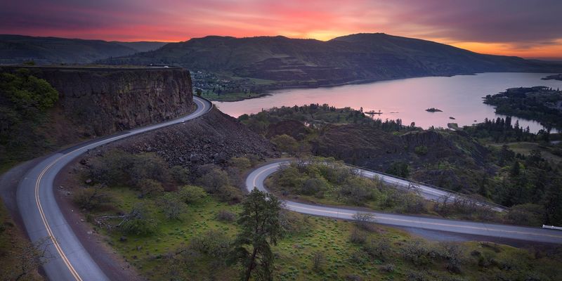
5. Great River Road (MN–LA)
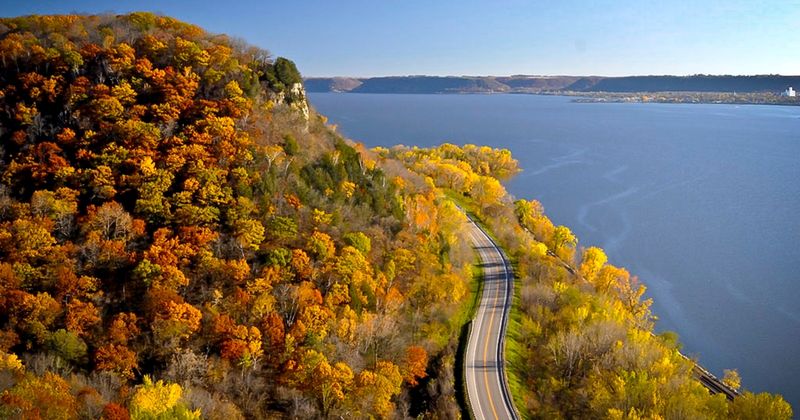
America’s longest scenic byway follows the mighty Mississippi River for nearly 3,000 miles through ten states, showcasing the waterway that built a nation. Towering bluffs frame the river’s path while historic towns tell stories of steamboat days.
Wildlife refuges provide sanctuary for countless bird species, making this route a paradise for nature photographers. Charming river communities offer antique shops, local restaurants, and museums celebrating Mississippi River heritage.
Consistent wayfinding signs marked with a distinctive green pilot’s wheel logo guide travelers along the entire route. Plan your adventure in segments, focusing on specific regions that match your interests and available time.
6. Natchez Trace Parkway (MS–AL–TN)
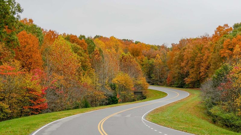
This peaceful 444-mile parkway traces an ancient path through Deep South woodlands, where towering trees create natural cathedral ceilings over the roadway. Commercial traffic stays away, leaving only the sounds of nature and your engine.
Historical markers tell fascinating stories of Native American traders, early settlers, and Civil War events. Cypress swamps, prairie grasslands, and hardwood forests create constantly changing scenery throughout your journey.
Speed limits remain modest by design, encouraging travelers to slow down and appreciate subtle details often missed on busy highways. Numerous hiking trails and picnic areas invite extended stops for deeper exploration of this historically significant corridor.
7. Going-to-the-Sun Road (Glacier NP, MT)
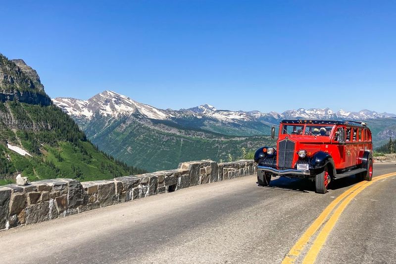
Carved into seemingly impossible cliff faces, this 50-mile engineering marvel ranks among the world’s most spectacular mountain drives. Glacial lakes reflect towering peaks while wildlife roams freely across alpine meadows.
Logan Pass sits at the Continental Divide, offering hiking access to hidden lakes and mountain goat habitat. The road’s narrow width and steep grades create an intimate connection with the dramatic landscape surrounding you.
Vehicle reservations are required for west entrance access during peak summer months in 2025. Snow typically blocks the full route until mid-June, making the complete opening a celebrated annual event for road trip enthusiasts nationwide.
8. Trail Ridge Road (Rocky Mountain NP, CO)
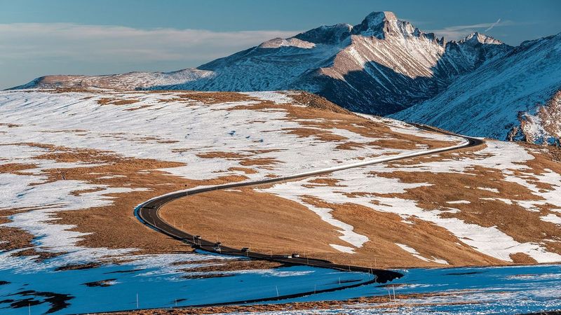
Climbing to 12,183 feet above sea level, this remarkable highway reaches higher than any other continuously paved road in America. Alpine tundra stretches endlessly while elk and bighorn sheep graze in meadows below towering peaks.
Weather changes dramatically with elevation, often requiring jackets even during summer visits. The Continental Divide crossing offers stunning views into both eastern plains and western mountain ranges.
Seasonal closures typically last from October through late May due to extreme winter conditions. Timed-entry reservations are required park-wide during 2025’s peak season, so secure your window well before departure to avoid disappointment at entrance gates.
9. San Juan Skyway & the Million Dollar Highway (SW Colorado)
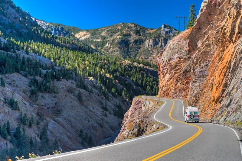
This 236-mile loop through Colorado’s San Juan Mountains combines breathtaking beauty with white-knuckle driving excitement. The infamous Million Dollar Highway section clings to sheer cliff faces without guardrails, demanding full attention from drivers.
Historic mining towns like Silverton and Ouray offer glimpses into Colorado’s gold rush heritage. Aspen forests create golden tunnels during autumn while snow-capped peaks provide dramatic backdrops year-round.
Winter weather and rockfall potential can close sections unexpectedly, particularly over Red Mountain Pass. Check Colorado Department of Transportation alerts before traveling, especially during shoulder seasons when conditions change rapidly.
10. Beartooth Highway (MT/WY)
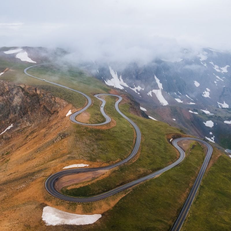
Switchbacking through some of America’s highest and most rugged terrain, this incredible highway climbs to 10,947 feet at Beartooth Pass. Alpine lakes dot the landscape like scattered jewels while glaciated peaks stretch toward endless skies.
The short driving season makes every clear day precious for travelers seeking high-altitude adventure. Wildlife sightings include mountain goats, marmots, and occasionally black bears foraging in alpine meadows.
Weather conditions can change from sunny to snowy within hours, even during summer months. Montana Department of Transportation monitors conditions closely, sometimes closing the pass with little advance notice due to sudden storms or maintenance needs.
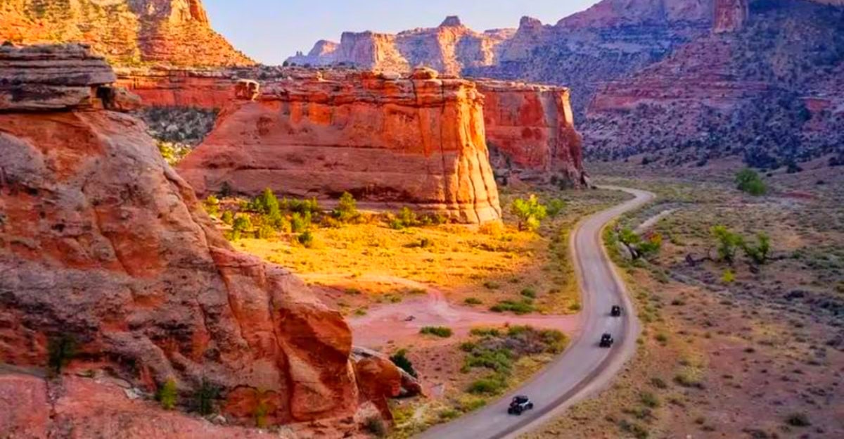
11. Utah Scenic Byway 12 (Bryce Canyon to Capitol Reef)
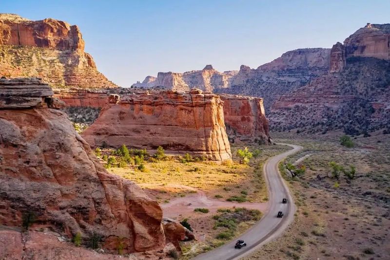
Connecting two spectacular national parks, this 122-mile All-American Road showcases Utah’s incredible geological diversity. Red rock formations rise like ancient cathedrals while slickrock hogbacks create an otherworldly driving experience.
The route crosses high plateaus covered in aspen and pine forests before descending into desert canyonlands painted in brilliant oranges and reds. Small communities offer local art galleries and restaurants serving regional specialties.
Services remain sparse across long stretches, making fuel planning essential for safe travel. Higher elevation sections can experience snow and ice outside summer months, requiring careful attention to weather forecasts before departure.
12. Historic Columbia River Highway Scenic Byway (OR)
Built in the 1910s as the “King of Roads,” this engineering masterpiece threads through the Columbia River Gorge past a dozen spectacular waterfalls. Multnomah Falls plunges 620 feet in two dramatic tiers, creating Oregon’s most photographed natural landmark.
Stone bridges and vintage guardrails preserve the highway’s historic character while providing safe passage through steep terrain. Hiking trails lead to additional waterfalls hidden in side canyons throughout the gorge.
Parking at popular Multnomah Falls requires separate timed permits accessed via Interstate 84, though the historic highway itself needs no special reservations for 2025. Expect occasional construction delays as preservation work continues.
13. Overseas Highway (Florida Keys, FL)

Island-hopping across 113 miles of turquoise waters, this unique highway connects mainland Florida to Key West via a series of bridges and coral islands. Former railroad bridges now carry cars above crystal-clear shallows teeming with tropical fish.
Each key offers distinct personality, from artsy Key Largo to laid-back Islamorada. Roadside stops provide snorkeling opportunities, fresh seafood, and glimpses of endangered Key deer roaming freely through neighborhoods.
Weather can change quickly in the tropics, with sudden squalls reducing visibility dramatically. Plan extra time for stops at state parks and underwater preserves that make this drive unforgettable beyond just transportation.
14. Kancamagus Highway (NH 112)
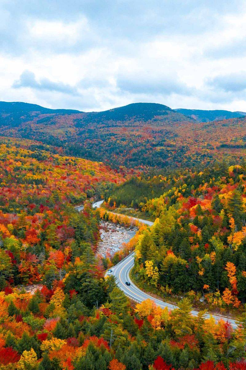
Winding 34.5 miles through New Hampshire’s White Mountain National Forest, this leaf-peeping legend transforms into a golden tunnel each autumn. The Swift River parallels much of the route, providing peaceful sounds and swimming opportunities during warmer months.
Mountain passes reveal distant peaks while pullouts offer access to hiking trails leading to waterfalls and scenic overlooks. No commercial development interrupts the wilderness experience along this designated scenic byway.
Services are limited to the endpoints in Lincoln and Conway, so fuel up before entering the forest. Weekend traffic during peak foliage season can create significant delays, making weekday visits much more enjoyable for serious photographers.
15. Seward Highway (AK)
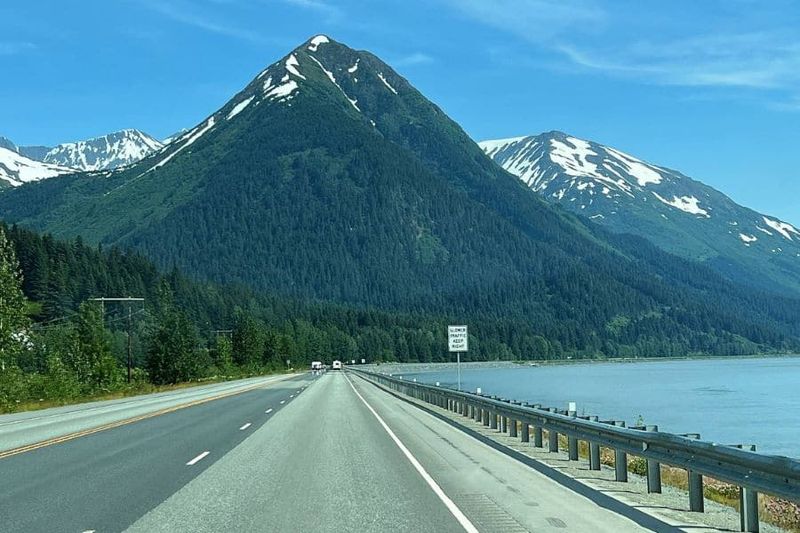
Stretching 127 miles from Anchorage to the coastal town of Seward, this All-American Road showcases Alaska’s incredible wilderness diversity. Turnagain Arm’s tidal waters create dramatic bore tides while beluga whales surface regularly during summer months.
Chugach National Forest surrounds the highway with glaciated peaks and pristine wilderness. Frequent pullouts provide wildlife viewing opportunities and access to hiking trails leading deeper into untamed backcountry.
Weather conditions change rapidly in Alaska, requiring flexibility in travel plans and emergency supplies in vehicles. Check Alaska Department of Transportation updates for current conditions, especially during winter months when extreme weather can create hazardous driving situations.


