Mount Hood finally looks wintery, but the stoke meets reality this weekend. Fresh flakes fell, yet base depths and terrain coverage are still thin where most of us ride. If you were eyeing a quick getaway for laps and hot cocoa, you will want to check the latest reports before locking plans. Here is what the new snow means now, and what to expect next week.
Mt. Hood Finally Sees Snow After Warm Start to Winter
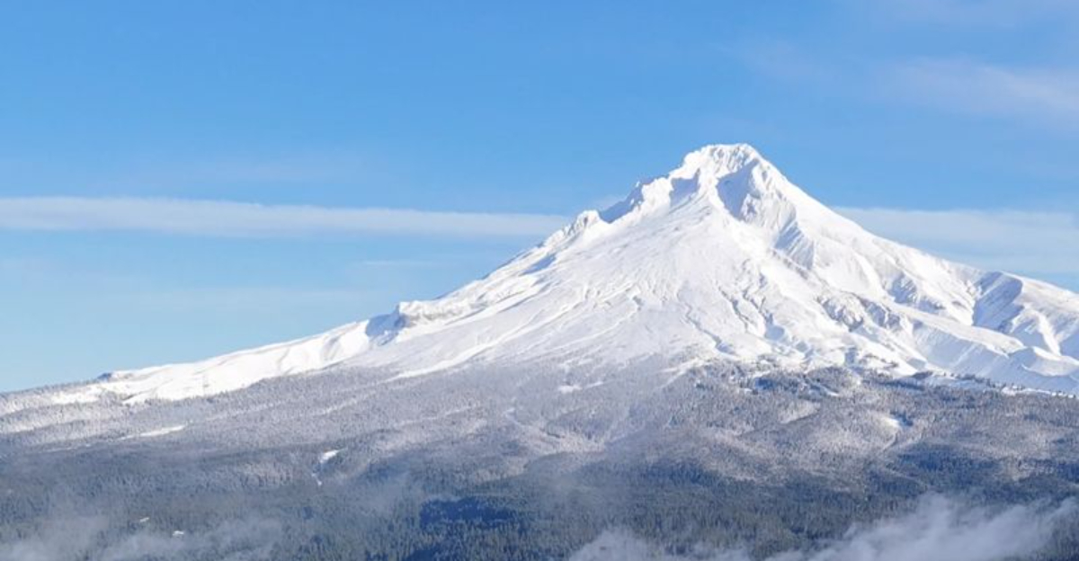
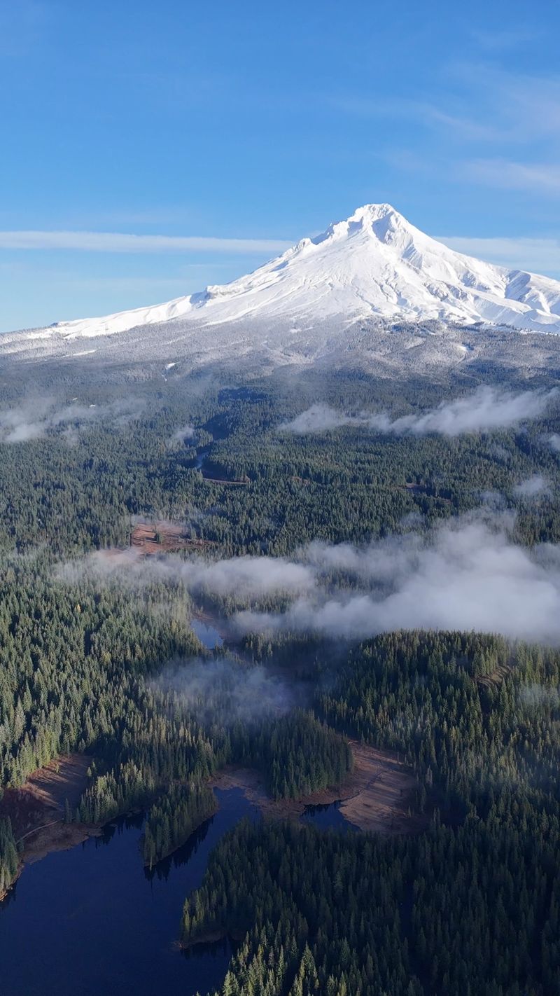
After weeks of waiting, snow finally returned to Mount Hood, dusting Meadows and Skibowl with a much needed refresh. A cold front slid through, nudging snow levels down into the passes and laying several inches over mid and upper elevations. You could feel the collective sigh of relief as webcams switched from brown to white and flakes blew sideways across lift terminals.
Even with the new coating, overall snowpack is still well below mid December norms. Meadows is reporting around a foot at base elevations, with totals this week ranging roughly 8 to 18 inches depending on site and aspect. In a typical year there would be a deeper base and more ropes dropping by now, so expectations should be tempered before packing the car.
The late start has kept lifts closed longer than usual, which is frustrating when legs are ready and new gear is begging for a tune. Patrol needs consistent coverage to protect skis and riders from rocks, brush, and early season hazards. Until snow stacks up, terrain openings will lag behind the hype and the highlight reels.
Forecast discussions mention temperatures swinging enough to bump snow levels up, then back down, which makes building a stable base tricky. That ping pong pattern often leaves lower trails thin while upper bowls start to fill. Keep refreshing the snow stake and look for a sustained cold stretch before expecting dependable laps.
Ski Resorts Still Closed or Limited Despite New Snow
Fresh snow usually flips the switch, but this weekend is still a mixed bag. Meadows has measurable accumulation, yet lifts remain closed as crews assess coverage and hazards on primary routes. Safety takes priority, and early season rocks and water bars are lurking beneath the surface.
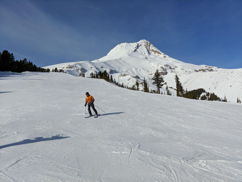
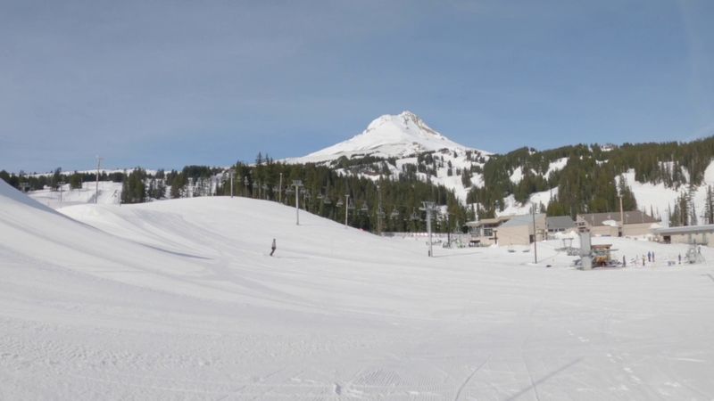
At Skibowl, higher elevations caught snow while lower lifts remain mostly thin, leaving classic runs not quite ready. Timberline holds its usual upper mountain advantage, but even there many lifts and parks await more depth before a full go. Mid December openings are common in normal years, yet this season is running late across the board.
Resort teams are playing the long game, aiming for quality over a rushed debut that could damage snow surfaces and equipment. If you plan to visit, expect limited options and be ready to pivot toward sightseeing, lodge hangs, or a single open lane if available. It is better than grass, but not the carefree holiday shred many hoped for.
The ripple effects are real for local lodges, rentals, and restaurants that count on early season weekends. Some guests have postponed trips, waiting for the next storm cycle to tip conditions. Keep checking official channels for updates, and bring patience along with your layers.
New Snow Not Enough for Full Weekend Skiing Plans
There is finally soft snow underfoot, but weekend plans still need a reality check. Base levels hover around a foot or less at lower elevations, with deeper wind loaded spots higher up. That is not enough for wide open trail networks, groomer passes end to end, or carefree tree dips.
Midweek brought a decent shot as snow levels dropped, yet earlier warmth and rain kept lower terrain from locking in. The result is a patchwork surface that rides better in shaded pockets than on sun exposed connectors. Expect variable turns, thin spots, and occasional crunch where coverage is shallow.
Forecasts hint at more accumulation into next week, which could move the needle if the cold holds. For now, think scouting missions rather than full itineraries, and keep expectations realistic about lift availability. If you are chasing quality, patience might beat chasing every flurry this weekend.
Seasonal norms typically see steadier November snow, so this delay reflects broader winter variability showing up across the Cascades. Conditions can change quickly once a sustained cold pattern arrives, especially with back to back systems stacking snow. Keep tabs on snow reports, avy notes, and wind directions to find the best sheltered stashes.
Forecast Signals Mixed Conditions Ahead
Looking forward, models point to a classic shoulder pattern with alternating snow and rain. Snow levels will wobble, bringing meaningful totals to higher terrain while bases flirt with mixed precipitation. When the cold wins, coverage builds fast, and when it loses, consolidation and crusts become the story.
Guidance suggests potentially significant mountain snowfall over the next week, but timing and storm tracks will decide whether lifts can spin safely. A couple of well placed colder pulses could finally knit a rideable base across key routes. Miss the timing, and we are back to thin cover and selective openings.
Temperature swings remain the wild card, making accumulation intermittent and aspect dependent. Early winter often looks like this, especially in warmer leaning years when the pattern has yet to lock. Expect patchiness until a longer cold stretch arrives and grooming crews can work their magic.
Longer range outlooks keep the variability theme alive, alternating bursts of snow with milder breaks. Plan around windows rather than fixed dates, and refresh reports before committing to drives or lodging. The right 48 hour window could transform the mountain, so stay nimble and ready to pounce.


