Multiple storm waves are lining up, and the storyline is not one big blizzard but a steady drumbeat of snow stretching from mesas to shorelines. You will see shifting forecasts, quick bursts of accumulation, and travel that goes from fine to slippery in an hour. If plans are flexible, you will handle this pattern better than most.
Keep checking updates, because the details will change fast as each quick hitter slides through.
An energized jet stream is sending a parade of quick moving systems from the Four Corners to the Great Lakes. Rather than one blockbuster storm, you get repeated rounds of light to moderate snow with short breaks in between. That cadence can be more disruptive than a single event because roads stay slick and cleanup rarely finishes before the next wave.
Forecasts will shift with each pass, and elevation or storm track can swing totals a lot over a short distance. Winter storm warnings, advisories, and special statements are popping up as conditions evolve. Even modest accumulations become impactful when temperatures are cold and wind lifts snow back onto treated surfaces.
Plan on flexible timing, backup routes, and patience at airports if bands arrive during peak travel. Keep a scraper, warm layers, and a charged phone in the car. You will navigate this best by checking updates often and slowing down when visibility drops.
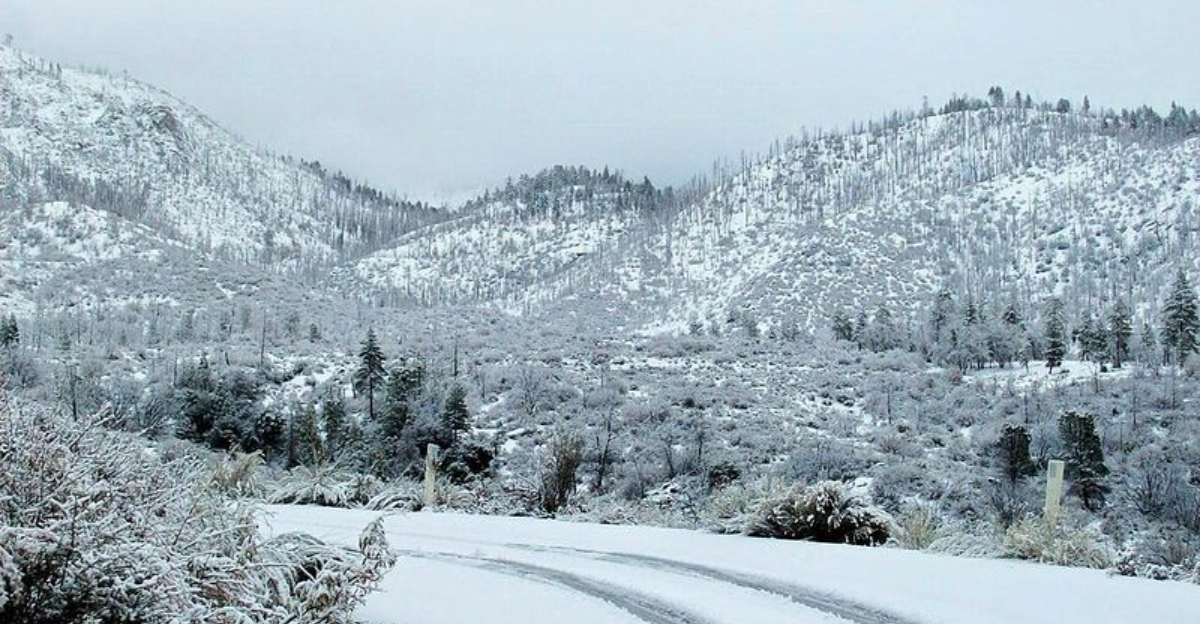
Higher terrain in Arizona, New Mexico, Utah, and Colorado is first in line as moisture rides up the slopes. Mountain snow will stack up quickly above pass level, and you can expect icy stretches, reduced visibility, and occasional chain controls. Gusty winds will loft powder across ridges, filling tracks and hiding slick patches.
Lower valleys may flip between rain and wet snow, then freeze at night, especially on bridges and untreated ramps. Conditions change fast with small elevation gains, so the pass you cleared an hour ago may be treacherous on the return. Watch for sudden closures when plows and avalanche crews need space.
Carry a winter kit with water, snacks, blankets, and traction aids, and top off fuel before climbing. If snowfall intensifies, delay the trip rather than gambling on limited pullouts. Check DOT cameras and forecasts frequently so you can time travel between bursts.
As storms slide east, the Plains and Midwest will collect several rounds of light to moderate snow. None may look impressive alone, but together they add up, especially when crews cannot fully clear streets before the next burst. Commutes get tricky as thin layers refreeze and side streets stay polished.
Open country will see drifting where winds accelerate across fields, pushing snow back onto roads you thought were finished. Cold air improves accumulation efficiency, so totals creep upward even with modest rates. Airports may slow as deicing lines lengthen, and regional delays ripple down the line.
Do not underestimate the slow burn of repeated events. Leave early, brake gently, and give plows room to work. If you can stack errands and skip one trip during active snow, you will cut risk and frustration.
Colder air crossing the relatively warm lakes will spark lake effect snow that can explode in narrow corridors. You can drive from flurries into whiteout in a mile, then back to nothing, which makes planning deceptively hard. Bands often pivot with wind shifts, pinning communities while neighbors see bare pavement.
These squalls can persist after the main system exits, dragging out impacts for days. Blowing snow reduces visibility and buries treated lanes, while localized totals beat the regional forecast. Expect quick adjustments to advisories and warnings as bands reorient overnight.
If travel is necessary, track radar, know your wind direction, and have a safe out if a band locks in. Keep supplies in the car and slow to conditions, not the speed limit sign. Lake effect can intensify fast, so staying alert pays off.


