New Jersey might be famous for its diners and turnpike, but the Garden State is secretly hiding some seriously stunning trails. From glacial ponds to towering waterfalls and sweeping ridge views, there is no shortage of adventure packed into this small but mighty state.
I grew up thinking NJ was all suburbs and strip malls until a friend dragged me up Mount Tammany and completely changed my mind. Whether you are a seasoned hiker or just getting started, these 18 trails deserve a spot on your 2026 bucket list.
Mount Tammany Loop (Red Dot + Dunnfield Creek), Delaware Water Gap
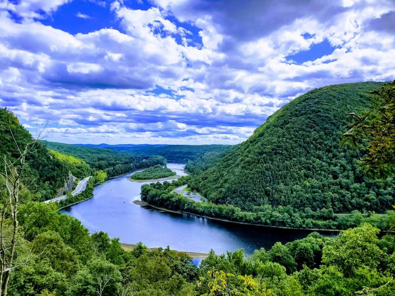
The views from Mount Tammany hit differently when you have earned them. This 3.5-mile loop in Delaware Water Gap combines the Red Dot Trail up and the Dunnfield Creek Trail back down, giving you the best of both worlds.
The climb is no joke, but the payoff is one of the most dramatic ridge-top views in the entire state.
The NY-NJ Trail Conference classifies this as a strenuous route, and they are not exaggerating. Rocky switchbacks keep you honest on the way up.
Once you reach the top, the Delaware River stretches out below like something off a postcard.
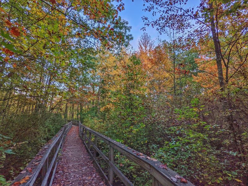
Start early to snag a parking spot at the I-80 trailhead. Weekends fill up fast, especially in fall when the foliage turns the whole valley into a fireworks show of color.
Bring trekking poles for the descent. Your knees will thank you later.
Stairway to Heaven (Appalachian Trail to Pinwheel Vista), Vernon
Yes, the name is that dramatic, and yes, the trail earns every bit of it. The Stairway to Heaven section of the Appalachian Trail in Vernon takes you up a steep, open rock slab that genuinely feels like you are ascending into the clouds.
Pinwheel Vista at the top rewards you with sweeping views across the Kittatinny Ridge.
The climb is short but steep, making it a fantastic workout without committing to a full-day epic. Most hikers tackle it as an out-and-back, though the surrounding trail network offers options for a longer loop.
The exposed rock face can get slippery when wet, so dry-day hiking is strongly recommended.
This trail has become something of a legend among NJ hikers, and for good reason. It attracts everyone from AT thru-hikers to weekend warriors chasing a quick adrenaline fix.
Go on a weekday if you prefer fewer crowds at the top.
Monument Trail Loop, High Point State Park
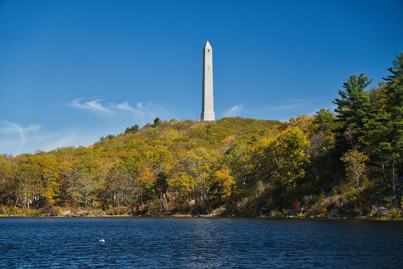
High Point State Park sits at the literal highest elevation in New Jersey, and the Monument Trail Loop makes sure you feel every bit of that distinction. At 1,803 feet, the obelisk-topped summit offers views stretching into three states on a clear day.
That kind of geographic bragging right never gets old.
The loop weaves through dense woodland before opening up along a scenic lake shore section that adds variety to the walk. With over 50 miles of trails in the park, you can easily extend the adventure if your legs are feeling ambitious.
The Monument Trail itself is well-marked and manageable for most fitness levels.
High Point State Park charges a seasonal entrance fee, so budget accordingly. The monument area is open during regular park hours, and the visitor center nearby offers helpful maps.
Fall is peak season here, but spring wildflowers make an equally compelling argument for an off-season visit.
Sunfish Pond via the Appalachian Trail, Worthington State Forest
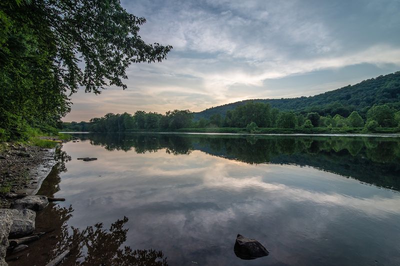
Sunfish Pond is the kind of destination that makes a long hike feel completely worth it. Tucked inside Worthington State Forest, this glacial pond sits at the end of the Appalachian Trail corridor and looks like something out of a fantasy novel.
The water is so clear it almost seems fake.
The round trip from the Dunnfield Creek trailhead runs roughly 11 miles, making this a solid full-day commitment. The trail follows the AT along a ridge before dropping down to the pond’s rocky shoreline.
Most of the route is well-maintained, though some sections involve technical rocky terrain that keeps things interesting.
Swimming is not permitted at Sunfish Pond, but sitting on the boulders at the water’s edge is absolutely encouraged. Pack a proper lunch and take your time soaking in the scenery.
I once spotted a black bear on this trail, so keep your food secured and your eyes open.
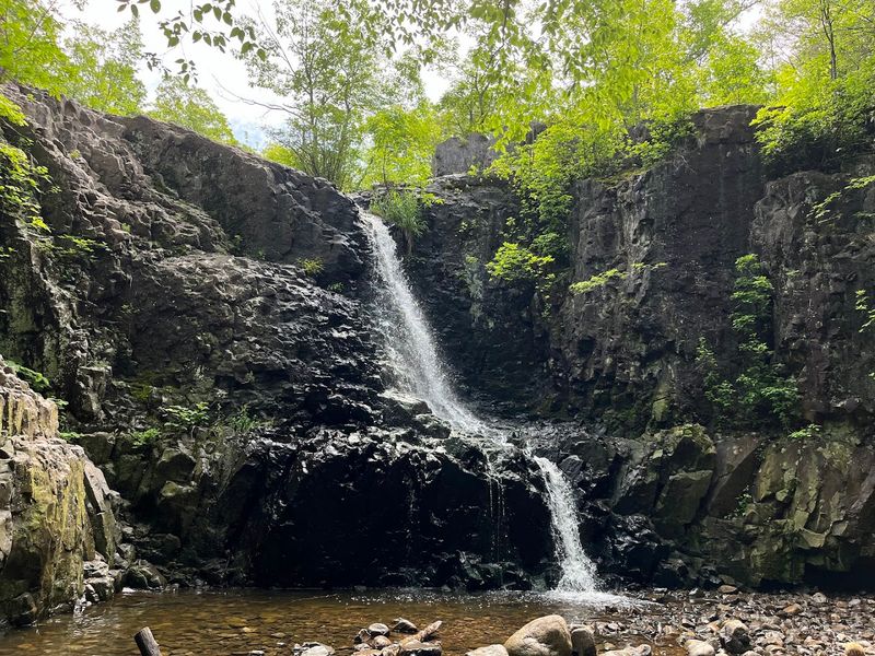
Buttermilk Falls + Appalachian Trail Connector, Delaware Water Gap NRA
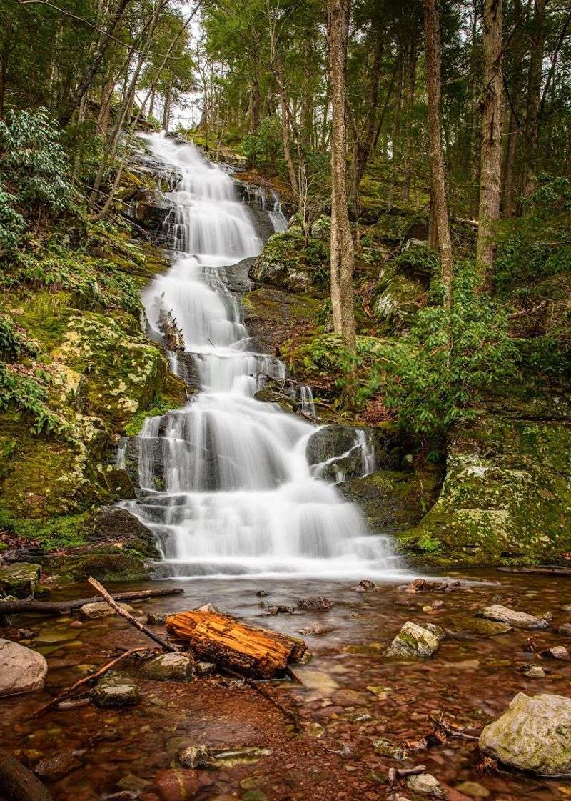
New Jersey’s tallest waterfall has a name that sounds like a breakfast item, but there is nothing ordinary about Buttermilk Falls. The National Park Service confirms this beauty inside Delaware Water Gap NRA stands as the state’s tallest waterfall, and seeing it in person makes that title feel completely justified.
The trail connects to the Appalachian Trail, which means you can turn a simple waterfall visit into a legitimate ridge hike if the mood strikes. The falls are most impressive after heavy rain when the water volume really cranks up.
Even during drier periods, the layered rock face and surrounding forest make the short hike worthwhile.
Access is straightforward from the Old Mine Road area, and the path to the falls is relatively easy compared to other nearby trails. Families with younger kids often enjoy this one as a gentler introduction to the Delaware Water Gap trail system.
Go in spring for maximum waterfall drama.
Wyanokie High Point Loop, Norvin Green State Forest
Norvin Green State Forest does not mess around when it comes to rugged terrain. The Wyanokie High Point Loop is one of the park’s signature hikes, combining rocky scrambles, dense forest, and a summit overlook that rewards every scraped knee and heavy breath.
This is not a trail for flip-flops.
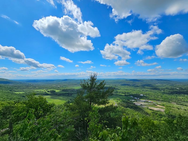
The loop typically runs around 6 miles depending on your exact route, and the trail network in Norvin Green offers plenty of opportunities to customize your adventure. Wyanokie High Point delivers panoramic views over the surrounding Highlands landscape, making it one of the most satisfying summit payoffs in northern New Jersey.
Trail markings can get a bit confusing in spots, so downloading an offline map before heading out is genuinely smart advice. The NY-NJ Trail Conference map for this area is worth printing.
Spring and fall offer the best hiking conditions, though summer mornings before the heat sets in work well too.
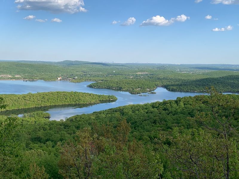
Vista Loop / Cactus Ledge Area, Ramapo Valley County Reservation (Mahwah)
Ramapo Valley County Reservation in Mahwah is Bergen County’s outdoor gem, and the Vista Loop through the Cactus Ledge area is its crown jewel route. The trail winds through varied terrain before popping out onto open rocky ledges with views that make you forget you are still in New Jersey.
Bergen County’s trail maps highlight this reservation well, and the NY-NJ Trail Conference has documented the Vista Loop thoroughly. The Cactus Ledge section earns its quirky name from the scrubby vegetation clinging to the exposed rock outcrops along the ridge.
It is a genuinely fun section of trail with personality to spare.
Parking at the main Ramapo Valley entrance fills up quickly on nice weekends, so arriving before 9 a.m. is strongly recommended. The reservation also connects to Ringwood State Park trails, making it possible to link up a much longer adventure.
Dogs are welcome on leash, which makes this spot even more popular with the weekend crowd.
Tripod Rock Route, Pyramid Mountain Natural Historic Area (Kinnelon/Montville)
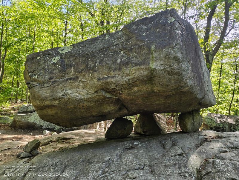
Tripod Rock might be the coolest geological party trick in all of New Jersey. Three smaller rocks support a massive glacial boulder in what looks physically impossible, yet there it sits in Pyramid Mountain Natural Historic Area, completely unbothered by logic.
Morris County’s park commission rightfully celebrates this place as a natural treasure.
The trail to Tripod Rock is moderately challenging, winding through rugged Highlands terrain before delivering you to the famous erratic. The surrounding area contains several other impressive glacial boulders, so the whole hike feels like a geology field trip that is actually fun.
Bear Rock, another massive erratic nearby, is also worth seeking out.
The trail system at Pyramid Mountain is well-marked with color-coded blazes, making navigation manageable even for newer hikers. Total mileage for the Tripod Rock route runs around 5 miles round trip.
Weekday visits are noticeably quieter, which lets you spend more time at the rock without the crowd factor.
Hacklebarney State Park River Trails (Black River Corridor)
Hacklebarney State Park sounds like something out of a cartoon, but the trails here are seriously scenic. Nine official trails wind through the park, and the star of the show is the Black River corridor, where the water cuts through a dramatic rocky gorge lined with ancient hemlock trees.
NJ’s official trail guide gives this place well-deserved attention.
The riverside trails stay cool even in summer thanks to the hemlock canopy overhead, making Hacklebarney a smart choice for hot-weather hiking. The terrain involves some scrambling over rocks along the river’s edge, which adds a sense of adventure without being genuinely dangerous.
Kids who like getting their boots a little muddy absolutely love it here.
The park is located in Long Valley and is relatively small, so a full loop takes just a few hours. That makes it a perfect half-day option when you want fresh air without a massive time commitment.
Pack waterproof boots for the river crossings.
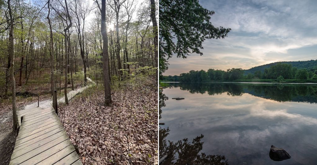
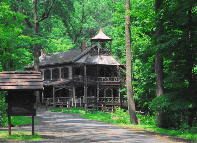
Deserted Village Loop (Feltville), Watchung Reservation
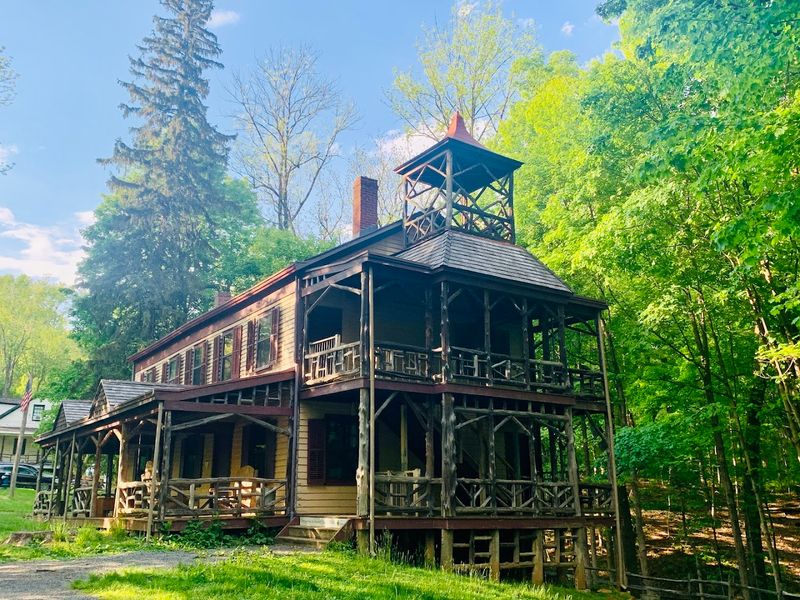
Few hikes come with a built-in ghost story, but the Deserted Village at Feltville inside Watchung Reservation absolutely qualifies. The interpretive loop through this 19th-century mill village passes preserved historic buildings that have been standing empty for over a century.
It is equal parts history lesson and genuinely eerie atmosphere.
David Felt built this self-contained village in the 1840s to house his paper mill workers, and the whole operation was eventually abandoned, leaving the buildings to the forest. The short loop trail is easy enough for most visitors, making it a great option for families or casual walkers who want something different from a typical nature hike.
Watchung Reservation is managed by Union County, and trail maps are available at the nature center nearby. The loop is well-marked and connects to longer trail options within the reservation.
Visit in late October when the fall colors and the village’s spooky history create a combination that is hard to beat.
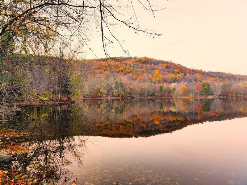
Sierra Trail, Watchung Reservation (Lake Surprise + Feltville Area)
The Sierra Trail in Watchung Reservation is the longer, more ambitious sibling of the Feltville loop, and it packs considerably more variety into a single outing. The route passes Lake Surprise, which has an excellent name and delivers on it with a peaceful lakeside section that breaks up the woodland walking nicely.
The trail also swings through the Deserted Village area, so you get the historic Feltville experience along with the lake and forest sections all in one route. Total mileage puts this firmly in the moderate category, making it suitable for hikers with a bit of experience who want a satisfying half-day adventure.
The terrain is rolling rather than dramatically steep.
Watchung Reservation sits in Union County and is surprisingly large for a county-managed green space. The Sierra Trail is marked in blue, and staying on the blazed route keeps navigation simple.
Early morning visits mean peaceful trails and better chances of spotting deer along the lake’s edge.
Hemlock Falls Loop, South Mountain Reservation
A 25-foot waterfall hidden inside a county park just minutes from suburban Essex County feels like finding a secret, and Hemlock Falls in South Mountain Reservation delivers exactly that kind of pleasant surprise. The loop trail leading to the falls is one of the most popular hikes in the entire county park system, and the waterfall is genuinely photogenic year-round.
The route follows Rahway River upstream through a hemlock-shaded ravine before reaching the falls, which drop dramatically over a rocky ledge. The loop adds some additional woodland walking that rounds out the experience without demanding too much from your legs.
Total distance sits comfortably around 3 miles.
South Mountain Reservation is maintained by Essex County and offers free access with ample parking at multiple trailheads. The Hemlock Falls trailhead near Millburn is the most popular starting point.
Winter visits are surprisingly rewarding when the falls partially freeze, creating an icy curtain that looks completely wild.
Green Trail System, Cheesequake State Park
Cheesequake State Park has the best name in the New Jersey state park system, and that is a hill I will die on. Beyond the excellent branding, the park offers a genuinely diverse trail system that crosses through multiple distinct ecosystems in a surprisingly small area.
NJDEP’s trail guide highlights the Green Trail as a standout option from the main trailhead.
The Green Trail winds through upland forest, freshwater marsh, Atlantic white cedar swamp, and open meadow sections, which means the scenery keeps shifting every few minutes. That ecological variety is rare anywhere in New Jersey, let alone in a single park.
Birders especially love Cheesequake for the mix of habitats packed into one visit.
The park sits in Middlesex County near the Garden State Parkway, making it accessible from a wide range of starting points. Admission fees apply during peak season.
The trail system is well-signed, and the park’s official map makes navigation straightforward even for first-time visitors.
Batona Trail (Pinelands Section), Wharton State Forest
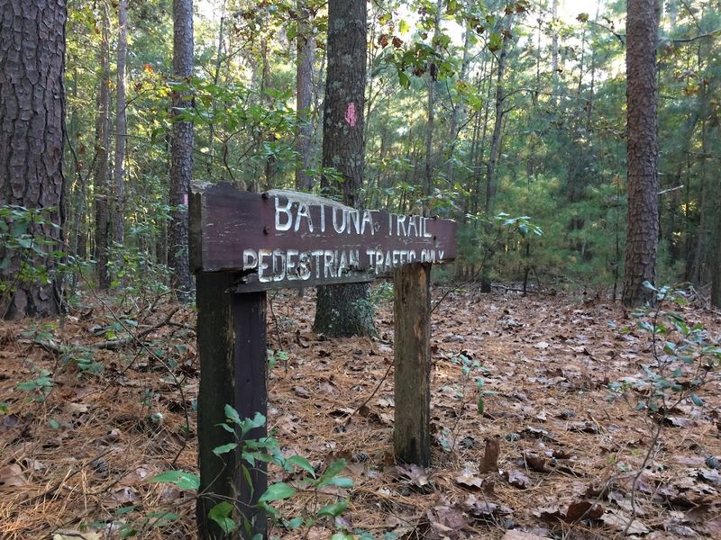
The Pinelands are unlike anywhere else in New Jersey, and the Batona Trail cuts right through the heart of them. NJDEP notes that roughly half of this 53-mile hiking trail runs through Wharton State Forest, which alone contains 19 official trails.
The Batona is flat, sandy, and utterly hypnotic in the way only a pine forest can be.
This is not a summit-chaser’s trail. The Batona rewards a different kind of hiker, one who appreciates the subtle beauty of cedar-stained streams, carnivorous pitcher plants, and the eerie quiet of a forest that feels genuinely ancient.
The pink blazes are easy to follow even when the trail weaves through dense scrub sections.
You can tackle the Batona as a day hike on any number of segments, or go full adventure and plan an overnight backpacking trip using the designated campsites along the route. Atsion Recreation Area makes a great starting point with parking, restrooms, and easy access to the trail.
D&R Canal State Park Towpath (Pick Any Segment)
Not every great hike needs to involve a summit or a waterfall, and the D&R Canal State Park Towpath makes that argument beautifully. NJDEP describes this historic canal corridor as a state park in its own right, stretching over 70 miles of mostly flat, easy walking alongside a 19th-century waterway.
Pick any segment and you will find a peaceful, scenic outing.
The towpath is crushed gravel for much of its length, making it accessible for hikers, cyclists, and even joggers without any technical terrain to worry about. Canal-side towns like New Hope, Lambertville, and Princeton add the bonus of a post-hike meal or coffee shop stop.
The canal itself is a calm, reflective ribbon of water that makes for genuinely relaxing scenery.
The Bull’s Island to Lambertville segment is a personal favorite for its combination of river views and charming small-town access at both ends. Early spring brings great birding along the canal corridor before the leaves fully fill in.
Great Swamp National Wildlife Refuge Trails (Boardwalks + Woods)
Great Swamp National Wildlife Refuge sits just 26 miles from Midtown Manhattan, which makes it one of the most accessible wild places on the entire East Coast. The U.S.
Fish and Wildlife Service manages trails and boardwalks here that cut through wetlands, forest, and open meadow, with some sections paved for accessibility. Wildlife sightings are practically guaranteed.
Herons, egrets, wood ducks, and the occasional river otter make regular appearances along the boardwalk sections. The refuge is divided into a wilderness area and a wildlife observation area, each offering a different hiking experience.
Both are worth exploring if you have a full morning to spare.
Birding is the main event at Great Swamp, and the spring migration period transforms the refuge into an absolute spectacle. Bring binoculars and a field guide because the variety of species passing through is genuinely impressive.
The trails are flat and well-maintained, making this one of the most welcoming refuges in the entire Northeast for hikers of any experience level.
Maurice River Bluffs Preserve Trail Loop (Millville Area)
South Jersey is not exactly famous for dramatic topography, which is exactly what makes the Maurice River Bluffs Preserve such a genuine surprise. The Nature Conservancy protects over 500 acres here, and the hilly terrain along the bluffs above the Maurice River is unlike anything else in the southern part of the state.
It genuinely feels like you stumbled into the wrong region.
The trail loop winds along the river bluffs through mature upland forest, offering periodic glimpses of the Maurice River below through the tree canopy. The elevation changes are modest by northern NJ standards but feel significant in this part of the state.
Bald eagles nest along the Maurice River corridor, making wildlife sightings a legitimate possibility on any visit.
The preserve is located near Millville and is managed with conservation as the priority, so the trails stay purposefully low-key without heavy infrastructure. Parking is limited, so weekday visits work best.
Spring is prime time for wildflowers and migrating songbirds along the river corridor.
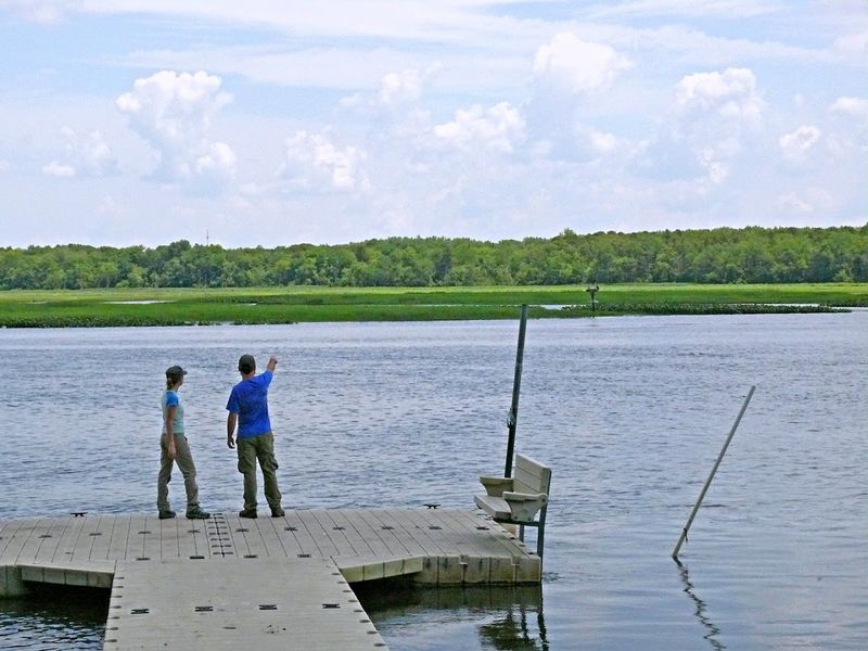
Island Beach State Park Self-Guided Trails (Reed’s Road / Barnegat Bay Side)
Island Beach State Park is best known as a beach destination, but the Reed’s Road Trail and the Barnegat Bay-side routes reveal a completely different side of this 10-mile barrier island. Maritime shrubland, freshwater ponds, and coastal dune habitat create a surprisingly rich ecosystem for a place most people associate with sunscreen and folding chairs.
The self-guided trails are short and flat, making them accessible for all ages and fitness levels. What they lack in elevation they make up for in wildlife, especially during fall migration when hawks, falcons, and shorebirds funnel down the coast in impressive numbers.
Osprey nest here in summer and are easy to spot from the bay-side paths.
Island Beach charges a per-vehicle entrance fee that varies by season. The park fills to capacity on summer weekends, so visiting in spring or fall gives you the trails practically to yourself.
Bring a windbreaker because the bay-side trails get breezy even on warm days, and the views across Barnegat Bay toward the lighthouse are worth every gust.


