Most people drive through Hunterdon County, New Jersey without stopping, assuming there is nothing worth slowing down for. That assumption is wrong.
Tucked into the western edge of the state, just outside the small borough of Bloomsbury, there is a 523-acre nature preserve wrapped around a river gorge that genuinely surprises first-time visitors. Rocky trails, stream crossings, a hidden waterfall, the ruins of an old paper mill, and a stretch of river that looks nothing like what you would expect from New Jersey all wait here.
The preserve has earned a 4.6-star rating from hikers who keep coming back, and after my own visit, I completely understand why. This is the kind of place that makes you rethink everything you thought you knew about the Garden State.
Where the Gorge Actually Is
Musconetcong Gorge sits at 182 Dennis Rd, Bloomsbury, NJ 08804, right in Hunterdon County in the western part of New Jersey. The parking area is small, fitting only a handful of cars, so arriving earlier in the day tends to work in your favor, especially on weekends.
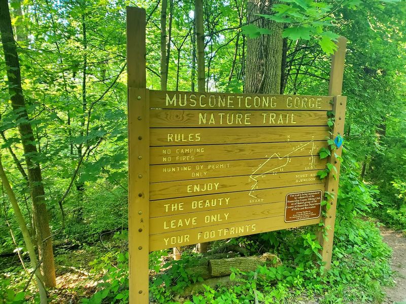
The preserve is managed by Hunterdon County and covers 523 acres along the Musconetcong River. Its official website at co.hunterdon.nj.us has trail maps and updated information worth checking before you go.
The park operates daily from 8 AM to 7 PM, which gives you a solid window of time to explore without feeling rushed. One practical note: there are no restrooms on site, so plan accordingly before leaving home.
The nearest town, Bloomsbury, is only a few minutes away by car if you need anything before hitting the trail. Getting there is straightforward, and the drive through the surrounding farmland and rolling hills of Hunterdon County is a pleasant start to the whole experience.
A Gorge That Earns Its Name
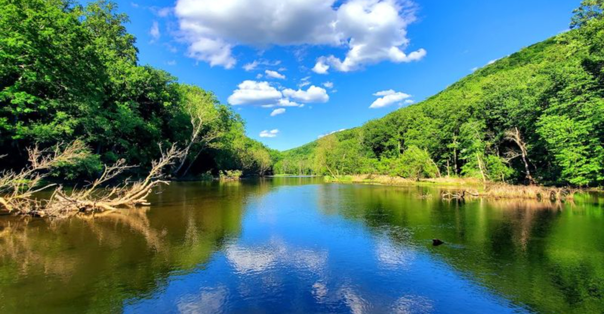
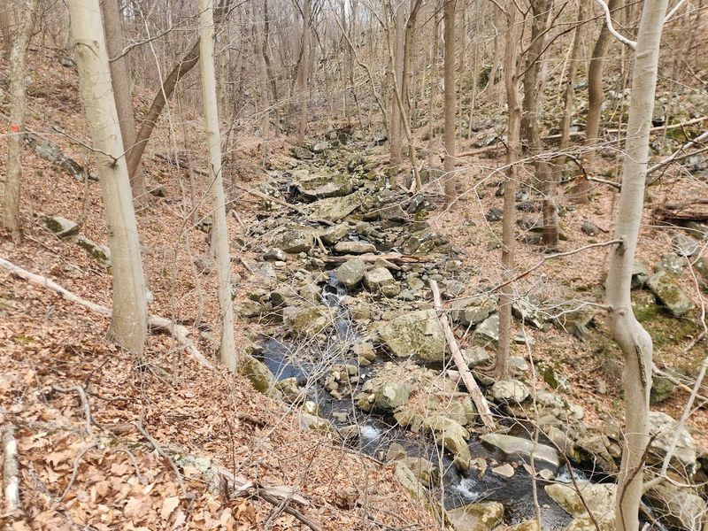
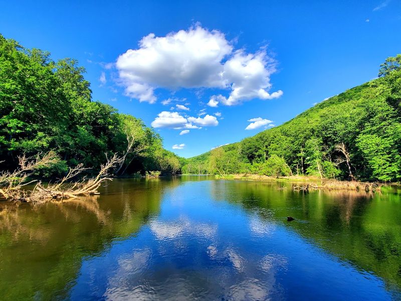
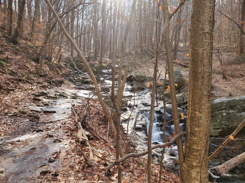
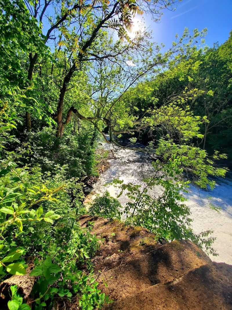
The Musconetcong River carved this gorge over thousands of years, and the result is one of the more dramatic natural features in the entire state. The river cuts through a narrow rocky valley, with the gorge walls rising on either side and the water moving steadily below.
What makes this place stand out is how compact and complete it feels. Within a few miles of trail, you move through open ridgelines, dense forest, rocky descents, stream crossings, and river-level views.
The gorge itself is the centerpiece, but the trails leading to and from it offer plenty of variety.
One reviewer described hiking from Dennis Road to the gorge on the teal trail and finding a stream with waterfalls and large boulders that made the whole trip feel worthwhile. That description held up during my own visit.
The gorge does not require a long drive into remote wilderness. It sits right here in New Jersey, which is part of what makes it feel so unexpected to people who have never been.
The Trail Network Explained
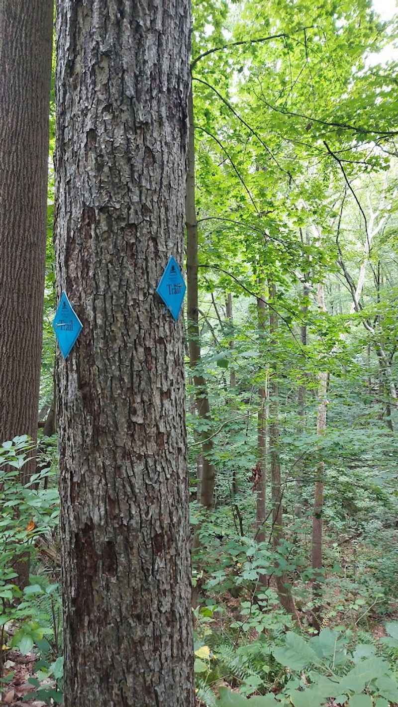
The preserve has several named trails, each marked by a different color blaze: blue, orange, yellow, teal, and white. Combining these trails in different orders creates loops of varying lengths, and most hikers find a combination that fits their pace and energy level.
A popular full loop follows yellow to teal to white to orange and finishes on blue, covering roughly four miles with moderate elevation changes. A longer out-and-back route using blue, orange, and yellow can stretch to around 6.7 miles, which one reviewer completed in December on a cold but clear day.
The blue trail loop and orange trail tend to be a bit smoother and less demanding, while the teal trail involves a significant climb at the gorge section. The white trail near the old train trestle also includes a steep incline that catches some hikers off guard.
Most reviewers suggest starting early, wearing proper footwear, and paying close attention to the blazes because a few sections have worn or missing markers. The trail variety is genuinely one of the best things about this preserve.
Rocky Terrain and What to Expect Underfoot
Nobody should show up here in sneakers. The trails at Musconetcong Gorge are consistently described by reviewers as rocky, rooted, and in some sections quite steep.
The footpath is narrow in places, and loose or wet leaves in cooler months add an extra layer of difficulty.
One hiker who completed a 6.7-mile route in December noted that the trail was a narrow rocky footpath covered with wet leaves, rating the overall difficulty as moderate to difficult. That assessment lines up with what most other reviewers report.
The terrain is not technical in the way that a mountain trail might be, but it does demand attention.
Boulders appear frequently along the trail, especially near the gorge and the stream sections. Hiking boots with ankle support are the clear recommendation across nearly every review.
Trekking poles are also worth bringing, particularly for the steeper descents on the teal and white trails. The challenge is part of what makes the hike rewarding, and most people find that the effort is well matched to what they get to see along the way.
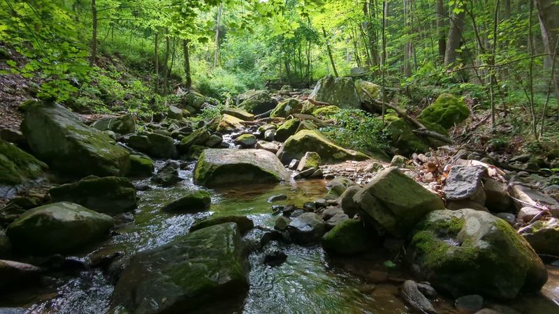
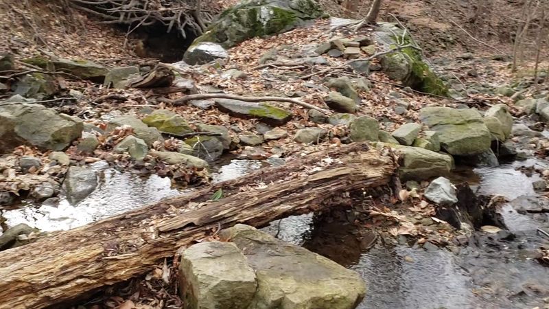
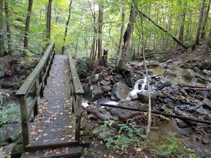
Stream Crossings Along the Way
One of the more memorable parts of hiking through this preserve is crossing the streams. The trails require you to hop or step across water at multiple points, and the experience changes a lot depending on recent rainfall and the time of year you visit.
After heavy rain, the crossings can be genuinely tricky. One reviewer noted that the water crossings were difficult following wet weather because there was no dry path across the rocks.
Another reminded hikers to be careful not to slip when crossing, since the rocks can be slippery regardless of conditions.
During drier stretches, the crossings are manageable and even enjoyable, especially for kids who tend to find them the highlight of the whole trip. A family that brought along a five-year-old and a three-year-old reported that both children handled the hike well, stream crossings included.
The key is checking recent weather before you go and wearing boots that can handle getting a little wet without completely soaking through. The crossings add character to the hike rather than making it feel like an obstacle course.
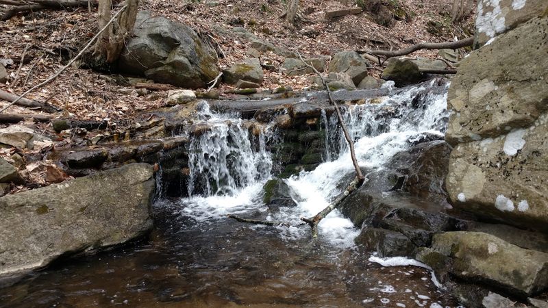
The Waterfall Worth Finding
There is a waterfall in this preserve, and finding it feels like a small reward for paying attention to the trail. It does not announce itself from a distance.
One reviewer described following the sound of water until the waterfall appeared, which is a fair summary of how the discovery tends to happen.
The waterfall sits near the river along the gorge section of the trail, and it is accompanied by boulders and a clear stream that makes the surrounding area worth pausing at for a few minutes. Several reviewers specifically mentioned the waterfall as a highlight, with one noting that the combination of waterfalls, boulders, and the view from the ridge made the whole hike feel complete.
One local hiker noted in a recent update that access to the waterfall and dam area near the Musconetcong River had been blocked as of late 2025, so it is worth checking current trail conditions before visiting to confirm what is accessible. The waterfall has been a beloved feature of this preserve for years, and many regular visitors are hopeful that access will be restored.
When it is open, it is not something you want to walk past without stopping.
Ruins of the Old Paper Mill
History shows up in unexpected places on this trail. Along the river, the remains of an old paper mill sit partially intact, and passing by them adds a layer of context to the landscape that purely natural parks often lack.
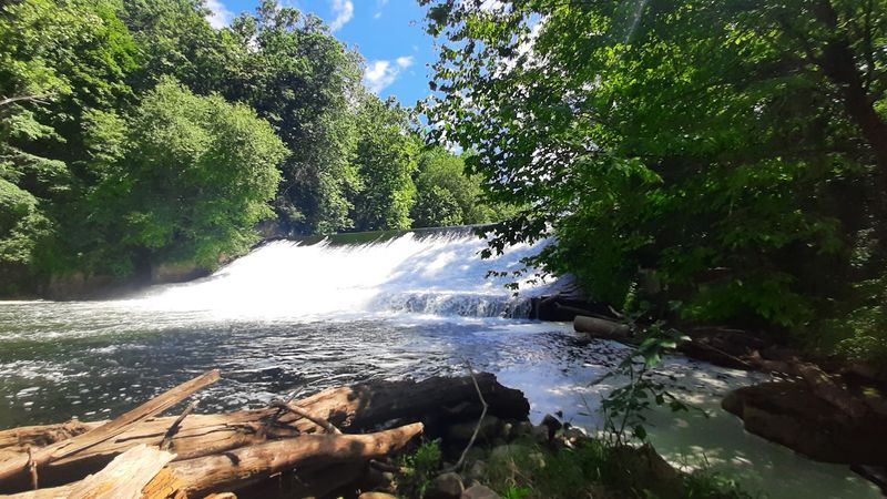
The mill operated along the Musconetcong River during an era when the waterway powered industrial operations throughout the region.
One reviewer mentioned the remains of the paper mill alongside an old dam as two of the most interesting features of the full loop hike. The ruins are not heavily marked or interpreted on the trail, so they tend to catch hikers by surprise when they appear through the trees near the water.
A long-time local visitor expressed genuine affection for the paper mill in a recent review, noting its loss of accessibility with some regret and hoping the area would be developed into something meaningful given how special the location is. The mill ruins are a reminder that this gorge was not always a quiet nature preserve.
People lived and worked along this river, and the stones they left behind are still here, slowly being reclaimed by the surrounding forest.
The Old Train Trestle and Tow Path
The white trail near the old train trestle off the tow path is one of the sections that long-time visitors to this preserve mention with particular enthusiasm. The trestle itself is a structural remnant of an earlier era of transportation in the region, and the tow path alongside the river has its own quiet history tied to canal-era commerce.
The climb near the trestle is steep enough that one local reviewer specifically called it out as a workout and warned that coming back down requires just as much care as going up. A lot of hikers, they noted, miss this portion entirely, which means those who do seek it out tend to have the area to themselves.
The tow path section offers a different kind of terrain compared to the rocky ridge trails. It runs closer to the water and at a lower elevation, giving a river-level view of the gorge that the upper trails do not provide.
Moving between these different trail personalities within a single hike is one of the things that makes Musconetcong Gorge feel like more than a simple loop through the woods. The variety keeps the experience interesting from start to finish.
Views from the Ridge
The upper portions of the teal trail reward the climb with open ridgeline views that look out over the gorge and the surrounding forested valley. Getting up there takes effort, but the payoff is a perspective on the landscape that is hard to find anywhere else in this part of New Jersey.
One reviewer who came from Monmouth County, an area with virtually no rocky terrain, described the views from the top as beautiful and said the boulders and ridge scenery made the trip worth every bit of the climb. Another noted that early spring, before the leaves fill in, offers the widest sightlines because the bare trees open up the view considerably.
The ridge also gives you a better sense of the gorge’s scale. From the trail level near the river, the gorge feels intimate and close.
From the ridge above, the full shape of the valley becomes clear, and the Musconetcong River looks like a thin line threading through the trees below. Both perspectives are worth having, which is why doing the full loop rather than a short out-and-back tends to be the more satisfying choice for most hikers.
How Difficult Is This Hike, Really
The honest answer is that difficulty depends almost entirely on which trails you choose and how long you make the hike. The preserve accommodates a wide range of fitness levels, which is part of why it attracts both casual walkers and more experienced hikers on the same weekend.
The shorter blue and orange loop is manageable for most people and has been completed by hikers with young children, including one family that brought a five-year-old who handled it without complaint. The full loop covering all the color trails is more demanding, and a 6.7-mile out-and-back version is listed by one reviewer as moderate to difficult due to the terrain.
The steepest sections are on the teal trail near the gorge and the white trail near the trestle. Both involve real elevation gain and require some care on the descent.
Trekking poles help, and one reviewer specifically recommended them. The trail is not overly challenging in an extreme sense, but it is not a flat walk in the park either.
Most people find it sits comfortably in the moderate range, with a few moments that push toward difficult if you take on the full network.
What to Know About Trail Markings
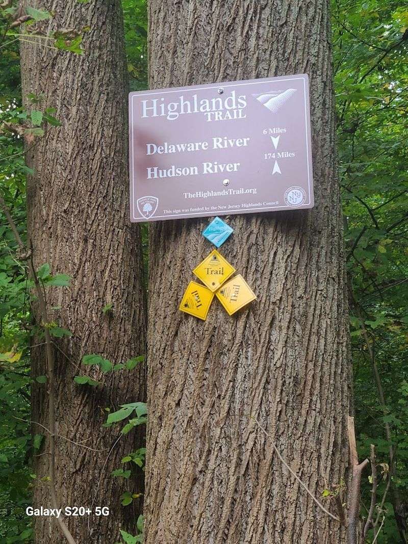
The trail system at Musconetcong Gorge is generally well marked, but a few sections have given hikers pause over the years. Multiple reviews mention that some blazes are worn, faded, or missing entirely in certain spots, which can make navigation tricky if you are not paying close attention.
The transition between the yellow trail and the white trail seems to be the area where confusion happens most often. One reviewer specifically warned about losing the trail markings after the yellow trail and suggested watching carefully for the white blazes.
Another hiker noted that their group took a wrong turn near the end of the route and had to climb off-trail to recover their position, though they described the unplanned detour as fun rather than stressful.
Downloading an offline trail map before you go is a practical move. The AllTrails app has routes for this preserve, and the county website also has maps available.
Going with someone who has hiked here before is another easy way to sidestep any navigational confusion. The trail system rewards hikers who pay attention, and the occasional unmarked junction is just part of the experience at a natural, lightly developed preserve like this one.
Best Times to Visit
Every season brings something different to this preserve, and experienced visitors tend to have strong opinions about when to come. Early spring gets mentioned as a great time because the bare trees open up sightlines along the ridge and the trails are less crowded before summer hiking season picks up.
Late summer and early fall are also popular. One hiker who visited on Labor Day reported perfect conditions: no bugs, no mud, and good weather throughout.
Fall brings color to the forest canopy, and the ridge views become even more worthwhile when the leaves turn.
Winter hiking is entirely possible here, as one reviewer demonstrated with a December trip in 36-degree temperatures, though wet leaves on rocky terrain add to the challenge. The one condition most reviewers agree to avoid is the period right after heavy rain.
The stream crossings become significantly harder, the rocks get slippery, and the trail surface turns unpredictable. Dry weather in any season is the safest bet.
The park opens at 8 AM daily, and arriving closer to that time on weekends helps with the limited parking situation before the lot fills up around mid-morning.
Wildlife, Plants, and What Grows Here
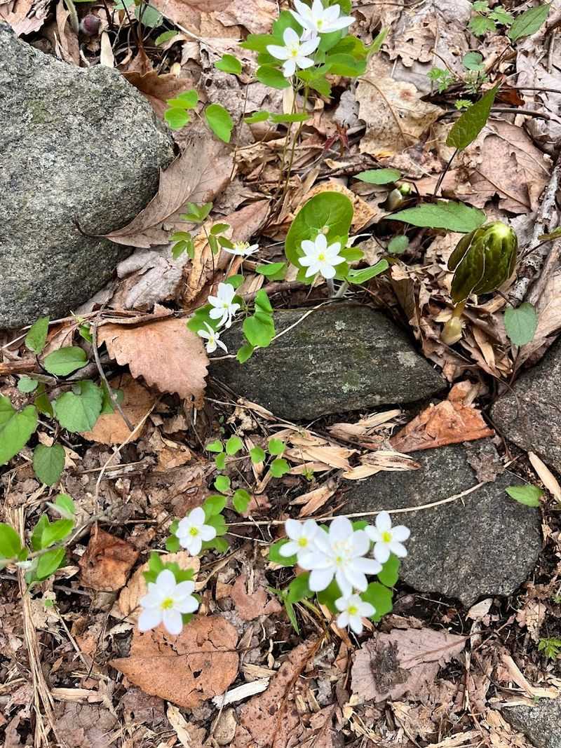
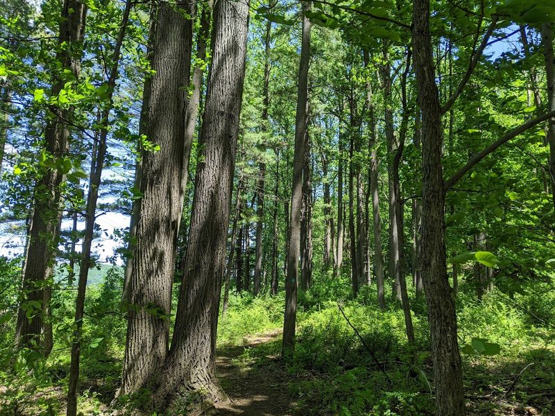
The preserve supports a healthy mix of plant and animal life typical of the New Jersey Highlands and Ridge and Valley region. The forest is a mix of deciduous hardwoods, with oaks, maples, and birches making up much of the canopy.
Ground cover varies by section, with ferns and mosses appearing near the wetter, lower areas close to the river.
One reviewer flagged poison ivy as something to watch for on the trail, which is a fair heads-up for anyone hiking with kids or in shorts. Staying on the marked trail and being able to identify the plant before you go is a reasonable precaution.
The preserve also allows hunting in designated areas and seasons, which is noted on the county’s official information. Hikers visiting during hunting season may want to check the county’s schedule and consider wearing bright colors as a basic safety measure.
Beyond that, the wildlife presence here is typical of a well-preserved river corridor: birds, small mammals, and the occasional deer are common. The Musconetcong River itself supports fish populations, and the gorge corridor provides habitat continuity that benefits species moving through the larger landscape.
Why This Place Keeps Drawing People Back
A 4.6-star rating from 179 reviews is not something a place earns by accident. The people who have hiked Musconetcong Gorge Preserve tend to come back, and they tend to bring others with them.
The combination of accessible location, varied terrain, historical features, and the river itself creates a package that is hard to replicate at a single spot in this part of the state.
One reviewer who identified as a local said this has always been a favorite, which is the kind of endorsement that carries real weight. Another called it a great hike for the dog, while a separate family brought children ranging from toddlers to teenagers and reported that everyone had a good time.
The trail network is flexible enough to match different energy levels on different days.
What keeps drawing people back is probably the combination of challenge and reward. The trail asks something of you, and then it delivers: a waterfall, a gorge view, a river you can sit beside, and ruins that make you curious about the past.
That mix of effort and payoff is what turns a single visit into a habit, and it is exactly what Musconetcong Gorge Preserve has been quietly offering for years.


