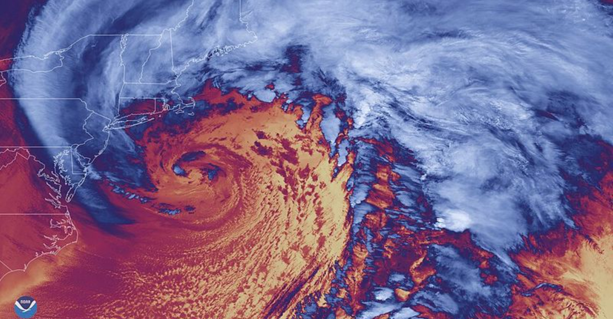
Just days after a deadly coast to coast winter blast, another powerful system is brewing off the Atlantic. You can feel the urgency as forecasters watch a low pressure area that could rapidly intensify into a bomb cyclone.
The exact track will determine who gets heavy snow, wind, or coastal flooding, but the window for preparation is now. Read on for what to know, what to expect, and what to do before the weekend hits.
Just days after an expansive and deadly winter storm carved a path across more than 2,000 miles, meteorologists are tracking a fresh low pressure system offshore. Guidance shows a tight pressure gradient forming over the Gulf Stream, creating a corridor for rapid deepening.
If the core strengthens and the track tucks close to the coast, you could see a swift shift from calm to punishing conditions within hours.
Forecasters are weighing ensemble scenarios that place the heaviest snow band from the Mid Atlantic into New England, with coastal areas at risk of wind driven power disruptions. While the upcoming system is unlikely to match the breadth of the last outbreak, its timing will stress recovery.
Downed lines, strained road crews, and lingering supply challenges could amplify impacts even at moderate intensity.
Your best move is to monitor forecast updates and prepare for changing conditions. Charge devices, restock essentials, and plan alternate travel windows.
If you live near tidal zones, keep an eye on surge forecasts and tide cycles, since a closer track can elevate flood risk despite modest snowfall inland.
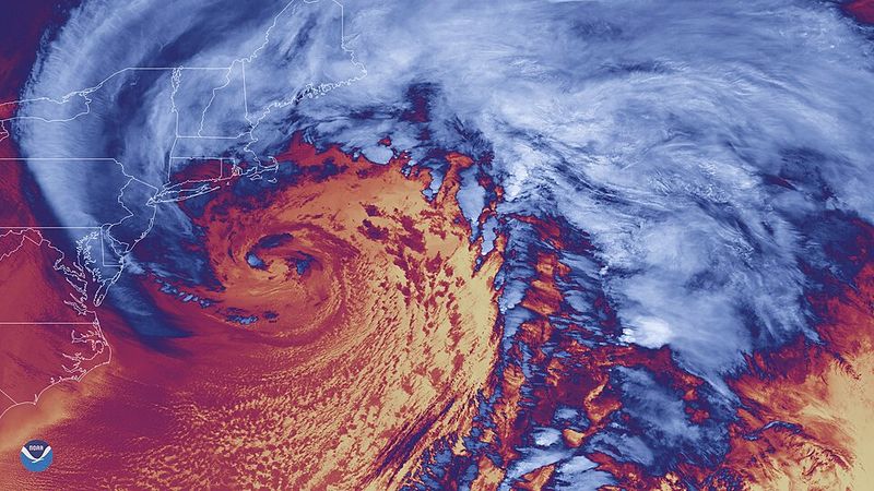
A nor’easter draws its punch from strong temperature contrasts and onshore winds, channeling Atlantic moisture into cold continental air. When central pressure plunges quickly, meteorologists call it a bomb cyclone, signaling faster strengthening and broader impacts.
For you, that can translate into heavier snow bands, stronger gusts, sharper pressure falls, and abrupt transitions from rain to heavy snow.
This weekend’s setup features lingering Arctic air and a developing offshore low. If the system phases with upper level energy, pressure drops can accelerate, tightening isobars and boosting wind.
That means whiteout conditions inland are possible where temperatures hold, while coastal zones face pounding surf and pockets of inundation at high tide.
Storms like this hinge on track and timing more than hype. A 50 mile wobble can flip outcomes from slushy mixes to crippling snowfall.
Stay flexible with travel plans, watch mesoscale updates, and use reliable sources that detail snow ratios, wind gust potential, and coastal flooding windows tailored to your location.
Models suggest a closer coastal track would push heavier precipitation and stronger winds into the I 95 corridor, especially from North Carolina through New England. Coastal residents should prepare for gusts capable of toppling branches onto lines, choppy nearshore waters, and minor to moderate flooding where surge meets high tide.
Inland, colder pockets could lock in snow, with sharp gradients over short distances.
The recent historic storm left a patchwork of outages and debris, so even a moderate nor’easter can compound recovery. If you depend on medical devices, ensure backup power and charged batteries.
Hazards often peak overnight, so secure outdoor items, clear drains, and avoid parking in low lying lots that flood first.
Travelers should build slack into itineraries for airports in New York, Boston, and Philadelphia. Expect deicing delays, runway snow bursts, and highway spinouts when bands pivot.
Keep a winter kit in your car, check road cameras, and watch local advisories for sudden closures tied to visibility and downed lines.
Preparation buys time when storms move fast. Start with basics you can control today: charge phones, test flashlights, and refill prescriptions.
Stock easy meals, water, and pet supplies for at least 48 to 72 hours, and set weather alerts on a trusted app or NOAA radio so you get push notifications as watches transition to warnings.
For homes near the coast, move vehicles to higher ground and review local tide tables. Sandbag low entries if your community provides them, and clear gutters so runoff does not back up.
Inland, check your snow shovel, ice melt, and fuel for generators, using outdoor only placement to prevent carbon monoxide risks.
Travel plans need flexibility. Consider shifting departures to daylight, when crews can plow and visibility tends to improve.
Share itineraries, keep your tank at least half full, and pack blankets, chargers, and traction aids. A few hours of prep now can spare you days of frustration if the track nudges closer and conditions deteriorate quickly.


