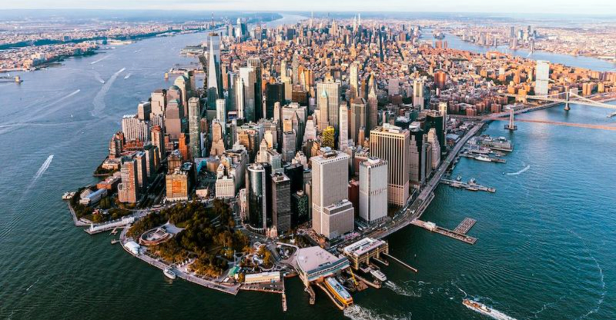
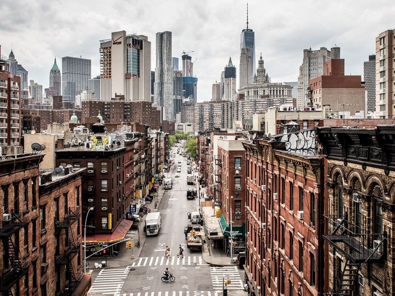
Something strange is happening beneath the streets of New York City. The ground under the Big Apple is slowly sinking, putting buildings and infrastructure at risk. Scientists have discovered that most of the city is subsiding at a rate of 1-2 millimeters per year. While this might sound small, over decades it can cause serious problems for the city’s buildings, roads, and subway systems.
A Quiet Crisis Beneath the City
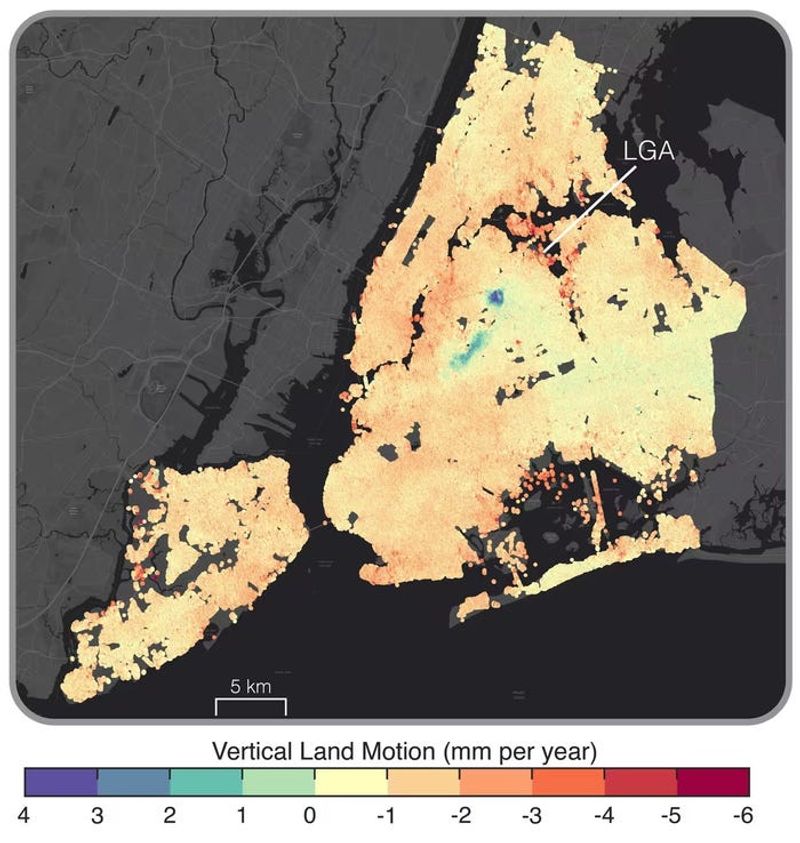
The ground beneath New York City isn’t as solid as it seems. Using special radar satellites, scientists can now measure tiny changes in ground level across the entire city. What they’ve found is troubling: almost 98% of NYC is sinking.
This isn’t a sudden collapse but a gradual process happening millimeter by millimeter each year. The concrete jungle’s massive weight is literally pushing down on the earth beneath it. Buildings constructed decades ago weren’t designed with this slow-motion threat in mind.
Over time, this subtle sinking creates stress on foundations, water pipes, and subway tunnels. The oldest structures face the greatest danger as they’ve already endured years of this invisible pressure. Even small changes in ground level can cause big problems when multiplied across thousands of buildings.
The Technology That Exposed It
Scientists couldn’t see New York sinking until recent advances in satellite technology changed everything. A technique called Interferometric Synthetic Aperture Radar (InSAR) now lets researchers measure ground movements smaller than a grain of rice.
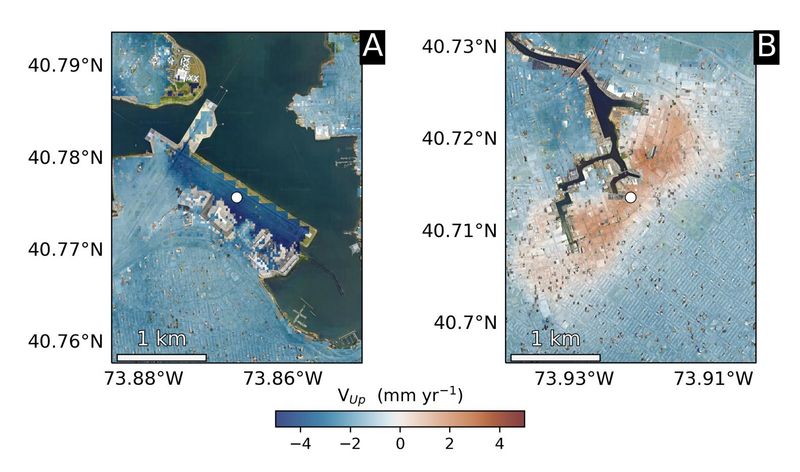
Satellites orbiting Earth beam radar signals down to the city and measure how long they take to bounce back. When they compare these measurements over months and years, they can create detailed maps showing which areas are sinking fastest. The colorful maps reveal a patchwork of stability and subsidence across all five boroughs.
Before this technology, engineers had to rely on occasional ground surveys that might miss the big picture. Now they can watch the entire city move in near real-time. This revolutionary approach has transformed our understanding of urban stability and revealed problems hidden in plain sight.
The Hotspots: Airports, Stadiums, and Soft Ground
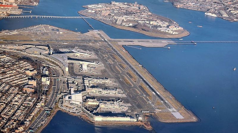
Not all parts of New York are sinking at the same rate. LaGuardia Airport’s main runway is dropping nearly four millimeters yearly – more than twice the city average! Arthur Ashe Stadium in Queens sinks even faster at about 4.6 millimeters annually, explaining why engineers designed its roof to be unusually lightweight.
Areas built on artificial fill or reclaimed marshland show the fastest subsidence. When developers created new land by dumping soil and debris into water, they created perfect conditions for future sinking. Lower Manhattan, parts of Brooklyn waterfront, and sections of Staten Island face similar challenges.
The uneven sinking creates particular problems for long structures like subway tunnels and water mains that need consistent support along their entire length. As one section drops faster than another, pipes can crack and tracks can warp, requiring constant maintenance.
Why the Land Is Settling
Groundwater extraction ranks as the primary villain in New York’s sinking saga. When water gets pumped from underground aquifers, the soil above compacts like a sponge drying out. Historical pumping for water supply and industrial uses has left voids that slowly collapse under pressure.
The sheer weight of the city itself compounds the problem. Manhattan alone holds about 1.6 trillion pounds of buildings pressing down on relatively soft ground. Subway vibrations and constant traffic create micro-movements that help soil particles settle more densely over time.
Natural processes play a role too. Some types of clay soil continue compacting for centuries after being disturbed. Climate change adds another wrinkle as changing rainfall patterns affect soil moisture and stability. The combination of these factors means New York’s foundation is constantly shifting beneath its iconic skyline.
Risks to Structures and Infrastructure
Building damage often starts subtly – a crack here, a slightly tilted floor there. As subsidence continues, these minor issues can escalate into serious structural problems. Experts estimate around 29,000 buildings across major U.S. cities, including many in NYC, sit in high-risk subsidence zones.
The city’s century-old water and sewer systems face particular danger. Cast iron pipes can snap when ground support changes, leading to costly sinkholes and water main breaks. Subway tunnels engineered for stable ground may develop alignment problems that slow trains and increase maintenance costs.
Sinking amplifies flooding risks too. Every millimeter the city drops is effectively the same as sea levels rising that amount. Low-lying neighborhoods already vulnerable to storm surges face a double threat as the land sinks while oceans rise. This combination could turn once-rare flooding into a regular occurrence for parts of New York’s coastline.


