Everyone knows about Norway’s famous fjords and northern lights, but the real magic happens in the places tourists haven’t discovered yet. Scattered across this stunning country are islands, villages, and scenic routes that feel like your own private discovery.
These fifteen spots offer the kind of authentic Norwegian experiences that’ll make your friends seriously jealous when you show them your photos later.
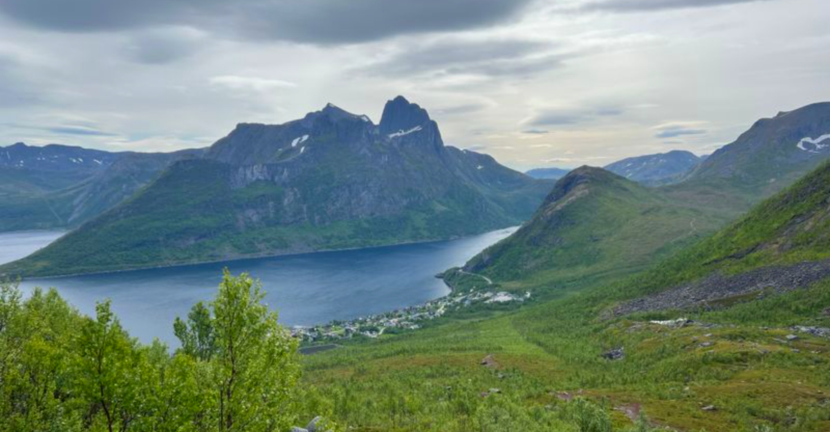
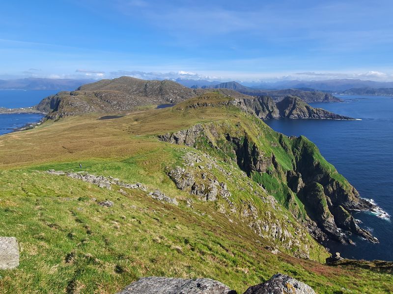
The Vega Archipelago
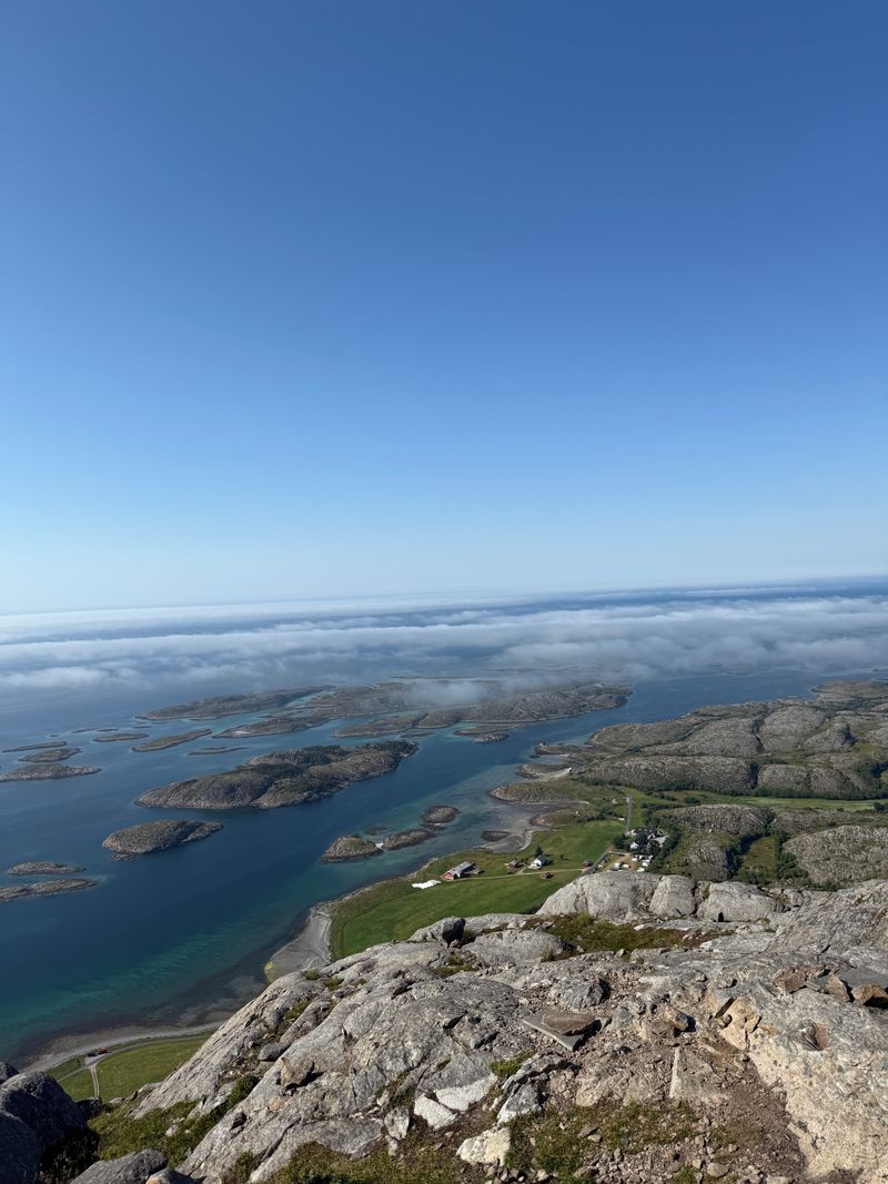
The Vega Archipelago earned its UNESCO badge thanks to a fishing culture that’s been going strong for over 1,500 years. Most tourists zoom past on their way to more famous destinations.
I paddled through these waters last June and didn’t see another kayak for three hours. The silence was almost spooky.
Local fishing villages dot the landscape, where life still revolves around the sea and the seasons.
Eider ducks nest here in huge numbers, and islanders have been harvesting their down for centuries using traditional methods. You can visit working farms and learn about this unique partnership between humans and birds.
The islands connect via bridges and ferries, making island-hopping surprisingly easy.
Summer brings endless daylight and calm waters perfect for kayaking. Winter transforms the archipelago into a moody, wave-battered wonderland.
Pack layers because the weather changes faster than your mood on a Monday morning. Rent a cabin on one of the outer islands for the full remote-living experience.
Træna
Reaching Træna feels like traveling to the edge of the world map. This tiny archipelago sits far off the Helgeland coast, accessible only by ferry or boat.
Roads? Barely any.
Traffic jams? Not in this lifetime.
About 450 people call these windswept islands home, living a lifestyle shaped entirely by the sea. Fishing remains the main industry, just as it has been for generations.
The community hosts an annual music festival that draws visitors from across Norway, transforming the quiet islands into a temporary cultural hotspot.
Walking around Træna, you’ll notice how everything connects to the ocean. Boats outnumber cars.
Weather forecasts matter more than celebrity gossip. Locals know each other by name, and visitors get treated like long-lost relatives.
The islands offer spectacular hiking with views that stretch forever across the Norwegian Sea. Seabirds nest in the cliffs, and the midnight sun creates surreal golden hours.
Bring cash because card machines can be spotty. Book accommodation months ahead during festival season.
Otherwise, you might find yourself camping under those endless summer skies.
Myken Lighthouse
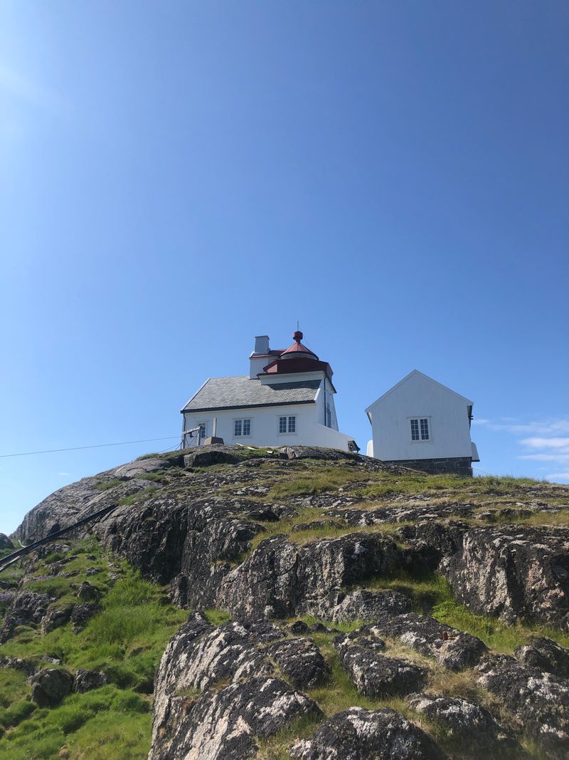
Sleeping in a lighthouse sounds romantic until you remember they’re usually stuck on barren rocks in the middle of nowhere. Myken Lighthouse delivers exactly that kind of glorious isolation.
Built in 1918, this automated beacon now welcomes guests looking for the ultimate unplugged escape.
The lighthouse sits on its own tiny island, surrounded by nothing but ocean and sky. Wind howls around the tower.
Waves crash against the rocks. Your phone signal?
Forget about it.
Former lighthouse keeper quarters have been converted into surprisingly cozy guest rooms. You’ll cook your own meals in the shared kitchen and spend evenings watching the sun dip toward the horizon.
The island also produces a small-batch whisky that’s gained cult status among spirit enthusiasts.
Summer brings seabirds and relatively calm seas. Winter means dramatic storms and serious solitude.
Book well ahead because rooms fill up fast despite the remote location. Bring all your food from the mainland.
Pack entertainment that doesn’t require WiFi. The ferry ride out takes about an hour, weather permitting.
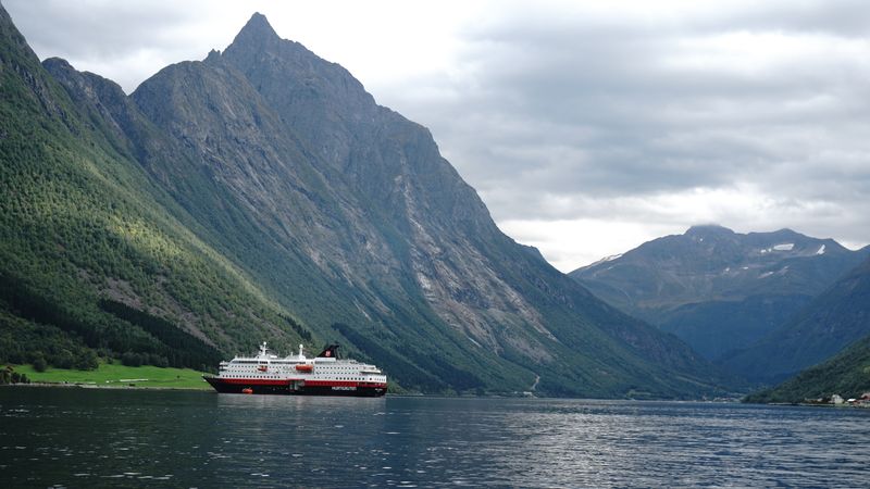
Helgelandskysten Scenic Route (Coastal Highway FV17)
Road trips usually mean highways and rest stops. Norway’s FV17 throws that playbook out the window.
This coastal route stretches for 433 kilometers, making it the longest National Tourist Route in the country. Ferries form part of the journey, turning your drive into an island-hopping adventure.
The highway hugs the Helgeland coast, weaving between mountains and sea. Every turn reveals another postcard view.
Architectural viewpoints pop up along the route, designed specifically for pulling over and soaking in the scenery.
I spent five days driving this route and could’ve used ten. Small fishing villages offer perfect lunch stops.
Islands connected by bridges create natural detours. The constantly changing landscape means you’ll never get bored.
Ferry schedules dictate your pace, which actually makes the journey more relaxing. You can’t rush when you’re waiting for a boat.
Summer provides the longest daylight hours for exploring. Autumn brings dramatic weather and fewer tourists.
Download offline maps because cell coverage gets patchy. Budget extra time because you’ll want to stop constantly for photos.
Senja Scenic Route
Senja looks like someone photoshopped mountains onto a coastline and cranked the drama slider to maximum. The official scenic route runs between Botnhamn and Gryllefjord, with short detours that pack serious visual punch.
Sharp peaks drop straight into the sea, creating landscapes that seem almost fake.
Architectural viewpoints dot the route, offering designed spaces to appreciate the wild scenery. The road twists and climbs, revealing new perspectives around every bend.
Mountains named Segla and Hesten provide iconic backdrops for photos that’ll dominate your social media for months.
Local fishing villages cling to the coastline, their colorful houses bright against gray rock. Summer brings wildflowers and midnight sun.
Winter delivers northern lights and snow-covered peaks. The route stays open year-round, though winter driving requires proper tires and confidence.
Plan at least a full day to drive the route properly. Rushing through defeats the purpose.
Pack snacks because restaurants are sparse. Hiking trails branch off from several viewpoints if you want to stretch your legs.
The northern lights season runs from September to April, making Senja a prime aurora hunting ground.
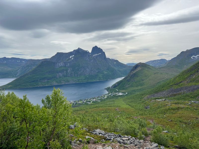
The Hjørundfjord
Fjords get all the tourist attention in Norway, but Hjørundfjord somehow missed the memo. Tucked between jagged Sunnmøre Alps peaks, this fjord delivers cinematic scenery without the tour bus crowds.
Tiny communities scatter along the shoreline, connected by narrow roads that wind through the mountains.
The fjord cuts 35 kilometers inland, surrounded by peaks that shoot up over 1,500 meters. Waterfalls tumble down cliff faces.
Eagles circle overhead. The water reflects the mountains like a mirror on calm days.
I stayed in a small village here and had the hiking trails almost to myself. Local farms offer accommodation and home-cooked meals.
Kayaking lets you explore the fjord at water level, gliding past sheer rock walls. The area remains refreshingly uncommercialized.
Summer provides the best weather for outdoor activities. Autumn colors paint the mountainsides in orange and gold.
Winter brings serious snow and limited access to higher elevations. Book accommodation directly with farms and guesthouses for the most authentic experience.
Rent a car because public transport options are limited. Bring hiking boots and waterproof gear regardless of the season.
Varanger Peninsula
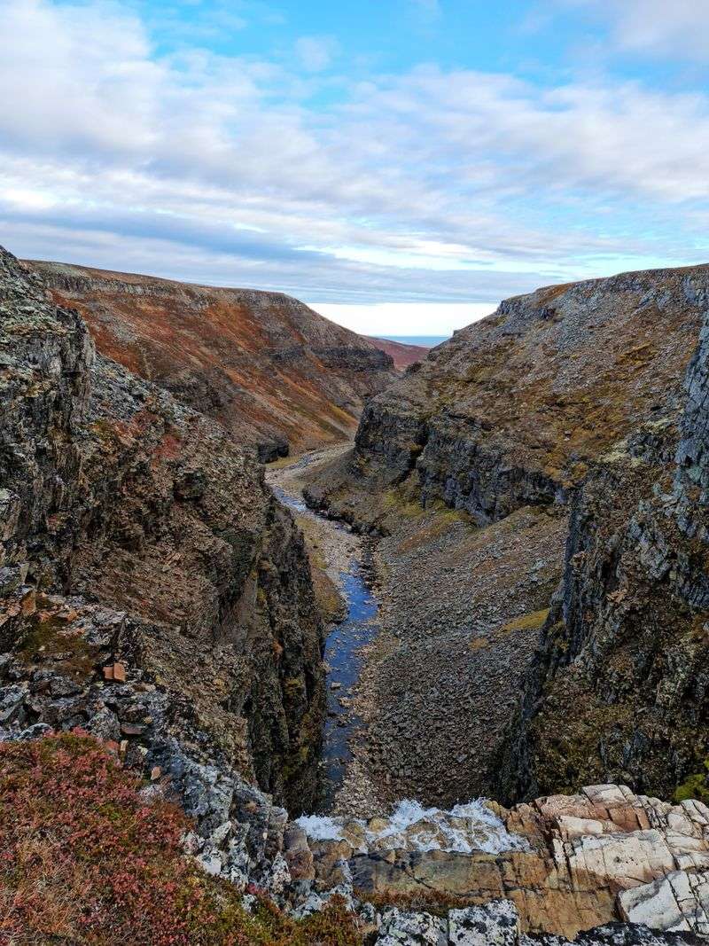
Mainland Norway’s northernmost point feels like a different planet. The Varanger Peninsula stretches into the Barents Sea, hosting the only true tundra on Norway’s mainland.
Birders from around the world make pilgrimages here, binoculars in hand and species checklists ready.
Over 200 bird species have been recorded in the area. Arctic species that nest in Siberia stop here during migration.
Puffins, guillemots, and razorbills crowd the coastal cliffs. King eiders bob in the bays.
The landscape shifts from barren tundra to rocky coastline within kilometers. Sami culture remains strong here, with reindeer herding still practiced traditionally.
Small fishing villages dot the coast, their brightly painted houses standing out against the stark terrain.
Summer brings the midnight sun and peak birding season. Winter means polar nights and potential northern lights, though temperatures drop seriously low.
The peninsula stays relatively dry despite its northern location. Pack serious cold-weather gear even in summer.
Join a guided birding tour to maximize your species count. Vardø and Vadsø serve as good base towns.
The drive around the peninsula takes a full day if you stop frequently.
Runde
Half a million seabirds can’t be wrong about real estate. Runde island hosts one of Norway’s most spectacular bird colonies, with cliffs that transform into feathered apartment buildings each breeding season.
Puffins steal the show with their colorful beaks and clumsy landings, but they share the space with countless other species.
The island connects to the mainland via an undersea tunnel, making access surprisingly easy. Hiking trails lead to viewpoints overlooking the nesting cliffs.
Bring binoculars because the birds nest at various heights, creating a vertical city of wings and calls.
Peak season runs from April through August when birds return to nest and raise chicks. Puffins arrive in April and leave by mid-August.
The cliffs buzz with activity as birds come and go, feeding their young and defending their territories.
Guided boat tours circle the island for water-level views of the cliffs. Hiking to the top viewpoints takes about an hour from the parking area.
Weather can change rapidly, so pack layers and rain gear. The island also offers diving opportunities around historic shipwrecks.
Accommodation on Runde books up fast during peak birding season.
Jæren Scenic Route
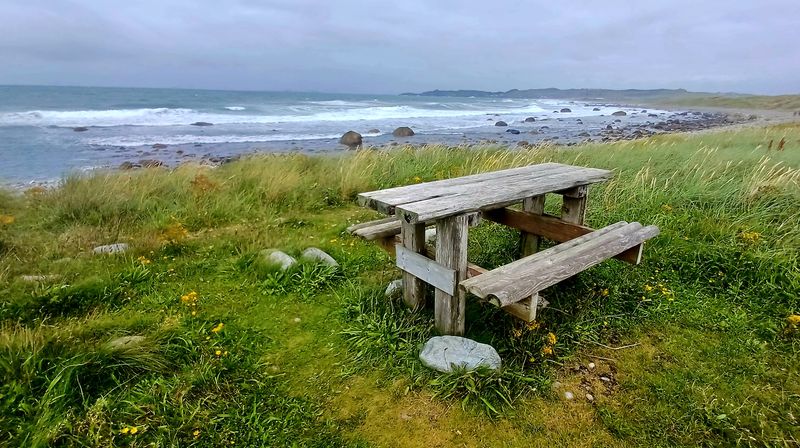
Norway doing beaches feels unexpected. Jæren breaks the Norwegian landscape stereotype completely.
Instead of mountains and fjords, this official scenic route serves up sandy beaches, rolling dunes, and horizons that stretch forever. Lighthouses punctuate the coastline like exclamation points.
The route runs from Bore to Flekkefjord, hugging the southwestern coast. Flat terrain means easy cycling if you’re into pedal-powered tourism.
Wide sandy beaches attract surfers when conditions align. Historic lighthouses offer museums and viewpoints.
Agriculture dominates the inland areas, with farms stretching across the gentle landscape. The region produces much of Norway’s vegetables and grain.
Stone walls built centuries ago still divide the fields, creating geometric patterns across the countryside.
Summer brings the warmest weather and longest beach days. Autumn storms create dramatic wave action and moody photography opportunities.
Winter can be harsh and windy. The route includes several architectural viewpoints designed by contemporary Norwegian architects.
Stop at local farm stands for fresh produce. Visit Obrestad Lighthouse for panoramic coastal views.
The area remains surprisingly uncrowded even during peak summer months.
Gaularfjellet Scenic Route
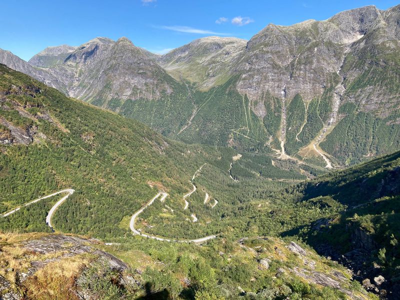
Hairpin turns make some drivers nervous and others giddy. Gaularfjellet delivers enough switchbacks to satisfy the latter group.
This mountain pass connects Moskog and Balestrand, climbing through landscapes that shift from valley farms to alpine heights. Waterfalls thunder down cliff faces at multiple points along the route.
The road reaches 800 meters elevation, offering views across valleys and peaks. Modern viewpoints provide safe spots to stop and gawk.
The route typically stays open from May to October, closed during winter due to snow.
Utigardsfossen waterfall drops 225 meters near the summit, creating a spectacular roadside attraction. Architectural viewpoints frame the falls and surrounding landscape.
The relatively short route packs impressive scenery into just 50 kilometers.
Drive slowly because the views demand attention and the curves require focus. Summer provides the most reliable weather and full access to hiking trails.
Early autumn brings fall colors to the birch forests. Check road conditions before setting out because weather can close the pass unexpectedly.
The route sees far less traffic than more famous mountain passes. Combine with other scenic routes for an epic road trip loop through western Norway.
Vettisfossen (via Utladalen)
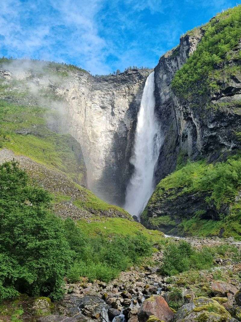
Earning your waterfall makes it taste sweeter. Vettisfossen requires a hike up Utladalen valley, keeping casual tourists away and rewarding those willing to walk.
The payoff? Norway’s highest protected waterfall, dropping 275 meters in a single free-fall plunge.
The hike from Hjelle takes about three hours round trip, following a well-maintained trail through the valley. The path stays relatively flat for most of the journey, saving the elevation gain for the final approach.
Valley walls rise dramatically on both sides, creating a spectacular corridor.
Vettisfossen appears gradually as you hike, growing larger with each step. The falls thunder down a cliff face, creating mist and noise that intensify as you approach.
Protected status means the water flow stays natural, not diverted for hydroelectric power like many Norwegian waterfalls.
Summer offers the best hiking conditions and highest water flow from snowmelt. Autumn brings lower water levels but spectacular colors.
The trail can get muddy after rain. Wear proper hiking boots with good traction.
Bring snacks and water for the journey. The valley also offers longer hiking routes for those wanting more adventure.
Røros
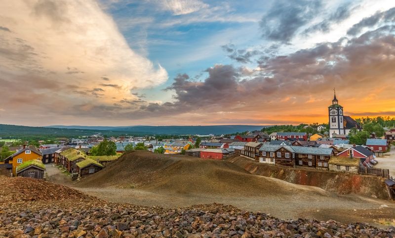
Wooden towns usually burn down eventually. Røros missed that memo for over 300 years.
This mining town earned UNESCO status thanks to remarkably preserved architecture and a copper mining history stretching from 1644 to 1977. Walking the streets feels like stepping into a historical drama set.
Colorful wooden buildings line the streets, their traditional architecture protected by heritage laws. The church dominates the town center, built to accommodate the mining community.
Slag heaps from centuries of copper production still mark the landscape around town.
Mining shaped everything here from architecture to culture. The company town structure meant the mining operation controlled housing, stores, and social life.
Today, museums tell the story of miners who worked underground in harsh conditions. You can tour the old mines and experience the underground world firsthand.
Winter transforms Røros into a snow-covered wonderland, with temperatures regularly dropping below minus 30 Celsius. Summer brings milder weather and cultural festivals.
The town hosts a winter market that draws visitors from across Scandinavia. Book accommodation ahead during market weekends.
Try local specialties like smoked reindeer. Explore the surrounding cultural landscape, also part of the UNESCO designation.
Rjukan–Notodden Industrial Heritage Site
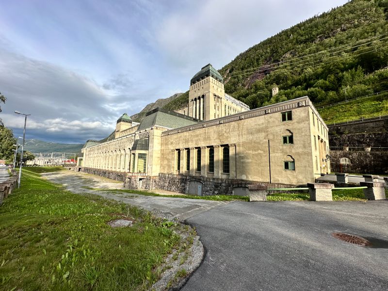
Waterfalls usually mean scenic photos. In Rjukan and Notodden, they meant industrial revolution.
This UNESCO site celebrates early 20th-century innovation, when Norwegian engineers harnessed waterfall power to produce fertilizer. The entire system remains largely intact, from power plants to worker housing.
Massive hydroelectric plants transformed waterfall energy into electricity. Factories used that power to produce nitrogen fertilizer through groundbreaking chemical processes.
Railways and cable cars transported materials and workers. Company towns housed the workforce.
The site spans both Rjukan and Notodden, connected by the heritage railway that once hauled fertilizer. Rjukan sits in a deep valley, famously dark in winter when mountains block the sun.
Engineers even installed a sun mirror on the mountainside to reflect light into the town square.
Museums explain the technical innovations and social history. You can tour power plants and factory buildings.
The Krossobanen cable car, originally built for workers, now carries tourists up the mountain. Winter brings serious cold and limited sunlight.
Summer offers the best conditions for exploring the sites. The area also features excellent hiking and rock climbing.
World War II history buffs know Rjukan for the heavy water sabotage operations.
Kongsberg Silver Mines
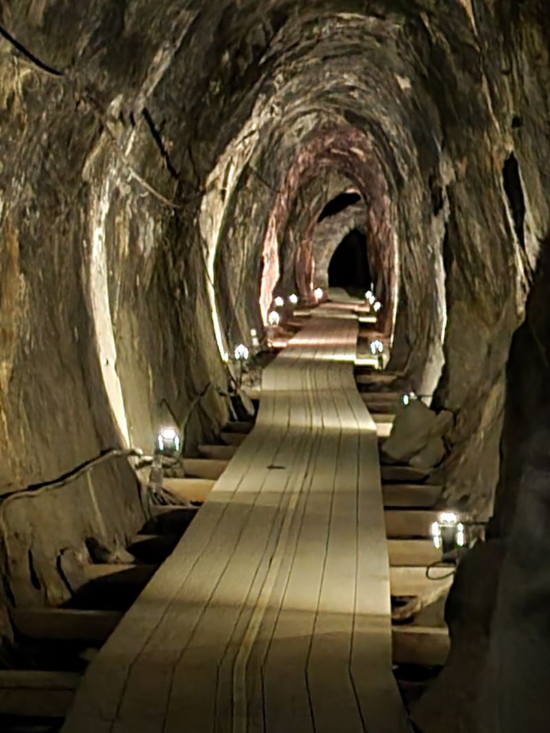
Going underground beats any virtual reality experience. The Kongsberg Silver Mines offer guided tours deep into the mountain, riding a mine train through tunnels carved centuries ago.
The Norwegian Mining Museum operates the King’s Mine visitor section near Saggrenda, providing a genuine underground adventure.
Silver mining put Kongsberg on the map in 1623, when two children supposedly discovered silver while herding goats. The town boomed, becoming Norway’s second-largest city at its peak.
Mining continued until 1957, extracting over 1,350 tons of silver.
Tours descend 342 meters below ground via mine train. The temperature stays around 6 degrees Celsius year-round, making warm clothing essential even in summer.
Guides explain mining techniques, working conditions, and the geology that created the silver deposits. Underground halls and tunnels reveal the massive scale of the operation.
Book tours in advance, especially during summer. Wear warm layers and closed-toe shoes.
The mine train ride adds adventure to the educational experience. Above ground, the mining museum provides historical context and displays of mining equipment.
The town itself features baroque architecture from its prosperous mining era. Kongsberg also hosts a jazz festival each summer.
Old Lærdalsøyri (Lærdal)
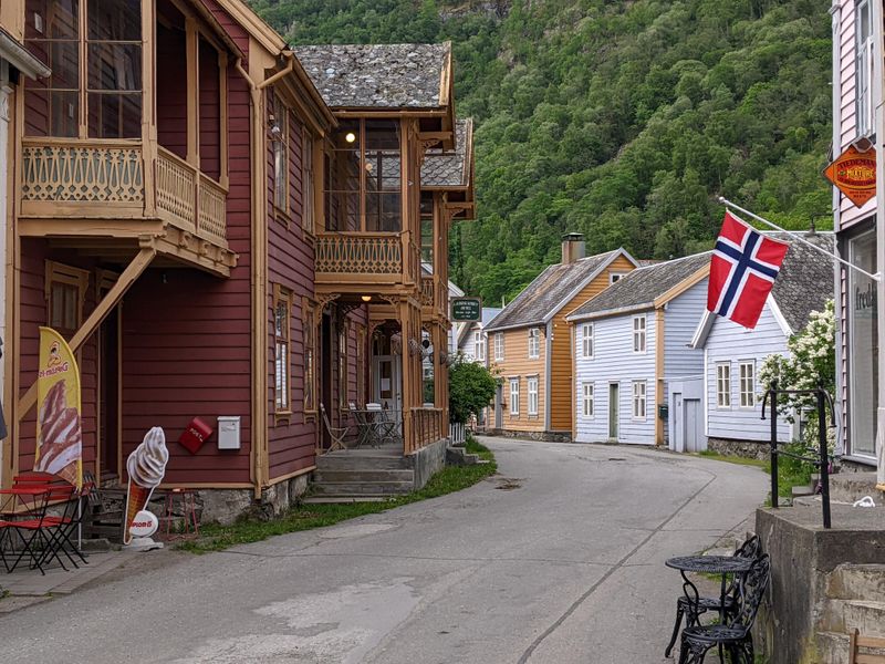
Time travel exists in Norway, apparently. Old Lærdalsøyri preserves 161 wooden buildings from the 18th and 19th centuries, creating a living museum where people actually live and work.
The protected settlement sits by the fjord, its traditional architecture remarkably intact despite the ever-present fire risk that destroyed so many Norwegian wooden towns.
Walking the narrow lanes between wooden houses feels surreal. Many buildings still serve their original purposes, housing shops, cafes, and residences.
The architectural style reflects prosperity from when Lærdal served as an important trading post and transportation hub.
A devastating fire in 2014 threatened the entire area, but firefighters managed to save most buildings. The close call highlighted the fragility of wooden heritage.
Today, strict preservation rules protect the settlement’s character while allowing it to function as a living community.
Small shops sell local crafts and products. Cafes offer coffee and waffles in historic settings.
The settlement feels most magical in evening light when tourists have left. Summer brings the most visitors and longest daylight hours.
The nearby Borgund Stave Church makes an excellent combination visit. Lærdal also serves as the western terminus of the world’s longest road tunnel, connecting to Aurland.


