New Jersey does not always get credit for its wild, rugged landscapes, but tucked away in Passaic County, there is a nature preserve that quietly earns that credit every single day. West Milford sits in the northern highlands of the state, far enough from the highway noise to feel like a different world entirely.
Here, a network of color-coded trails winds through forested ridges, past a reservoir, over rocky streams, and down to a waterfall that most people outside the area have never heard of. This preserve has been drawing hikers, dog walkers, and weekend explorers for years, and yet it still manages to feel like a local secret worth keeping.
The trails range from easy strolls to genuinely challenging climbs, which means there is something here for first-timers and seasoned hikers alike. Keep reading to find out exactly what makes this place so worth the trip.
Where Exactly This Preserve Sits
Apshawa Preserve is located at 4 Northwood Dr, West Milford, NJ 07480, nestled within the Highlands region of Passaic County in northern New Jersey. The preserve is managed through conservation efforts that have kept it largely undeveloped, which is a big part of its appeal.
West Milford itself is one of the largest townships in New Jersey by land area, and it is home to several protected natural spaces. Apshawa stands out among them because of the variety it packs into a relatively compact footprint.
The parking area is small and unmarked, so cars tend to cluster together loosely along the roadside. Arriving early on weekends is a smart move, especially during warmer months when the lot fills up faster than most people expect.
The preserve is open 24 hours a day, every day of the week, which gives hikers plenty of flexibility to plan their visit around their own schedule.
The Trail System Explained
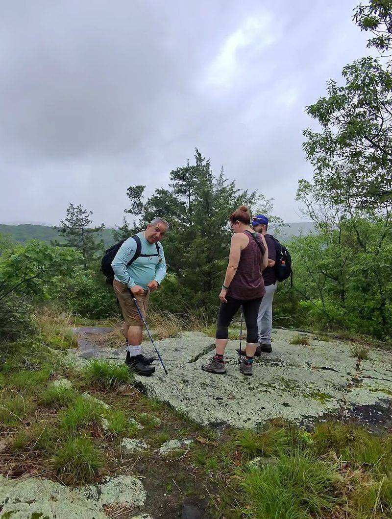
The trail system at Apshawa Preserve is built around a set of color-coded blazes painted directly onto trees. Blue, orange, green, red, and white trails each cover different terrain and connect to one another at various points throughout the preserve.
The blue trail is generally considered the main artery of the network, running about one mile from the parking area to the dam. From there, hikers can branch off onto white, green, or red trails depending on how much ground they want to cover.
A full loop of the preserve comes in at roughly 4.5 miles and takes most hikers between two and four hours depending on pace and stops. The trail markers have been updated in recent years, making navigation noticeably more reliable than it once was.
That said, carrying a downloaded map or using a GPS app on a phone is still a practical habit worth keeping before heading out.
What the Terrain Actually Looks Like
The trails at Apshawa are not flat. Rocky footing, tree roots, and elevation changes show up regularly across most of the color-coded routes, so this is not a place to wander in flip-flops or thin-soled sneakers.
The green and white trails carry the most significant elevation, with sections that climb steeply enough to get the heart rate up. The blue trail is comparatively moderate, making it the most accessible option for newer hikers or those bringing younger kids along.
Throughout the preserve, the forest floor shifts between dense canopy coverage and more open ridgeline sections. Rocky outcroppings appear along several of the higher trails, and the ground can get slippery after rain.
Hiking boots with ankle support are strongly recommended, especially for anyone planning to tackle the green or white routes. The terrain rewards preparation, and the views from the higher points make the effort feel entirely worth it on a clear day.
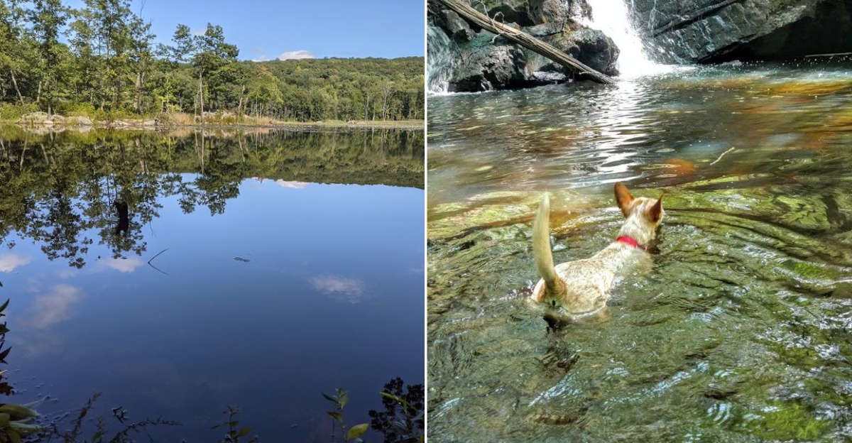
The Waterfall That Keeps People Guessing
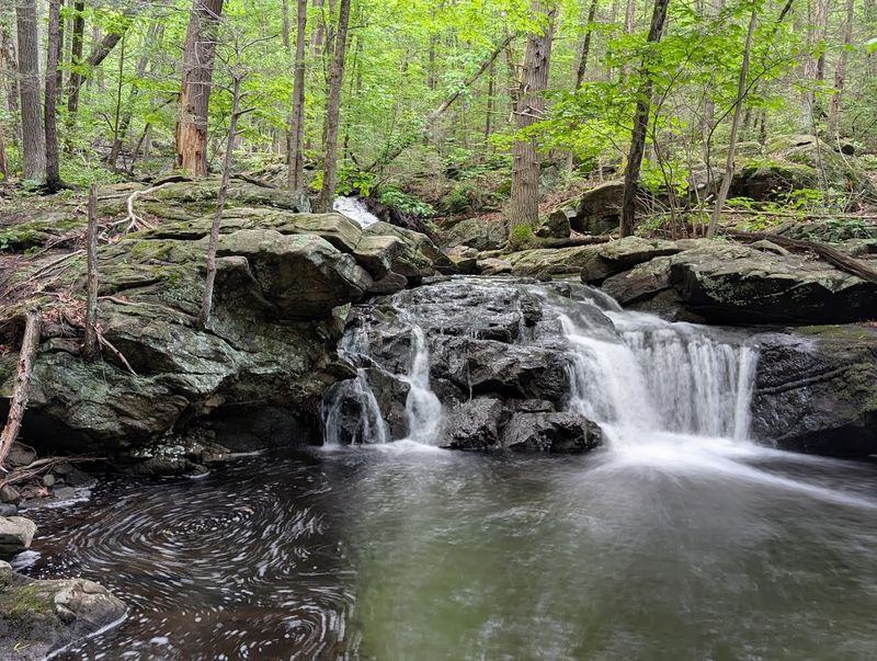
One of the most talked-about features of the preserve is a waterfall hidden along the trail network, and finding it is a genuine navigation challenge that has tripped up more than a few experienced hikers.
The key is in the route choice at a specific junction on the green trail. Turning left on green leads toward the waterfall, the ruins, and the summit.
Turning right on green takes hikers toward the reservoir instead, and the falls will likely be missed entirely without backtracking.
Water flow at the falls varies significantly with seasonal rainfall and drought conditions. During dry stretches, the flow can be extremely light.
After a wet spring or a few days of steady rain, the falls are considerably more dramatic. Either way, the surrounding rock formations and the dense forest framing the area make the spot worth visiting regardless of water volume.
Marking the junction clearly on a phone map before starting the hike saves a lot of confusion later.
The Ruins Hidden in the Woods
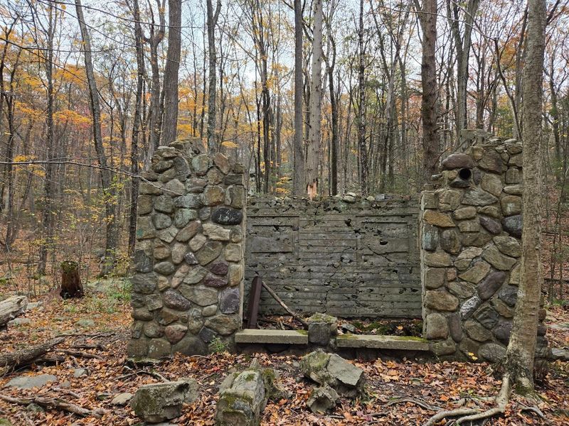
Scattered along the upper portion of the trail network are the remains of what was once a water tank structure. The ruins sit in a forested section of the preserve and have become one of the most talked-about highlights among regular hikers.
The stonework is old enough to be genuinely striking, especially given how quietly it sits among the trees with no signage drawing attention to it. The structure has been reclaimed by moss and surrounding vegetation over the years, giving it the kind of weathered presence that makes hikers stop and look twice.
Finding the ruins requires following the same left-hand turn on the green trail that leads to the waterfall, so both highlights tend to be visited on the same loop. The combination of the falls, the ruins, and the ridgeline views makes that particular route the most rewarding option in the preserve.
Hikers who skip it are missing the best part of what Apshawa has to offer.
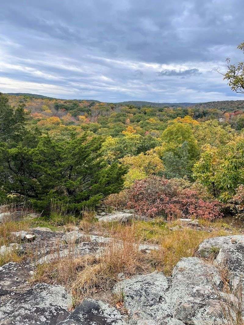
Views From the Ridge
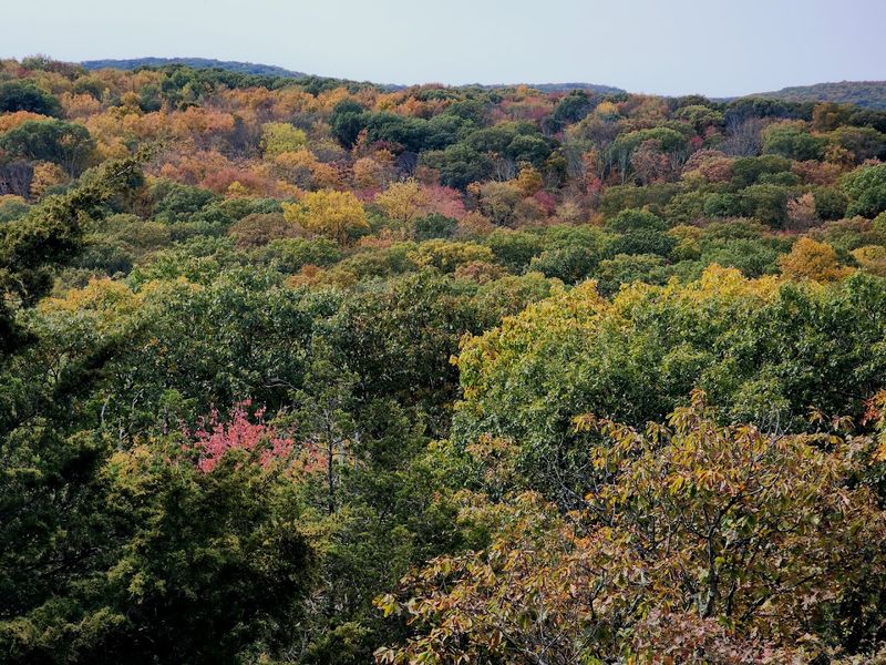
Several points along the upper trails open up to clear views of the surrounding landscape. On a good day, the New York City skyline is reportedly visible from certain elevated sections, which adds an unexpected layer of perspective to a hike that already has plenty going for it.
The white trail climbs for a few minutes after branching off from the blue trail and delivers a viewpoint that looks out over the reservoir and the forest stretching in every direction. That particular spot is one of the more rewarding stops in the preserve.
The ridgeline sections also tend to catch a breeze, which is a welcome contrast to the more enclosed forest paths lower down. Timing a visit for late autumn or early spring, when the leaf cover is thinner, opens up even broader sightlines from the elevated sections.
Clear skies and low humidity produce the best long-distance views, so checking the forecast before heading out is always a worthwhile step.
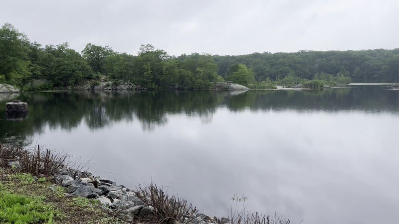
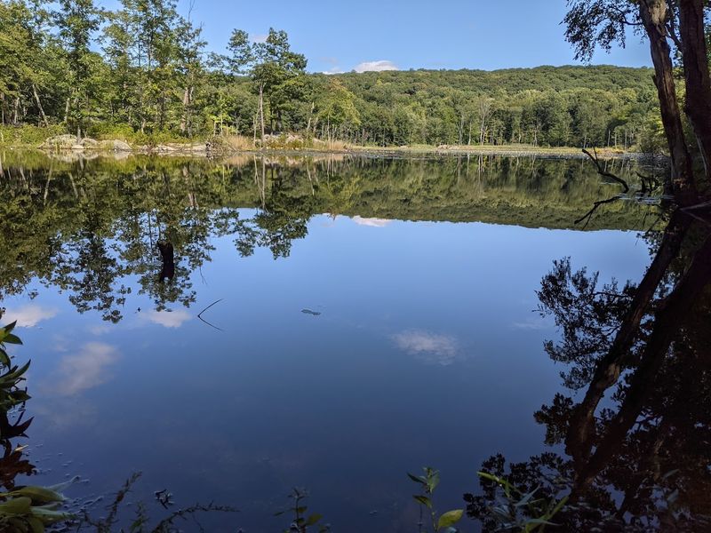
The Reservoir and the Dam
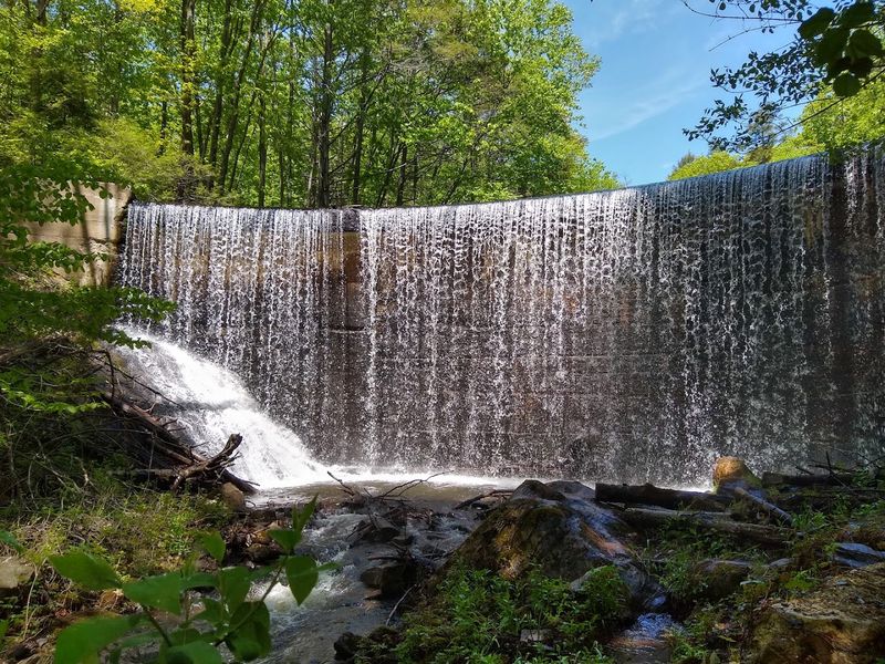
The reservoir is one of the most prominent landmarks inside the preserve, and the dam that holds it back sits at the end of the blue trail roughly one mile from the parking area. The red trail circles the entire reservoir, making it possible to get a full 360-degree perspective of the water and the surrounding treeline.
The dam itself is a simple but sturdy structure, and there is a sign posted indicating that walking on it is not permitted. The sign has a way of making that restriction feel like a test of willpower for some hikers, but the rule exists for safety reasons and is worth following.
The reservoir area is calm and relatively open compared to the more enclosed forest sections of the preserve. Early morning visits tend to produce the most peaceful atmosphere here, with less foot traffic and better light for anyone bringing a camera.
The water reflects the surrounding trees in a way that makes the spot particularly easy to appreciate.
Wildlife and Natural Features Along the Way

The preserve supports a healthy variety of wildlife, and hikers who move quietly through the trails are likely to encounter more than just trees and rocks. White-tailed deer have been spotted inside the gated areas of the preserve, and large predatory birds are a common sight overhead along the ridgeline sections.
Beavers have also made their presence known in the preserve. The yellow trail was closed off at one point after beaver activity flooded portions of the route, which is a reminder that the ecosystem here is genuinely active and not just a backdrop for hiking.
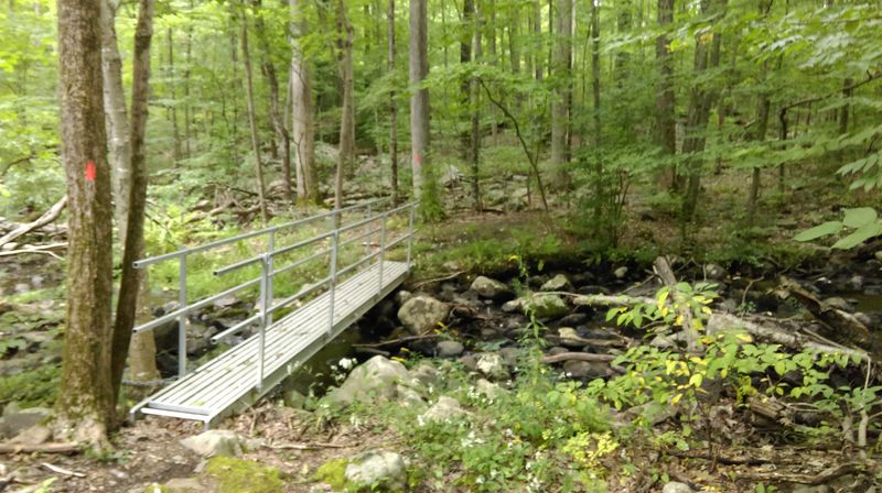
Streams and brooks run through multiple sections of the trail network, and the sound of moving water follows hikers through much of the lower terrain. Dogs are welcome at the preserve and tend to enjoy the water crossings thoroughly.
Keeping dogs on a leash is a reasonable precaution given the wildlife activity, and it also helps protect the natural habitat that makes the preserve worth visiting in the first place.
Bringing Dogs to the Trails

Apshawa Preserve has developed a reputation as one of the better spots in the area for hiking with dogs, particularly larger breeds that need real exercise rather than a quick neighborhood loop. The trails offer enough variety in terrain and length to give energetic dogs a proper workout.
The streams and brook crossings scattered throughout the lower trail sections are a particular draw for dogs that enjoy water. The blue trail’s brook crossing, for example, tends to be a natural stopping point where dogs can cool off before continuing.
The rocky and root-covered terrain is manageable for most healthy dogs, though the steeper sections of the green and white trails may require some extra encouragement for older or smaller animals. Bringing enough water for the dog as well as the hiker is important, especially during warmer months when the streams may be running lower than usual.
A leash is the practical and responsible choice throughout the entire preserve.
Tips for Navigating Without Getting Lost
Navigation at Apshawa has improved significantly since trail markers were updated, but the preserve still has a few sections where the blazes are spaced far enough apart to cause hesitation. The red trail in particular has received some criticism for inconsistent marking and washed-out sections that can be difficult to follow.
Downloading a trail map before arriving is the single most effective way to avoid confusion. Apps like AllTrails carry maps of the preserve that work offline, which matters in areas where cell signal can be unreliable.
Park rangers have been known to hand out printed maps at the parking area, and grabbing one of those is a good backup.
Some trails end without a clear marker, requiring hikers to double back to a known junction rather than pushing forward into unmarked territory. Keeping track of the last blaze seen and checking a phone map at any moment of uncertainty prevents the kind of extended detour that turns a two-hour hike into a four-hour ordeal.
Why This Preserve Deserves More Attention
For a preserve within reasonable driving distance of New York City, Apshawa punches well above its weight in terms of what it delivers to hikers. A waterfall, a reservoir, a dam, historic ruins, ridgeline views, wildlife, and a network of trails covering multiple difficulty levels are not things typically found packed into the same 4.5-mile loop.
The preserve does not have the marketing budget of a state park, and it lacks the facilities that tend to draw casual crowds. No concession stands, no paved paths, no restrooms.
What it has instead is a genuinely wild character that is increasingly rare this close to a major metropolitan area.
West Milford as a whole offers several outdoor destinations, but Apshawa stands out for the combination of accessibility and authentic trail experience it provides. First-time visitors often leave surprised by how much the preserve delivers, and a good number of them come back.
That quiet loyalty from the people who know about this place is probably the most honest endorsement it has.


