Bitter Arctic air is spilling into the Lower 48, flipping the script as parts of the U.S. turn colder than Alaska. If you have wondered why your breath freezes mid-sentence, this displaced polar vortex is the culprit.
The cold is not just quick and sharp, it is stubborn and lingering, gripping multiple regions through early February. Here is what you need to know now, plus how to stay safe while temps and wind chills crash.
An arctic blast is driving temperatures so low that some Lower 48 spots are colder than Alaska. You can feel it in the stinging wind and the way car doors freeze shut before dawn.
The displaced polar vortex has shoved relentless cold across the Northern Plains, Upper Midwest, and interior Northeast, keeping highs stuck well below normal.
Wind chills between -20°F and -40°F are no joke, and that bitter bite can turn dangerous fast. If you need to be outside, cover skin and keep trips short.
Cities like Detroit will struggle to hit single digits, and the cold is spreading east toward big coastal hubs where dense populations magnify impacts.
Expect more advisories and school schedule changes as this chill lingers through early February. Power demand climbs when everyone cranks heaters, so try to stagger usage and seal drafts.
Even short walks feel punishing, and pets can suffer frostbite as quickly as people.
Road salt has limits in extreme cold, so untreated surfaces become treacherous. Black ice hides under powder, and sidewalks refreeze overnight.
If you are commuting, leave extra space, clear all windows, and watch for plow ridges that catch tires.
Emergency managers are pushing clear safety messages because exposure times shrink in this level of cold. Check in on neighbors who might be isolated.
The headline is simple: this is the coldest stretch of the season for many, and it demands respect.

The polar vortex is a vast whirl of low pressure and frigid air spinning near the poles. Most days it stays corralled by a strong jet stream, but sometimes it stretches and sags south.
When that happens, you feel the consequences as Arctic air spills across the U.S. and refuses to leave.
Right now the circulation is elongated and displaced, not just weakened. That subtle shift matters because it allows repeated pushes of cold, rather than one quick hit.
Instead of a weekend chill, you get a multi-week pattern that keeps daytime highs stuck below normal and nights dangerously cold.
More than 170 million Americans are in the below-normal temperature zone, including parts of the Southeast. If you are in northern Florida or Georgia, seeing 20s is a wake-up call for pipes, plants, and pets.
Cold this entrenched lays groundwork for snow and ice when moisture arrives later.
The jet stream acts like a highway for storms, and its amplified bends favor more frequent winter systems. You might not get constant snow, but the setup increases risk windows.
For planners, that means staffing, salt supplies, and energy capacity need attention.
Think of the polar vortex as background architecture shaping day-to-day weather. When it lurches, local forecasts follow.
Understanding the why helps you prepare smarter, from layering clothes to scheduling travel around the harshest wind chills.
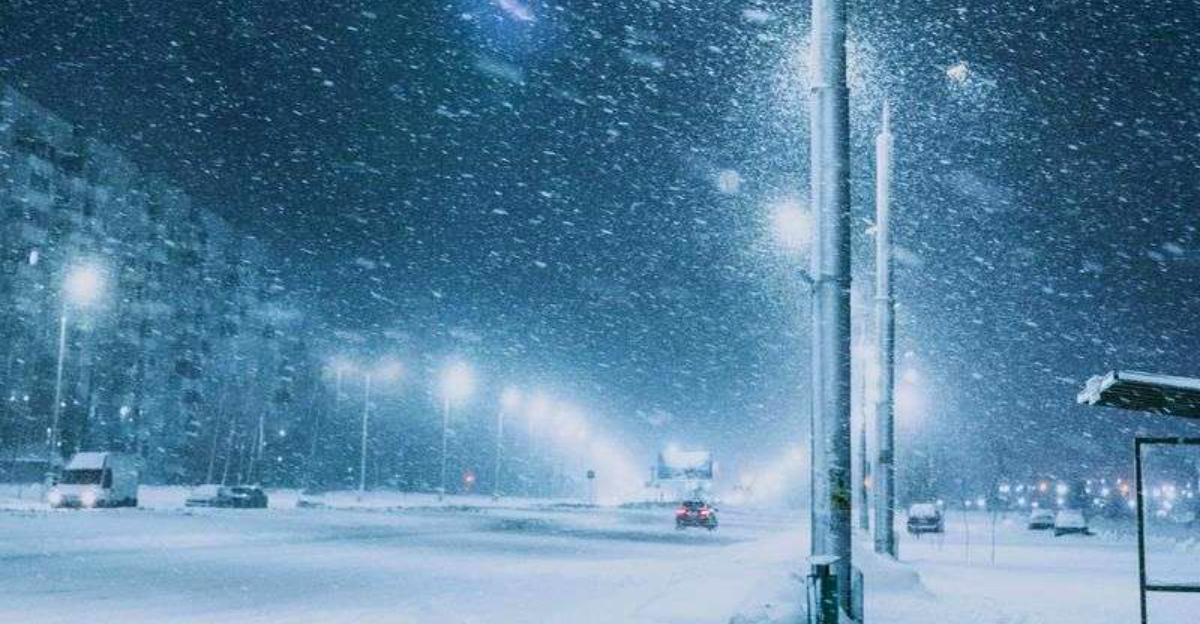
This Arctic outbreak is sprawling, touching the Northern Rockies, the Plains, the Midwest, and the Northeast. You can sense its reach when even coastal cities wake to single digits and biting wind.
Fox Weather notes many towns will run well below seasonal norms, day and night.
Farther south, the chill sneaks into the Deep South with surprising punch. Parts of Florida could see lows in the 20s, a recipe for frost on citrus and stress on uninsulated homes.
If you live in a typically mild zone, this is the time to protect pipes and bring pets inside.
Wind chill is the headline risk because it accelerates heat loss from skin. Without proper layers, frostbite and hypothermia can develop quickly, especially for those without shelter.
Hospitals prepare for cold-related injuries, while outreach teams look for people needing warm spaces.
Transportation networks feel the strain when salt struggles and diesel gels. Plows and sand trucks run extended shifts, and airports may juggle deicing delays.
Utilities brace for peak loads as heaters roar, and crews stand by for line issues.
For you, the playbook is simple but serious: limit exposure, dress smart, and plan errands during the warmest daylight. Keep an emergency kit in the car and charge devices before storms.
This cold is broad and persistent, and staying ahead of it reduces risk.
Prolonged cold is a different beast than a quick snap, and your routine should change with it. Ice lingers on shaded roads, refreezes at night, and turns morning commutes into slip zones.
If you treat each day like a fresh storm, you will make smarter, safer choices.
Start with clothing that traps heat without sweat, like moisture-wicking base layers and insulated outer shells. Cover hands, ears, and face to cut wind chill exposure.
For homes, insulate pipes, run cabinet doors open on exterior walls, and test alarms near space heaters.
Vehicles need love too: a charged battery, proper antifreeze, winter-grade washer fluid, and tires with good tread. Keep a kit with blankets, snacks, water, a flashlight, and a phone charger.
Top off fuel to prevent line freeze and to stay warm if you are stuck.
Stay plugged into alerts so you are not surprised by plunges and gusty bursts. Wind chill warnings mean business, so shift outdoor plans and check on neighbors who might need help.
Pets feel the cold like you do, and short walks with booties can prevent paw injury.
Even after a thaw, black ice can reform as temperatures dip again. Walk like a penguin on slick spots, and sprinkle sand where traction is poor.
With no quick warm-up in sight, steady preparation transforms a harsh pattern into a manageable one.


