Snow is showing up where you rarely see it, turning everyday routines into something unexpectedly tricky. If you live in a place that usually skips winter, even a dusting can shut down roads and scramble plans fast. This rare setup combines a push of Arctic air with just enough moisture to flip rain to flakes.
Stick with this guide so you know what to watch for, when to travel, and how to stay safe until the thaw.
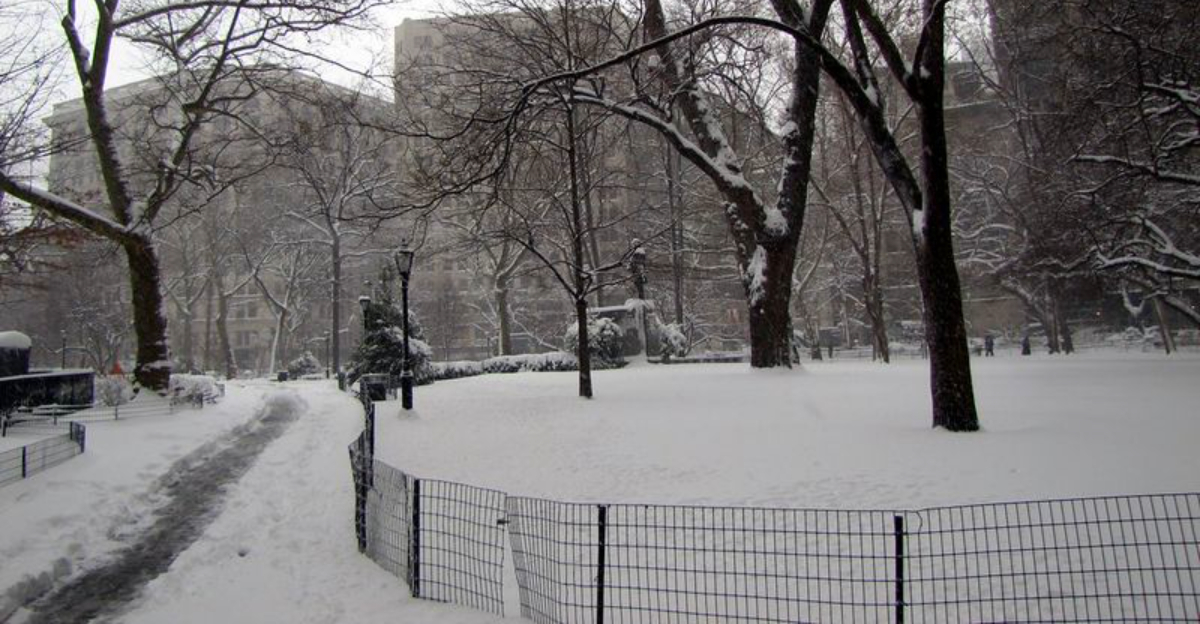
Meteorologists are tracking an unusual overlap of cold Arctic air and available moisture that is painting typically mild regions in white. When snow is rare, even an inch can remake your neighborhood overnight, turning lawns into postcards and familiar streets into slick puzzles. You notice the quiet first, then the crunch, then the realization that bridges and overpasses have glazed faster than anyone expected.
Because plows, salt, and winter-ready crews are scarce, modest totals still hit hard. Schools close, small businesses delay openings, and commutes stretch into uncertain timelines you do not want to test. Black ice lurks after meltwater refreezes, an invisible trap that erases traction without warning and turns gentle slopes into surprise slides.
Forecasters emphasize that impact is about preparedness more than depth, especially where winter driving experience is thin. Treat this like a serious storm, even if the totals sound small on paper. If you can, postpone trips, let sun work on treated spots, and check local updates often.
Keep walkways clear, layer clothing, and keep pets inside while temperatures bottom out. You will enjoy the rare beauty more when you respect the hazards hiding beneath the sparkle. Safety first, photos second.
Snow is rare in many U.S. regions because winters usually lean mild, especially along the Gulf Coast, Deep South, desert valleys, and ocean-hugging cities. You need a precise combo: cold deep enough from cloud to pavement and moisture arriving on time. Most winters, the air mass is too warm in the lowest layers, so flakes melt into rain before you ever see them.
When Arctic air dives south and a storm slides along that boundary, the puzzle pieces can finally click. Elevation tilts the odds, with ridges snagging snow while nearby lowlands stay wet. During special setups, the cold layer deepens enough to deliver flakes at sea level, surprising places that have not swept a sidewalk in years.
Climate variability helps shuffle the deck, shaping unusual tracks and timing. That does not automatically signal a long-term trend, but it does remind you how dynamic winter can be. Local topography, coastal influence, and recent soil temperatures often decide whether you wake to white or drizzle.
Watch forecasts for phrases like deep cold layer, dynamic cooling, and wet-bulb. When those align with incoming moisture, you may be in for a rare snow day. Plan ahead even if history says it is unlikely.
Travel risk spikes when snow visits places without winter-ready infrastructure. Road salt supplies are limited, plows are scarce, and many drivers have never practiced stopping on ice. Bridges and overpasses freeze first, turning gentle ramps into surprise slip zones that feel fine one second and gone the next.
If you do not need to drive, stay put and let crews catch up. If travel is essential, slow way down, leave long gaps, and avoid sudden steering. Keep a kit in your car with water, snacks, a flashlight, phone charger, blanket, and a small shovel for slush berms.
Airports not designed for regular snow may stack up delays fast, with deicing bottlenecks and runway treatments lagging the flakes. Check flight status early, consider rebooking windows, and build extra time into every connection. Power outages can add complications when sticky snow weights trees and lines, even with modest accumulations.
At home, test smoke and CO alarms, keep devices charged, and know how to manually open a garage door. Clear steps with sand or clay litter, not just water that refreezes. You will get where you are going safer by prioritizing patience over speed in rare snow.
Authorities say the prettiest snow can still be the most deceptive when your town is not built for it. Treat this like any serious hazard, even if totals look modest on the forecast graphic. Charge devices, test heat, and gather food, water, meds, and pet supplies so you are not driving during the slickest window.
Line up blankets, flashlights, and backup batteries in one spot you can reach in the dark. Check on neighbors who might struggle with cold snaps or mobility. Keep pets indoors and dry towels by the door, since damp paws plus tile can become a slip hazard you will not see coming.
After the flakes stop, the hazards linger as meltwater refreezes overnight into black ice. Plan for delayed school or work returns while crews sand trouble spots and sun angle improves traction. Do not underestimate wind chills if you are shoveling slush that later cements into crust.
Stay tuned to local alerts and weather radios until roads and power stabilize. A little caution now prevents bigger problems later. Enjoy the novelty, snap a few photos, and save the victory lap for when temps rise above freezing and hold.


