A rare winter setup is brewing across the far South, and it could change your plans fast. With Arctic air sliding in and Gulf moisture surging north, the ingredients are lining up for snow in places that hardly ever see it. That means roads, schools, and daily routines could be disrupted with little warning.
Stay ahead of it now so you are not scrambling when the first flakes start to fly.
Rare Southern Winter Storm Raises Concern Across Multiple States
Meteorologists are flagging an unusual winter storm that could drop significant snow across parts of the far South, including Tennessee, North Carolina, and South Carolina. You are seeing a classic clash of cold Arctic air sliding south while Gulf moisture lifts north. When that overlap hits just right, snow wins the tug-of-war over rain, even where wintry weather is rare.
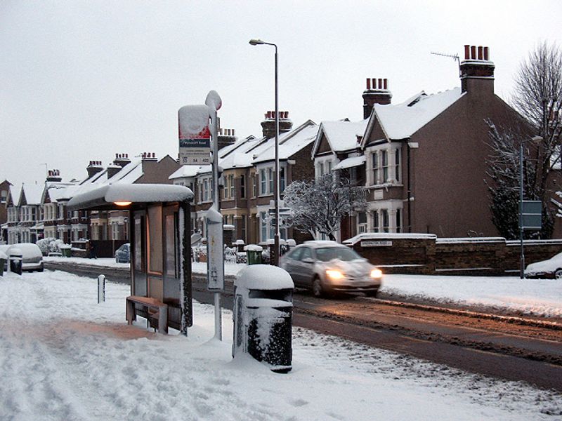
Because southern infrastructure is not built for snow and ice, even a few inches can create outsized disruption. Bridges and overpasses chill faster than ground-level roads, so icing develops quickly and invisibly. Expect school closures, limited bus service, and slower emergency response if conditions deteriorate during peak hours.
Power outages are possible where wet snow or glaze ice weighs on branches and lines. Stock up on essentials early, charge your devices, refill medications, and plan for pets. Keep your car fueled and your emergency kits updated with flashlights, blankets, snacks, and a phone charger.
Travel may rapidly worsen once precipitation begins, so flexible plans matter. Follow trusted local forecasts and alerts as the storm track wiggles. A small shift can dramatically change outcomes, turning a cold rain into a slick, high-impact snow for your neighborhood.
Tennessee Could See Some of the Heaviest Snowfall
Tennessee sits in a prime zone for accumulating snow as cold air locks in across central and eastern counties. With ground temps falling and steady moisture overrunning the state, snow can quickly stick to roads and bridges. If it arrives during commute windows, you could see spinouts, ramp closures, and gridlock.
Even modest totals can linger due to limited plow fleets and treatment supplies compared to northern states. Expect secondary roads and shaded hollows to stay slick well after main highways improve. Wet, heavy snow brings a risk of tree damage and isolated power outages, especially where elevation enhances totals.
Protect yourself by shopping early, charging devices, and reviewing a simple winter plan. Keep a vehicle kit with scraper, blanket, snacks, water, and a small shovel. If you must drive, go slow, leave extra space, and avoid sudden braking on potential black ice.
Check Tennessee DOT cameras and alerts before heading out. Watch for quick forecast changes as the deformation band sets up. A narrow swath could double snowfall over short distances, making your neighborhood a hot spot while others see less.
Carolinas Face Snow, Ice and Forecast Uncertainty
Across the Carolinas, temperature profiles may wobble near freezing, setting up a messy mix. Inland North Carolina has the best odds for plowable snow, while parts of South Carolina may toggle between sleet and freezing rain. Along the coast, milder marine air could keep things mainly wet.
Even a thin glaze of ice snaps branches and knocks out power, so keep phones charged and batteries ready. Elevated terrain and Piedmont areas are favored for snow as cold air pools in valleys and hollows. Small shifts in track or timing can flip the outcome for your street.
Stay flexible with travel and appointments, especially early morning and after sunset. Black ice is sneaky on bridges and shaded stretches, so slow down and use gentle steering. If you lose power, avoid candle fires and run generators outside to prevent carbon monoxide.
Follow local NWS updates and county alerts because watches can become warnings fast. Prep essentials, check on neighbors, and bring pets indoors. If snow is uncommon where you live, extra caution can make all the difference during this rare event.
Travel and Power Impacts Likely in Snow-Prone Areas
Travel disruptions are likely wherever snow or ice takes hold, hitting highways, airports, and rail lines. Black ice is the stealth hazard here, forming on cold pavement with a near-invisible sheen. If you can, postpone trips once precipitation begins and let crews work.
Air travelers should rebook proactively, track airline alerts, and pack chargers and meds in carry-ons. On the road, slow down, increase following distance, and avoid abrupt braking that can trigger skids. For hills, maintain momentum gently and do not spin tires.
Power outages may occur where heavy, wet snow or glaze ice accumulates on trees and lines. Utilities often pre-stage crews, but restoration can take time in widespread events. Keep flashlights, extra batteries, nonperishable food, and water handy, and store extra blankets.
Fuel vehicles, test generators outdoors, and check on older neighbors. Move patio furniture and secure outdoor items before winds pick up. With preparation and patience, you can minimize risk and stay comfortable while the South weathers this rare storm.


