Relentless rain pounded western Washington, and the water is still rising. If you live anywhere near the rivers, you feel it in your gut every time the forecast updates. Stories of rescues, road closures, and hurried evacuations paint a stark picture of a region under pressure. Here is what you need to know right now, and how to stay one step ahead.
Atmospheric River Triggers Record Floods
You could hear the rain thrum on rooftops for days, a relentless drumbeat fed by a moisture plume from far out in the Pacific. This atmospheric river channeled warm, moisture rich air directly into western Washington, unloading torrents that overwhelmed storm drains and swelled creeks into churning rivers. Local gauges tallied staggering totals, with some valleys absorbing more than a foot of rainfall in a narrow window.
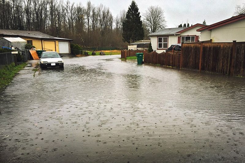
By midweek, the Skagit, Snohomish, Cedar, and Snoqualmie surged toward or past major flood stage, overtopping floodplains that usually hold through winter. Levees groaned under pressure as backwaters seeped into fields, barns, and neighborhoods, turning familiar roads into fast moving channels. If you live nearby, the brown, debris filled water likely crept up driveways and across pastures faster than expected.
Forecasters warned that cresting would continue even after the heaviest bands slid east, because watersheds drain on a delay. That lag means downstream communities feel impacts long after the last downpour, a cruel echo of the storm’s peak. Keep distance from banks and bridges, watch for undercut edges, and do not drive across flooded stretches where depth and current can deceive.
Evacuations and Emergency Response Underway
When alerts hit phones and sirens sounded, the order was clear and urgent: get out now. Governor Bob Ferguson declared a statewide emergency as rivers rose rapidly, and evacuation zones expanded by the hour. In Skagit County alone, tens of thousands were told to leave, including Burlington residents and parts of Mount Vernon as the Skagit pressed toward near record crests.
National Guard units rolled in with high water vehicles to back up local crews stretched thin by nonstop calls. Door to door checks helped reach people without cars, while shelters opened in schools and community centers on higher ground. Highways vanished under water, detours multiplied, and even emergency routes became risky as culverts failed.
If you were packing in a hurry, the checklist got real: medications, chargers, documents, pet supplies, and warm layers. Authorities reminded drivers to turn around at barricades, because fast currents can sweep vehicles off unsteady pavement. Expect checkpoints, boil water advisories, and rotating road closures as teams assess damage, shore up levees, and coordinate supply lines for neighborhoods still cut off.
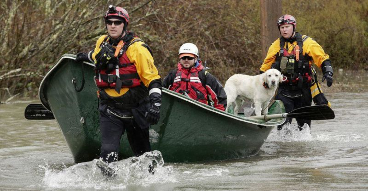
Dramatic Rescues and Community Impact
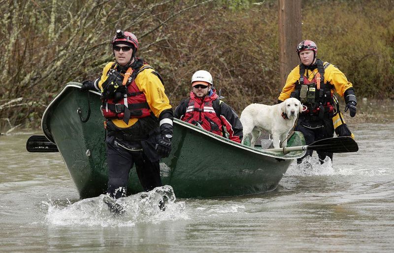
As water climbed stairwells and lapped at attic doors, rescue crews shifted from warnings to urgent action. In Sumas, a Coast Guard helicopter hovered over rooftops where families waved flashlights through gable vents, hoisting survivors while boats circled below. Across King County, marine units ferried people from fields and homes beside the Snoqualmie as channels spilled over.
Border towns like Nooksack, Everson, and Sumas faced deep, cold water that swallowed streets and silenced engines. If you tried to drive out late, you likely met a wall of floodwater and turned back, or waited for a swiftwater team to guide you. Community volunteers brought coffee, blankets, and portable chargers to shelters, giving neighbors a moment to breathe.
Schools closed, small shops sandbagged doorways, and farms moved livestock to higher ground while feed got scarce. Power flickers added stress for people dependent on medical equipment, pushing backup plans into action. In the days ahead, expect wellness checks, debris cleanup, and mental health support as the community rallies to repair homes and lives.
Ongoing Threat and Forecast Concerns
The rain has eased for now, but the danger has not passed. Rivers remain high, soils are saturated, and levees continue to take a pounding as runoff works downstream. Forecast discussions hint at additional Pacific waves, and even a modest burst could nudge crests back up where margins are razor thin.
Landslides are a growing concern on steep, soaked slopes where roots loosen and ditches overflow. If you live below a hillside, watch for cracking soil, tilting trees, or muddy water suddenly turning cloudy. Keep an ear on advisories for bridge closures, utility shutoffs, and shelter relocations as crews reposition resources.
Recovery will be a relay, not a sprint, with damage assessments, insurance claims, and debris removal unfolding alongside flood patrols. You can help by documenting losses, photographing water lines, and staying out of restricted zones so engineers can inspect safely. Stock up on batteries, potable water, and fuel, and check in on neighbors as the region braces for more high water in the days ahead.


