A fast intensifying winter storm is sweeping across the Northeast, triggering states of emergency and urgent warnings as millions brace for snow, ice, and dangerous wind. If you have travel plans or a commute, now is the moment to rethink and get prepared. Power outages, near whiteout bursts, and rapidly changing conditions could arrive with little warning. Stay with this guide for what to expect, how to navigate disruptions, and what to do right now to stay safe.
A powerful storm is racing across the Northeast, and officials have declared states of emergency to get ahead of it. You are being asked to stay off the roads, charge devices, and prepare a go bag in case power blinks. Rapid intensification means conditions could change within an hour, turning wet roads into ice and slush into deep drifts.
Governors activated National Guard units, pre positioned plow convoys, and staged utility crews for quick restoration. If you need supplies, shop early and keep visits short. Heavy snow bands combined with strong wind may bring near whiteout visibility, especially on open stretches and higher terrain.
Timing is tricky right after the holiday rush, with many people trying to return home. Fox Weather reports that interior zones could see the largest totals, while coastal areas flip between snow, sleet, and freezing rain. Even if precipitation starts as rain, temperatures can tumble and glaze everything in minutes.
Plan for deteriorating conditions well before the heaviest snowfall arrives. Keep blankets, water, and a flashlight ready, and check on neighbors who may need help. Follow local alerts, since street closures and transit adjustments can roll out quickly.

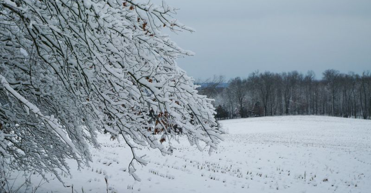
Meteorologists say millions are in the path of moderate to heavy snow, with interior New England, upstate New York, and parts of the northern Mid Atlantic primed for the highest totals. If you live near elevation or away from the coast, expect several inches to over a foot. Rates could spike fast, outpacing plows and burying untreated roads.
Gusty winds will blow and drift snow across highways and ramps, shrinking lanes and visibility. In cities, even a few inches can gridlock traffic and slow buses on narrowed streets. Bridges, ramps, and secondary roads will ice first, so plan alternate routes and leave generous stopping distance.
Power outages are possible where heavy, wet snow clings to trees and lines. Keep phones charged, gather batteries, and identify a warm place if heat fails. Utility crews are pre staged, but repairs may wait until winds relax and roads reopen.
Expect sharp snowfall gradients over short distances, so your neighborhood could look very different than the next town. Monitor local forecasts and radar for banding swings. If you can, finish errands early, clear gutters, and move vehicles to help plows work efficiently.
Road conditions are deteriorating fast as snow and ice spread over major corridors, and officials are urging you to skip non essential travel. If you must go, slow down, add space, and carry a winter kit with blankets, water, snacks, and a phone charger. Most storm injuries happen on roads, especially when visibility drops without warning.
Air travel is in for a long day of delays and cancellations. Even after snow tapers, de icing and runway clearing will slow departures. Check your airline app, rebook early, and avoid tight connections that could strand you overnight.
Transit agencies are pretreating platforms, keeping switches warm, and staging crews to clear tracks. Expect reduced frequency, slower speeds, and temporary closures if ice accumulates. Give yourself extra time, wear waterproof layers, and watch for slick stairs and platforms.
With temperatures falling this evening, refreezing will turn slush into black ice. Park off snow routes so plows can widen lanes, and keep an eye on drifting across bridges. If you can delay trips until daylight and after crews pass, you will be much safer.
Even as snowfall pulses, officials are asking you to stay vigilant for lingering ice, wind, and bitter cold. Check on older neighbors, secure trash bins, and bring pets indoors. Keep phones charged, test flashlights, and top off fuel for generators used outdoors only for safety.
Have food, water, medications, and warm layers ready if outages stretch overnight. Meteorologists warn that track shifts can slide the heaviest snow or ice by a county or two. That makes last minute travel risky, since conditions can flip during a single commute.
Once the storm moves out, cleanup will take time, especially where dense, wet snow snapped limbs. Give utility crews space, and avoid downed lines which may be energized. Shovel small, frequent lifts to protect your back, and clear hydrants and vents to prevent dangerous buildup.
Follow local alerts, sign up for text updates, and use verified sources for timing and school or office closures. If you rely on medical devices, confirm backup power plans now. Stay patient, stay warm, and do not let improving skies fool you until roads and sidewalks are truly safe.


