North Texas is on alert as a powerful winter system targets the Dallas – Fort Worth area with heavy snow, slick ice, and white – knuckle travel conditions. Forecasts call for a fast – changing mix that turns messy by Thursday night and dangerous by Friday morning. You will want a clear plan before the first flakes fly, from rerouting commutes to prepping your home. Keep reading for timing, totals, and practical steps to stay safe and ahead of the storm.
The warning window begins early Thursday and stretches through Friday morning, a period when many people commute, fly, or manage school drop – offs. Expect a transition from cold rain and sleet to snow Thursday night as colder air deepens across North Texas. This timing is crucial for you because road conditions can shift from wet to icy in just a couple of hours.
By late evening, heavier snowbands may lock in, dropping visibility and quickly covering roads, ramps, and bridges. Plow and treatment operations will try to keep pace, but bursts of snow can outstrip crews during peak intensity. Plan on delaying non – essential trips and setting up remote options where possible.
Friday morning could bring the hardest travel window, even after snowfall tapers. Overnight refreeze increases the black ice risk on untreated and elevated surfaces. If you must head out, build in extra time, reduce speed, and check live updates before you move.
Models point to a swath of 6 to 12 inches across parts of North Texas, with localized higher amounts where snowbands stall. Areas north and northeast of the metroplex often do best in these setups, so Collin, Denton, and Grayson Counties could overachieve. Your exact total depends on how quickly sleet flips to snow and whether a band parks overhead.
The Dallas – Fort Worth core may see wide gradients from suburb to suburb. A five – mile shift in a mesoscale band could mean 4 inches for one neighborhood and 10 inches for another. That is why the forecast can feel uncertain right up to the last minute.
Expect nowcasting overnight as radar trends validate which corridor stacks up fast. If you live near the Red River or east toward Greenville and Paris, prepare for the higher end. Keep a shovel or snow brush handy and clear steps periodically to avoid heavy compaction.

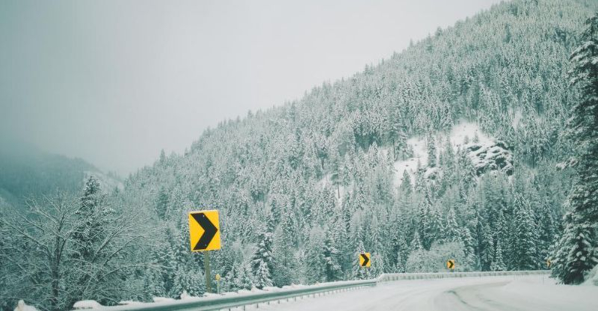
Before the flip to snow, sleet and freezing rain can glaze bridges, overpasses, and neighborhood hills. That thin sheen of ice is hard to see at night, so it is easy to underestimate how slick conditions are. Your best move is to slow down early and avoid sudden braking or lane changes.
After the snow ends, temperatures dipping below freezing can refreeze slush into black ice by dawn Friday. Driveways, shaded sidewalks, and untreated side streets are classic trouble spots. Sand or traction material can help, and a small kit in your trunk pays off quickly.
Remember that all – wheel drive helps with momentum, not stopping. Winter tires and gentle inputs are your real safety net. If you can postpone a trip until pavement temperatures recover later in the weekend, do it.
Highways can turn impassable during heavy bursts as slush thickens and visibility drops. Crews will pre – treat major routes, but ramps, flyovers, and residential streets lag behind. You should expect rolling delays, closures, and detours as conditions deteriorate.
Air travel is vulnerable to both snow rates and deicing bottlenecks. DFW and DAL often preemptively thin schedules, which can ripple nationwide. If flying, rebook early, watch for waivers, and avoid tight connections.
Public transit may run reduced service or suspend routes on iced tracks and roads. Keep backup plans for last – mile travel. Track airline and agency feeds closely and confirm status the morning of departure.
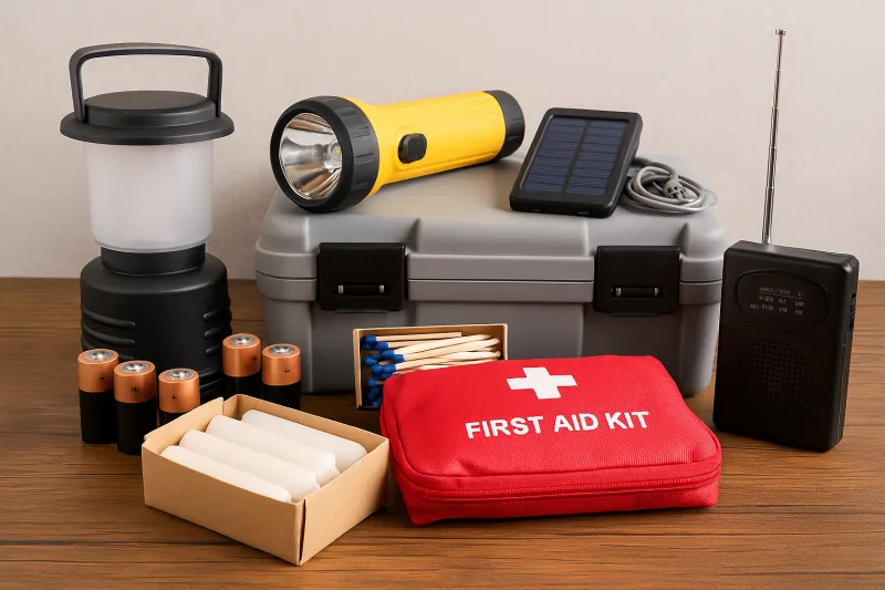
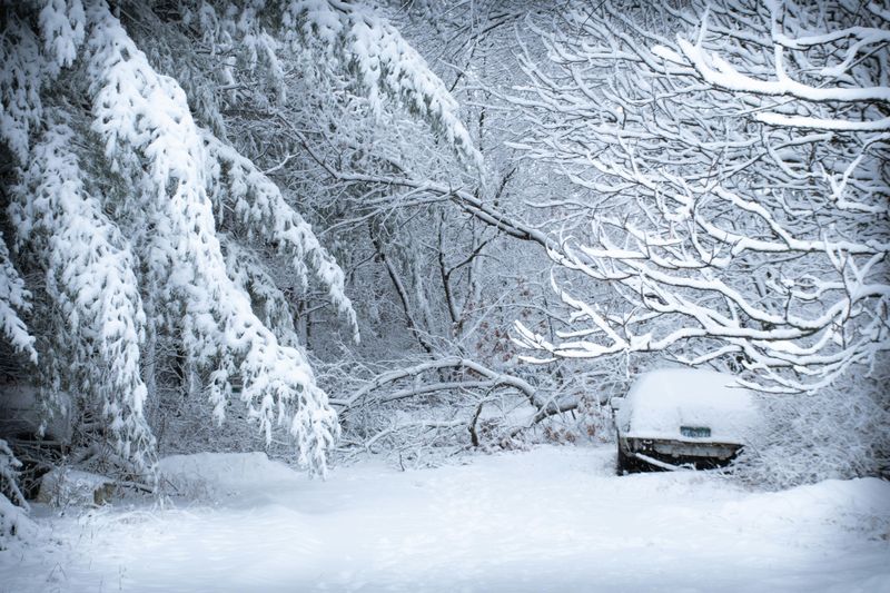
Heavy, wet snow and ice can tug on lines and tree limbs, causing scattered outages. While the grid is more resilient than in years past, localized failures are still possible during peak load. Charge devices, top off batteries, and keep flashlights where you can grab them in the dark.
Heat is the priority. Close blinds, seal drafts with towels, and consolidate to a few rooms to conserve warmth. If you have a generator, test it now and never operate it indoors or in a garage.
Keep pipes from freezing by dripping faucets and opening cabinet doors for warm air circulation. Stock simple meals that do not require long cook times. A battery radio is a smart backup when cell networks get congested.
Districts often call for closures or delayed starts when road crews need extra hours. Expect rolling decisions late Thursday night into early Friday. Parents should prepare alternate childcare and plan for digital assignments if needed.
For work, remote options reduce commute risk and keep teams productive. Talk with your manager early and set expectations for deliverables and availability. If your role is on – site, confirm any staggered shifts to avoid the worst road windows.
Essential errands should be front – loaded before the storm. Refill prescriptions, grab pet supplies, and fuel up while lines are short. A small buffer of groceries and comfort foods makes waiting it out far easier.
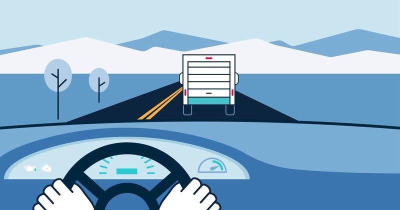
Slow is smooth and smooth is safe. Increase following distance, brake gently, and steer with small corrections. If you start to slide, ease off the pedal and look where you want to go.
Use low gears on hills and avoid cruise control on slick surfaces. Clear all windows and lights before rolling, not just a peephole in the windshield. Keep traction aids, gloves, and a small shovel in the trunk.
If conditions deteriorate fast, do not push through. Find a safe place to wait or turn back. Your safest drive might be the one you postpone until crews get ahead of the storm.

Cold snaps hit hardest for elderly neighbors, people with limited mobility, and those without reliable heat. A quick check – in text or porch visit can make all the difference. Layer clothing, avoid overexertion while shoveling, and watch for frostbite on fingers and ears.
Pets need short outdoor breaks and warm bedding inside. If you use ice melt, choose pet – safe formulas to protect paws. Keep water bowls fresh because heaters can dry indoor air quickly.
If someone relies on medical devices, confirm backup power options now. Share your plan with a friend so someone knows where you are. Community care turns a tough storm into a manageable one.
Reliable sources beat rumor every time. Bookmark weather.gov, your local NWS office, and trusted local TV meteorologists for radar, nowcasts, and alerts. Push notifications can replace constant refreshing and keep stress down.
Use aviation, road, and power apps for targeted updates. Airline alerts, TxDOT cameras, and outage maps give practical intel for your zip code. You can set quiet hours so the phone does not buzz all night.
Cross – check anything viral with official feeds before acting. When in doubt, plan conservatively and adjust as new data arrives. Clear information helps you make calm, smart choices.
As the storm pulls away, temperatures should climb slowly into the weekend, helping roads recover. Plowed piles and shaded spots will take longer to melt, so expect lingering slick patches. Your patience during the first sunny lull prevents those last – minute fender benders.
Use the quiet window to restock supplies and document any damage. Clear gutters and storm drains to handle the next round of meltwater. If you have travel plans, aim for afternoon departures when pavement temps are friendlier.
Take notes on what worked for you this time and what to tweak. A stronger go – bag, a better scraper, or a backup charger is a small upgrade with big payoff. Prepared habits turn winter from a crisis into a season you can manage.


