Hunterdon County, New Jersey is not exactly the first place people think of when they want a serious hike with rewarding views. But tucked away along Old Mountain Road in Lebanon sits a volcanic ridge that most hikers drive right past on their way to more famous parks nearby.
This spot is the kind of place that rewards the curious and the persistent. The mountain sits above Round Valley Reservoir, and on a clear day, the water stretches out below the rocky ridge in a way that stops most hikers mid-step.
The trail system covers everything from short one-mile loops to multi-mile adventures connecting with neighboring parks. Whether you are a weekend warrior or someone who just wants a good reason to lace up your boots, this overlooked ridge has a lot more going on than its low profile suggests.
Keep reading to find out why this place deserves a top spot on your hiking list.
Where Exactly This Preserve Is and How to Get There
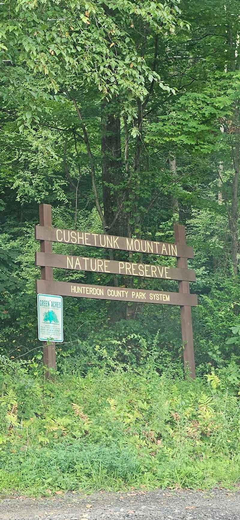
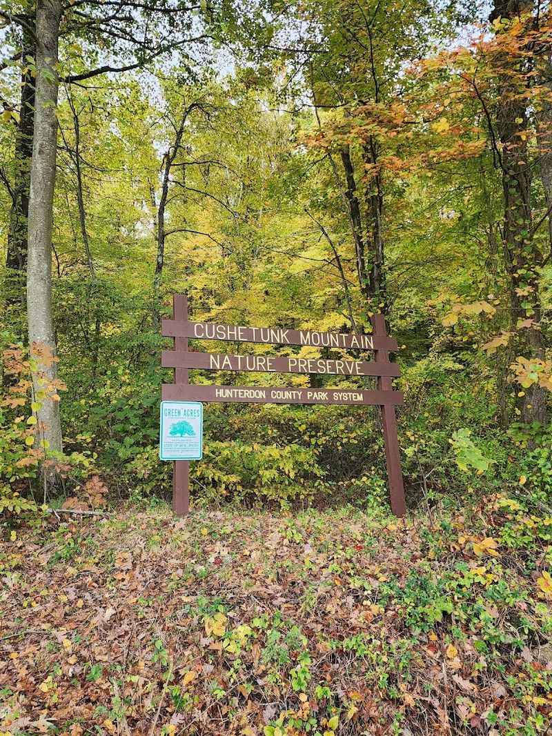
Most people passing through Lebanon, New Jersey on their way to Round Valley Reservoir never notice the small trailhead tucked along Old Mountain Road. Cushetunk Mountain Preserve is located at 106 Old Mountain Rd, Lebanon, NJ 08833, right in the heart of Hunterdon County.
The parking lot is gravel-surfaced and well-maintained, with enough space for a modest number of cars. An informational sign and trail map greet hikers at the entrance, and a small collection of walking sticks left by previous hikers often sits near the sign, ready for anyone who needs one.
The preserve is managed by Hunterdon County and operates daily from 8 AM to 6 PM. Getting there is straightforward, but the road itself is quiet and easy to miss if you are not paying attention.
A quick check on a map app before heading out will save you from circling the area looking for an entrance that blends right into the tree line.
The Volcanic Geology Behind the Mountain
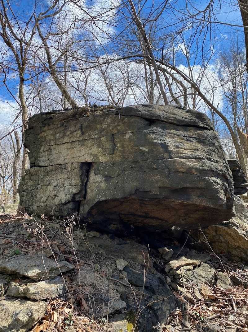
Not many hikers realize they are walking on ancient volcanic rock when they climb Cushetunk Mountain, but that is exactly what is underfoot. The ridge is composed primarily of basalt, a dark volcanic rock formed from cooled lava flows that occurred hundreds of millions of years ago.
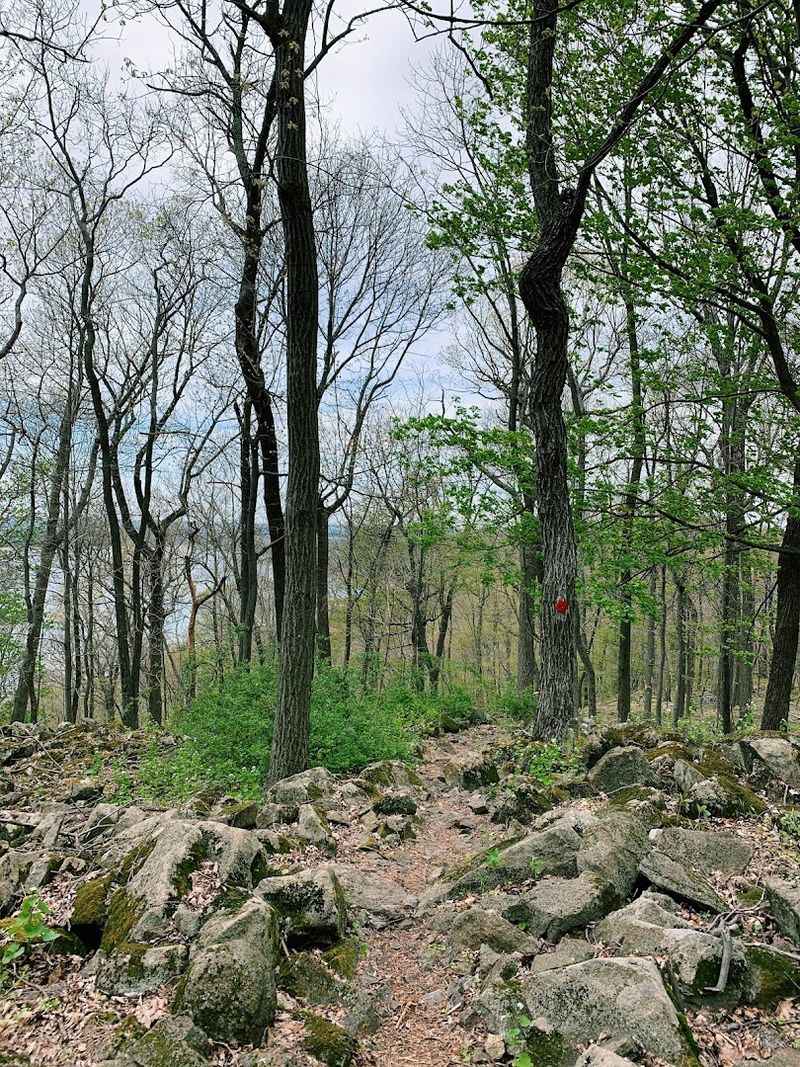
This geological history is what gives the mountain its distinctive character. The trail surface changes noticeably as you climb, shifting from packed dirt and grass to loose stones and then to larger boulders and rocky outcrops near the upper sections of the ridge.
The stones range in size from small pebbles to massive boulders, and the smaller loose ones can shift underfoot on steeper sections, which is something to keep in mind when choosing your footing. The volcanic origin of the ridge also explains the rugged, uneven terrain that makes this hike feel more demanding than the modest elevation might suggest on paper.
The mountain earned its character the hard way, forged deep underground.
The First Climb and What to Expect Right Away
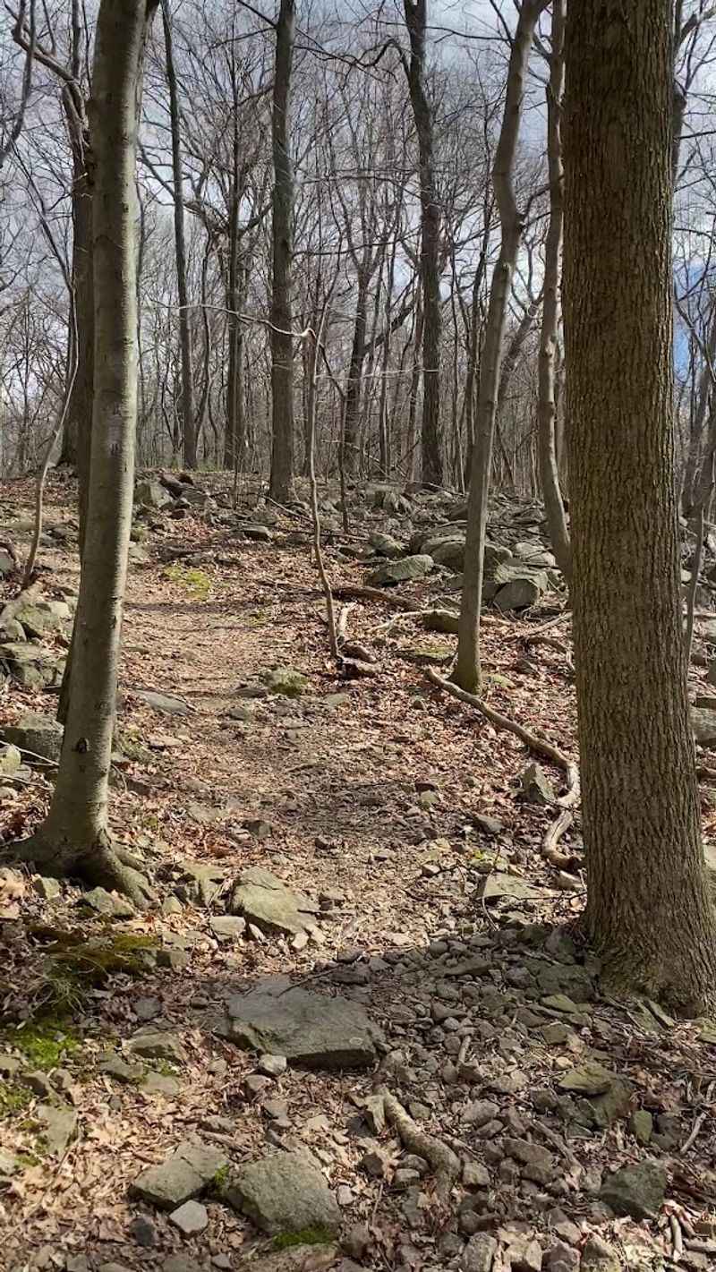
The trail wastes no time letting you know what kind of hike this is going to be. From the trailhead, the path launches almost immediately into a steep, steady climb that lasts roughly ten to fifteen minutes at a consistent uphill grade.
There is no gradual warm-up here. The incline is real, and hikers who are not used to sustained uphill sections will feel it in their legs quickly.
The trail surface during this initial climb is a mix of dirt, roots, and loose stones, all of which demand attention, especially when the ground is damp.
After that first push, the trail levels out slightly and reaches a fork where hikers choose their direction. Going left leads toward the rocky ridge peaks and the overlooks above Round Valley Reservoir.
Going right sends hikers toward trails that descend closer to the water. That first climb is the price of admission, and what comes after it makes every step worth the effort.
The Views Over Round Valley Reservoir
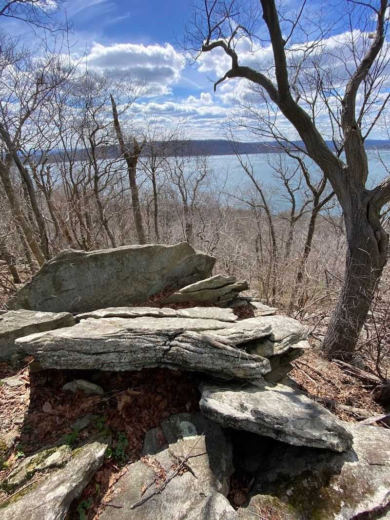
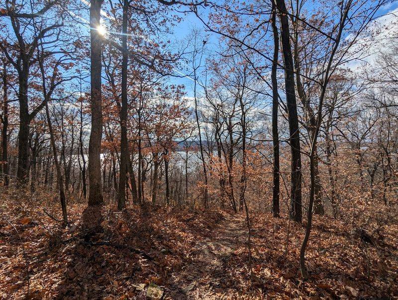
Round Valley Reservoir sits directly below the rocky ridge of Cushetunk Mountain, and from the right vantage points along the trail, the view down to that water is genuinely striking. The reservoir is one of the largest and deepest in New Jersey, and its size becomes clear when you see it from above.
The overlooks are not all open and wide. Some viewpoints are partially framed by trees, so the best views tend to come from the rock formations along the left-side trail rather than from any single designated lookout.
Clear days offer the most dramatic perspective, with the water reflecting the sky and the far shore visible in the distance.
Autumn brings an added layer of color to the scene, with the surrounding hillsides turning orange and red around the reservoir’s edge. The view from the top of this volcanic ridge is the kind of payoff that makes you forget how hard that first climb actually was.
Few spots in Hunterdon County offer this kind of elevation reward.
Trail Options and Loop Combinations
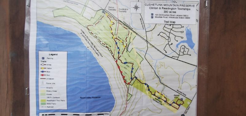
One of the strongest features of this preserve is the variety of trail options available. The color-coded system includes white, red, blue, and yellow trails, and they can be combined in multiple ways depending on how long or challenging a hiker wants the outing to be.
A popular combination starts on the white trail, moves to the red, then the blue, and finishes back on the yellow, covering roughly six miles in total. Shorter options exist for those who want a quicker outing, with some loops coming in around three miles while still reaching the ridge and the lake views.
The trails also connect with Round Valley State Park and Pickell Park in Readington Township, which opens up the possibility of much longer hikes for those who want to extend their day well beyond the preserve’s own boundaries. Trail distances at this preserve range from a single mile to as many as fourteen miles, making it adaptable for almost any fitness level or time commitment.
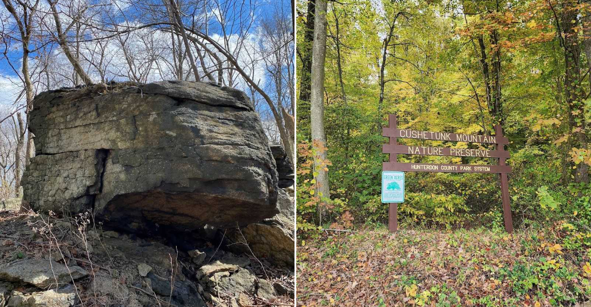
The Rock Formations Along the Ridge
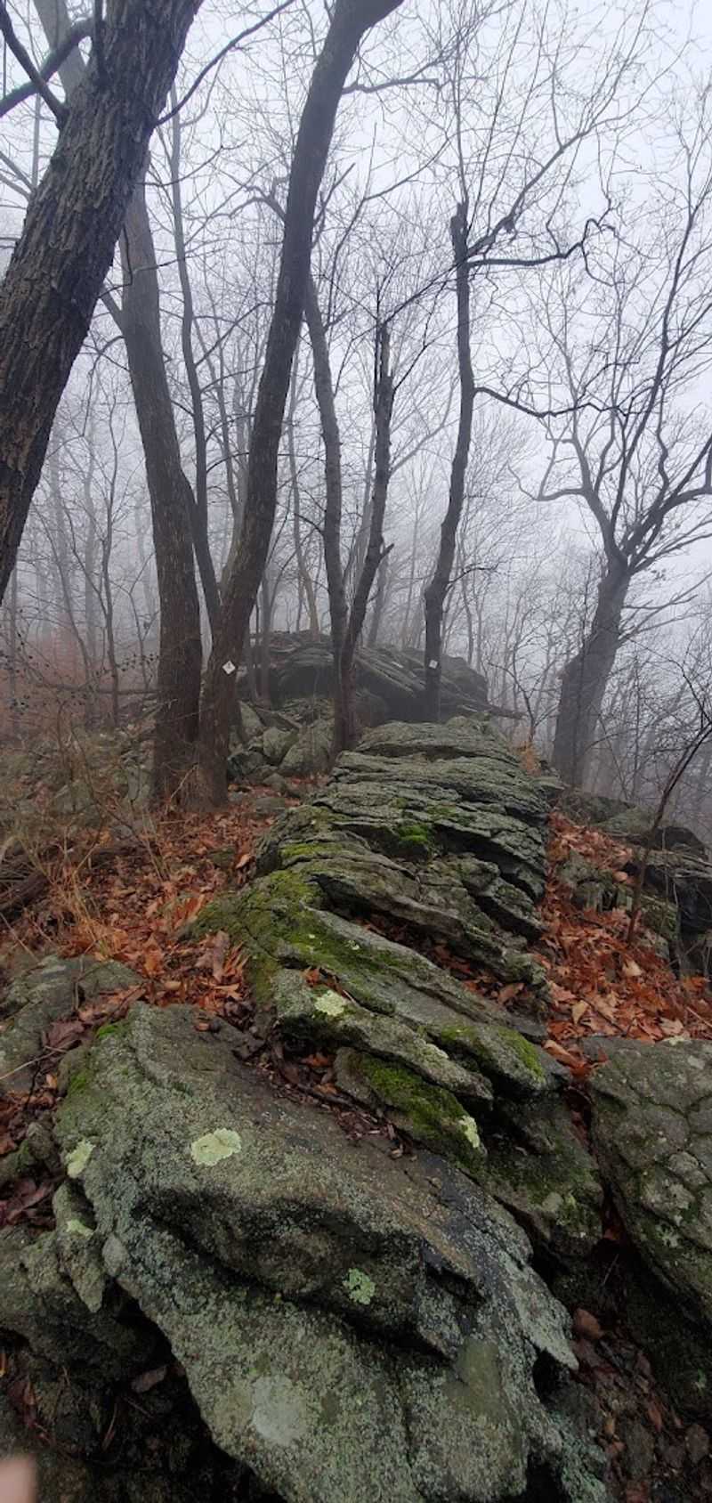
The rocky outcrops along the ridge are one of the most interesting physical features of this hike. As the trail approaches the upper sections near the left-fork route, the terrain shifts from forest floor to exposed rock formations that sit at the edge of the ridge above the reservoir.
These formations are worth exploring, and many hikers spend time scrambling around the boulders to find the best angles for the views below. The rocks are solid and grippy in dry conditions, but they become slick quickly when wet, so caution is warranted after rain or on misty days.
One detail worth knowing: there are a few pieces of rebar sticking up near some of the rock formations, left over from trail maintenance work. They are not hidden, but they are easy to miss if you are focused on the view rather than your footing.
Staying aware of where you place your feet near the rocky sections keeps the experience enjoyable from start to finish.
Footwear and Gear That Actually Matter Here
Gear choices matter more at Cushetunk Mountain than at many other local parks, and that is not an overstatement. The combination of steep inclines, loose volcanic stones, and potentially muddy sections creates conditions where proper footwear makes a real difference in both safety and comfort.
Sturdy hiking boots with ankle support and good grip are the standard recommendation for this trail. Sneakers or casual shoes tend to struggle on the loose rocks during the descent, which is actually more technically demanding than the climb up.
A hiking pole or walking stick adds stability on slippery sections, and the trailhead often has a few available for hikers who arrive without one.
Carrying water is essential, especially on warmer days when the tree canopy provides shade but the physical effort of the climbs still generates significant heat. The trail system is long enough that under-preparing on hydration becomes a problem before hikers realize it.
Coming prepared is what separates a great day on this mountain from a frustrating one.
Autumn at the Mountain and Why Timing Matters
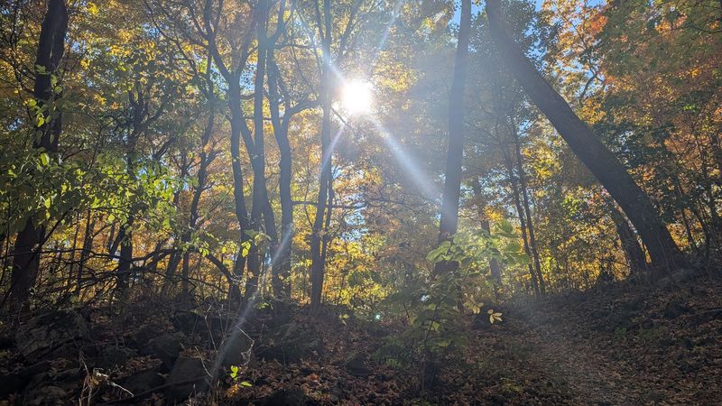
Autumn transforms Cushetunk Mountain into one of the more compelling fall hiking destinations in Hunterdon County. The deciduous forest surrounding the ridge turns orange, red, and yellow in October, and the color wraps around the reservoir below, creating a layered landscape that looks completely different from the summer version of the same trail.
The combination of cooler temperatures, around 60 degrees in mid-October, and the visual change in the forest makes fall the most popular season for hiking here. Trail traffic increases noticeably on weekends during peak foliage, so visiting on a weekday gives a much quieter experience on the same trail.
Spring also offers its own appeal, with the forest floor covered in flower petals as the trees finish their bloom cycle. Winter opens up views that are blocked by leaves during warmer months, particularly the sight lines toward Round Valley Reservoir.
Each season at this preserve has a distinct character, and choosing your timing shapes the entire experience.
How This Preserve Compares to Round Valley Reservoir Nearby
Round Valley Reservoir sits right next door to Cushetunk Mountain Preserve, and the two areas share trail connections, but the experience of hiking each one is noticeably different. Round Valley draws significantly more foot traffic, particularly on weekends, while Cushetunk remains relatively quiet even during peak hiking season.
On a Friday, the Cushetunk trails can be nearly empty, which is a meaningful contrast to the busier atmosphere at the reservoir park. For hikers who prefer solitude over a social trail experience, the preserve offers that without requiring any extra travel.
The trail character also differs. Round Valley offers more shoreline access and flatter sections, while Cushetunk focuses on ridge climbing and elevation gain.
The two parks connect via trail, so ambitious hikers can combine them into a longer outing that covers both water-level and ridge-top terrain in a single trip. Knowing both options exist makes planning a day in this corner of Hunterdon County much more flexible.
Practical Tips Before You Head Out
A few practical details can make the difference between a smooth outing and an avoidable headache at Cushetunk Mountain Preserve. The parking lot is gravel and limited in size, so arriving early on popular weekends prevents the frustration of finding it full.
There are no restroom facilities on site, which is worth knowing before the drive out.
The preserve opens at 8 AM every day of the week and closes at 6 PM, so planning around those hours keeps things straightforward. Some trail sections have been closed at various points for maintenance or safety reasons, and checking current conditions before arriving prevents surprises mid-hike.
Bringing a fully charged phone with a map app loaded is genuinely useful here, not just a precaution. The trail markings are reliable on most routes but inconsistent enough in certain spots that having a digital backup adds real confidence.
A solid pair of boots, water, insect repellent in warm months, and a walking stick for the descent cover most of what this mountain asks of you.


