Plenty of places in New England look peaceful at first glance, but few hide a story like this one. What seems like a calm reservoir in central Massachusetts was once a valley filled with roads, farms, and four small towns.
Today that world sits beneath the surface of the Quabbin Reservoir. Here is what happened in the Swift River Valley, why those towns were erased, and what you can still see around the edges today.
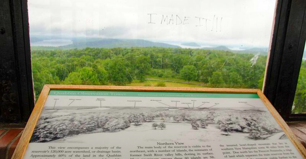
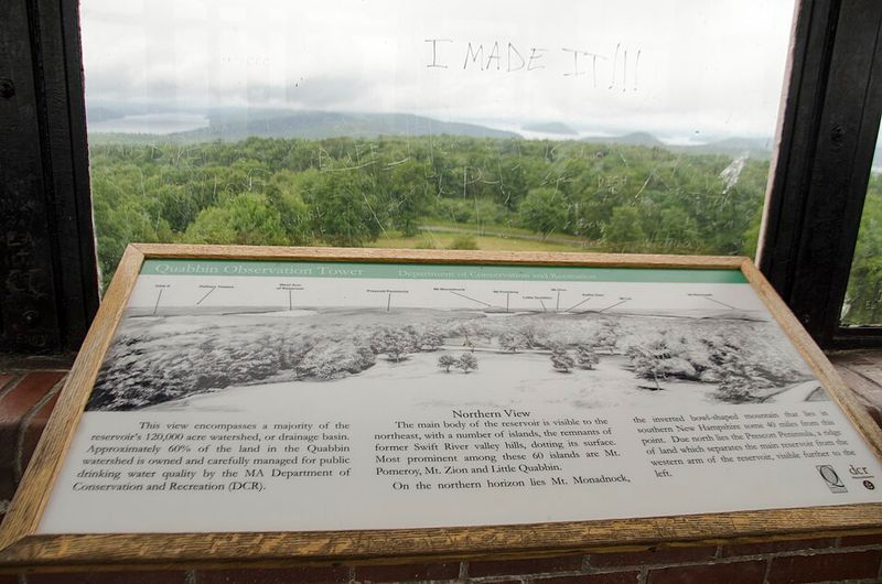
A first look at the reservoir
The first place I would send you is the Quabbin Visitor Center at 485 Ware Road, Belchertown, Massachusetts 01007, because it gives the clearest introduction to Quabbin Reservoir in central Massachusetts, United States. From there, the story stops being abstract and starts feeling startlingly real.
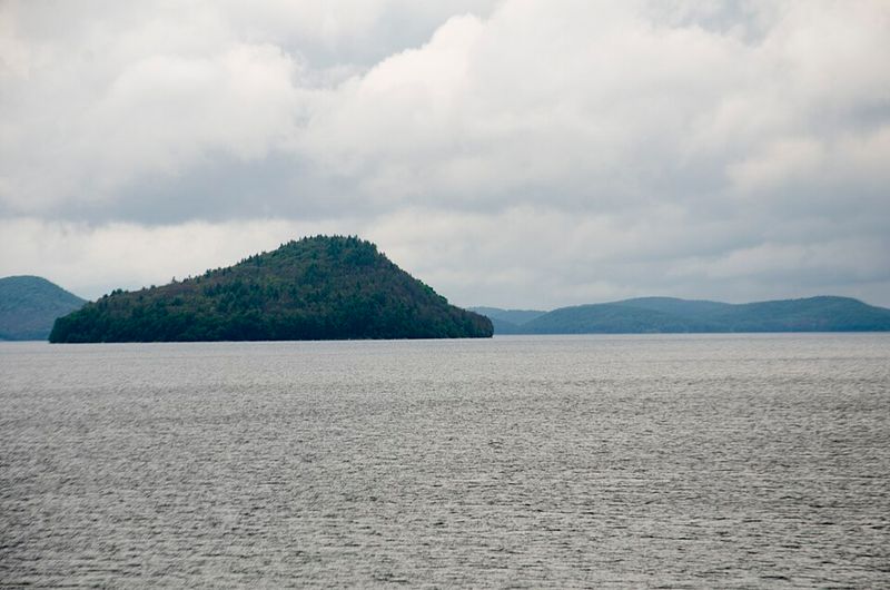
I looked out over miles of water and trees, and the scene seemed almost too serene for the history attached to it. That contrast is what makes this place unforgettable: the surface offers calm, while the backstory keeps tapping you on the shoulder.
Quabbin is not just a scenic stop with handsome overlooks and tidy exhibits. It is a water supply system built on a former valley where four towns once stood, and seeing that fact explained on maps before gazing outside gives the whole visit extra weight.
The visitor center also helps ground the scale of the project, which can be hard to grasp from photos alone. After a few minutes here, even the silence feels informative, and the reservoir starts reading like a history book written in water.
Why this valley was chosen
What grabbed me next was how practical the original decision was, even if the human consequences were enormous. Engineers chose the Swift River Valley because the topography made it ideal for storing a tremendous amount of water for Boston and surrounding communities.
The basin was large, the watershed was favorable, and the region could support a reservoir on a scale that Massachusetts needed in the early twentieth century. Once I understood that geography, the project stopped sounding like a wild idea and started looking like a calculated reshaping of an entire region.
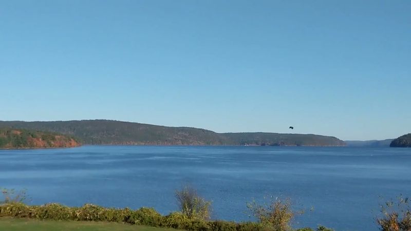
Construction began in the 1930s, and Quabbin eventually became one of the largest man made drinking water reservoirs in the United States. It holds roughly 412 billion gallons, which is one of those numbers that sounds polite on paper and ridiculous in person.
Standing near the overlooks, I kept trying to imagine the valley before the water arrived. The ridgelines still frame the basin so clearly that you can almost sense why planners saw a future reservoir here long before visitors like me came for the view.
Four towns removed from the map
The most startling fact is also the simplest: four whole towns had to go. Dana, Enfield, Greenwich, and Prescott were disincorporated in 1938 so the reservoir project could move forward, and that administrative phrase barely hints at the upheaval behind it.
I found myself repeating those names because they deserve to sound like places, not footnotes. Each town had its own roads, churches, schools, stores, family farms, habits, arguments, celebrations, and routines, and then the state drew a line through all of it.
Enfield was the largest and often described as the commercial center, while the others formed their own close communities across the valley. Together they had existed for generations, which makes their disappearance feel both official and deeply personal at the same time.
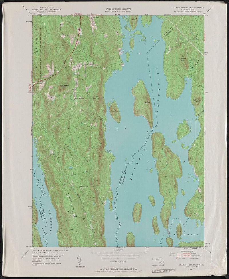
Maps around Quabbin make this history easier to picture because they show the former town boundaries against the modern shoreline. Once I saw those outlines, the reservoir stopped looking like empty space and started feeling like a covered page with old writing still pressing through.
Life in the old Swift River Valley
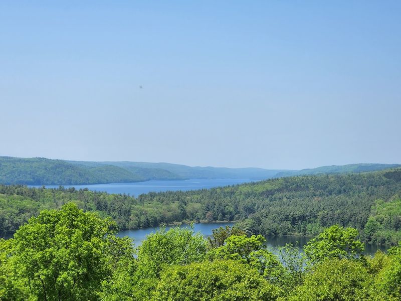
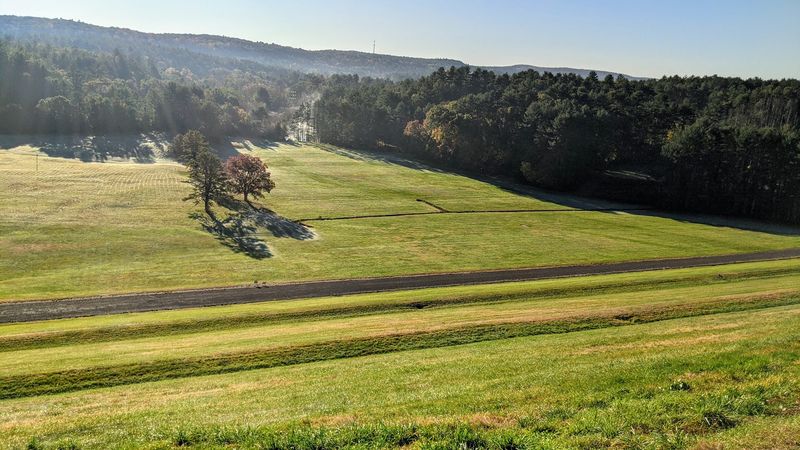
Before Quabbin became a giant sheet of water, the Swift River Valley was a rural patchwork of farms, mills, neighborhoods, and modest town centers. That detail matters because it reminds you the project did not cover wilderness first; it covered lived in places.
I like picturing the valley as working countryside rather than as a dramatic ruin, because ordinary life tells the real story best. Families raised crops, ran local businesses, attended school events, used familiar roads, and built routines that would have seemed permanent until the reservoir plan arrived.
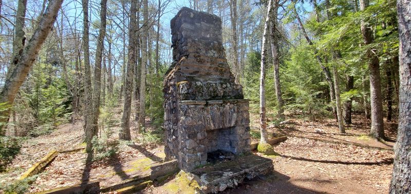
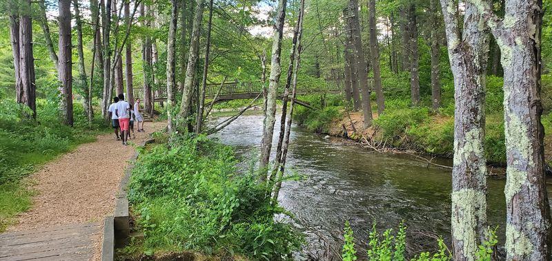
Stone walls, cellar traces, and old alignments around the edges still hint at that earlier world. You do not need a huge imagination to understand it either, since central Massachusetts still has landscapes where fields, woods, and quiet roads fit together in the same pattern.
That is what makes Quabbin so compelling to me as a travel destination. It is scenic, yes, but the beauty lands harder once you realize this calm water replaced a valley where people once worried about weather, chores, neighbors, and supper instead of future shorelines.
The power of eminent domain
Here is where the story turns from fascinating to truly uneasy: Massachusetts used eminent domain to acquire the land needed for the reservoir. Property owners were compensated, but many felt the payments did not reflect what their homes, farms, and livelihoods were really worth.
I cannot read about that process without thinking about how cold paperwork can feel when it lands on a kitchen table. The project may have served a public need, yet the people living in the valley still had to absorb the disruption one move, one negotiation, and one farewell at a time.
Thousands of residents relocated during the late 1920s and 1930s as the towns gradually emptied. Some families moved nearby, others scattered farther away, and all of them had to translate a lifetime of attachments into sale prices and departure dates.
That legal mechanism explains how Quabbin became possible, but it does not make the transition feel neat. Even now, when I look across the reservoir, I think less about engineering jargon and more about how many ordinary front doors once closed for the last time here.
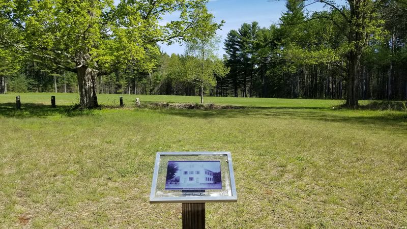
Buildings moved and memorial grounds relocated
Some of the hardest details to absorb involve what happened before the water rose. More than a thousand buildings were removed or relocated, and family plots from valley cemeteries were carefully transferred to new memorial grounds above the future shoreline.
I appreciate that this part of the history is usually told with restraint, because it deserves care rather than melodrama. Houses were sometimes moved to nearby towns, while others were destroyed so future water quality would not be compromised by leftover debris.
The relocation of memorial sites added another layer of emotion for families already leaving familiar land. It meant the reorganization of memory itself, with stones, names, and generations physically shifted so the valley could become part of the reservoir basin.
Nothing about that process sounds simple, even when described in tidy historical summaries. When I visit Quabbin, I keep thinking that the water did not merely cover roads and fields, it followed a long, deliberate clearing of physical traces, as if the landscape had been asked to pack up first.
Dams, roads, and the rising water
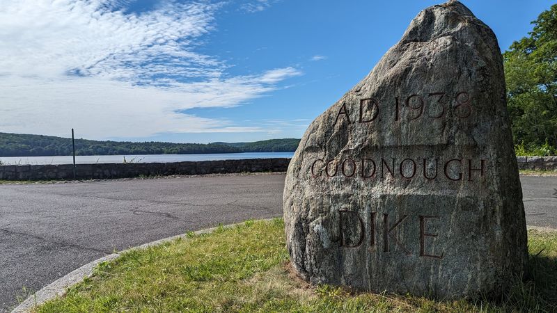
Engineering takes center stage once you get into the mechanics of how the reservoir was actually formed. Winsor Dam and Goodnough Dike were the major structures that allowed the Swift River Valley to be transformed into the vast water body visitors see today.
I was especially struck by Winsor Dam, which stretches impressively across the landscape and makes the scale of the undertaking impossible to ignore. Roads and rail lines also had to be dismantled or rerouted, so the project reshaped movement across the region as thoroughly as it reshaped the valley itself.
Route 32A became one of the bypasses around the new reservoir, a reminder that transportation had to adapt around the future shoreline. Water began filling the basin in the late 1930s, and the reservoir reached full capacity several years later, turning former town land into protected water supply.
There is something oddly humbling about seeing such a quiet place born from such relentless construction. The final result looks natural enough to fool your eyes, but the dams tell the truth with no need for a whisper.
Enfield and the hidden town center
Of the four former towns, Enfield tends to capture the imagination most strongly because it was the valley’s main commercial center. Shops, a school, churches, homes, and a train station once created a busy local hub where there is now only water overhead.
I find that image almost impossible to shake once I have it in mind. The reservoir surface appears smooth and uncomplicated, yet beneath it lies the footprint of streets and gathering places where people once ran errands, chatted with neighbors, and waited for trains like any other day.
Most structures were removed before the basin filled, but foundations, cellar holes, and other remains still exist in parts of the old landscape below. Historians and map makers continue tracing where these streets and buildings once stood, giving form to places that are no longer visible from shore.
That hidden geometry is part of what gives Quabbin its pull. You are not just looking at water and forest, you are standing above an erased downtown, and the thought keeps rippling outward long after the reservoir itself has gone still.
A protected landscape today

One of the biggest surprises for me was how thoroughly the area has become a protected landscape. The watershed is tightly managed to preserve drinking water quality, and that protection has also created extensive habitat for forests, birds, and other wildlife.
Quabbin now feels like a place where history and ecology quietly share the same bench. Bald eagles are one of the better known success stories here, and the overall sense of seclusion is helped by strict rules about access, boating, and where people can go.
Because the reservoir serves as a major water source for Boston and many surrounding communities, conservation is not just a nice extra. Every trail, gate, overlook, and restricted area makes more sense once you remember the reservoir is working infrastructure first and a visitor destination second.
I actually like that balance. It keeps the experience from sliding into theme park territory, and it means the woods, coves, and long views still feel clean, disciplined, and unusually calm, as if the landscape has traded noise for purpose and decided that was a fair bargain.
How to visit with context
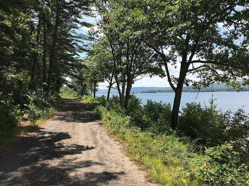
Quabbin rewards a slower visit than I expected, especially if you give yourself time for both scenery and context. The overlooks, trails, and visitor center exhibits work best together, because one gives you the beauty and the other explains why the beauty feels so loaded.
I would not rush through with a quick photo stop and a snack in the car. This is the kind of place where maps matter, where old town names matter, and where a few minutes reading display panels can completely change what you think you are seeing from the next hilltop.
Seasonally, fall is hard to beat for crisp views and color, but quieter days in spring or early summer can feel just as rewarding. Access rules vary by area, so it helps to check current guidance before heading out, especially if you want specific overlooks, gates, or trail options.
The practical payoff is simple: arrive curious, stay patient, and let the place reveal itself in layers. Quabbin does not hand over its story all at once, which is exactly why it lingers so stubbornly in the mind.
What lingers after the visit
Long after I left Quabbin, the strongest impression was not simply the scale of the reservoir. It was the way this place asks you to hold two truths at once: a crucial public water supply and a former valley of towns that still shape the meaning of the landscape.
Descendants and historians continue preserving the memory of Dana, Enfield, Greenwich, and Prescott through reunions, archives, photographs, and local storytelling. That ongoing remembrance keeps the reservoir from becoming just a scenic backdrop with an interesting plaque near the parking area.
I think that is why the place feels so layered and so memorable. The woods are real, the water is real, and the civic purpose is real, yet the past stays present enough that every overlook seems to carry a second, quieter map beneath the first.
For me, Quabbin Reservoir is one of the most unusual historical landscapes in the United States precisely because it does not perform its mystery. It simply sits there in plain view, calm as glass, while an entire vanished region continues to echo underneath.
Why the story still fascinates people today
What makes Quabbin so memorable is the contrast between its peaceful scenery and the history beneath the water. Visitors arrive expecting quiet forests and sweeping views, then learn an entire valley of towns once stood here.
Historians and descendants still preserve the memory of Dana, Enfield, Greenwich, and Prescott through photographs, maps, and reunions. That ongoing remembrance ensures the reservoir remains more than just a water supply – it is also a landscape shaped by a vanished community.


