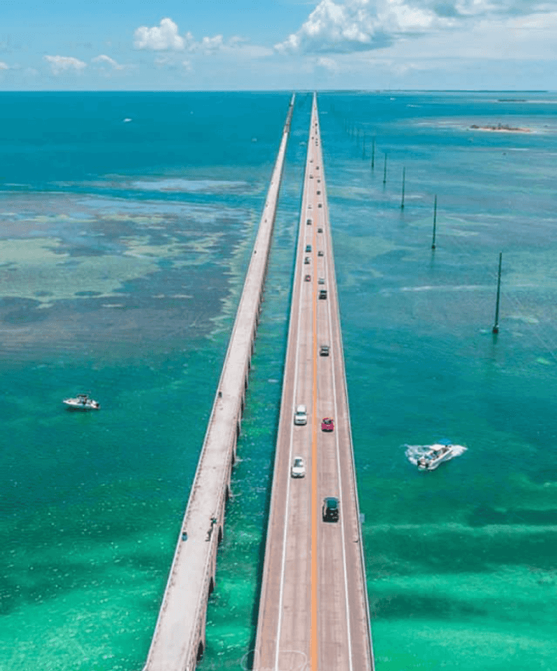
There is a road in Florida that feels less like a highway and more like a bridge to another world. It stretches 113 miles across open water, hopping from island to island through the Florida Keys, with the Atlantic Ocean on one side and Florida Bay on the other.
I have driven a lot of roads across this country, but nothing quite prepares you for that first moment when the land disappears and all you can see is water in every direction. This drive pulls you in with its turquoise views, quirky roadside stops, and that rare feeling of being completely surrounded by the sea while still behind the wheel.
Keep reading, because every mile of this route has a story worth knowing before you go.
Where the Road Begins: Mile Marker 0 and the Heart of the Keys
The Overseas Highway, officially part of US Route 1, runs along the Florida Keys from Florida City at the mainland end all the way down to Key West, with its famous Mile Marker 0 sitting right in the heart of Old Town Key West.
The full address most travelers reference is US-1, Florida Keys, with coordinates placing the route at approximately 24.7435 N, 80.9906 W near the midpoint of the chain.
The road threads through 42 bridges and connects more than 30 individual islands, known locally as keys.
What makes this stretch so unusual is that for long sections, you are genuinely driving over open water, with the pavement elevated on old railroad infrastructure that dates back over a century.
Before you even reach Key West, the highway itself becomes the destination.
The Railroad That Became a Road
Henry Flagler, the railroad magnate behind much of Florida’s early development, had an audacious idea at the turn of the 20th century: build a railroad all the way to Key West.
Construction on the Florida East Coast Railway extension began in 1905, and workers spent years driving concrete and steel into the shallow sea floor under brutal heat and hurricane conditions.
The railroad opened in 1912 and was considered one of the engineering wonders of its era, often called Flagler’s Folly by skeptics who never believed it could be done.
A catastrophic hurricane in 1935 destroyed large sections of the line, and the state of Florida purchased the remaining infrastructure to convert it into a highway.
By 1938, the Overseas Highway was open to cars, and Flagler’s old railroad bridges became the foundation that still carries drivers today.
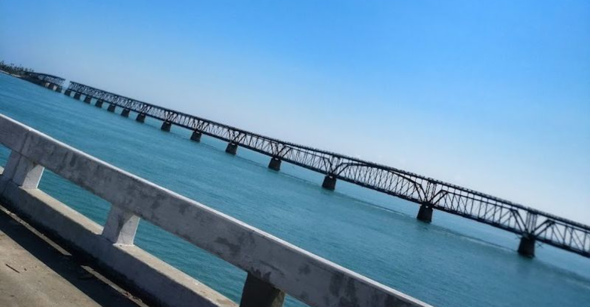
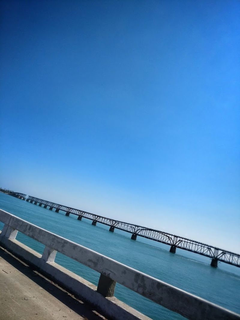
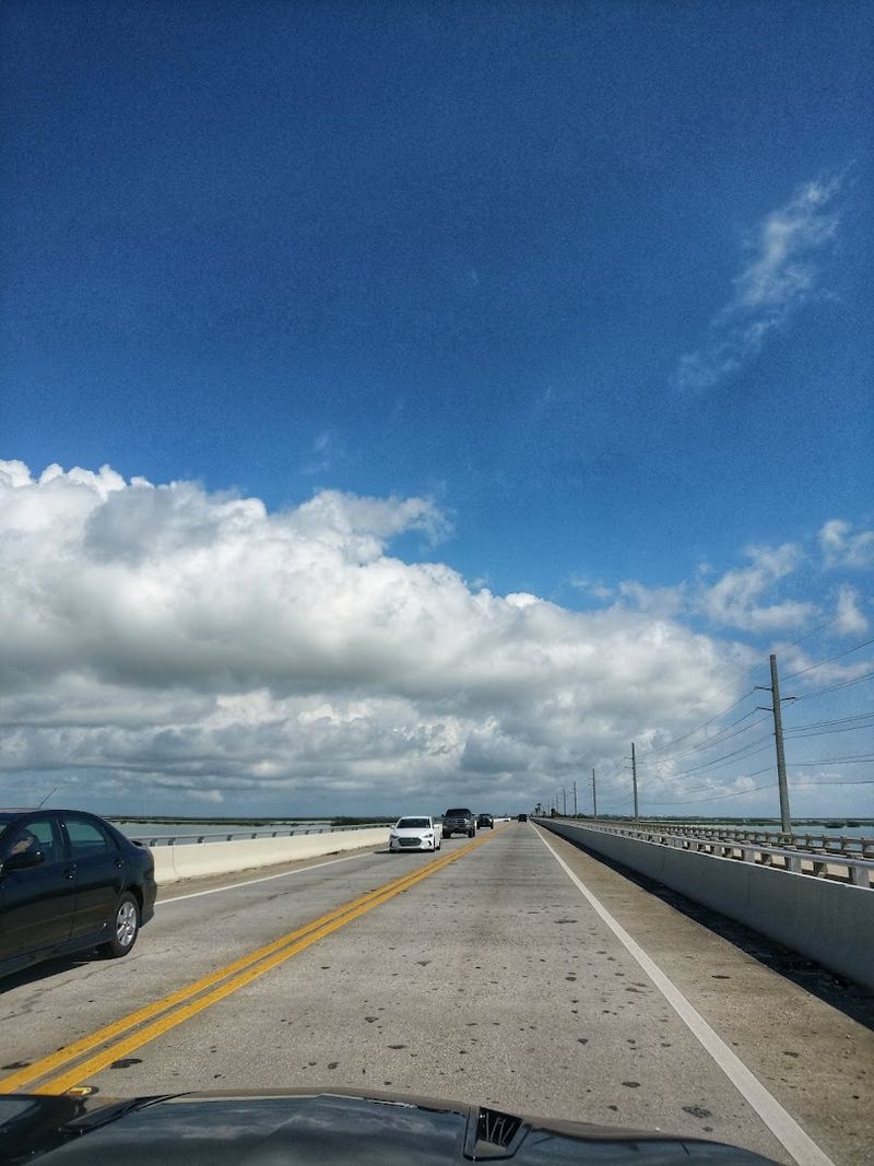
The Seven Mile Bridge: A Drive Over Open Water
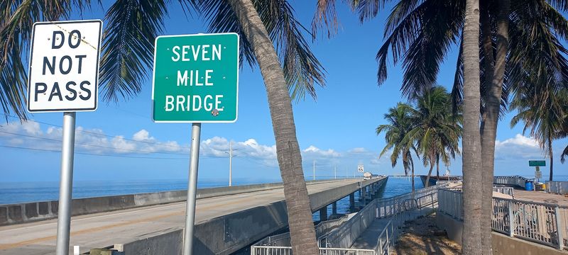
Of all the bridges on the Overseas Highway, the Seven Mile Bridge is the one that stops people mid-sentence when they first see it.
Connecting Knight’s Key in Marathon to Little Duck Key, this bridge stretches 6.79 miles over open Gulf and Atlantic waters and offers some of the most uninterrupted ocean views you will find from any road in the United States.
The current bridge was completed in 1982, and right beside it runs the original Flagler-era bridge, now partially preserved as a fishing pier and historic landmark.
On a clear day, the water below shifts from deep navy blue to brilliant aquamarine as the depth changes, and you can spot fishing boats, pelicans, and the occasional dolphin breaking the surface.
Crossing it feels less like a commute and more like skimming across the top of the sea.
John Pennekamp Coral Reef State Park: The First Stop Worth Making
Just past the northern entrance of the Florida Keys near Key Largo, John Pennekamp Coral Reef State Park sits right off the Overseas Highway and deserves far more than a passing glance.
Established in 1963, it was the first undersea park in the United States, protecting a stretch of living coral reef that runs parallel to the Keys.
Visitors can rent snorkel gear, book glass-bottom boat tours, or take scuba diving excursions to see the reef up close, including the famous underwater statue of Christ of the Abyss, a nine-foot bronze figure resting on the ocean floor.
The park also has paddleboard and kayak rentals for those who prefer to stay on the surface.
I spent a morning here before continuing south, and the reef alone made the entire trip worth planning months in advance.
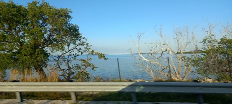
The Colors of the Water: What Makes This Drive So Visually Stunning

One of the first things you notice on the Overseas Highway is that the water on your left and the water on your right are two completely different colors.
To the east sits the Atlantic Ocean, deeper and often a rich cobalt blue, while to the west lies Florida Bay, shallower and typically a lighter, milky turquoise.
This color contrast is not a trick of the light. It comes from the difference in water depth, sediment, and sea floor composition on each side of the narrow island chain.
Early morning drives tend to produce the most vivid colors, when the sun is low and the water catches the light at an angle that makes the whole scene look almost unreal.
Pulling over at any of the small roadside turnouts to just stand and look is something I wish I had done more of on my first trip through.
Islamorada: The Sport Fishing Capital of the World

About halfway up the Upper Keys, Islamorada announces itself with a collection of marinas, fishing charter docks, and roadside seafood shacks that give it a personality unlike anywhere else on the highway.
The village, which actually spans six separate islands, has earned its reputation as the sport fishing capital of the world, drawing anglers who come specifically to chase bonefish, tarpon, and sailfish in the surrounding flats and offshore waters.
Even if fishing is not your thing, Islamorada rewards a stop. The Islamorada Fish Company sits right on the water with open-air seating, and the conch fritters and fresh fish sandwiches hit differently when you are watching pelicans land ten feet from your table.
The Theater of the Sea, one of Florida’s oldest marine parks, also sits along this stretch and offers close-up encounters with dolphins and sea turtles.
Marathon and the Turtle Hospital: A Surprising Roadside Discovery
Marathon sits roughly in the geographic middle of the Keys and serves as a practical rest stop for anyone driving the full length of the Overseas Highway.
Beyond its grocery stores and gas stations, Marathon holds one of the most unexpectedly moving stops on the entire route: the Turtle Hospital, located at 2396 Overseas Highway, Marathon, Florida.
Founded in 1986, it operates as a licensed veterinary facility that rescues, rehabilitates, and releases injured sea turtles, and it offers guided tours that take visitors behind the scenes to see the patients up close.
On my visit, there were loggerheads recovering from boat strikes and green turtles being treated for a condition called fibropapillomatosis, which causes tumor growth on their skin.
The staff explains everything with patience and genuine care, and watching a turtle that was near the end get a second chance at the ocean is something that stays with you.
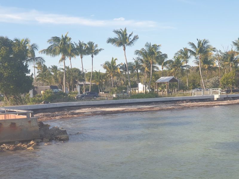
Bahia Honda State Park: The Best Beach on the Highway

Most people do not associate the Florida Keys with great beaches, and honestly, much of the highway does not have traditional sandy shores. Bahia Honda State Park is the exception.
Tucked between the Seven Mile Bridge and Big Pine Key, Bahia Honda offers three separate beach areas with soft white sand and water so clear you can see your feet in four feet of depth.
The remnants of Flagler’s old railroad bridge loom over the park, giving the whole place a dramatic, layered quality that mixes natural beauty with industrial history.
Snorkeling, kayaking, and paddleboarding rentals are available on site, and the park’s campground lets you fall asleep to the sound of water on three sides.
I arrived early on a weekday and had a stretch of beach nearly to myself, which felt like finding a quiet corner of paradise that most people drive right past.
Big Pine Key and the Tiny Deer You Never Knew Existed
Big Pine Key is the kind of place that surprises you. The island is home to the National Key Deer Refuge, which protects the Key deer, a miniature subspecies of the white-tailed deer that stands only about 24 to 32 inches tall at the shoulder.
These animals are found nowhere else on Earth and were nearly pushed to extinction in the mid-20th century before federal protection helped their population stabilize to around 700 to 800 individuals today.
Speed limits drop significantly through Big Pine Key, and for good reason. The deer wander freely near roadsides and residential neighborhoods, completely unbothered by passing cars.
I spotted three of them grazing near a residential street just off the highway, and their small size makes them look almost like a children’s storybook illustration brought to life.
The refuge also protects dozens of other rare species that depend on the freshwater pine rockland habitat found here.
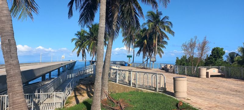
The Old Seven Mile Bridge: Walking Where Trains Once Ran

Right alongside the modern Seven Mile Bridge sits its predecessor, the original Flagler-era structure built in the early 1900s as part of the Florida East Coast Railway extension.
After the new bridge opened in 1982, the old one was preserved and converted into the world’s longest fishing pier, stretching nearly two miles from the Marathon side before a missing section interrupts the span.
Pedestrians and cyclists are welcome on the restored portion, and on any given morning you will find locals with fishing rods, tourists with cameras, and joggers who have claimed this unusual track as their regular route.
The views from the old bridge are arguably better than from the car, because you are standing still, at water level, with nothing between you and the horizon.
Florida’s Department of Transportation has undertaken restoration work on sections of the bridge to keep it accessible for years to come.
Key West: The End of the Road and the Beginning of the Party
After 113 miles of water, bridges, and island hopping, the highway finally delivers you to Key West, the southernmost city in the contiguous United States and one of the most distinctive towns in the country.
Key West operates on its own schedule and its own set of social rules. The streets of Old Town are lined with conch-style Victorian houses painted in soft pastels, shaded by enormous banyan trees, and filled with the kind of independent shops and galleries that resist any attempt at homogenization.
Mallory Square at sunset draws a crowd every single evening for the unofficial Sunset Celebration, where street performers, artists, and visitors gather to watch the sun drop into the Gulf of Mexico together.
Ernest Hemingway’s home at 907 Whitehead Street is open for tours, and the resident six-toed cats that roam the property are a genuine attraction in their own right.
Best Tips for Driving the Overseas Highway
A few practical notes can make the difference between a frustrating trip and a genuinely memorable one on the Overseas Highway.
The drive from Florida City to Key West takes roughly three to four hours without stops, but planning for a full day or even two gives you time to actually enjoy the places along the way rather than just passing through them.
Mile markers run from 126 near Florida City down to 0 in Key West, and locals use them to give directions, so learning the system early saves confusion.
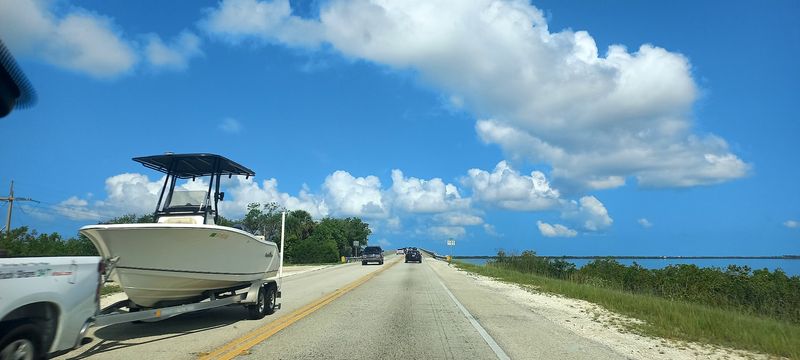
Traffic on US-1 through the Keys can back up significantly on Friday afternoons and Sunday evenings when Miami residents head down or return, so midweek travel is noticeably smoother.
Bring sunscreen, a reusable water bottle, and a camera with extra storage, because the light on the water changes constantly and every bridge offers a view worth capturing.


