There is a trail in northwestern Oregon that turns an old railroad corridor into one of the most rewarding outdoor routes in the Pacific Northwest. It runs 21 miles through dense forest, over historic trestles, and past quiet farmland that feels completely removed from city life.
The kind of place where you can ride a bike for hours without checking your phone once. Whether you are a casual hiker, a weekend cyclist, or someone who just wants fresh air and tall trees, this trail delivers something real and memorable every single time you visit.
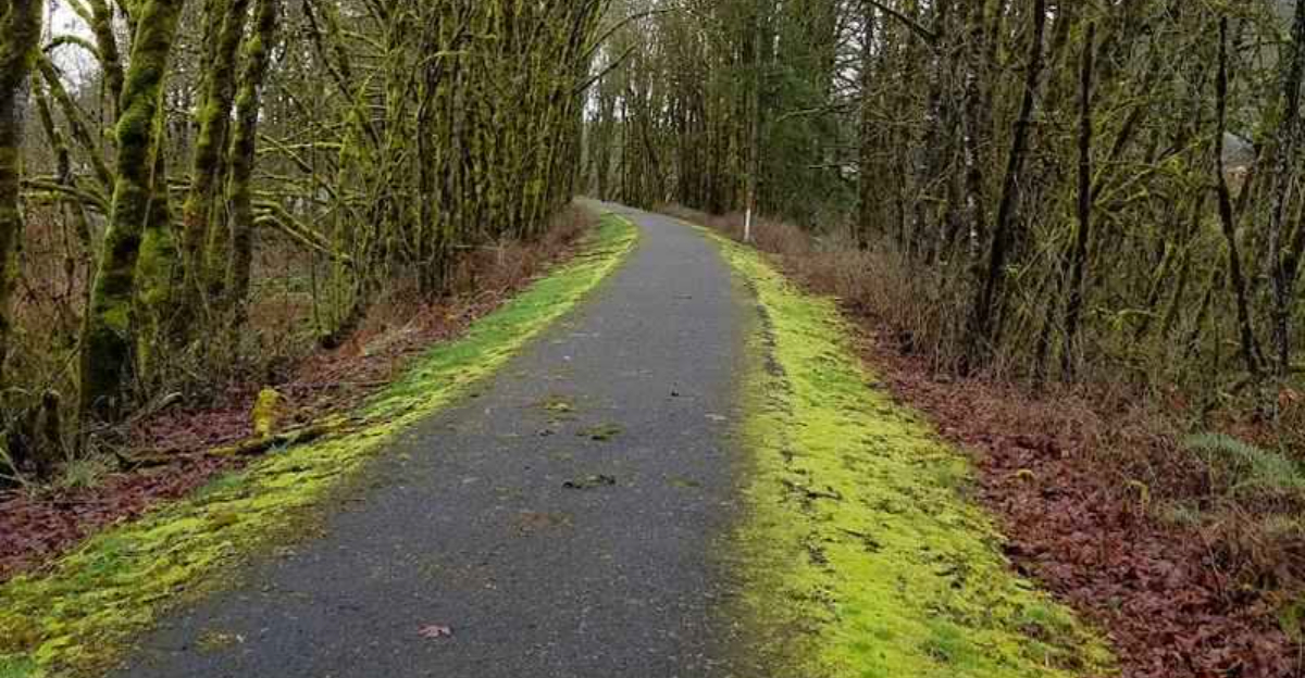
Where the Trail Begins: Banks Trailhead and Location

The Banks-Vernonia State Trail stretches 21 miles through Columbia County in northwestern Oregon, connecting the small town of Banks in Washington County to the town of Vernonia. The southern trailhead sits at 12807 NW Bacona Road, Banks, Oregon 97106, and this is where most visitors start their journey.
Banks itself is a quiet, unassuming town that sits about 30 miles west of Portland. The trailhead parking area is well-maintained, with restrooms, trail maps, and enough space for trailers carrying bikes.
It is easy to find and clearly marked, which is a relief when you are eager to get moving.
The trail follows the old Pacific Railway and Navigation Company railroad grade, which means the elevation gain is remarkably gentle throughout. That gentle grade makes the route accessible to a wide range of fitness levels, from young kids on their first long ride to older adults who want a comfortable but rewarding outing.
Starting at Banks, you immediately feel the forest close in around you in the best possible way.
The History Behind the Rails-to-Trails Conversion

Long before hikers and cyclists claimed this corridor, trains rolled through these hills carrying timber and passengers. The Pacific Railway and Navigation Company built the line in the early 1900s to connect Portland with the Oregon coast, and for decades it served as a vital link for the logging industry that defined this region.
When freight traffic declined and the line was eventually abandoned, the State of Oregon recognized an opportunity. Rather than let the corridor disappear into the undergrowth, the Oregon Parks and Recreation Department converted it into a public trail.
The project was completed in phases, with the full 21-mile trail officially opening in 1990.
Banks-Vernonia became one of the first rail-trails in the Pacific Northwest, and it helped inspire similar projects across the country. The old railroad grade, once built for heavy locomotives, turned out to be ideal for non-motorized travel.
Gentle curves, solid bridges, and a consistent surface made the transition surprisingly smooth. History here is not just a story on a placard; you can actually ride the same route those old trains once traveled.
Trestles and Bridges That Steal the Show

Two of the most talked-about features on the entire trail are the historic trestles that carry you high above the surrounding forest floor. The Horseshoe Bend Trestle and the Buxton Trestle are genuine highlights, and they are the kind of structures that make you slow down, stop pedaling, and just look around.
The Horseshoe Bend Trestle is the larger of the two, rising about 80 feet above a creek bed and offering sweeping views of the tree canopy below. Crossing it on a bike or on foot feels genuinely thrilling without being scary.
The trestles have been carefully restored and fitted with solid railings, so safety is not a concern.
These bridges are a direct connection to the trail’s railroad past. The original wooden trestles were built to carry locomotives, and the fact that they still stand today is a testament to careful preservation work by the Oregon Parks and Recreation Department.
Photographers love the trestles at any time of year, but autumn is especially stunning when the surrounding maples and alders turn gold and orange. Crossing them is easily the most memorable moment on the trail.
Cycling the Full 21 Miles: What to Expect

Riding the full length of the Banks-Vernonia State Trail is one of those experiences that rewards you the entire way. The trail is paved for most of its length, with a short gravel section near the northern end, and the gentle railroad grade means you never face a brutal climb.
The ride from Banks to Vernonia covers 21 miles and involves a net elevation gain of roughly 600 feet heading north, which makes the return trip noticeably faster and easier. Most fit cyclists complete the one-way trip in two to three hours, though stopping for photos, snacks, and trestle gazing adds plenty of extra time.
Road bikes work fine on the paved sections, but a hybrid or gravel bike handles the full trail more comfortably. The trail passes through shaded forest for long stretches, which keeps things cool even on warm summer days.
There are several access points along the route where you can park a second vehicle for a one-way shuttle ride. Families with younger kids often break the trail into shorter segments, using the Stub Stewart State Park section as a midpoint turnaround.
Every mile brings something slightly different to look at.
L.L. Stub Stewart State Park: A Trail Within a Trail

Right in the middle of the Banks-Vernonia State Trail sits one of Oregon’s most conveniently placed state parks. L.L.
Stub Stewart State Park intersects the trail near the town of Buxton and offers campsites, yurts, cabins, and a full network of mountain bike trails that branch off into the surrounding hills.
For anyone doing a multi-day trip on the main trail, Stub Stewart is an obvious and excellent overnight stop. The campground is well-equipped with restrooms, showers, and a camp store, so you are not roughing it completely.
The mountain bike trails inside the park add an extra layer of adventure for riders who want something more technically challenging than the main paved route.
Even if you are just doing a day trip, Stub Stewart makes a great lunch stop. There are picnic tables, open meadows, and enough space to stretch out and rest before heading back.
The park also draws equestrians, who share some of the unpaved side trails. Seeing a group of horses navigate the forest paths while you eat a sandwich is one of those small, unexpected moments that makes a trip feel genuinely complete.
Wildlife and Nature Along the Corridor

The forest along the Banks-Vernonia State Trail is alive in ways that catch you off guard if you are paying attention. Tall Douglas firs and western red cedars form a canopy overhead, while sword ferns and salal cover the forest floor in deep, layered green.
This is classic Oregon Coast Range landscape, and it is genuinely beautiful.
Wildlife sightings are common on quieter mornings. Great blue herons fish in the creeks that run alongside sections of the trail, and Roosevelt elk are occasionally spotted in the clearings near the northern end.
Songbirds are everywhere in spring and early summer, and the sound of a varied thrush calling through the trees is one of those sounds that stays with you.
The creeks and wetlands along the route also support beaver populations, and you can sometimes spot their handiwork in the form of dams and chewed stumps near the water. Wildflowers appear along the trail edges in spring, adding splashes of color to the otherwise green corridor.
Bringing a pair of binoculars makes the wildlife-watching aspect of the trip significantly more rewarding, and it costs nothing extra to slow down and look.
Hiking the Trail: A Different Pace, a Different View

Not everyone who visits the Banks-Vernonia State Trail arrives with a bike. Hikers find the route just as rewarding, especially those who prefer a slower pace that allows for more observation and spontaneous stops.
The paved surface makes for easy walking, and the flat grade is comfortable for long distances.
A round-trip hike of six to eight miles from the Banks trailhead takes you through some of the most scenic forest sections and across the Horseshoe Bend Trestle, which alone is worth the effort. Hikers tend to notice things that cyclists miss, like the texture of moss on old wooden fence posts or the way light hits the creek surface in the late afternoon.
The trail also connects to unpaved side paths in certain sections, giving hikers options to explore off the main corridor. Waterproof boots are a smart choice in wetter months, as mud can collect near creek crossings on the unpaved sections.
Oregon’s rainy season runs roughly from October through March, but hiking in light rain through a dripping forest has its own quiet charm that dry-weather visitors never quite experience.
Vernonia: The Northern End of the Line

Reaching Vernonia after a full day on the trail feels like a genuine accomplishment. The small town of about 2,200 people sits in a valley surrounded by forested hills, and it has the relaxed, unhurried atmosphere that perfectly matches the spirit of the trail itself.
The northern trailhead is right in town, which makes the arrival feel rewarding rather than anticlimactic.
Vernonia has a few restaurants, a bakery, and some local shops where you can refuel after the ride or walk. The town also has a small lake, Vernonia Lake, which is a pleasant spot to sit and rest before heading back or catching a shuttle.
The surrounding area has a strong logging history, and that heritage is visible in the older buildings and the general character of the community.
The town is not a tourist destination in the flashy sense, but that is part of its appeal. It feels authentic and unpretentious, and the locals are genuinely friendly toward trail visitors.
A cold drink and a slice of pie at a local diner after 21 miles on the trail is one of the simplest and most satisfying endings to an outdoor adventure you can have in Oregon.
Planning Your Visit: Seasons, Tips, and Getting There

The Banks-Vernonia State Trail is open year-round, but the experience changes significantly depending on when you go. Summer brings dry conditions, longer daylight hours, and the highest trail traffic, especially on weekends.
Spring and fall offer cooler temperatures, fewer crowds, and the most dramatic natural colors along the route.
Winter visits are absolutely possible and can be surprisingly peaceful, though rain gear and waterproof footwear are non-negotiable. The trail does not close for rain, and the forest looks particularly lush and atmospheric in wet weather.
Just be aware that some parking areas can get muddy after heavy rainfall.
The trail is free to use, though there is a fee for overnight camping at Stub Stewart State Park. Bike rentals are not available at the trailhead itself, so plan to bring your own or arrange a rental in the Portland area before heading out.
The drive from Portland takes about 45 minutes, making this an easy day trip from the city. Dogs are welcome on leash, and the trail is fully accessible for most mobility levels along the paved sections.
Arriving early on summer weekends is the best way to secure a parking spot without stress.


