There is a place in the far western corner of Oklahoma where the road simply stops, the land turns dramatic, and time seems to slow down in the best possible way. Fewer than 150 people call this tiny community home, and yet it sits at the crossroads of some of the most striking scenery in the entire state.
The historic highway that ends here has carried travelers, cattle drovers, and curious adventurers for generations. From the shadow of the tallest peak in Oklahoma to the ancient trails carved into the surrounding mesa country, this little town packs an extraordinary amount of story into a very small footprint.
Stick around, because what lies ahead in this article is well worth the read.
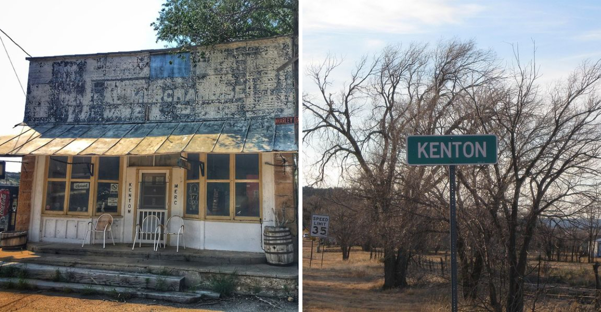
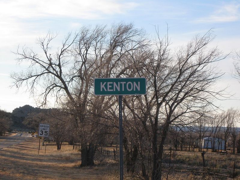
Right at the end of U.S. Route 325, where the pavement gives way to open sky and red rock country, you will find Kenton, Oklahoma, a census-designated place in Cimarron County with a population of just 31 people as of the 2020 census.
The full address is Oklahoma 73946, and the coordinates place it at the far northwestern edge of the Oklahoma Panhandle, tucked into the Cimarron River valley near the New Mexico border.
Most people have never heard of Kenton, and that is honestly part of its appeal. There is no traffic, no crowd, and no noise beyond the wind moving through the high plains.
The town sits just south of Black Mesa, the highest point in the state, and it serves as the unofficial base camp for visitors heading up to that summit. Getting here takes commitment, but the reward is a landscape so raw and open that it genuinely feels like a different world from the rest of Oklahoma.
U.S. Route 325 is not the kind of road that shows up on most people’s road trip playlists, but it should be.
This highway cuts through the Oklahoma Panhandle and terminates right at Kenton, making the town its literal end point.
The route passes through some of the most open and undeveloped land in the entire country, where cell service disappears and the horizon feels impossibly far away. Driving it for the first time is equal parts peaceful and humbling.
The highway has historical roots tied to the cattle drives and wagon trails that once moved through this part of the country. The Santa Fe Trail corridor ran through this general region, and that history gives the road a certain weight that a highway map alone cannot capture.
Travelers who make the drive report that the landscape shifts gradually, going from flat farmland to increasingly rugged mesa terrain as Kenton gets closer. By the time the town appears, the scenery has already made a strong argument for why this remote corner of Oklahoma deserves a lot more attention than it gets.
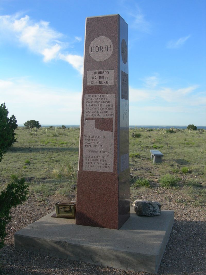
Black Mesa is the main reason most visitors make the long drive to Kenton in the first place. At 4,973 feet above sea level, it is the highest point in Oklahoma, and reaching the summit requires a roughly nine-mile round-trip hike across open terrain.
The mesa gets its name from the dark layer of volcanic basalt that caps its top, a remnant of ancient lava flows that swept through the region millions of years ago. That dark rock creates a striking visual contrast against the red and tan soil below.
The trail to the summit is managed and accessible to the public, and a granite monument marks the exact high point at the top. On a clear day, you can see into three states from up there: Oklahoma, New Mexico, and Colorado.
The hike is not technically difficult, but the distance and the sun exposure make it important to carry plenty of water. Starting early in the morning is the smartest move, especially during the warmer months.
The view from the top, looking out over miles of mesa country, is the kind of payoff that makes every step feel completely worth it.
Kenton sits right inside the Cimarron River valley, and that geography shapes almost everything about the town’s character. The river itself runs through some of the most remote and visually striking terrain in the entire state.
The valley carves a path through layers of red rock and sandstone, creating a landscape that looks more like the American Southwest than what most people picture when they think of Oklahoma. The contrast is genuinely surprising the first time you see it.
The Cimarron River has a long and complicated history in this region. It served as a water source for travelers on the Cimarron Cutoff of the Santa Fe Trail, and its banks have seen centuries of human activity, from Indigenous peoples to Spanish explorers to American settlers moving westward.
Today the river runs low or dry during much of the year, which is typical for rivers in this semi-arid region. But the valley it carved remains deeply impressive, with its wide open floor and the dramatic walls of stone rising on either side.
The setting gives Kenton a natural frame that few other small towns anywhere in the country can match.
With just 31 residents counted in the 2020 census, Kenton is one of the smallest communities in Oklahoma by any measure. The population has fluctuated over the years, and at various points the town has been home to slightly more people, but it has always remained firmly in the category of truly tiny.
Life here operates on a completely different rhythm than anywhere with a traffic light. Neighbors know each other by name, and the community functions through a level of cooperation and mutual reliance that larger towns rarely experience.
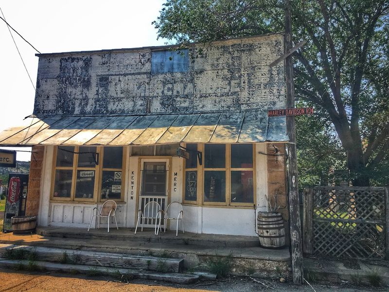
The town does have a few basic services, including a small general store that has served as a gathering point for locals and travelers alike for many years. That kind of place becomes the social hub of a community this size almost by default.
There is something genuinely admirable about a town that keeps going despite its small numbers, remote location, and limited infrastructure. The people who choose to live in Kenton are not there by accident.
They value the quiet, the space, and the particular kind of freedom that comes with living at the edge of the map.
One of the most unexpected things about the Kenton area is that you can actually walk alongside dinosaur footprints. The region around Black Mesa contains some of the best-preserved dinosaur tracks in the entire state, embedded in the ancient rock that makes up this part of the landscape.
The tracks date back roughly 150 million years to the Late Jurassic period, when this area was a very different environment. Large sauropods and other dinosaurs left their impressions in what was then soft sediment, and those impressions hardened into stone over millions of years.
Several sites in the area allow visitors to see these tracks up close, and the experience of standing next to a footprint made by an animal that enormous and that ancient is genuinely hard to put into words. It puts the age of the landscape into a very concrete perspective.
The Black Mesa area has also yielded significant fossil discoveries over the years, attracting paleontologists and researchers from universities and museums. The rock layers here tell a long and layered story of life on this continent, and Kenton happens to sit right in the middle of that story.
The land around Kenton carries the memory of one of the most important trade routes in American history. The Cimarron Cutoff of the Santa Fe Trail passed through this region, connecting Missouri to Santa Fe in what is now New Mexico.
Wagon trains, merchants, and military expeditions all moved through this corridor during the peak years of the trail’s use in the 1800s. The terrain they crossed was essentially the same landscape you see today: wide, dry, and exposed, with the mesas serving as landmarks in an otherwise featureless expanse.
Historical markers in the Kenton area acknowledge this trail history, and for anyone who finds American frontier history compelling, standing in a place where those wagons actually rolled is a surprisingly moving experience.
The Cimarron Cutoff was considered the more dangerous branch of the Santa Fe Trail because of its lack of reliable water sources and its exposure to the elements. That history gives the landscape around Kenton an extra layer of meaning that goes well beyond its visual drama.
Every mile of this terrain was once hard-earned ground.
The remote setting around Kenton supports a surprisingly rich variety of wildlife. Pronghorn antelope are a common sight on the open plains surrounding the town, and they move through the landscape with a speed and grace that is hard to match in the animal world.
Mule deer, coyotes, and various raptor species also frequent the area. Golden eagles are spotted regularly here, riding the thermals above the mesas and scanning the ground below with the kind of patience that only a bird with a six-foot wingspan can afford.
The high desert environment around Black Mesa supports plant and animal communities that are distinct from the rest of Oklahoma, with species more commonly associated with the Rocky Mountain foothills and the Chihuahuan Desert to the south. That ecological overlap makes the area genuinely interesting for naturalists.
Birdwatchers in particular find the Kenton area rewarding, as the mix of open grassland, rocky mesa, and river valley creates diverse habitat within a relatively small geographic area. The quiet of the place also means that wildlife is not constantly startled or pushed away, so patient observers tend to be well rewarded.
Just outside of Kenton, Black Mesa State Park and Nature Preserve offers one of the more unusual state park experiences in Oklahoma. The park sits at the base of the mesa and provides camping, fishing, and access to the surrounding landscape.
A small lake within the park offers a peaceful spot for fishing and wildlife watching, and the campground there gives visitors a comfortable base for exploring the area over multiple days. Spending a night under the stars here, with almost zero light pollution in any direction, is an experience worth planning a trip around.
The Nature Preserve section of the park protects a significant stretch of the mesa and its surrounding terrain, preserving both the geological features and the wildlife habitat that make this area so distinctive. It is one of the few places in Oklahoma where the landscape feels genuinely wild in every direction.
The park is managed by the Oklahoma Department of Wildlife Conservation, and it remains one of the lesser-known state parks in the system despite being one of the most visually dramatic. Visitors who discover it tend to leave with a strong urge to come back, preferably for longer next time.
Spring and fall are widely considered the best seasons to visit the Kenton area. Temperatures during those months are manageable for hiking, the light is beautiful for photography, and the landscape takes on a warmth that the harsh summer sun tends to wash out.
Summer visits are possible but require serious preparation. Temperatures regularly climb well above 90 degrees Fahrenheit, and the lack of shade on the Black Mesa trail means heat exposure is a real consideration.
Carrying at least two liters of water per person is a minimum, not a suggestion.
Winter brings cold temperatures and occasional snow, which actually transforms the mesa country into something visually stunning. However, road conditions in this remote area can become tricky, so checking the weather carefully before heading out is important.
The nearest larger town with gas stations, grocery stores, and lodging options is Boise City, about 30 miles to the east. Filling up your tank before heading to Kenton is essential, as services in town are extremely limited.
Cell service is also unreliable throughout the area, so downloading offline maps before arrival is genuinely useful advice.
The rock beneath and around Kenton tells a story that spans hundreds of millions of years. The mesa country here exposes layer after layer of sedimentary rock, with the dramatic dark basalt cap of Black Mesa sitting on top like a geological exclamation point.
That basalt layer is the remnant of lava flows that originated in what is now northeastern New Mexico, spreading east across the landscape roughly 30 million years ago. The hardness of that volcanic rock protected the softer sedimentary layers beneath it from erosion, which is why the mesa stands so tall while the surrounding land has worn away.
The red and orange sandstone visible throughout the valley comes from ancient river and desert deposits, laid down when this region looked nothing like it does today. Reading those layers is like flipping through a very slow and very old book about the history of the continent.
Geology enthusiasts find the Kenton area endlessly fascinating for exactly this reason. The exposure of so many different rock types and time periods in a relatively compact area makes it an outdoor classroom that no textbook can quite replicate.
Every cliff face here has something worth stopping to look at.
Most travel destinations are easy to forget once you are back home and the routine takes over. Kenton, Oklahoma, is not one of those places.
The combination of scale, silence, and raw landscape tends to stick with people in a way that is difficult to explain to someone who has not been there.
There is something about standing in a place where the nearest traffic jam is a hundred miles away, where the sky takes up more visual space than the land, and where the rocks beneath your feet are older than anything you can comfortably wrap your mind around.
The smallness of the town itself adds to the effect rather than detracting from it. Knowing that fewer than 150 people have ever chosen to call this corner of the world home makes every visit feel like a privilege, like being let in on a secret that most of the country does not know exists.
Whether you come for the hike, the history, the fossils, or simply to see what the end of a historic highway actually looks like, Kenton delivers something genuine. And in a world full of overhyped destinations, genuine is exactly what most travelers are quietly searching for.


