There is a trail in southeastern Oklahoma that winds through cathedral-like stands of longleaf pine, climbs ridgelines with sweeping views, and eventually delivers you to a quiet highland lake so still it looks like polished glass. Most people drive right past this part of the state without a second thought, which is honestly their loss and your gain.
The Ouachita National Forest stretches across the Ouachita Mountains and rewards every hiker who shows up with boots laced and curiosity intact. Whether you are a seasoned trail runner or someone who just discovered that hiking pants have zip-off legs, this forest has something genuinely worth the drive.
Where the Trail Begins: Location and Access
The Oklahoma side of Ouachita National Forest sits in the Ouachita Mountains of southeastern Oklahoma, part of a massive federal forest that spans from eastern Oklahoma into western Arkansas, with administrative offices located in Hot Springs, AR 71902, reachable at +1 501-321-5202.
Most Oklahoma-based hikers access the forest through LeFlore and Latimer counties, where forest roads branch off Highway 270 and lead to trailheads tucked quietly between ridgelines.
The Ouachita National Recreation Trail, one of the longest continuous hiking trails in the central United States at roughly 223 miles, begins near Talihina, Oklahoma, making it a natural starting point for anyone wanting a taste of the highland pine experience.
Parking areas near the Talihina trailhead are free, well-maintained, and typically uncrowded on weekday mornings.
Signage at the main entry points is clear enough to orient first-timers, though downloading a detailed forest map before arrival is genuinely the smartest thing you can do before setting foot on any trail here.
Towering Pine Forests That Feel Like a Different World
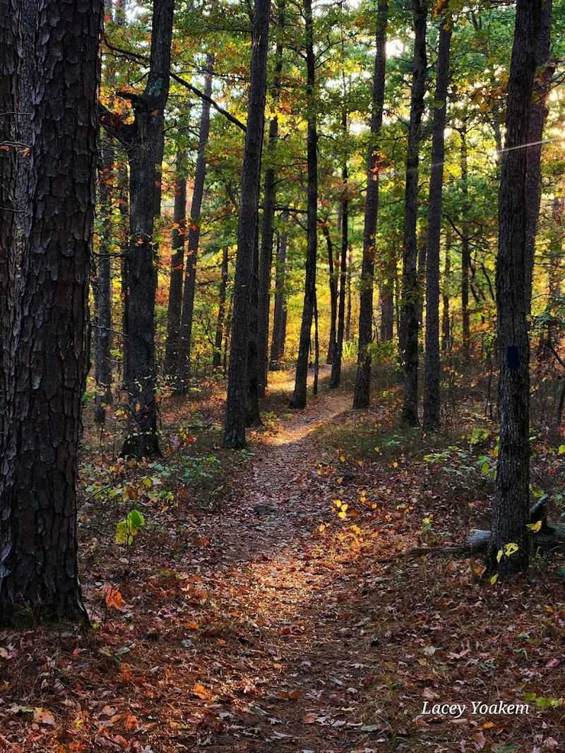
The moment you step past the trailhead and into the tree line, the temperature drops a few degrees and the noise of the modern world simply stops.
Shortleaf pines dominate the Oklahoma portion of the forest, growing tall and straight like columns holding up a green ceiling, their bark plated in reddish-brown scales that catch the afternoon light in a warm, amber glow.
Mixed in among the pines are hickory, oak, and dogwood, so the forest floor shifts from deep shade to dappled pockets of sunlight depending on where the canopy opens up.
The understory stays relatively clear on well-traveled sections of trail, which means you can actually see some distance into the woods without fighting through brush.
In early spring, the ferns push up through the pine needle carpet and the whole forest floor turns a vivid, almost electric shade of green that photographs beautifully but honestly looks even better in person.
There is a particular quality to the pine-scented air here that no candle company has ever successfully bottled, and breathing it in for the first time feels like a genuine reset for the lungs.
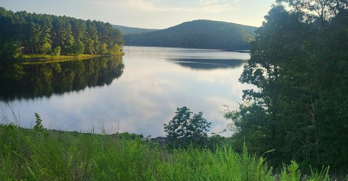
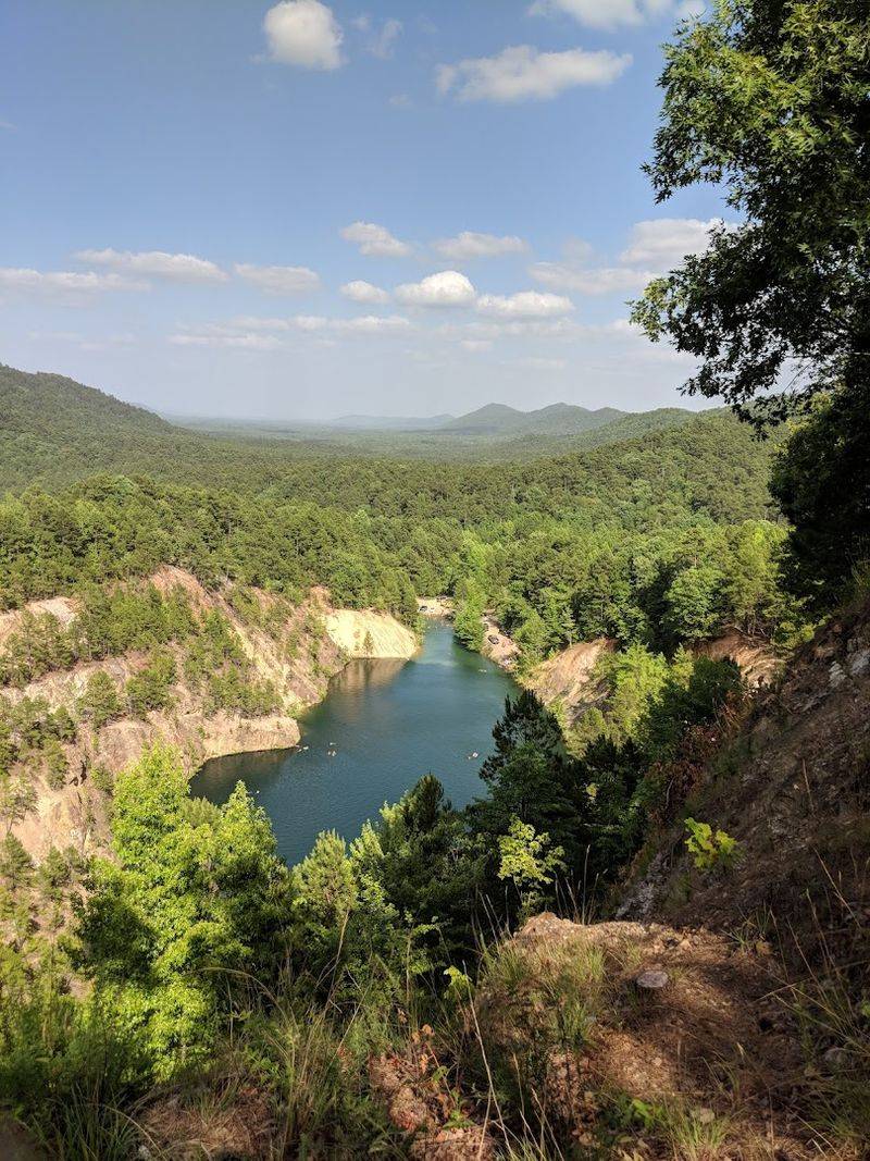
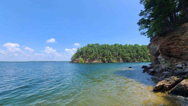
The Highland Lake Reward at the End of the Climb
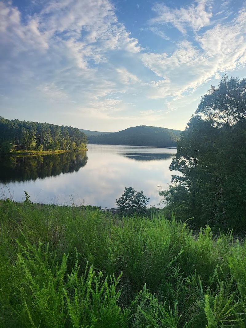
After a few miles of steady climbing through pine-covered slopes, the trail delivers one of the more satisfying payoffs in all of Oklahoma outdoor recreation: a quiet highland lake ringed by forested ridges and almost completely free of crowds.
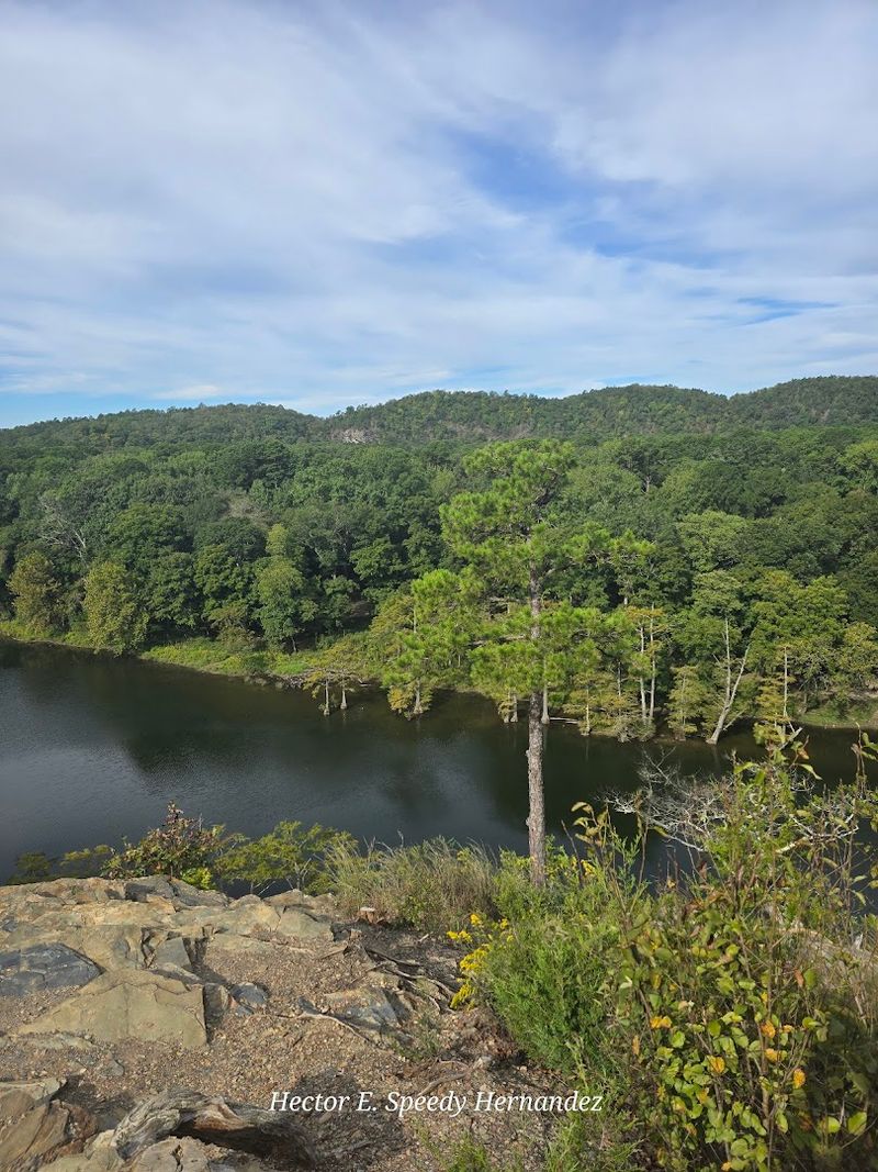
Lake Wister and smaller backcountry water bodies near the forest interior offer this kind of solitude, but the truly remote highland lakes accessible only by trail feel like personal discoveries rather than tourist stops.
The water in these forest lakes sits unusually clear for the region, reflecting the surrounding pine ridgelines with a mirror-like quality that makes every photo look professionally composed.
Anglers come here for largemouth bass and catfish, but plenty of hikers simply sit at the water’s edge, eat a sandwich, and stare at the ridgeline reflection for twenty minutes without checking their phones.
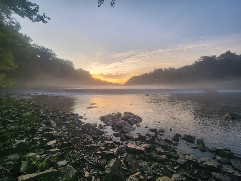
Sunrise visits are especially worth the early alarm, because the mist that settles over the lake surface in cool mornings creates a low, drifting layer of fog that turns the whole scene into something quietly extraordinary.
The Ouachita National Recreation Trail: A Hiker’s Main Event
The Ouachita National Recreation Trail is the crown jewel of the forest trail system, and its Oklahoma section alone offers enough variety to keep any hiker busy for multiple trips.
The trail runs east to west across the Ouachita Mountains, crossing ridgelines, creek drainages, and open pine savannas, with elevation changes that range from gentle rollers to some genuinely lung-testing climbs near the higher peaks.
Day hikers typically pick a section between two trailheads and shuttle a vehicle, which lets you enjoy a one-way route without retracing steps.
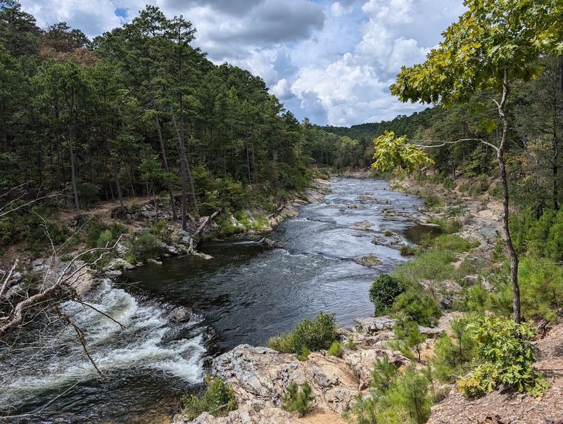
The trail is well-blazed with orange markers in most sections, and the tread is generally solid, though a few creek crossings can get slippery after rain.
Backpackers planning overnight trips will find established camping areas and water sources along the route, though treating or filtering any water you collect from streams is simply non-negotiable out here.
The trail shuttle service that operates in the area is friendly, reliable, and has saved more than a few hikers from a very long walk back to their car.
Wildlife Along the Route: Who Else Is Out Here
The forest is busy in ways that are easy to miss if you are moving too fast or staring at your phone instead of the tree line.
White-tailed deer are common sightings along the Oklahoma trails, often spotted at dawn or dusk near meadow edges and creek banks where they come to graze and drink.
Wild turkey populations are healthy here, and their distinctive calls echo through the trees in early morning in a way that is both startling and oddly delightful the first time you hear it.
Black bears do live in the Ouachita Mountains, and while encounters are rare, storing food properly and making a reasonable amount of noise on the trail is standard practice rather than optional advice.
Rattlesnakes appear occasionally in spring and summer, particularly on rocky south-facing slopes where they warm up in the sun, so watching where you step and where you place your hands on rocks is genuinely important.
In September, tarantulas have been spotted crossing forest roads in the area, which is either fascinating or alarming depending entirely on your personal relationship with large spiders.
Best Seasons to Visit and What to Expect
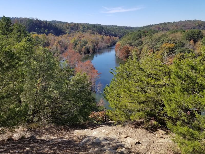
Late fall and early winter are widely considered the best seasons to hike the Oklahoma portion of the forest, and the reasons are both practical and beautiful.
Temperatures cool to comfortable hiking range, the leaf-off season opens up long-distance ridge views that are completely hidden during summer, and the trail crowds thin out considerably after October.
Spring brings its own appeal, with wildflowers, fresh fern growth, and morning fog that clings to the creek valleys in photogenic layers, though trail mud can be a real factor after heavy rains.
Summer hiking is absolutely possible, but the heat and humidity in southeastern Oklahoma are not subtle, and starting any hike by 7 a.m. and finishing before midday is the single most effective strategy for enjoying the experience rather than surviving it.
Winter visits have a spare, dramatic quality, with ice-coated tree branches and open views across bare ridgelines that look like something from a landscape painting.
Packing layers regardless of season is smart, because mountain weather in the Ouachitas can shift from warm and sunny to cool and windy within a single afternoon.
Camping Under the Pines: Sleeping in the Forest
Camping in the Oklahoma section of the Ouachita National Forest ranges from developed sites with basic facilities to completely primitive backcountry spots where your only neighbors are the trees and whatever wildlife decides to investigate your campsite at 2 a.m.
Primitive camping along the Ouachita National Recreation Trail is free and requires no reservation, which is a genuinely rare and refreshing policy in an era when securing a campsite often feels like buying concert tickets.
Developed campgrounds in the area offer fire rings, picnic tables, and vault toilets, with some sites close enough to water that you can hear a creek from your sleeping bag.
Hammock camping works beautifully here given the density and spacing of the pine trunks, and the forest canopy provides natural shelter during light rain.
Nights in the forest are impressively dark and quiet, making stargazing from a camp chair a legitimate activity rather than an afterthought.
Bringing a solid bug net and insect repellent for summer and early fall camping is less of a suggestion and more of a survival requirement.
Quartz Crystals and Geology: The Ground Has Stories
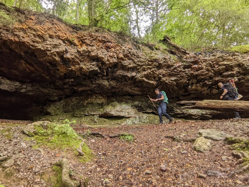
One of the more surprising things about hiking through the Ouachita Mountains is what the ground itself is made of, and the geology here is genuinely fascinating even for people who do not normally think twice about rocks.
The Ouachita Mountains are among the oldest mountain ranges in North America, formed through ancient tectonic collisions that pushed and folded layers of rock into the ridged, east-west running landforms visible on any topographic map today.
Quartz crystals and nodules appear along certain trails, particularly in the Arkansas portions of the forest, but the geological formations extend across the Oklahoma side as well, with interesting rock outcroppings visible on ridge hikes.
The crystal-rich areas around the broader forest have made this region popular with rockhounds, and designated collecting areas exist where visitors can legally take home a reasonable amount of quartz.
Even without collecting anything, spotting the way quartz veins run through exposed rock faces along the trail adds a layer of visual interest to a hike that already has plenty going for it.
The mountains themselves tell a 300-million-year story underfoot, which makes every step feel a little more meaningful.
Practical Tips for First-Time Visitors
A few practical details can make the difference between a smooth, enjoyable day in the forest and one that involves a lot of frustration and unnecessary backtracking.
Downloading the Ouachita National Forest motor vehicle use map and the relevant trail maps before leaving cell service is the single most useful thing a first-time visitor can do, since phone signal disappears quickly once you are a mile or two from the highway.
Forest roads are generally accessible to standard vehicles during dry conditions, but after heavy rain some roads become slick and rutted enough to challenge two-wheel-drive vehicles.
Gates on forest roads can be closed without much warning, so having an alternate exit route in mind is a practical habit rather than paranoia.
Water sources exist along most trails, but carrying at least two liters from the trailhead and treating anything you collect in the field is the standard approach for any hike longer than four miles.
The forest website at fs.usda.gov/ouachita carries current road and trail conditions, and checking it the day before a planned visit takes about three minutes and can save a very long drive to a closed trailhead.
Why This Oklahoma Forest Keeps Pulling People Back
The Ouachita National Forest has a return visitor rate that speaks for itself, and spending even one full day in the Oklahoma section makes it easy to understand why people keep coming back season after season.
The combination of accessible trails, free primitive camping, clean highland lakes, and a forest landscape that genuinely changes with each season creates a destination that never feels entirely used up.
The forest spans from eastern Oklahoma all the way to Hot Springs, Arkansas, and the scenic drive connecting the two states through the heart of the mountains is one of the most underrated road trips in the entire south-central United States.
For Oklahoma City residents, the drive to the Talihina area takes roughly one hour and forty-five minutes, which puts a full mountain hiking experience well within reach of a weekend without requiring any serious logistical planning.
There is something about a place that costs almost nothing to visit, requires no reservations, and consistently delivers views and experiences that feel genuinely earned rather than packaged for tourists.
The Ouachita Mountains are not flashy, but they are honest, and that turns out to be exactly what a lot of people are looking for.


