There is a place tucked between Hilton Head Island and Savannah, Georgia, where the roads are mostly unpaved, golf carts outnumber cars, and the Spanish moss hangs so thick it feels like the whole island is draped in lace. No bridges connect it to the mainland.
You have to earn your way there by ferry, which means the crowds that swamp so many coastal destinations simply never show up. What you find instead is a small, unhurried sea island roughly five miles long and two and a half miles wide, where the salt air smells clean, the marshes glow gold at sunset, and history peeks out from behind every mossy oak.
This is the kind of place that makes you slow your pace without even trying, and once you read what is waiting here, you will want to book that ferry ticket immediately.
Where Exactly Daufuskie Island Sits on the Map

Daufuskie Island sits at the very southern tip of South Carolina’s sea island chain, nestled between Hilton Head Island to the north and Savannah, Georgia, to the southwest. It is the southernmost permanently inhabited sea island in the entire state, which gives it a borderline character all its own.
The island covers roughly eight square miles, stretching about five miles in length and nearly two and a half miles wide. Its coordinates place it at approximately 32.1188 degrees north latitude and 80.8644 degrees west longitude, deep in the Lowcountry.
No road bridge connects Daufuskie to the mainland or to neighboring islands, so the only way in is by private boat or passenger ferry. That geographic isolation is exactly what has kept the island so wonderfully unchanged, and it is the first thing that sets the tone for every visit.
The Ferry Ride That Sets the Mood

Getting to Daufuskie is half the experience, and that is not an overstatement. The ferry departs from Hilton Head Island, and the ride across the Calibogue Sound takes only about 45 minutes, but those minutes feel like a genuine transition from the busy modern world into something quieter and older.
The water on the sound can be glassy calm on a still morning, with pelicans skimming the surface and dolphins occasionally surfacing alongside the boat. On a breezy afternoon, the chop adds a little drama and salt spray to the crossing.
Passenger ferries run on a schedule, so checking times in advance is important, especially if you are day-tripping. Missing the last boat back is the kind of adventure that sounds fun in a story but less fun in real life.
Arriving by water means your first view of the island is its wild, uncleared shoreline, and that first impression sticks.
A History Rooted in the Gullah Geechee Culture

Long before resort developers discovered the Lowcountry, Daufuskie was home to a deeply rooted Gullah Geechee community, descendants of enslaved Africans who built a distinct culture on these sea islands that has survived for generations.
The Gullah Geechee people maintained their own language, foodways, crafts, and spiritual traditions, many of which were preserved on Daufuskie precisely because the island’s isolation kept outside influences at bay longer than most places. Walking the island today, you can still feel that cultural weight in the old cemeteries, the remaining historic churches, and the stories that locals share.
The Gullah Geechee Cultural Heritage Corridor, a federally designated area, runs through this region and recognizes the significance of these communities along the southeastern coast. Daufuskie is one of the most authentic places to encounter this living heritage, and approaching it with curiosity and respect makes the visit far more meaningful.
The First Union African Baptist Church

Few buildings on the island carry as much quiet power as the First Union African Baptist Church, one of the oldest structures still standing on Daufuskie. Built in 1881, this simple white wooden church served as the spiritual center of the island’s Gullah Geechee community for well over a century.
The church sits beneath enormous live oak trees, their branches wide and arching, and the surrounding grounds include a historic cemetery where generations of island families are buried. The headstones tell stories in their own right, some carved with symbols that blend African spiritual traditions with Christian faith.
Services are no longer held regularly at the original building, but it remains a place of deep historical significance that visitors are encouraged to approach thoughtfully. Spending a few quiet minutes here, reading the names and dates on those old stones, gives the island’s past a human face that no museum exhibit could replicate.
The Mary Field School and Pat Conroy’s Legacy

One of the most talked-about chapters in Daufuskie’s modern history began in 1969, when a young teacher named Pat Conroy arrived to teach the island’s children at the two-room Mary Field School. What he found was a group of kids who had been largely cut off from mainland education, and what he did about it became the basis for his memoir, The Water Is Wide.
Conroy’s time on Daufuskie was brief but transformative, both for the students he taught and for the writer he became. The book drew national attention to the isolation and neglect that small island communities could face, and it launched one of the American South’s most celebrated literary careers.
The old Mary Field School building still stands on the island, a modest reminder of that story. For readers of Conroy’s work, visiting the school feels like stepping directly into a page of literary history, which is a rare and genuinely moving experience.
Exploring the Island by Golf Cart

Once you step off the ferry, you quickly realize that Daufuskie operates on its own transportation logic. There are no traffic lights, no gas stations, and almost no paved roads.
The island’s preferred mode of getting around is the golf cart, and renting one is practically a rite of passage for first-time visitors.
The unpaved roads wind through maritime forest, past old homesites, along the beach, and through neighborhoods where residents have settled into a pace of life that feels genuinely different from anything on the mainland. A full loop of the island by cart takes only a couple of hours, but most people stretch it out all day by stopping constantly.
Rental options are available near the ferry dock, and rates are reasonable for a half day or full day. Bring sunscreen, a hat, and a sense of adventure, because some of those sandy tracks lead to surprisingly beautiful and unexpected spots.
Melrose Beach and the Atlantic Shoreline

The Atlantic-facing side of Daufuskie offers several miles of beach that feel nothing like the crowded resort strands found on Hilton Head or Myrtle Beach. The shoreline here is wide, flat, and almost entirely undeveloped, with just the sound of the surf and the occasional shorebird for company.
Melrose Beach, on the southeastern end of the island, is one of the most accessible stretches and one of the most beautiful. At low tide, the packed sand extends far out, making it ideal for long walks, shell collecting, and watching brown pelicans dive just beyond the break.
The beach also faces east, which means sunrise here is genuinely spectacular, with the light coming up directly over the water in shades of orange and pink. Waking up early enough to catch that light is one of those travel moments that feels almost unfairly good, and this beach delivers it reliably.
The Haig Point Lighthouse

Standing at the northern tip of the island, the Haig Point Lighthouse is one of Daufuskie’s most photogenic landmarks and one of the few remaining range lights of its type on the East Coast. Built in 1873, it guided ships through the tricky channels of the Calibogue Sound for decades before being decommissioned.
The lighthouse is now part of the private Haig Point Club community, which limits access for general visitors, but it is clearly visible from the water and from certain points near the club’s grounds. The structure is well preserved, painted white, and framed beautifully by palmettos and coastal oaks.
History buffs and architecture lovers tend to make a point of getting as close a look as possible, and ferry tours sometimes pass close enough for good photographs. Even a distant view of this lighthouse, rising above the tree line at the island’s edge, is a genuinely striking sight.
Wildlife and Birdwatching on the Marshes

The salt marshes surrounding Daufuskie are among the most productive ecosystems on the East Coast, and they support an extraordinary variety of wildlife. Great blue herons, snowy egrets, roseate spoonbills, and wood storks are all regular visitors to the tidal flats and creek edges that frame the island.
During fall and spring migration, the island becomes a stopover point for dozens of songbird species moving along the Atlantic Flyway, and serious birders have been known to rack up impressive lists in a single morning. Loggerhead sea turtles also nest on the Atlantic beaches during summer, and the island’s low human traffic gives those nests a better chance of success than most developed beaches.
Kayaking the tidal creeks at dawn is one of the best ways to encounter the marsh wildlife up close. The water is calm, the light is extraordinary, and the birds are so accustomed to the quiet that they barely acknowledge your presence.
The Old Daufuskie Crab Company

No visit to a South Carolina sea island is complete without fresh seafood, and Daufuskie delivers on that front with characteristic low-key charm. The Old Daufuskie Crab Company, one of the island’s most well-known dining spots, sits right on the water and serves the kind of food that tastes best when eaten outside with salt air in your face.
Blue crab, shrimp, and fish pulled from local waters are the stars of the menu, prepared simply and honestly without a lot of fuss. The she-crab soup, a Lowcountry classic, is rich and satisfying, and the deviled crab is the kind of dish that makes you understand why people plan entire trips around a single meal.
The setting is relaxed and unpretentious, with picnic tables and a view of the marsh that never gets old. This is the kind of place where you order too much, eat slowly, and feel no guilt about either decision.
The Ruins and Remnants of Plantation-Era History

Daufuskie has a layered and complicated history, and some of that history is literally visible in the landscape. Scattered across the island are the remnants of antebellum plantation structures, tabby foundations, and brick ruins slowly being reclaimed by the forest and the vines.
Tabby, a building material made from oyster shells, sand, water, and lime, was widely used throughout the Lowcountry during the 18th and 19th centuries, and Daufuskie has several notable examples. These ruins are quiet and overgrown, and stumbling across one while exploring a back trail is a startling reminder of the island’s plantation past.
Approaching these sites thoughtfully matters, since they represent not just architecture but the labor of enslaved people who built them. The island’s history is not simple or comfortable, and that complexity is part of what makes Daufuskie a more honest and more interesting place to explore than a sanitized resort destination.
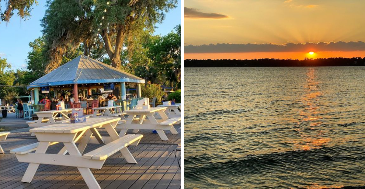
Sunsets Over the Calibogue Sound

The western side of Daufuskie faces the Calibogue Sound, and the sunsets from that shore are the kind that make even the most camera-shy traveler reach for a phone. The light comes down over the water in layers, moving through gold and orange and deep red before fading into a purple dusk that lingers longer than you expect.
Finding a spot on the sound-facing shore in the late afternoon is one of the simplest and most rewarding things to do on the island. There are no crowds competing for the view, no admission fee, and no schedule to keep.
Just the light, the water, the marsh grass, and whatever birds decide to share the moment with you.
The sound also reflects the colors back in a way that makes the whole scene feel almost doubled. It is the kind of sunset that resets something in you, and it is one of the best free experiences Daufuskie has to offer.
The Lowcountry Atmosphere That Recalls Old Florida

There is a quality to Daufuskie that is hard to name precisely but easy to feel. The unpaved roads, the slow pace, the absence of chain restaurants and big-box stores, the way the vegetation crowds right up to the path edge, it all adds up to something that feels like the Florida coast must have felt fifty or sixty years ago, before development changed everything.
Old Florida had this quality of being both wild and lived-in at the same time, a place where nature was not manicured or managed but simply present. Daufuskie still has that.
The maritime forest is thick, the marshes are genuinely vast, and the human footprint is light enough that the island still belongs mostly to the birds and the tides.
For travelers who mourn what coastal development has taken away from so many southeastern beach towns, Daufuskie offers something increasingly rare: a shoreline that has not been traded away for convenience.
Practical Tips for Planning Your Visit

A little planning goes a long way when visiting Daufuskie. Ferry service runs from Hilton Head Island, and schedules vary by season, so checking current departure and return times before your trip is essential.
Missing the last ferry back is not a disaster, but it does require having a place to stay.
There are no grocery stores or pharmacies on the island, so bringing food, water, sunscreen, and any medications you need is important. The island has a small general store near the ferry dock, but supplies are limited and prices reflect the cost of getting everything over by boat.
Cell service can be spotty in parts of the island, which is either a feature or a bug depending on your perspective. Cash is useful to have on hand, since not every vendor accepts cards.
Most importantly, bring a willingness to slow down, because the island will insist on it anyway.


