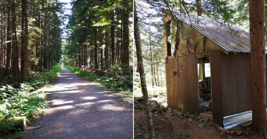
Somewhere in the North Cascades of Washington, a trail winds through old-growth forest and over rocky terrain to reach something most hikers never expect to find: an entire town frozen in time. Monte Cristo was once a booming mining settlement in the late 1800s, packed with workers, machinery, and big dreams.
Today, all that remains are crumbling foundations, rusted equipment, and a mountain backdrop that makes the whole place feel like a secret the wilderness decided to keep. This trail is the gateway to this forgotten chapter of Pacific Northwest history, and it rewards every hiker who makes the journey with scenery and stories that are hard to find anywhere else in the state.
The Rise and Fall of a Mining Boomtown
Monte Cristo was founded in 1889 after prospectors discovered rich deposits of silver, gold, and lead in the surrounding mountains. Within just a few years, the town had grown to include hotels, a concentrator, a post office, and hundreds of residents who arrived hoping to strike it rich.
A railroad was built specifically to connect Monte Cristo to the outside world, which was a massive engineering undertaking given the rugged terrain of the Cascades. At its peak, the town was one of the most productive mining operations in the entire Pacific Northwest.
But the boom did not last. Floods repeatedly damaged the railroad, ore quality declined, and the financial panic of the 1890s made continued investment difficult to justify.
By the early 1900s, most residents had packed up and left. The wilderness slowly crept back in, and Monte Cristo became what it is today: a quiet, weathered reminder of ambition that outpaced its own timeline.
What You Will Actually Find at the Townsite

Arriving at the Monte Cristo townsite feels like walking into a history book that nobody finished writing. Scattered across the flat valley floor are stone and concrete foundations from buildings that once housed miners, merchants, and families.
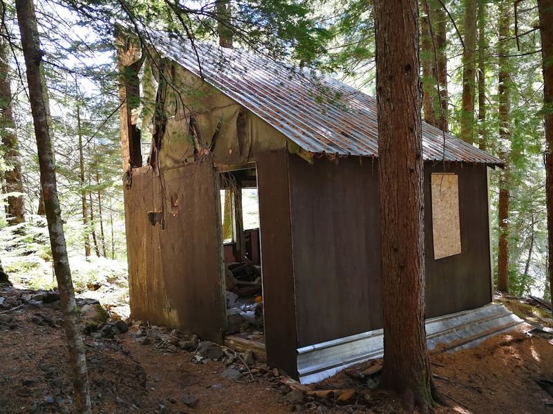
Rusted machinery sits in the open air, including ore buckets, cable remnants, and pieces of the old concentrator that processed raw ore pulled from the surrounding peaks. A few structural remnants still stand, though most of the original wooden buildings collapsed or were removed long ago.
The Monte Cristo Preservation Association has worked to stabilize some structures and maintain interpretive signage throughout the site, giving hikers context for what they are looking at. Reading those signs while standing among the ruins gives the visit a depth that goes well beyond a typical nature hike.
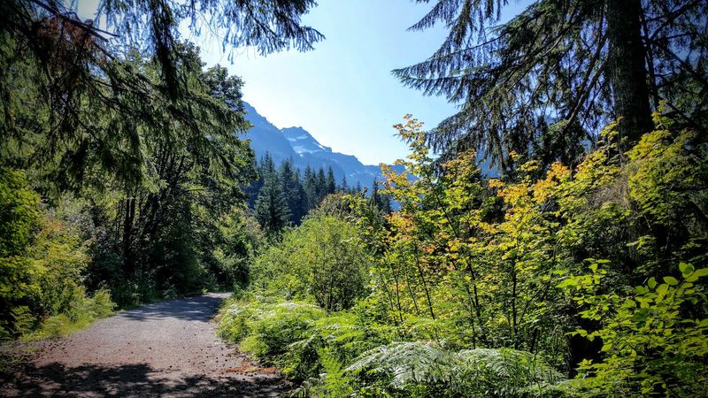
The four surrounding peaks, including Cadet, Wilmon, and Monte Cristo itself, frame the townsite from above and make the setting genuinely striking from every angle.
The Trail Itself: What the Hike Feels Like
The Monte Cristo Trail is often described as one of the more accessible backcountry hikes in Snohomish County, which makes it popular with families, casual hikers, and history enthusiasts who might not tackle more technical routes.
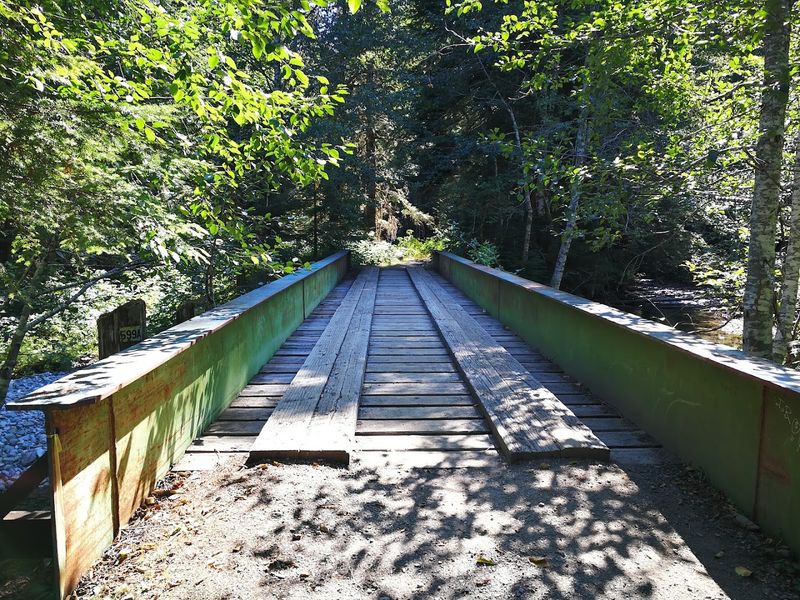
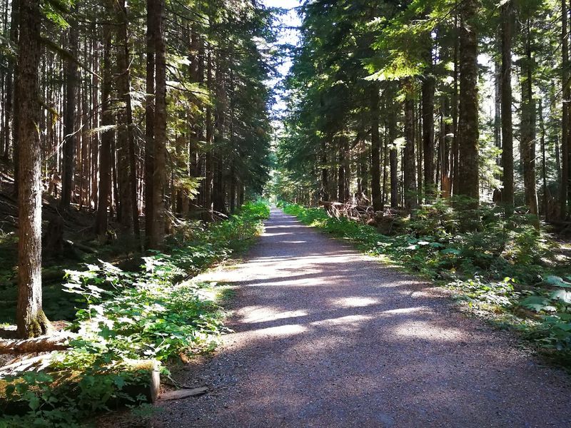
The trail follows the old railroad bed for much of its length, which means the grade stays gentle and the path stays wide. Wooden bridges carry hikers over the South Fork Sauk River at several crossings, and the river stays visible and audible for stretches of the route.
Forest cover is thick through most of the hike, with tall conifers blocking direct sun and keeping the trail cool during warmer months. As the trail opens up near the townsite, the valley widens and the mountain views become the dominant feature of the landscape.
Round trip, the hike covers about eight miles and takes most people between four and six hours, depending on pace and how long they spend exploring the ruins.
Wildlife and Nature Along the Route
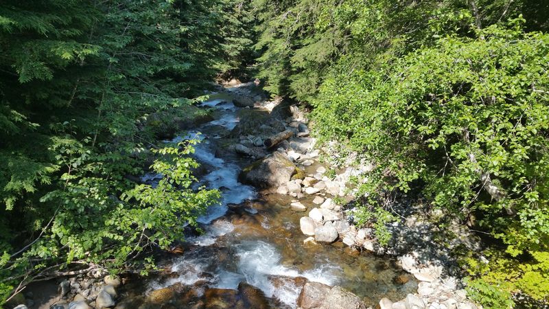
The Monte Cristo Trail corridor runs through a mix of riparian habitat along the river and dense conifer forest on higher ground, creating conditions that support a wide range of wildlife throughout the year.
Black-tailed deer are commonly spotted near the trailhead and along the lower sections of the route. Marmots and pikas become more visible as hikers approach the open alpine areas near the townsite, especially during summer months when they are active above the treeline.
Bird activity along the trail is consistent, with species like Steller’s jays, varied thrushes, and dippers frequently observed near the river crossings. Black bears are present in the area, and hikers are encouraged to carry bear spray and store food properly if camping overnight.
The South Fork Sauk River supports native fish populations, and the surrounding peaks form part of the Henry M. Jackson Wilderness, adding a layer of protected habitat to the entire corridor.
The Best Time of Year to Make the Trip
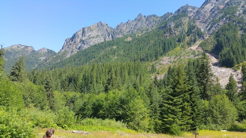
Timing matters considerably when planning a trip to Monte Cristo. The Mountain Loop Highway and the access road to the trailhead are typically closed or impassable from late fall through early spring due to snow accumulation and seasonal flooding.
Late June through early October is generally the most reliable window for the hike. July and August bring the driest conditions and the clearest mountain views, while September offers cooler temperatures and fewer crowds on the trail.
Spring visits in late May or early June can be rewarding when wildflowers are blooming along the lower trail sections, but hikers should check road conditions before heading out since the access road can remain closed longer than expected in heavy snow years.
Fall color along the river corridor peaks in October and draws photographers and casual hikers alike. Checking the Washington State Department of Transportation and the Mount Baker-Snoqualmie National Forest websites before any visit is always a practical step.
The Railroad That Made It All Possible
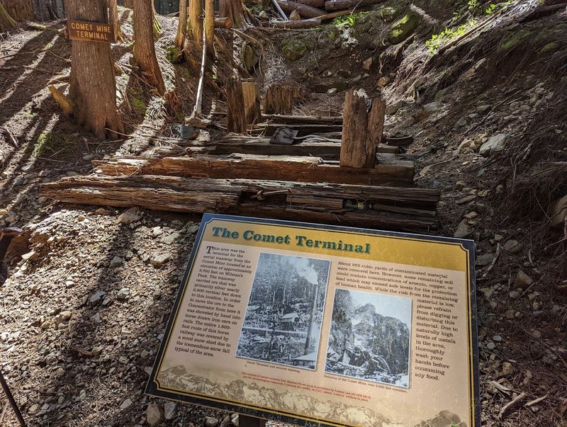
Few pieces of Monte Cristo’s history are as impressive as the railroad that once connected the remote mountain town to the outside world. The Everett and Monte Cristo Railway was completed in 1893 and ran approximately 73 miles from Everett through rugged Cascade terrain to reach the mining settlement.
Building the railroad required enormous effort and expense, with crews cutting through dense forest, bridging rivers, and navigating steep valley walls just to lay the tracks. The line was a genuine engineering achievement for its era.
Floods repeatedly damaged sections of the railroad throughout the 1890s and early 1900s, and repair costs eventually became unsustainable. The line was formally abandoned in 1936, and much of the original grade was converted into the trail that hikers use today.
Walking the old railroad bed with that history in mind transforms the hike from a simple nature walk into something closer to a living timeline of the industrial ambitions that once shaped this corner of the Cascades.
Photography Opportunities on the Trail
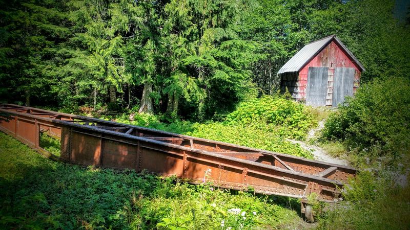
Monte Cristo draws photographers for a clear reason: the combination of industrial ruins, mountain peaks, river scenery, and forest light creates a layered visual environment that is difficult to find in a single location elsewhere in Washington.
The rusted machinery and stone foundations photograph well throughout the day, but morning light hitting the eastern faces of the surrounding peaks adds contrast and depth that midday sun flattens out. Overcast days, which are common in the Cascades, produce soft, even light that works particularly well for detail shots of the ruins.
The wooden footbridges along the trail are popular subjects, especially when the river is running high in early summer. Wildflowers near the townsite in July provide foreground interest for wide shots that include the peaks above.
A wide-angle lens handles the landscape and ruin compositions well, while a medium telephoto is useful for isolating details in the machinery or capturing wildlife along the river corridor without disturbing animals.
Practical Tips Before You Head Out
A few practical details can make the difference between a smooth trip to Monte Cristo and a frustrating one. The access road off Mountain Loop Highway is unpaved for its final stretch and can be rough after winter, so checking road conditions before departure is worth the extra step.
Cell service is essentially nonexistent once you leave the Mountain Loop Highway corridor, so downloading offline maps through an app like AllTrails or Gaia GPS before leaving home is a straightforward precaution. A paper map of the area is a reliable backup.
Water from the South Fork Sauk River is available along the trail but must be filtered or treated before drinking. Bringing at least two liters per person for a day hike is a reasonable baseline, with more recommended for warmer days.
Solid hiking footwear with ankle support handles the trail conditions well, particularly near the river crossings where rocks can be slippery. Layered clothing is standard practice in the Cascades regardless of the season.
Where the Trail Begins: Getting to Monte Cristo
The Monte Cristo Trail starts near the end of Mountain Loop Highway, roughly 30 miles east of Granite Falls in Snohomish County, Washington. The trailhead sits near the old townsite access road, and most hikers park near the end of the paved section before heading in on foot.
The route to the ghost town follows an old railroad grade for about four miles each way, making it a relatively manageable out-and-back hike with around 700 feet of elevation gain total. The trail passes through dense second-growth and old-growth forest, crosses the South Fork Sauk River multiple times on wooden footbridges, and gradually reveals the surrounding peaks as you get closer to the townsite.
A Northwest Forest Pass is required for parking at the trailhead. The road to the trailhead is typically accessible from late spring through fall, as snow and flooding can close the area during winter and early spring months.
Share this story