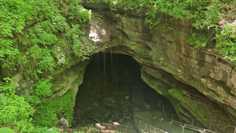
Beneath busy streets and skyline views, America’s cities hide labyrinths shaped by water, stone, and time. Newly mapped cave systems are rewriting local histories and changing how we think about growth, conservation, and adventure. You will find science, mystery, and real human grit in these passageways as explorers add fresh miles each season. Ready to look below the surface and see what your city is standing on?
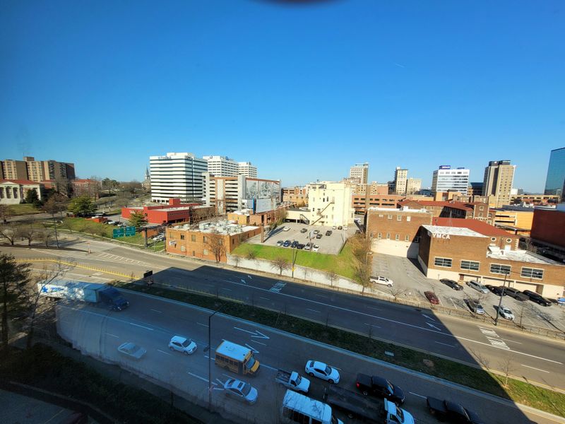
1. Bowling Green, Kentucky
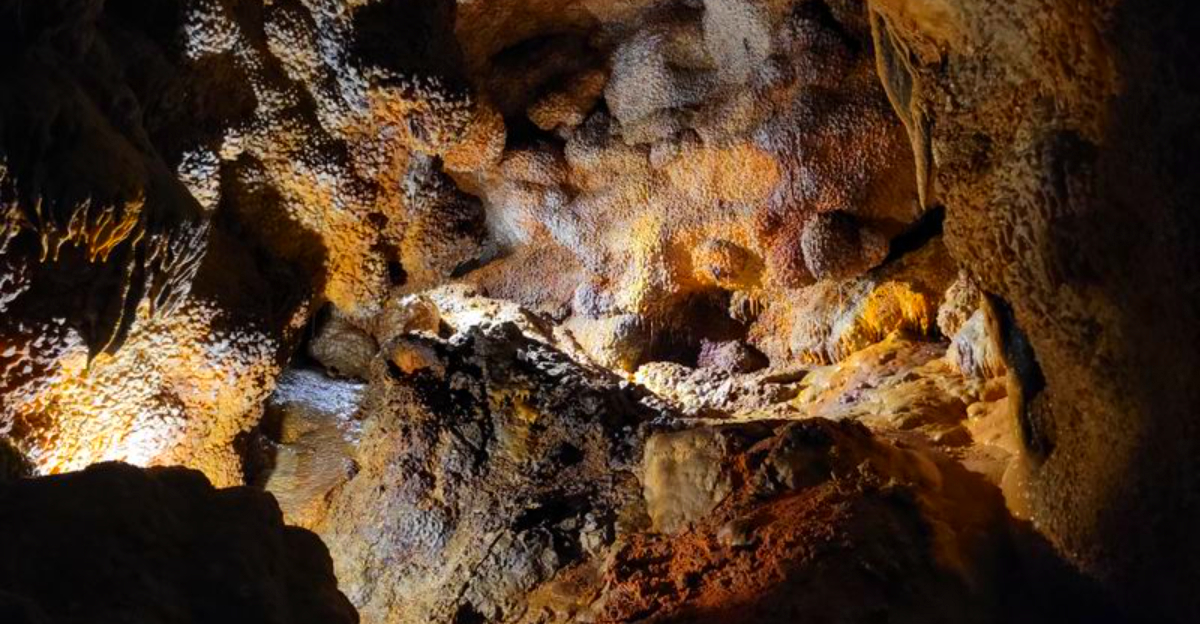
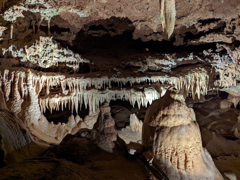
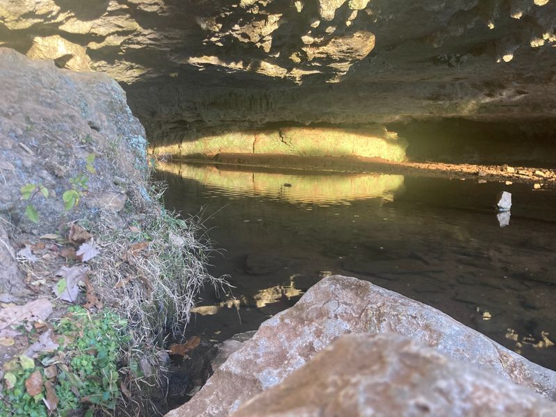
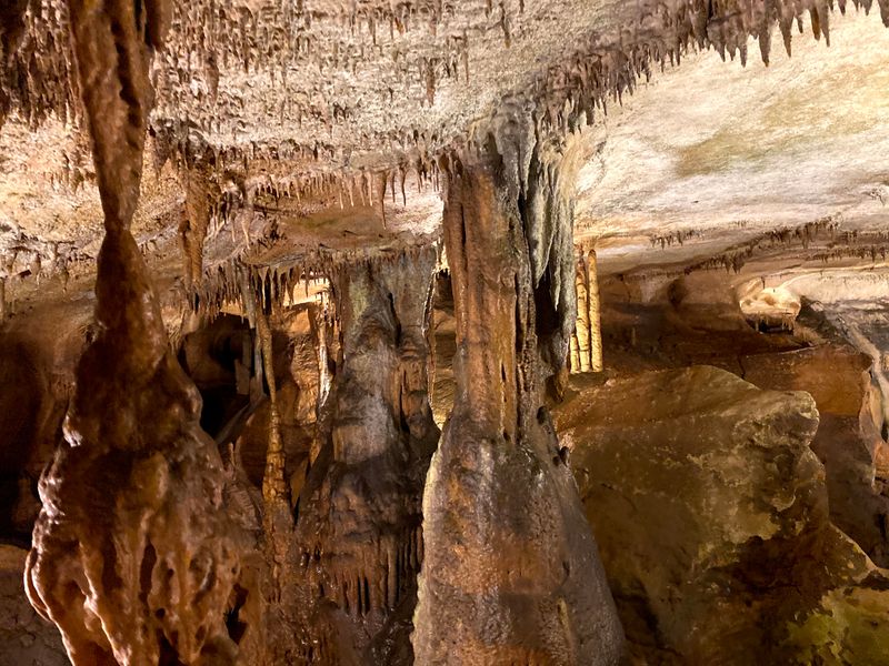
Bowling Green keeps pushing deeper, with side passages feeding the legendary Mammoth Cave system. Recent surveys added miles nearby as teams mapped complex breakdown rooms and water-sculpted corridors. You can feel history underfoot while new data confirms the cave’s global record.
Local researchers cite March 2022 extensions that lifted surveyed totals beyond 420 miles. These updates sharpen models for groundwater protection and visitor management. If you explore responsibly, you help protect bats, dripstone, and delicate sediments.
Expect tight crawls, echoing chambers, and sudden vertical drops. Bring humility, patience, and a reliable backup light.
2. Austin, Texas
Austin’s limestone suburbs keep revealing caves during roadwork and new builds. Construction pauses, biologists arrive, and suddenly a corridor opens toward protected habitat. You feel the city negotiating growth with geology, one discovered void at a time.
New mapping compiles lidar and photogrammetry to document live aquifer pathways. That helps safeguard rare species while guiding stormwater plans. If you love Hill Country trails, remember the trails continue underground.
Expect low ceilings, fragile draperies, and unexpected airflow hinting at larger rooms. Move softly, keep lights warm, and pack a cave-safe notebook for sketching survey stations.
3. Huntsville, Alabama
Huntsville’s karst hides surprises under cul-de-sacs and greenways. Recent surveys linked previously separate pockets into longer routes, confirming what locals suspected from sinking streams. You can hear faint water tracing paths toward swallow holes.
Urban expansion meets subterranean complexity, inspiring careful planning for sinkhole risk and habitat corridors. Mappers document airflow and ceiling scallops to infer hidden junctions. Each sketch tightens the puzzle.
Expect hands-and-knees crawls, mud that clings like memory, and a sudden echo revealing big space. Stay patient with route-finding, flag fragile formations, and carry extra gloves for muddy survey notes.
4. Springfield, Missouri
Springfield sits atop the Ozarks’ swiss-cheese geology. New surveys traced underground drainage that feeds nearby springs, revealing stacked levels and tight sumps. You sense a living plumbing system designed by centuries of rainfall.
Cavers map scallops, dye-trace flows, and build models for flood behavior. That knowledge helps neighborhoods avoid sinkhole surprises. It also preserves clear spring water locals cherish.
Expect cold riffles, polished chert nodules, and low crawls beside trickling rills. Bring waterproof field books and patient teamwork. The passages reward slow looking, where a tiny eddy or draft hints at undiscovered bends.
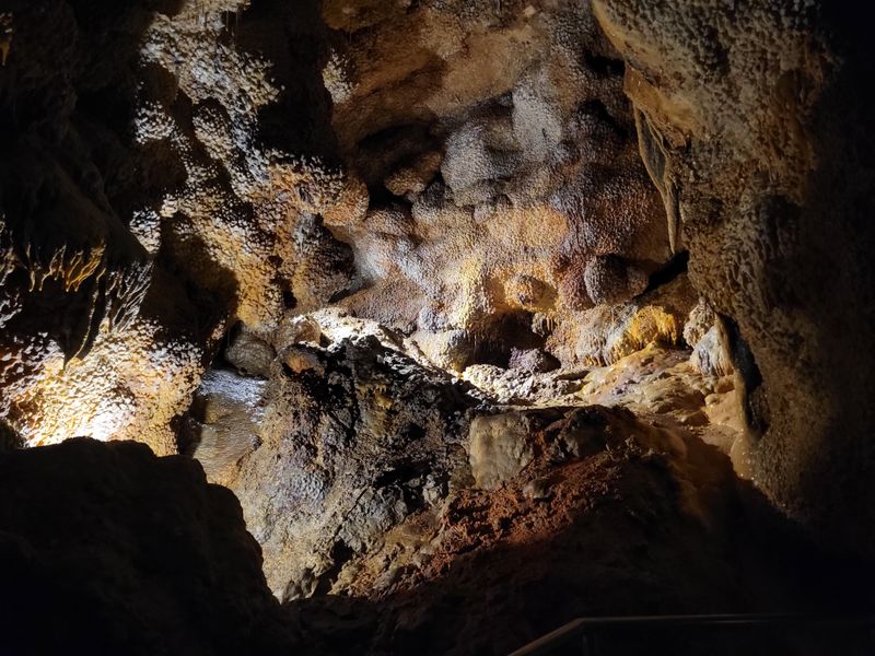
5. Nashville, Tennessee
Nashville’s rolling limestone hides caves beneath neighborhoods and parks. Recent mapping extended known systems, reinforcing how delicate the subsurface truly is. You realize each backyard may shelter airways bats depend on.
Teams coordinate with city planners to balance trails, storm drains, and sinkhole hazards. Data guides conservation buffers that protect underground ecosystems. It is quiet stewardship with big consequences.
Expect puddled crawlways, gypsum flowers, and sudden silence that amplifies your breath. Use soft steps, avoid touching formations, and keep light beams low to reduce stress on wildlife. The music city hums above while drip rhythms play below.
6. San Antonio, Texas
San Antonio’s caves are pipelines to the Edwards Aquifer. New mapping found hidden passages that explain puzzling water travel times. You can almost trace a raindrop’s underground commute to the city tap.
Dye studies and lidar mapping sharpen recharge models and conservation zones. Those maps guide construction practices and park protections. Every accurate survey protects water for millions.
Expect clean-washed limestone, narrow fissures, and pools that vanish into darkness. Carry aquifer-safe ethics and avoid contaminants. Your footprints matter here, so keep gear spotless and stay on established routes marked by trained guides.
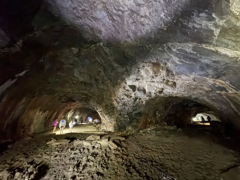
7. Boise, Idaho
Boise’s underground differs from limestone country. Here, basalt lava tubes twist beneath sagebrush, with skylights letting in dust-lit beams. Newly mapped sections clarify ancient flow paths from volcanic vents.
Surveyors capture rough walls with handheld lidar, building crisp digital models. That data informs hazard assessments and recreation access. You will feel the volcanic story under your boots.
Expect abrasive surfaces, sharp edges, and broad corridors that suddenly pinch. Wear tough gloves and knee protection. Watch for fragile microbial mats and respect closures protecting roosting bats who share this dark highway.
8. Rapid City, South Dakota
Rapid City sits beside a maze of Black Hills caves. New connections trace ancient water routes, feeding regional lore and science. You can stand in chambers where drafts whisper toward undiscovered miles.
Volunteer teams continue Jewel Cave mapping, adding passage beyond previous limits. Each extension refines speleogenesis models. The work is patient, meticulous, and thrilling.
Expect big rooms echoing like cathedrals, then tight crawls that demand calm breathing. Pack dependable navigation tags and respect permit rules. Your careful steps help preserve delicate mineral features that took ages to form.
9. El Paso, Texas
El Paso’s Franklin Mountains shelter limestone caves with longer links than anyone expected. Recent mapping connected segments into extended routes, changing local maps. You feel desert silence echoed underground.
Geologists study fracture patterns to predict new finds. These insights guide access and protect fragile speleothems from casual damage. Exploration proceeds with care and patience.
Expect dry passages, occasional guano piles, and sharp breakdown. Wear sturdy boots and carry spare light sources. Keep conversations soft to sense airflow that points toward additional junctions, because each breeze might announce another discovery.
10. Tampa, Florida
Tampa’s caves ride close to the surface in soft limestone. Mapping often happens underwater, where divers follow guidelines through submerged galleries. You watch silt bloom with each kick if you are not careful.
New surveys link sinkholes to spring vents, improving flood and collapse assessments. The maps also protect fragile aquifer zones. It is precision work measured in inches.
Expect low visibility, haloclines, and tight restrictions. Training matters here, along with redundant gear and disciplined buoyancy. Respect private property and coordinate with local dive teams before attempting any entry.
11. Flagstaff, Arizona
Flagstaff’s volcanic fields left a network of lava tubes. Newly mapped sections help decode eruptive history and airflow patterns. You step into a freezer-like chill even on sunny days.
Scientists catalog ceiling drips, tube collapses, and skylight chimneys to model past flows. Public access mixes with preservation, so stay mindful. The rock can chew through careless gloves fast.
Expect long, straight runs punctuated by low stoops and sharp rubble. Bring helmets and sturdy layers. Keep voices low to hear subtle drafts that hint at side passages waiting for the next patient survey push.
12. Knoxville, Tennessee
Knoxville’s karst continues to surprise as surveys stitch smaller caves into larger webs. New links change drainage maps and inform development setbacks. You glimpse how water threads neighborhoods underground.
Teams use dye tracing, compass shots, and line plots to confirm connections. Those results shape conservation easements and stormwater planning. It is practical science with real community impact.
Expect hands-and-belly crawls, brief sumps, and minerally stained pools. Carry compact survey kits and patience for repeated measurements. Your careful notes ensure the network grows accurately, meter by meter.
13. Birmingham, Alabama
Birmingham anchors one of the nation’s longest cave systems, and mapping keeps adding miles. Recent pushes extended galleries beneath city limits, refining hydrology and access plans. You feel scale when the beam fades before the ceiling.
Local clubs partner with scientists to catalog biology, airflow, and mineral growth. Their data supports careful gate installations and seasonal closures. The cave’s health comes first.
Expect long traverses, steady gradients, and delicate formations off the main route. Protect them with hands-off discipline and clean gear. Every survey station honors decades of volunteer effort and discovery.


