Green River, Utah looks quiet at first glance, but its story runs deep under your feet. Follow the water long enough and you will find riddles that bend intuition, tilt horizons, and make canyons feel like plot twists.
I came for melons and motel neon, then stayed because every bend in the river hinted at something moving below the map. Ready to chase the clues that make this river make sense?
The Green River doesn’t flow uphill… but it sure looks like it
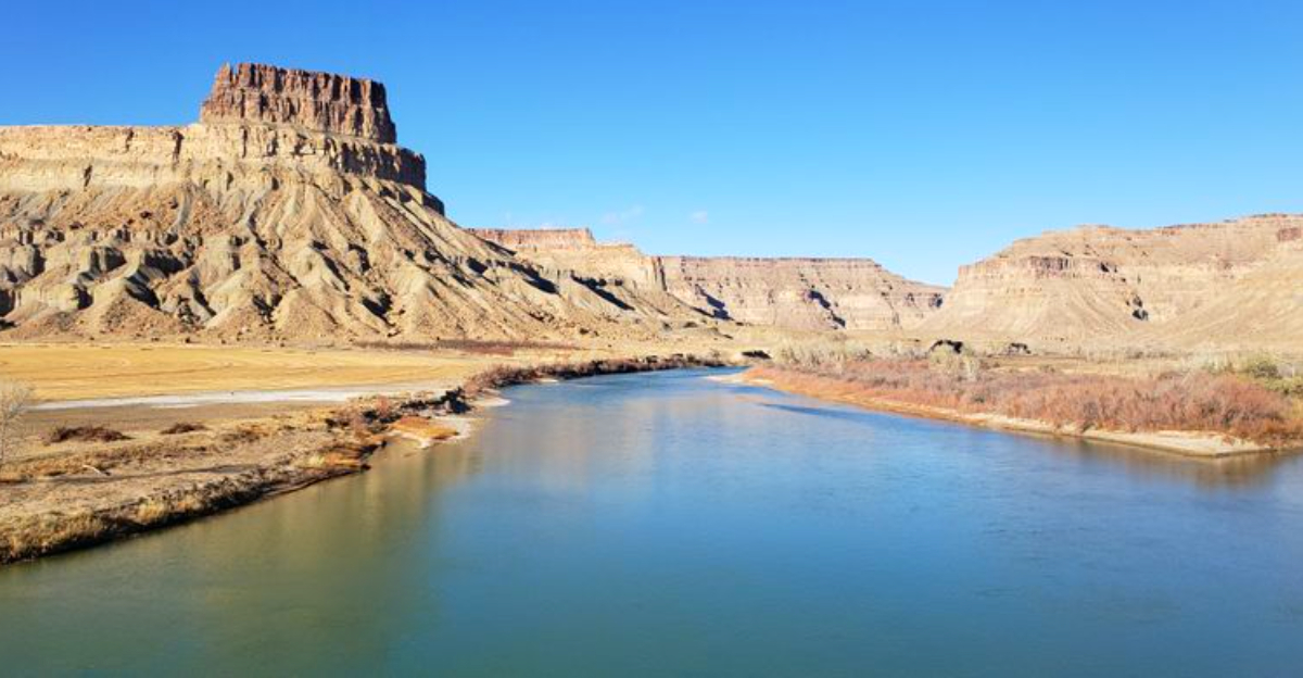
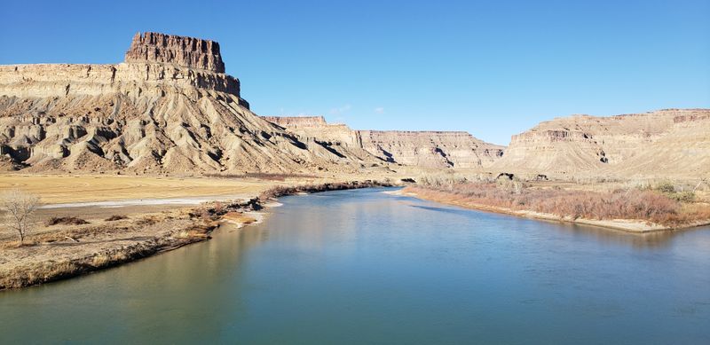
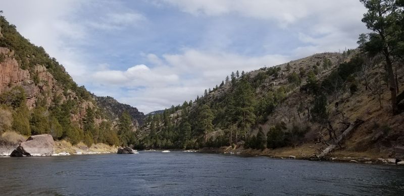
A low, steady hiss of current says otherwise, yet your eyes swear the Green River climbs. Stand at a rim north of Green River, Utah, and the channel feels like it is sneaking up a ramp, shoulder-checking gravity on the way.
Locals shrug, guides grin, and you reach for a level app like a magician’s volunteer.
Here is the trick you taste on dry wind: topography tells the story wrong when you only read the surface. The channel inherited an older slope, then the land around it tilted, lifted, and sagged in maddening ways.
So the present-day view fakes an uphill route, while the water quietly honors physics.
It is a perfect Green River moment: simple scene, complicated cause. Kayakers joke about paddling cardio miracles, then feel the current tug true beneath their hulls.
You learn to trust the flow, not the skyline, and that lesson unlocks almost everything else you will see.
The real mystery isn’t water – it’s timing
A small observation hits on arrival: the debate is not if water falls downhill, it is when the downhill was arranged. In Green River, Utah, the big question circles timing like a hawk over slickrock.
Did the river predate the rise, or did it thread an obstacle course after?
Geologists argued for generations, swapping maps and field notes across café counters on Main Street. One camp said the channel was ancient, carving steadily as mountains heaved skyward.
Another camp saw a late arrival, somehow punching through high ground with stubborn precision.
The truth likely splices both moods with deeper forces. You can walk the riverbank at dusk and feel the clockwork in the canyon walls, each terrace a timestamp.
That sense of schedule turns the Green into a historian, not a rebel, and the story becomes a race between uplift and incision.
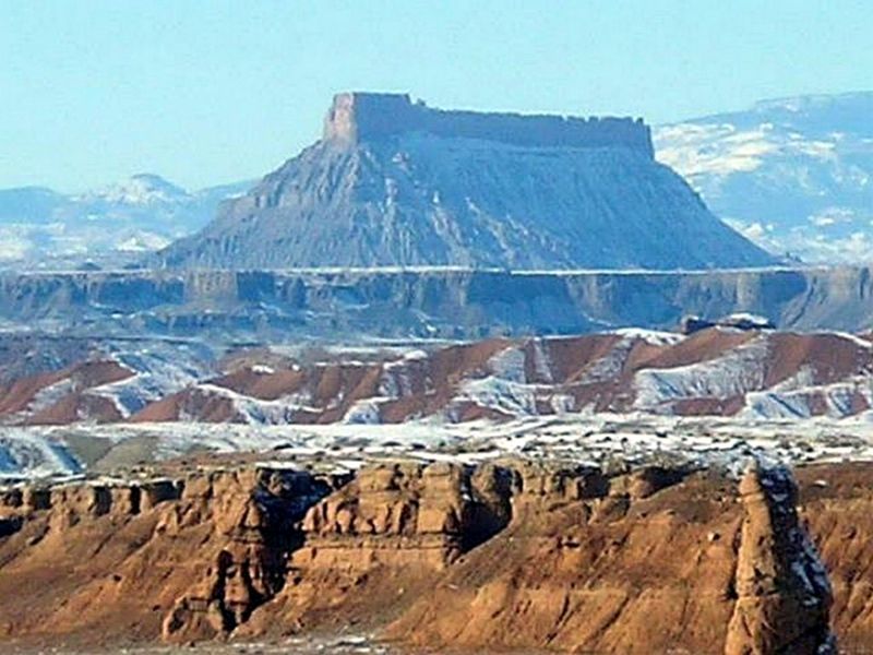
The Uintas run east to west, the plot thickens
A quirky local detail flips your map brain: the Uinta Mountains run east to west, rare in the Rockies. That sideways wall feels like a dam placed by a prankster geologist.
Yet the Green River does not detour politely around it.
From town, the idea sounds abstract until you trace the line on a windshield map. Most ranges trend north-south, channeling water along the grain.
The Uintas block the way laterally, so a straight-through canyon reads like graffiti across stone order.
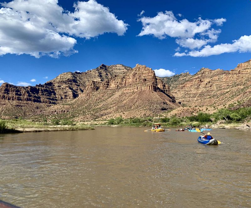
This geometry sets the stage for wonder. Every switchback drive toward Flaming Gorge or the canyons beyond adds tension to the mystery.
East-west mountains, north-south expectations, and a river that cuts perpendicular make the eventual explanation feel earned.
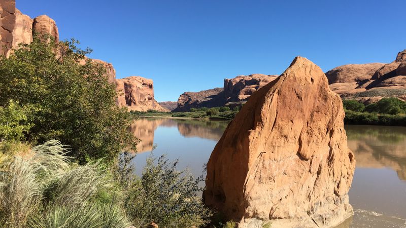
Not a minor creek, but the Colorado’s muscle
A human detail lands at the put-in: outfitters talk about volume like chefs brag about spice. The Green River is the Colorado’s biggest tributary, a workhorse channel that moves sediment, water, and stories.
If a trickle wandered strangely, you might shrug. This one demands reasons.
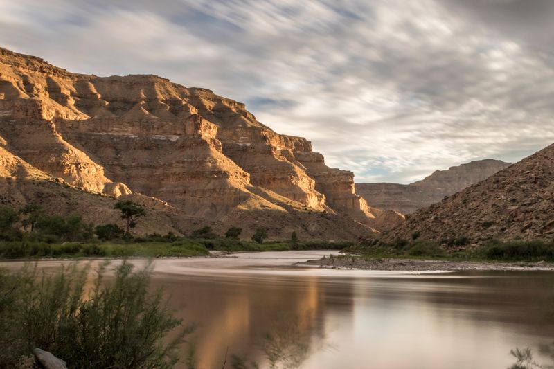
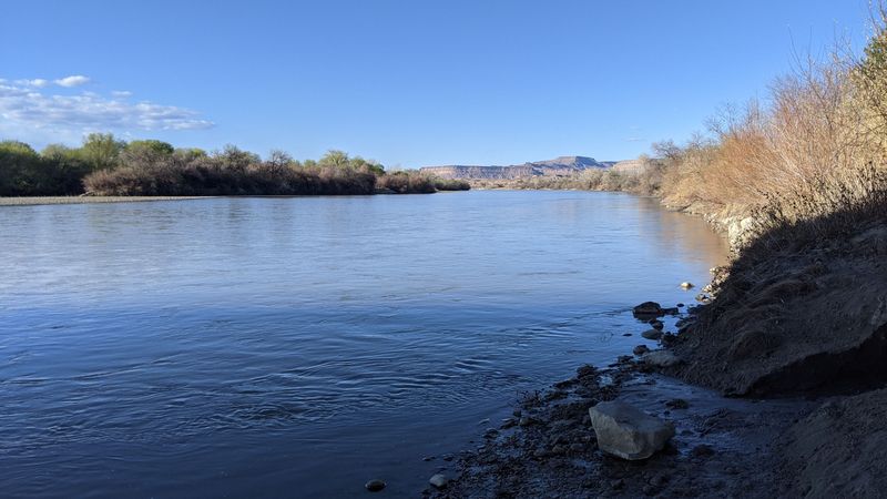
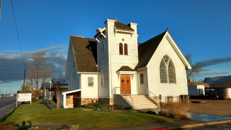
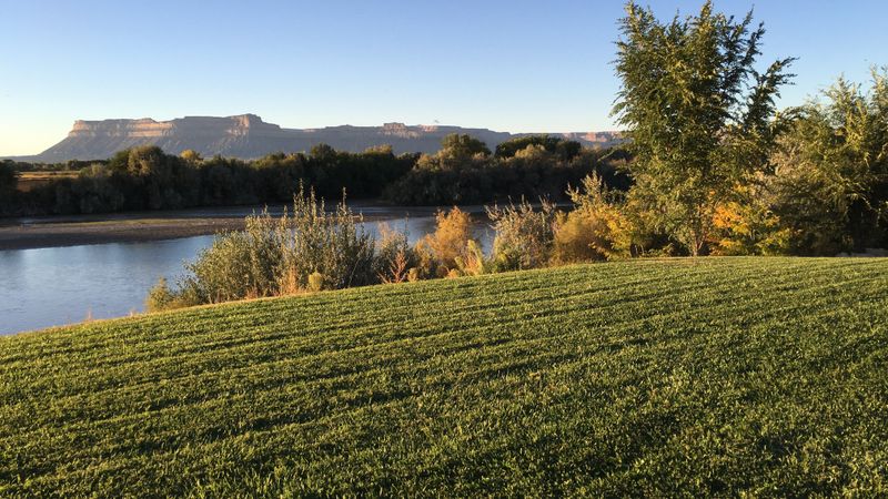
Spend an afternoon along the banks in Green River, Utah, and you feel the scale. Freight trains rumble nearby, but the river’s momentum feels older and heavier.
It carries a region’s pulse, punching canyons and feeding wetlands where birds stitch their migrations.
Because it is big, its path is consequential. Explaining its course is not trivia, it is continental bookkeeping.
The Green unlocks how the interior West lifted, sank, and rearranged, one bend at a time.
Older theories: the river was here first
A tip you learn too late in armchair geology: antecedence explains a lot until it explains too much. The classic pitch says the Green River predated mountain building, slicing downward as the Uintas rose.
Clean. Brave.
A river with perfect timing and infinite stamina.
Standing on a rim, you can almost believe it outright. The canyon looks like a saw cut kept open by relentless abrasion.
But questions linger where the plateaus twist and knuckles of resistant rock complicate the tale.
Critics wanted more than romance. They asked how terraces, knickpoints, and odd tilts fit a tidy origin.
In Green River, Utah, you feel that itch to add chapters, because the landscape clearly edited its own draft after the first cut.
Fresh clues begin far below
The movement under your boots changes the conversation. Newer research dives beneath the surface, trading scenic overlooks for seismic cross-sections.
Down there, the crust and upper mantle hold the keys the canyons only hint at.
In coffee-fueled talks at the museum in town, visiting scientists pull up models showing density contrasts. The idea: surface erosion alone cannot script the whole Green River plot.
Something deeper tugged the stage itself.
That pivot reframes every overlook drive. Instead of asking how the river fought rock, you ask how the rock moved around the river.
Suddenly the route that looked impossible becomes a breadcrumb trail to an underground engine.
Meet the lithospheric drip
The small shiver of recognition arrives when someone says drip. A lithospheric drip is dense rock at the base of the crust and upper mantle that begins to sink.
Imagine heavy syrup separating from a thinner layer, pulling downward with slow insistence.
No bangs, no fireworks. Just gravity doing tedious, patient work at depth.
The lower crust follows, and over geologic time, the surface feels the consequences in uneven uplift and subsidence.
Here in Green River, Utah, that image sticks while you watch swallows skim the eddies. The river does not bulldoze mountains; the basement floor is quietly rearranging.
Understanding the drip is like finding the backstage crew that keeps moving the props.
Why the drip formed: too much mountain, too much weight
A guide’s laugh carries over the water as you eye those high rims. The Uintas thickened during mountain building, loading the base of the crust with pressure.
Under those conditions, garnet-rich rocks can form, and garnet is unapologetically heavy.
Layer by layer, the root densifies until it outweighs the mantle below. What once braced the range becomes a liability, like a backpack filled with stones you forgot to unload.
The system starts looking for relief.
In town, I held a garnet sample under bright shop lights and felt the metaphor in my palm. Weight matters, especially at depth.
Add enough, and the underside lets go.
Instability: when foundations want to fall
A subtle tremor of logic says once rock grows dense enough, it stops behaving like a foundation. The root becomes cargo, eager to drop.
Gravity courts it, and the long breakup begins.
Geologists read this in mineral assemblages, heat flow, and weird seismic speeds. Put together, the signals say the base shifted from support to burden.
That flip sets the drip in motion.
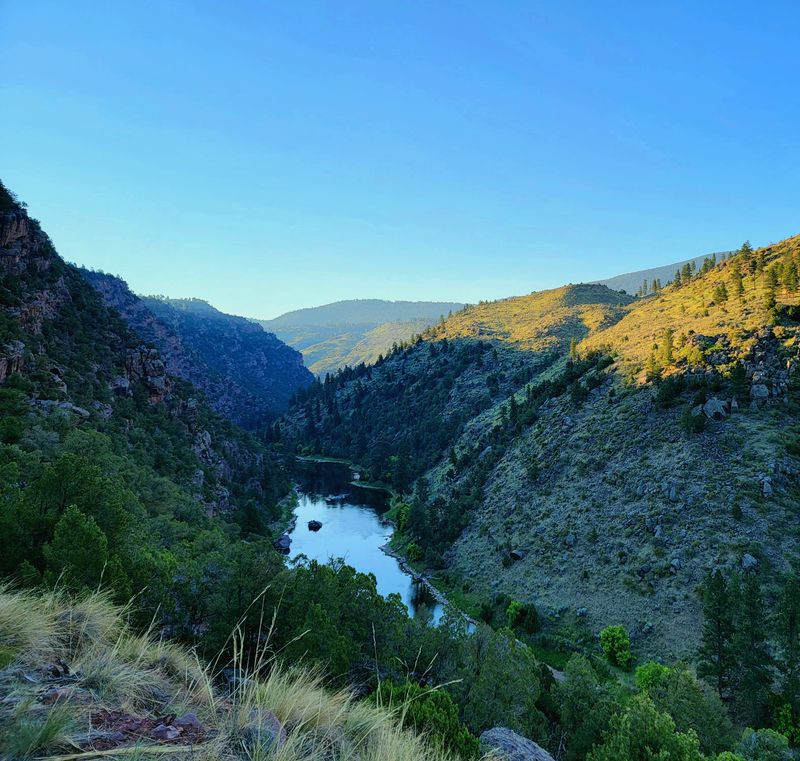
Walk the riverfront path in Green River at sunrise and feel how calm can hide big change. The channel is steady on top, yet deep below, a slow divorce reshaped the marriage of crust and mantle.
That tension gives the canyons their strange poise.
How sinking rock rewrites the surface
The motion is slow, the effects are not subtle. As the drip forms and detaches, the land above warps.
Some areas lift, others settle, and the regional tilt can swing like a gentle seesaw.
That means mountain building here is not just a single shove upward. It is a choreography of bulges and sags, a terrain that keeps editing its slopes.
The river threads through this editing suite, holding onto a path it learned earlier.
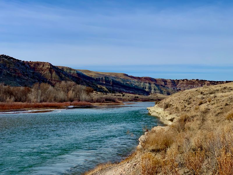
From overlooks near town, you can sense mismatched terraces on opposite banks, like shelves hung when the floor was moving. Those shelves are clues to tilting.
They whisper that the blueprint changed mid-construction.
Why the river’s route looks uphill now
A tip paddlers share with a grin: trust the current, not the skyline. Long ago, the Green followed a reasonable downhill grade.
Afterward, deep warping tilted the deck, lofted some blocks, and dropped others.
Today, your eyes compare route to relief and swear something is off. But the river is honoring an older map, preserved like a groove in vinyl.
What looks uphill is a mismatch between present shape and inherited path.
On a quiet float near Green River, Utah, I watched shadows slide upslope while riffles hurried past my bow. The view lied, the water told the truth, and the physics kept a perfect beat.
Seeing the drip with seismic waves
A vendor at the melon stand joked that geologists listen to Earth’s heartbeat. Seismic imaging is how they do it, sending and recording waves that change speed through different rocks.
Beneath the Uintas, the patterns hint at a dense, drip-shaped body sinking.
These anomalies are not Hollywood clear, but the consistency matters. Independent surveys sketch the same blob with slightly different brushes.
Put them together, and the picture sharpens.
Back in town, a poster at the visitor center mapped the stations like constellations. Reading it felt like decoding star charts for the ground.
The drip revealed itself as a shadow with a story.
Models that sync with canyon carving
Movement, smell of sage, and a stack of plots tell the satisfying part. When researchers model the drip’s life cycle, the timing lines up with big uplift spurts and deep incision events.
The canyon cutting accelerates when the deep engine kicks hard.
That agreement is not a mic drop, but it is close. You get waveform fits, thermochron clocks, and terrace ages that harmonize.
The models hum the same tune the rocks have been singing.
On a late evening walk, I traced terrace steps with my eyes like reading a musical score. Each bench marked a tempo change, and the river kept time as the basement shifted beneath it.
A river that fossils an old landscape
A small observation travelers notice on arrival: flat-topped benches feel like echoes. The Green River may be preserving an ancient, gentler landscape, locking in a route from a time before the ground buckled.
The channel becomes a cast of an older mold.
As the region warped, that imprint stayed, guiding flow through a world that no longer matches it. The result is a path that looks defiant only because the surroundings evolved away.
The river guards memory while rock forgets.
I paused on a bluff and pictured a quieter surface, rolling and modest. The present is rougher, taller, stranger.
Yet the river holds the line like a bookmark you never removed.
Not defying gravity, revealing Earth’s interior
A human detail seals it: a ranger said the river is not stubborn, it is honest. The Green is recording the interior, not breaking rules.
Gravity wins every round, but the arena floor moved mid-fight.
Once you hear that, Green River, Utah changes from pit stop to portal. Each bend is a footnote about the crust and mantle negotiating terms.
The canyons are transcripts of that quiet meeting.
So you leave town with sunburn, melon juice on your sleeve, and a head full of subsurface maps. The river did not climb mountains.
The mountains and the mantle rearranged the playing field while the water kept its promise downhill.


