Ready for one of Utah’s most electrifying alpine adventures? The Mount Timpanogos Timpooneke Trail pairs big-mountain drama with accessible trail engineering, delivering views that stretch for miles and memories that last even longer. Whether you crave wildflower meadows, wildlife encounters, or a summit panorama over Utah Valley, this route has it all. Use these 12 targeted tips to plan smart, hike safe, and savor every step of this unforgettable ascent.
1. Distance and Elevation Gain
From the Timpooneke Trailhead, expect a stout round trip of approximately 14.0 to 14.5 miles with around 4,400 to 4,500 feet of elevation gain. This profile demands steady pacing, robust fitness, and consistent hydration. The climb unfolds gradually yet persistently, with few truly flat sections. Many hikers underestimate the time cost of switchbacks and final ridge travel. Plan your nutrition, water, and turnaround time carefully to stay ahead of weather and fatigue. Knowing these numbers helps set realistic expectations and keeps morale high when the grade bites.
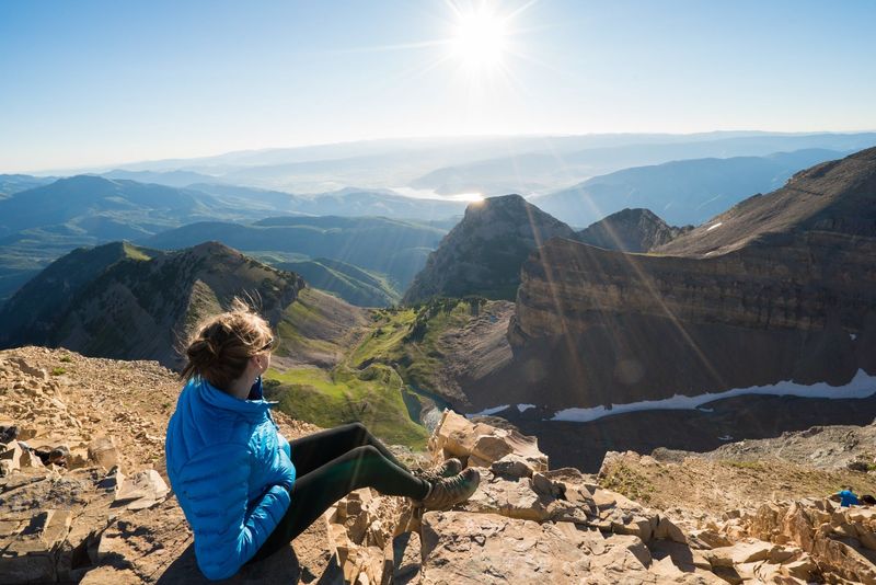
2. Summit Elevation
The summit tops out around 11,750 feet above sea level, a true high-alpine perch with sweeping visibility. At this elevation, pace naturally slows and breathing becomes more deliberate. Plan to manage altitude with a steady cadence and periodic breaks. If you’re new to higher elevations, consider an acclimatization day nearby. The final push can feel exposed and airy, so maintain three points of contact on sketchy sections. Clear days reward with immense vistas; hazy afternoons can change quickly. Respect the altitude and savor that summit moment.
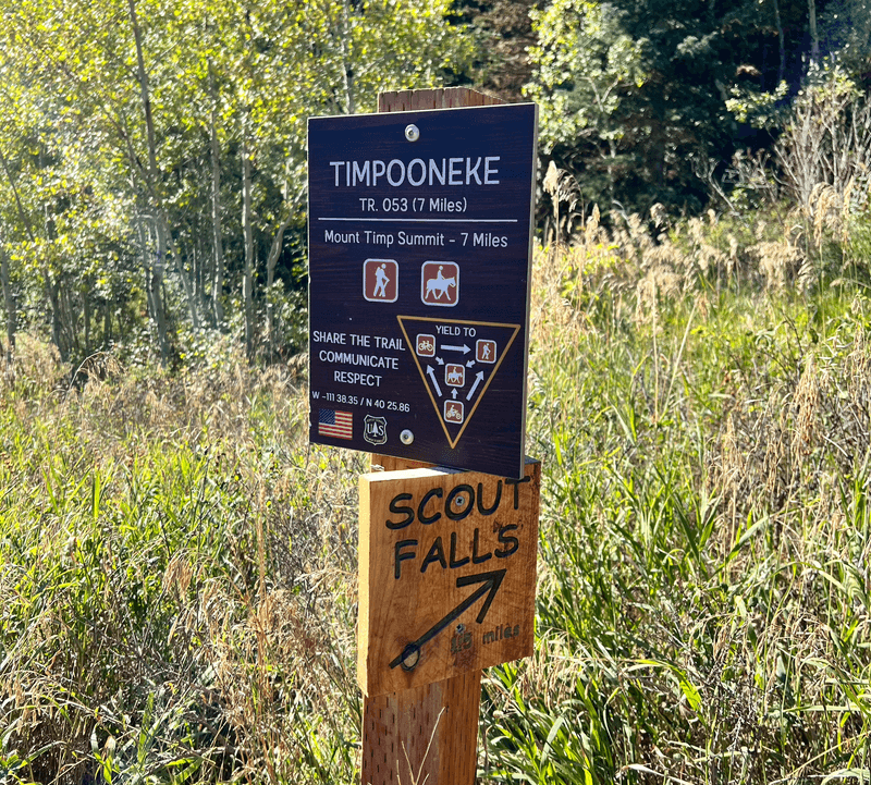
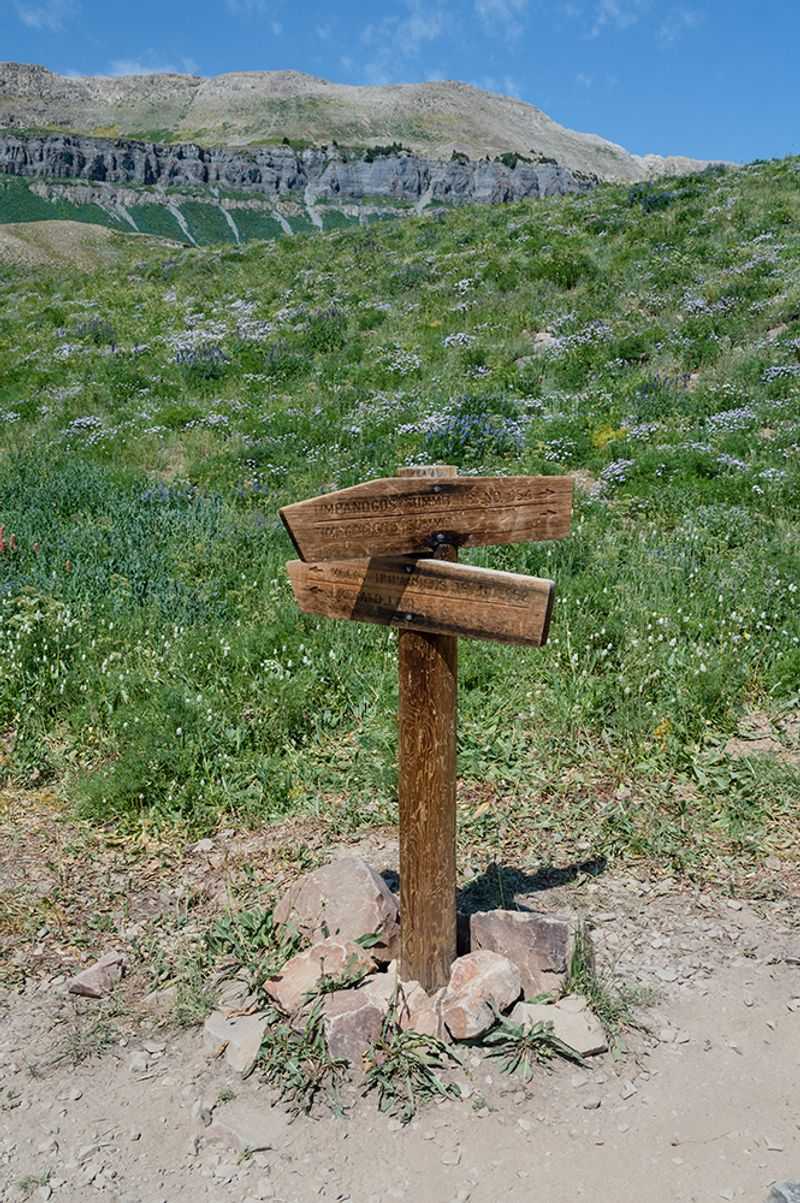
3. Trailhead Location
The Timpooneke Trail begins at Timpooneke Campground in American Fork Canyon within the Uinta-Wasatch-Cache National Forest. Arrive with a navigation app or offline map, as canyon service can be spotty. Signage is generally good, but trailhead parking fills quickly during peak season. Restrooms and basic facilities are present, yet water availability varies. Pay attention to posted notices about wildlife, closures, or seasonal hazards. The canyon’s scenic drive sets the tone for a big alpine day. Double-check gate hours, fees, and campground operations before committing to predawn arrivals.
4. Overall Difficulty
Classified as strenuous to very challenging, this hike combines substantial distance with significant elevation gain and some exposed, rocky terrain. Fitness and preparation matter. Train with back-to-back elevation days or stair sessions if you’re new to big vertical. Pack enough calories, layers, and a small first-aid kit. Trekking poles help with stability on steep switchbacks and the descent. Start early to manage heat, weather, and time at altitude. Respect your turnaround time if progress is slow. A realistic plan transforms a demanding climb into a rewarding achievement.
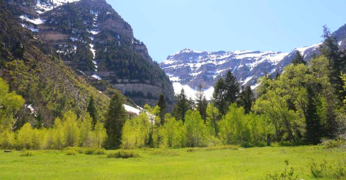
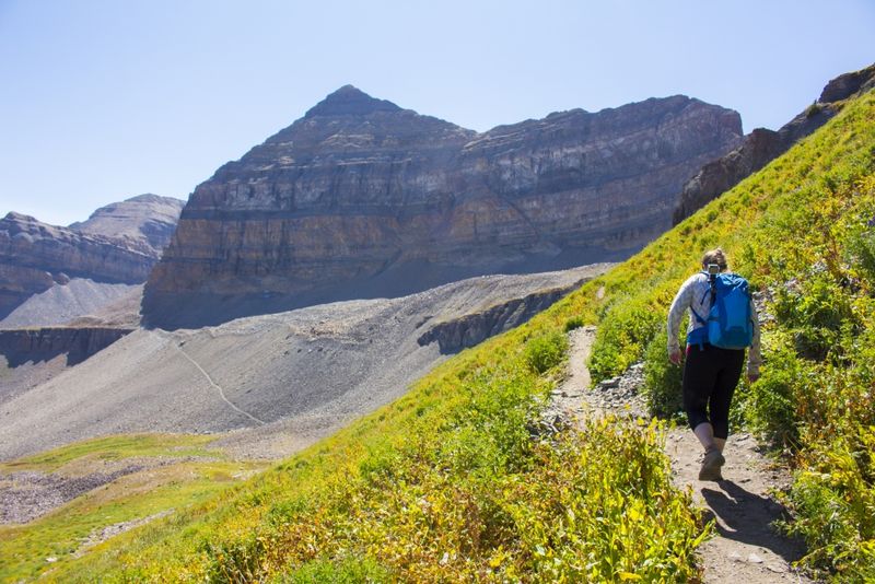
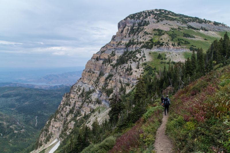
5. Trail Profile
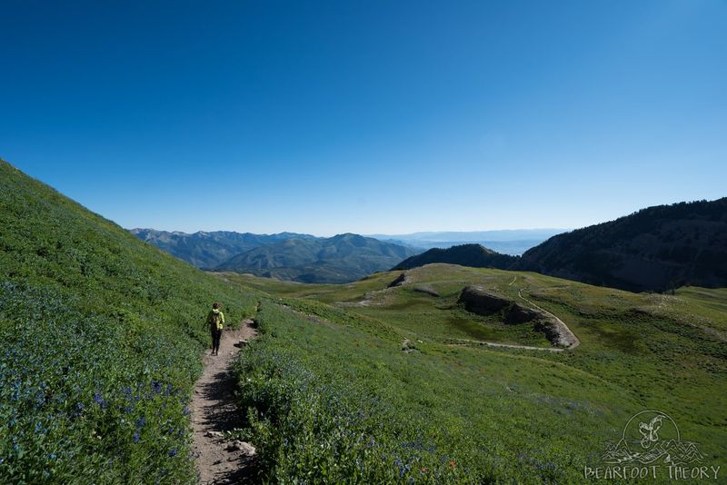
Expect a classic progression: shady forest at the start, then blooming meadows, and expansive alpine basins before the headwall and ridge. Switchbacks provide a manageable grade, though the climb is relentless. Rockfields and occasional scree require attentive footing. The upper mountain brings thinner air, gusty winds, and sun exposure. Route-finding is straightforward in summer, but snow can obscure tread. Save energy for the ridge and summit block, which demand focus. This evolving terrain keeps the hike engaging while testing endurance and footwork.
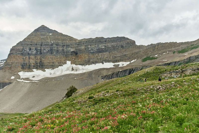
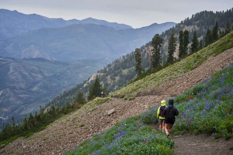
6. Wildlife and Wildflowers
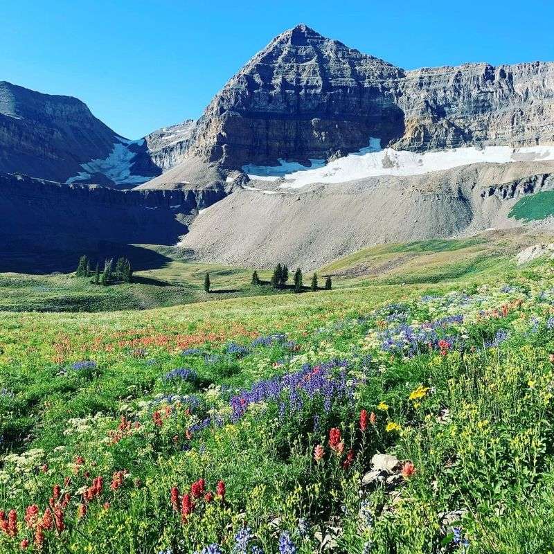
Summer transforms Timpanogos into a wildflower showcase, with lupine, paintbrush, and columbine lining the path. In the upper basins, keep an eye out for mountain goats traversing cliffs. Maintain distance, give wildlife space, and store food securely. Pollinators abound in calmer weather, and photographers will find endless compositions. Step carefully to avoid trampling fragile flora. Early morning offers softer light and fewer crowds. Enjoy the show, but stay on durable surfaces to help preserve this high-alpine ecosystem for future hikers.
7. Best Season
Prime hiking season runs July through early October, when lingering snowfields have mostly melted and the trail is well defined. Earlier or later, expect snow, hidden ice, or unstable bridges. Monsoon patterns can bring afternoon storms, so earlier starts help avoid lightning. Late summer wildflowers give way to crisp fall colors and cooler temps. Nights can be chilly even in August. Shoulder seasons demand traction, insulation, and careful weather monitoring. Choose dates that balance melted snow, stable forecasts, and your tolerance for crowds.
8. Trail Conditions and Hazards
Upper sections may feature loose rock, gusty winds, and occasional snowfields, especially early in the season. Snow bridges can form over streams or hollows and may collapse underfoot. Test questionable crossings and carry microspikes when conditions suggest. Helmets are optional but useful in rockfall zones if crowded. Keep an eye on clouds building rapidly from the west. Lightning, cold rain, and graupel are not uncommon. If conditions deteriorate, descend promptly. Accurate forecasts and conservative decisions are your best risk management tools.
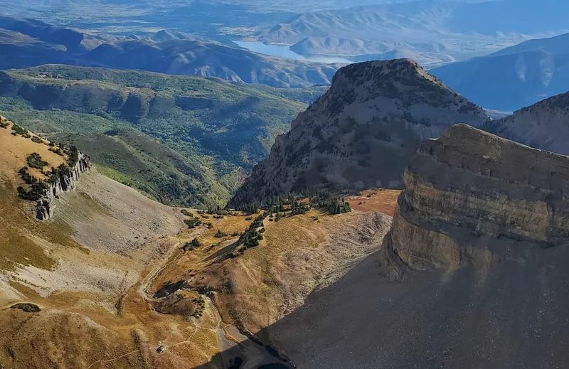
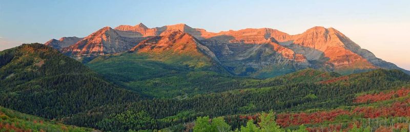
9. Views and Highlights
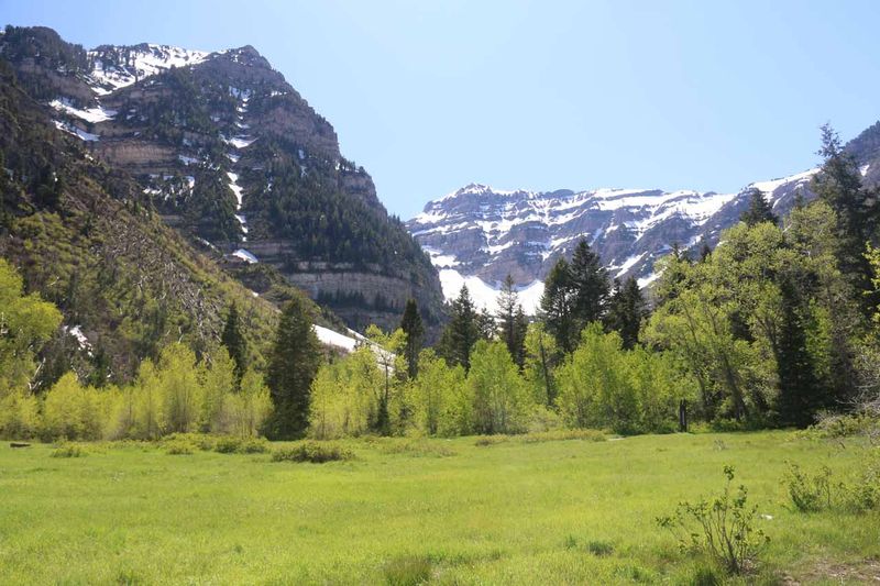
From the summit, gaze across Utah Valley, shimmering Utah Lake, and serrated Wasatch ridgelines. On the clearest days, the reach seems endless. The alpine basins and wildflower meadows below are equally photogenic, offering texture and color en route. Sunrise or early golden hour elevates the drama of cliffs and glaciers’ remnants. Carry a lightweight layer for summit winds to linger comfortably. The satisfaction of linking forest, meadow, and high ridge to a true peak makes every step worthwhile.
10. Permit, Fee, and Parking
Parking is at the Timpooneke Campground trailhead, and it fills quickly on weekends and holidays. Arrive very early for a spot. A canyon entrance fee or timed access may be required, so check current regulations and bring payment methods. Overflow options are limited and often regulated. Carpooling reduces impact and stress. Respect posted signs and avoid blocking campground operations. Verify gate hours to prevent after-hours complications. Planning logistics ahead makes your alpine start smooth and efficient.
11. Two Main Route Options
There are two primary routes to the top: Timpooneke and Aspen Grove. Timpooneke is generally more gradual and very popular, while Aspen Grove is steeper with notable waterfalls and scenery. Both meet near the summit ridge. Choose based on desired grade, crowds, and trailhead logistics. Some experienced parties make a loop with a car shuttle, but that requires careful planning. If it’s your first time, Timpooneke’s steady grade and clear navigation are reassuring. Either way, you’ll earn grand alpine rewards.
12. Trail Timing and Pacing
Most hikers spend 8 to 12 hours on the round trip, depending on fitness, conditions, and breaks. Start at or before sunrise to bank cool miles, dodge afternoon storms, and secure parking. Build a pacing plan with snack and water intervals, plus a firm turnaround time. Track progress at key landmarks like the basins and ridge. Poles reduce downhill fatigue and improve rhythm. Save mental energy for the summit block and descent. Finishing with daylight is safer and far more enjoyable.


