As winter makes its entrance with a sweeping snowstorm, New York City, Long Island, and Central New York brace for the first significant snowfall of the season. The National Weather Service predicts a blanket of snow that will transform the landscape, creating both challenges and opportunities for residents. Here’s what to expect as the storm approaches.
First Snow of the Season Arrives
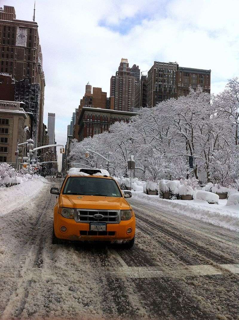
The first snow of the season always brings an air of anticipation. This weekend, a broad winter storm is set to cover New York City, Long Island, and parts of Central New York in a picturesque blanket of snow. According to the National Weather Service, the snowfall will start late Saturday evening, continuing through the night, gradually transforming the urban landscape.
As the storm sweeps through, accumulating snow will differ by location, influenced by the storm’s intensity. Snowfall is expected to taper off by Sunday morning, providing a serene winter scene. Forecast graphics indicate varying accumulations across the region, helping residents prepare for winter’s embrace.
While the snowfall creates a visual wonderland, it also brings challenges, particularly for travel. Roads may become hazardous, and temperatures are expected to remain below freezing early in the week, allowing snow to linger. Residents should plan accordingly and stay updated with local advisories to ensure safety during this winter event.
Heaviest Snow Forecast on Long Island

Long Island is bracing for what could be the heaviest snowfall in the metro area. Forecasts suggest several inches of accumulation, with snow expected to begin around 8 p.m. Saturday and continue through the night. Areas like Suffolk County, especially near Islip, may see snow totals higher than typical early-season storms.
The National Weather Service forecasts overnight snow accumulations in the 2-4 inch range. With below-freezing temperatures, roads and surfaces are expected to become slick, prompting pre-staging of plows and salt trucks.
Residents are advised to prepare for challenging travel conditions and allow extra time if venturing out. The snow, while beautiful, poses risks that require caution. Whether it’s snow-covered roads or the serene quiet of a snowy morning, Long Island’s experience will be one to remember this winter.
Broader Tri-State Impacts and Central New York Outlook

Beyond Long Island, the wider Tri-State Area will feel winter’s touch, though New York City itself may see lighter accumulations. Forecasts predict 1-4 inches in the city’s five boroughs, a typical amount for an early storm.
In areas like Westchester County and central New Jersey, snow totals could be higher, reaching up to 5-6 inches. The combination of rapid temperature drop and abundant moisture creates ideal conditions for lake-effect enhancement, particularly near Lake Ontario.
Travelers should anticipate hazardous conditions with reduced visibility and slick roads. Emergency management offices are already implementing winter weather plans to ensure public safety and efficient snow removal. This storm showcases the dynamic nature of winter in the Tri-State Area, where each location tells a different story of snow.
Cold and Lingering Snow Through the Week
As the snowstorm passes, the cold will linger, keeping snow on the ground longer than usual. Temperatures are expected to remain below freezing through early next week, with daytime highs struggling to climb above freezing.
This extended cold spell means icy roads, especially at night and in shaded areas, will remain a concern. Snow that falls this weekend may stick around, creating a winter wonderland that persists.
A weak polar vortex might influence the storm pattern, bringing additional snow showers. Wind chills will add to the cold, increasing the risk of frostbite for those exposed to the elements. Residents are encouraged to prepare for continued winter conditions and monitor the latest advisories to stay safe.


